Previous Forecast
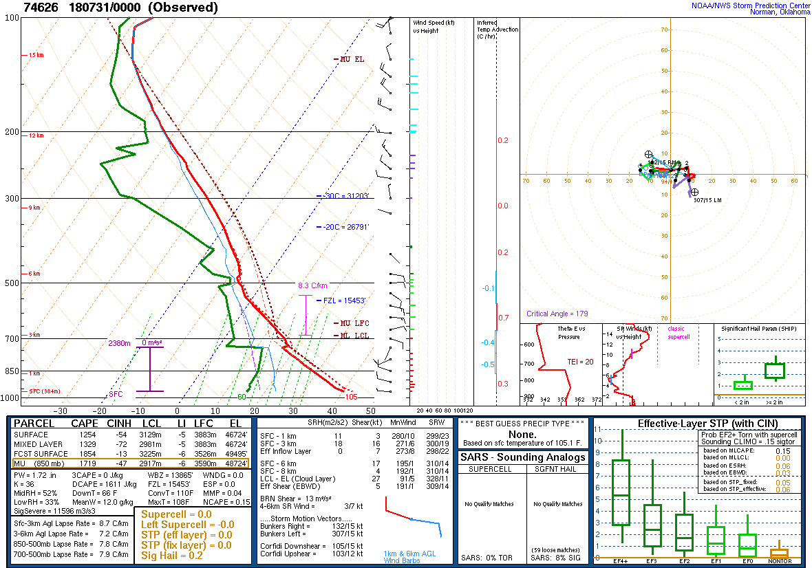
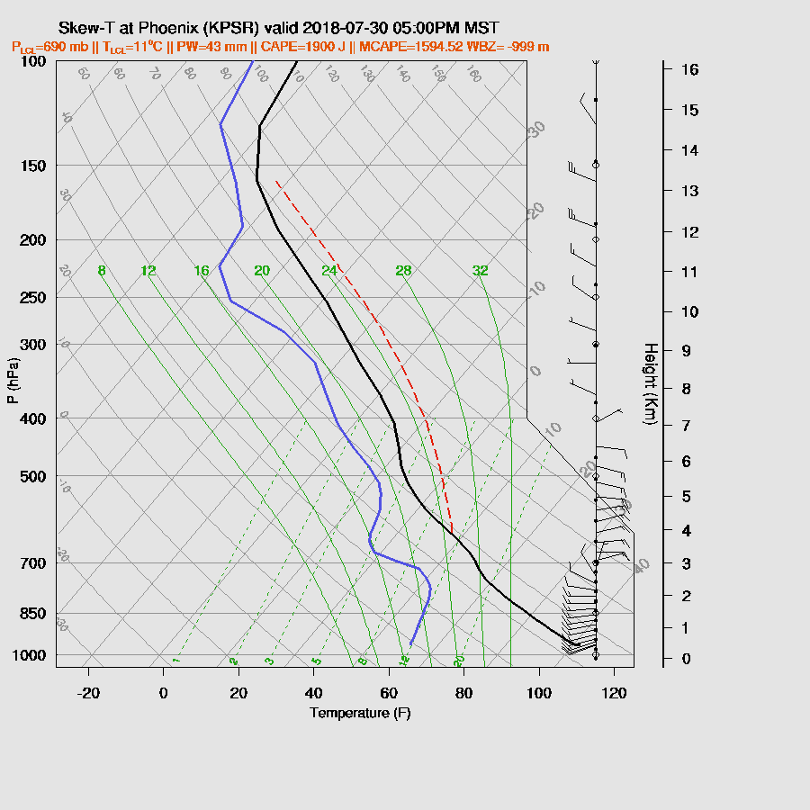
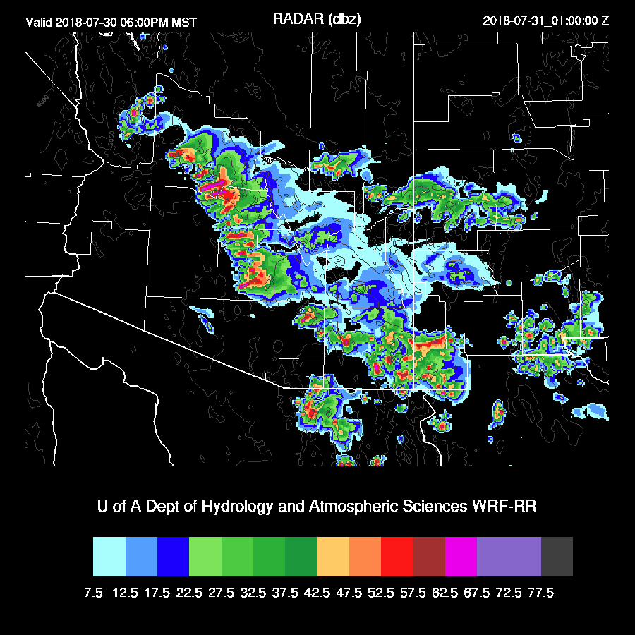
It was a difficult day for forecasting. Phoenix got walloped during the early evening as severe storms moved off of the high country into the valley. The 0Z Phoenix sounding showed that the PBL was mixed to almost 700mb with a weak cap and 1300 J/kg of MLCAPE. Storms were over the higher terrain to the north all the way around to the southeast. Multiple outflows were observed on RADAR entering the valley thus providing the local convergence and lifting necessary to initiate scattered deep convection. Not that much rain fell in Phoenix proper as the strongest storms remained just north of the city. However, as the storms collapsed, severe winds were generated with a G74 at Glendale and G67 at Luke.
The 12Z model runs were unable to forecast this outbreak, but they were close. The WRFRR was the best as it had scattered strong storms just north and east of Phoenix but coverage wasn’t enough and they weren’t able to propagate into the valley. The forecast vertical profile was excellent though. So close!
While none of the 12Z WRF nor the 12Z HRRR moved activity into Phoenix, it was a different story with the 15Z HRRR and WRFRR. The 15Z HRRR moved scattered storms through the Phoenix area accompanied by very strong winds.

The 15Z WRF had a broken line of strong storms that moved through Phoenix around 6pm. However, this was not correct as most activity died as it moved through. The 15Z WRFRR had too much moisture and heating and ended up with around 3000 J/kg of CAPE. So what actually transpired was more than the 12Z and less than the 15Z. The 15Z HRRR was the better run.
Day 1
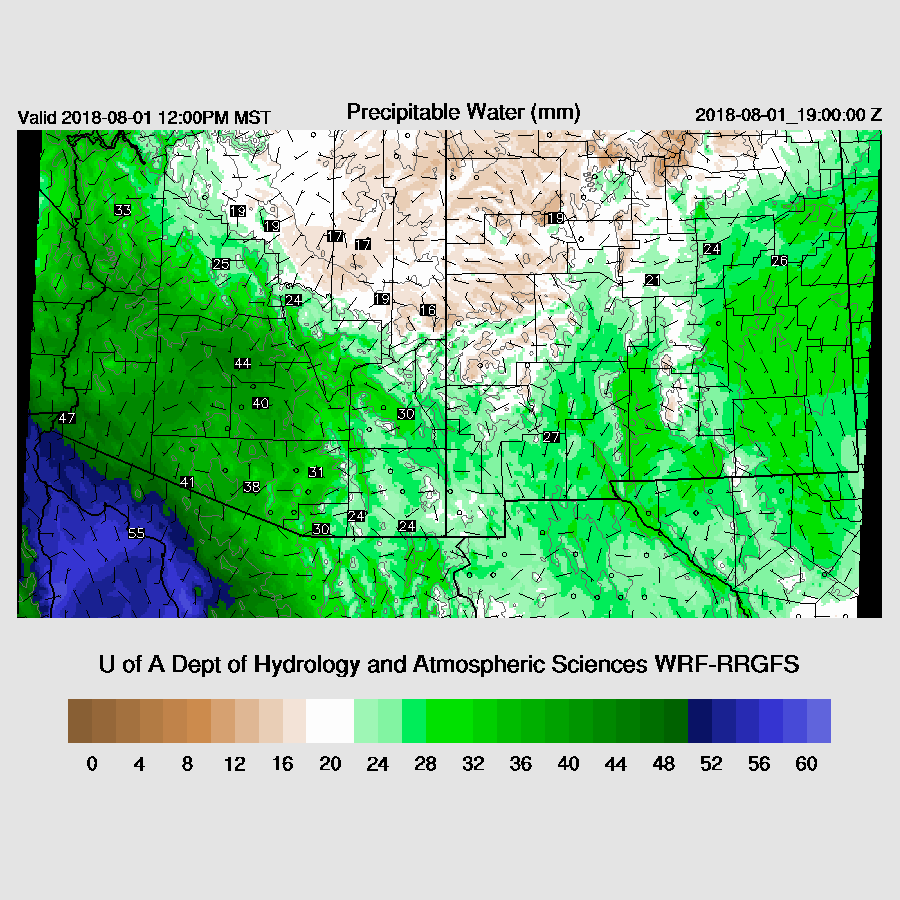
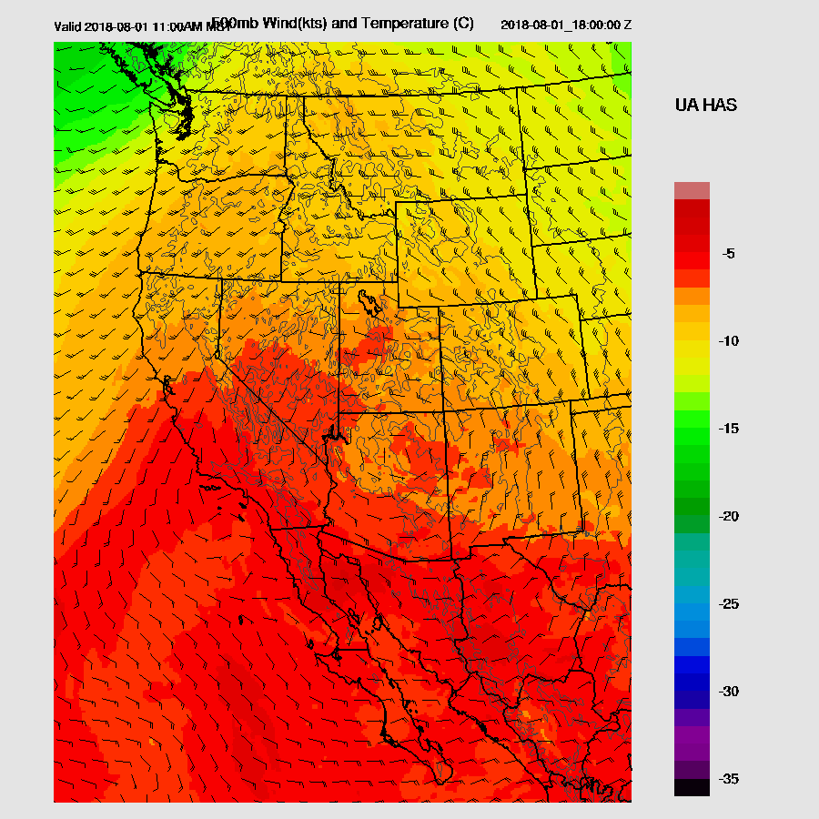
Drying has occurred over much of the eastern ½ of the state but very wet air continues over southwestern and far western Arizona.

CAPE is quite low for most areas except for the high country and the far SW part of the state. It looks like only the high terrain will see any activity today. The one exception is that little finger of CAPE over central Pima County. Does this feature really exist? The WRFGFS doesn't have it while the WRFNAM is similar looking but has lower values.

The problem is that the 15Z WRFRR came along and made the forecast complicated. It develops late afternoon and early evening activity farther north into eastern Pima County. I took a close look at forecast vs actual PW as of 17Z and the 15Z WRFRR is very close to observed PW so I can’t discount it for being too wet. What I thought was going to be a quiet day may not be so quiet for areas around/in Tucson later today and this evening.

Day 2
A similar story tomorrow as dry air continues over NE Arizona and wet over SW Arizona.
The 500mb anticyclone center is over northern Arizona which places southern Arizona in weak, generally easterly flow. So, some storms could be steered towards the lower elevations of Pima and Pinal Counties.
The atmosphere recovers and CAPE is much higher over much of the southern ½ of the state thus the potential for more activity is present.

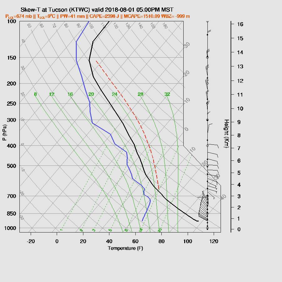
Tucson is mixed fairly deeply by late afternoon and CAPE is around 1600 J/kg so plenty to support deep convection. Steering is weak but does have an easterly component so some storms may move towards the lower elevations. Anvil shading from storms to the north may also be an issue.
Phoenix is again capped with only a moderately deep mixed layer thus storms will struggle to get into the lower elevations there.

The runs vary quite a bit with the success of storms making it into the lower elevations of SE Arizona. The WRFNAM is quite active while the other two runs keep most storms over the higher terrain.
The 15Z WRFRR is now available (as I started the discussion so late) and it’s quite active, similar to the WRFRR so it’s hard to say what will actually happen tomorrow.

No comments:
Post a Comment
Note: Only a member of this blog may post a comment.