Previous Forecast
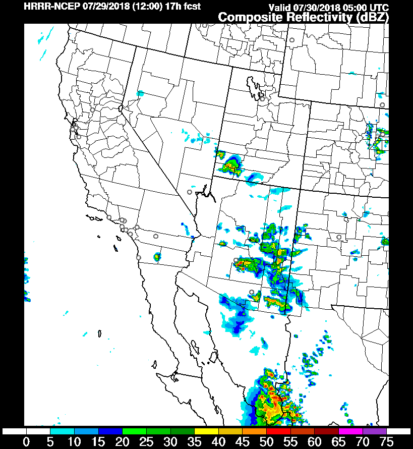
Activity remains over the higher terrain of the state. Southern Pima into Cochise and eastern Arizona were especially active.

The 12Z WRFRR was one of the better runs but didn’t have any activity out in western Pima county. None of the runs had any activity in either Phoenix or Tucson which verified well. 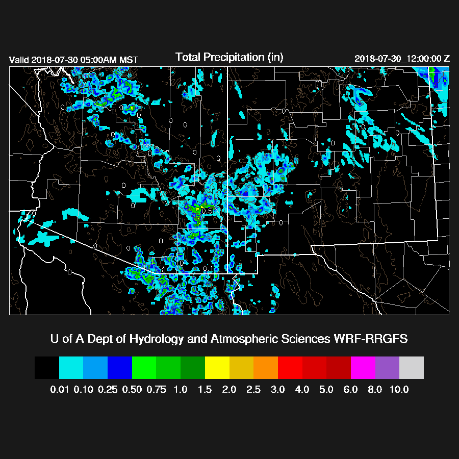
The 12Z HRRR did a pretty good job for the most part, similar to the WRF except for later in the evening when it moved storms into the lower elevations of eastern Maricopa and Pinal counties.
Initializations
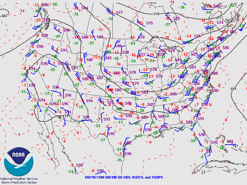
The 500mb high center is located over Nevada and a weak inverted trough is somewhere over southern Arizona into northern Sonora and weak cyclonic motion can be seen over southern Arizona in the visible imagery. A MCV is moving out over the central GofC. The RR has about everything initialized. The NAM is missing the MCV but that is no factor for Arizona today.
Both the RR and NAM did an OK job initializing the scattered morning clouds across the state but the RR was too far south for the thicker clouds that are west of Phoenix. The NAM had some large, 4-8mm, wet bias errors over the SW and into NW Mexico (below). The RR has mainly small errors except for far NW Mexico where there was a bit of a wet bias. The WRFRR is the favored model today.

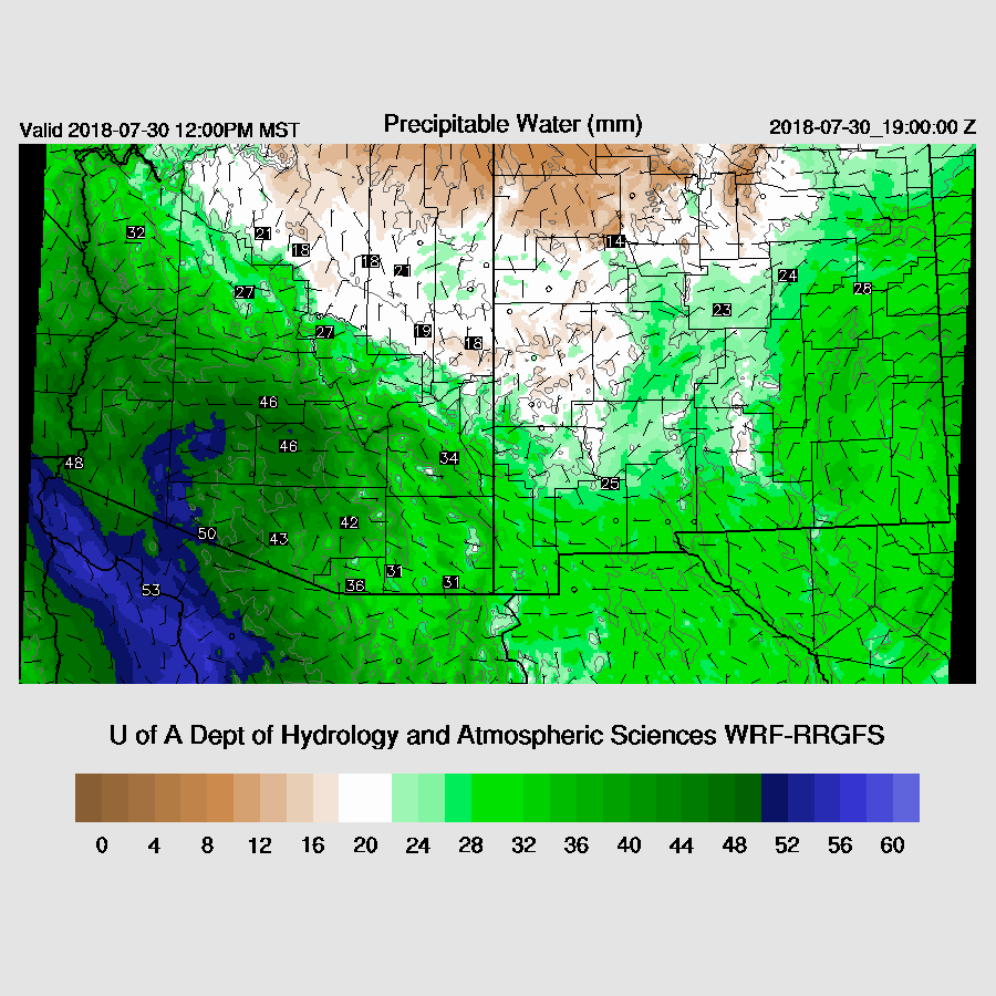
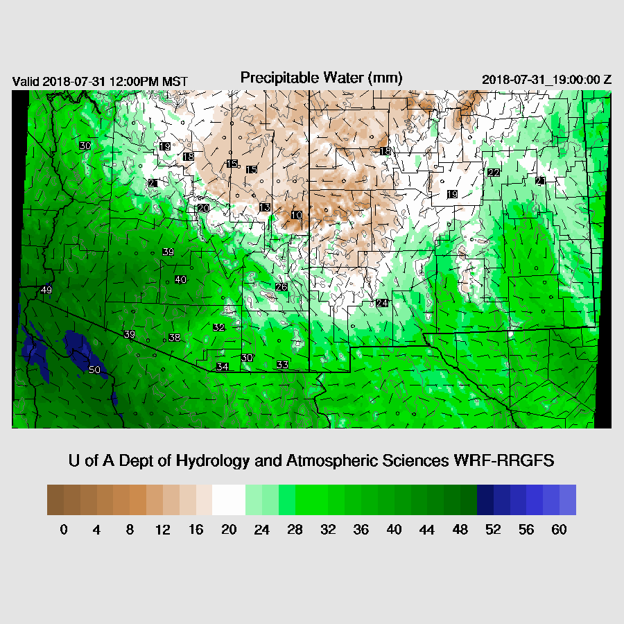
PW is about the same as yesterday with 42-50mm in the lower elevations and very wet air continues to be transported into the state as flow continues from the surface to above 850mb from the GofC. There is quite a moisture gradient across the state as dry air has moved into NE Arizona and NW NM.
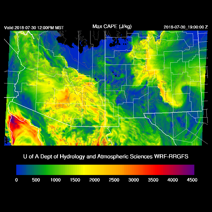
CAPE is again high to very high over much of central and SE Arizona so any storms that are able to form will be very strong and produce heavy rain. This backdoor dryline that is over NE Arizona and western NM may act as a convergence line and help initiate and enhance storms later today.
By mid-afternoon, scattered strong storms are located over the higher terrain of the state.

The plotting routine went a little crazy with the streamlines, but eastern Arizona into SW NM appears to be in difluent/divergent flow aloft.

Some storms move off the high terrain towards the Phoenix area while Cochise county again experiences very strong convection. This may become a MCS as there is some upper support.

The vertical profiles look very similar for both Tucson and Phoenix as CAPE is around 1500 to 2000 J/kg along with a good wind profile. However, both are not mixed deeply and have significant inversions/caps on top of the mixed layer. So it’s the same old story of needing strong lifting from outflow boundaries in order to trigger deep convection for the lower elevations.

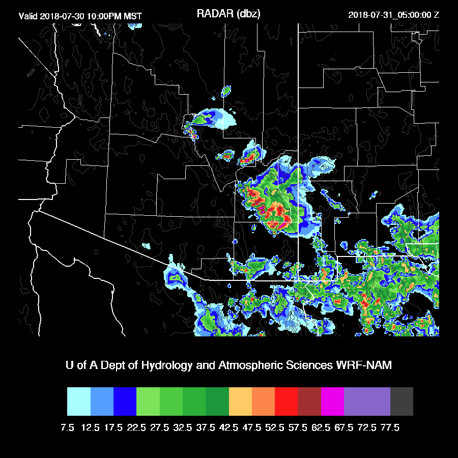
Big storms are just north of the Phoenix valley during the early evening and result in multiple outflows into the valley only from the north and northeast It appears that linear outflows do not supply enough mesoscale lift for widespread deep convection but may be enough for a few storms. If a big outflow boundary comes in from the south or southeast and they intersect, it may be more active but none of the model runs are forecasting this situation.
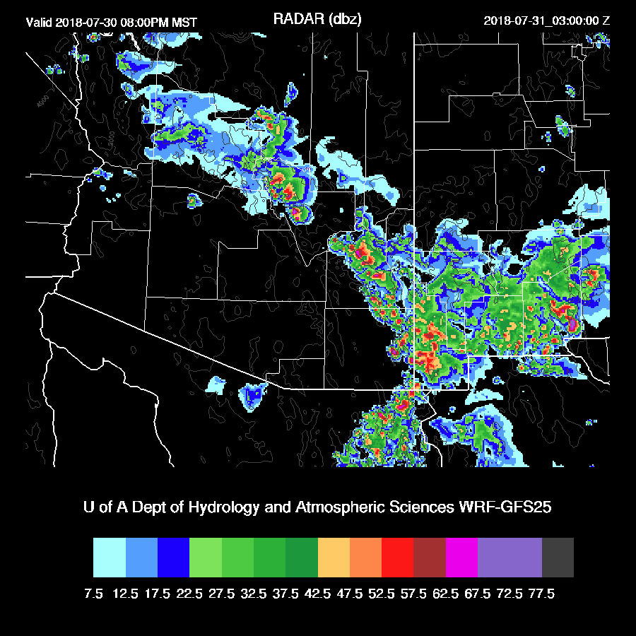
The storm complex in Cochise county moves to the west and threatening the Tucson area.

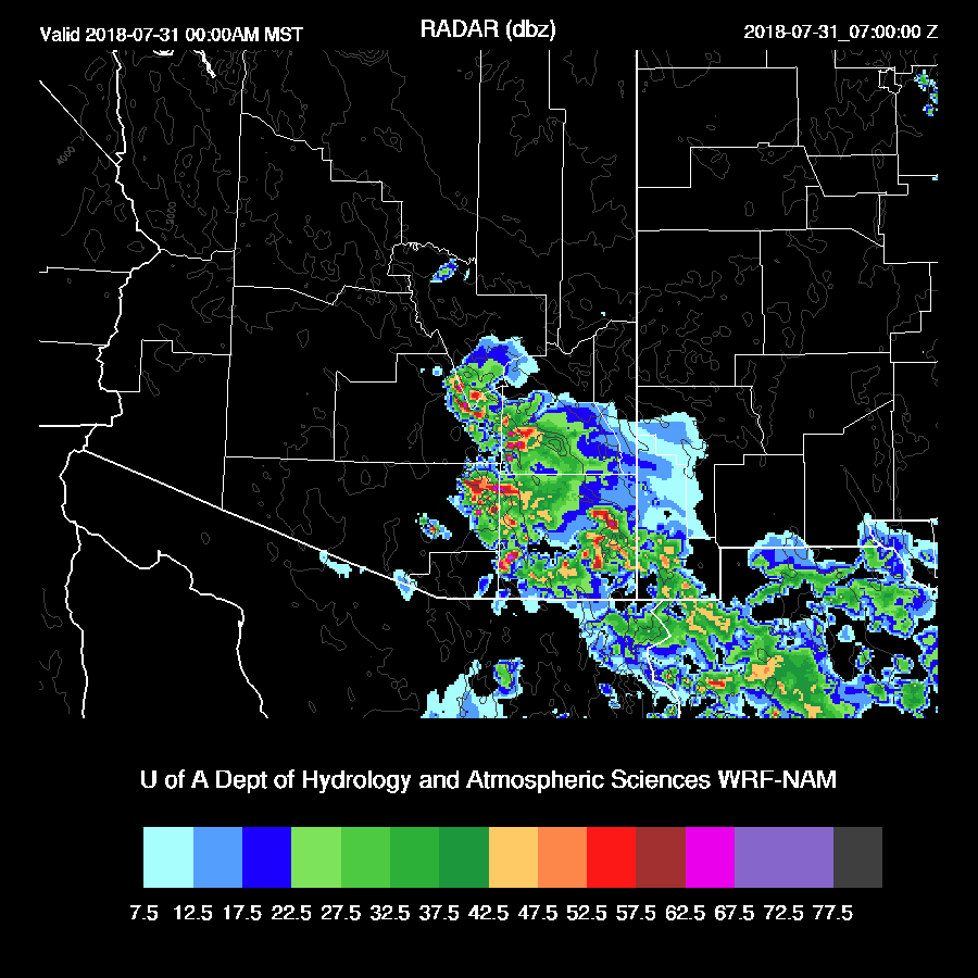
The WRFNAM plays it a bit different as it moves a strong line of storms towards Pima county from the NE.
The WRFRR moves a strong outflow boundary into the Tucson area later in the evening and this appears sufficient to trigger at least a few storms but not a widespread outbreak.

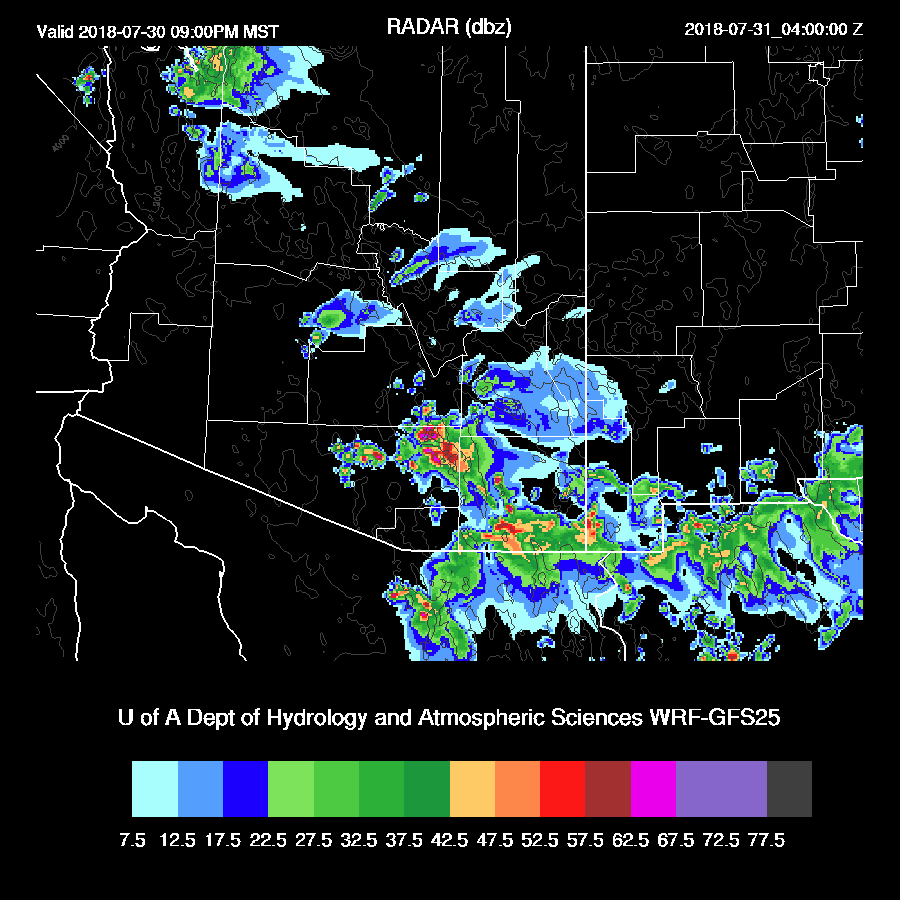
The WRFNAM moves widespread storms into the Tucson area around midnight and typically, these “rim shot” storms come in earlier in the evening so the timing may be a bit off. The WRFRR is probably more accurate but the WRFNAM can’t be ruled out. I’ll be watching to see how active Cochise county is later this afternoon and evening as the WRFNAM kept it pretty quiet which enabled the Rim storms to propagate into an unmodified air-mass.
The 6Z WRFGFS looks much like the 12Z WRFNAM with Rim storms moving into Tucson during the evening. The 6Z WRFNAM looks similar to the 12Z WRFRR with less activity. So, my take is a 50-50 shot at big night time storms for Tucson.
I waited around to see what the 12Z WRFGFS has had to say and it is quite interesting as it develops a broken line of strong to severe storms from NE of Phoenix all the way into far SW NM.
This line moves into the Tucson area during the late night hours. It looks likely that SE Arizona is going to experience a big outbreak tonight.

Day 2
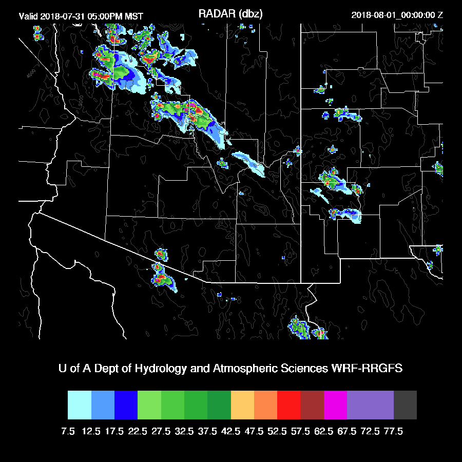
Drier air moves into much of the eastern ½ of the state. I’m thinking that all the above storm action was aided by not just the upper divergence but this westward moving dryline. In any case, with such an active day forecast for today plus drying, little or no activity is expected for most of tomorrow.
Storms are mainly active from Flagstaff and northwest from there.
No comments:
Post a Comment
Note: Only a member of this blog may post a comment.