Previous Forecast
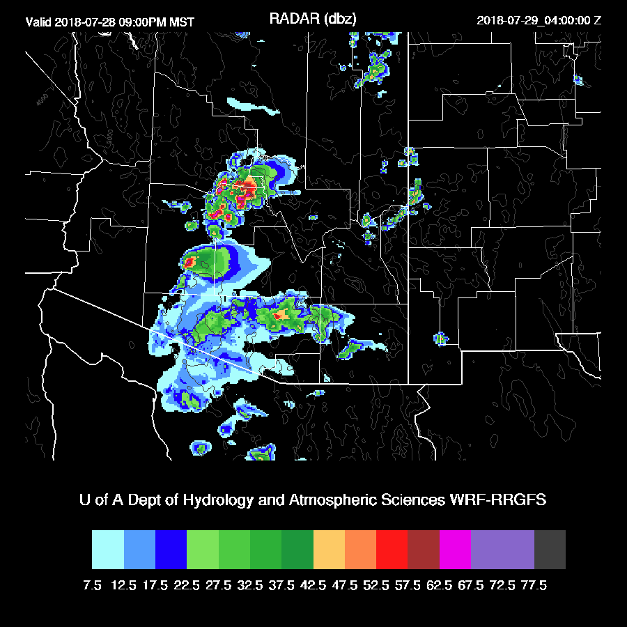
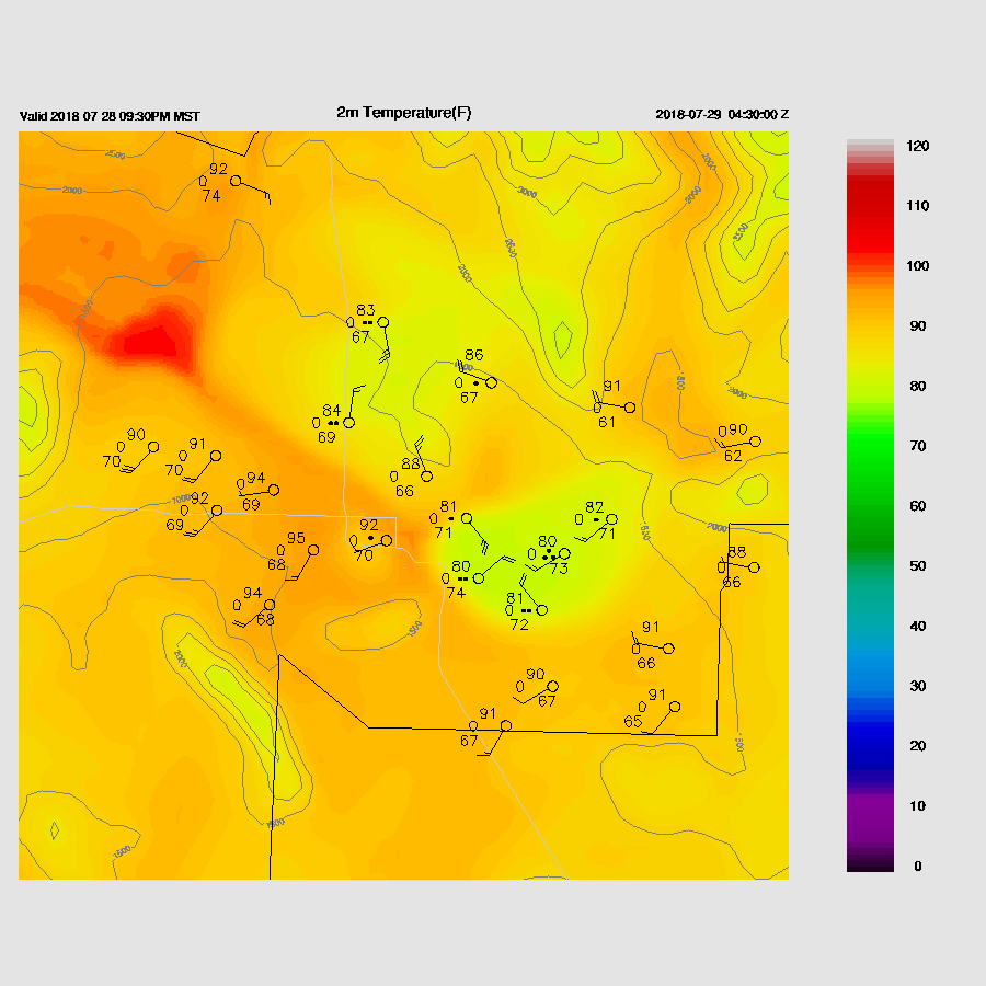
Once again storms mostly remained over the higher terrain of the state except for Tucson where storms developed north of the city and then moved SSW. Storms made it to the outskirts of Phoenix which resulted in a big outflow across the valley.
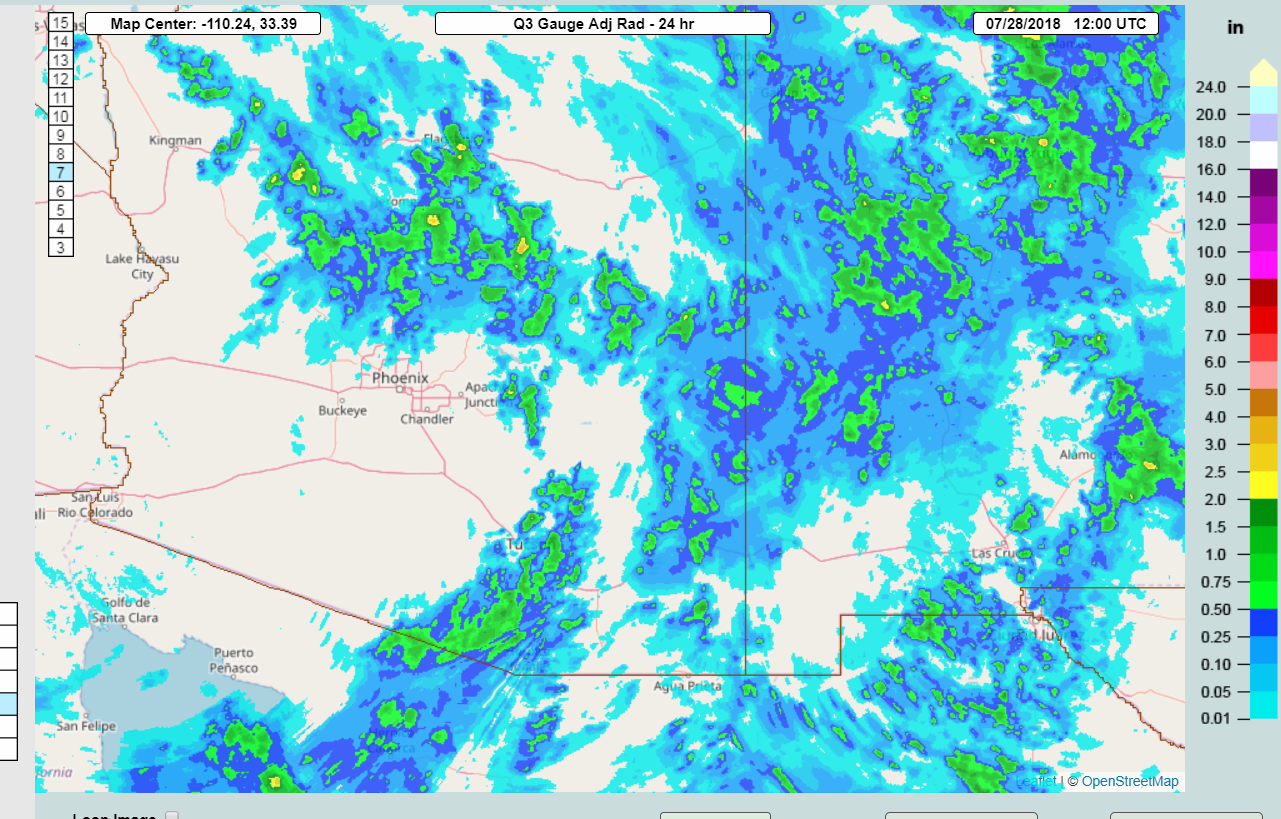
A couple of runs had the Tucson activity and some had the Phoenix outflow forecast fairly well. I really need to have an ensemble version of each forecast product! Maybe next year. The 6Z WRFGFS was one of the better runs.
Initializations
The mid-level anticyclone remains over NW Arizona but has weakened with maximum heights around 5950m. Most of the state continues in favorable northeasterly steering flow and 500mb temperatures continue to be fairly cool at around -6 to -8C. An IT is in southern NM and is associated with an area of clouds and this IT may be the western extension of a larger IT that is over the Big Bend region.

Clouds are also widespread over southern and western Arizona along with a few showers as is also the case over much of NW Mexico. Another IT/MCV is over northern Baja. Initializations look OK except neither has any clouds over southern NM but this error shouldn’t impact Arizona.
RR PW initialization is good and the NAM isn’t as bad as previous days. It does have some 6+ mm wet errors over eastern Arizona though. Overall, initializations look OK with no clear favorite.
Day 1
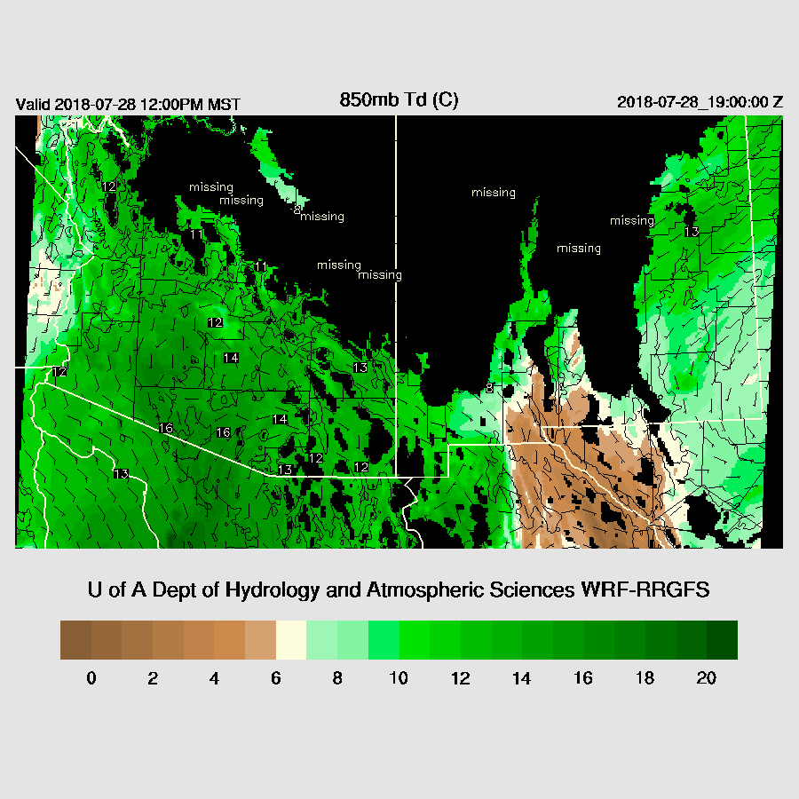
PW continues to be moderate to high over southern Arizona with around 42mm to 46mm over the lower deserts. Weak moisture advection continues from the Gulf of California today keeping PW high throughout the period.. 850 dew-points are very high over south central AZ while significant drying is present over southern NM which may again prevent widespread storms over far eastern Arizona.
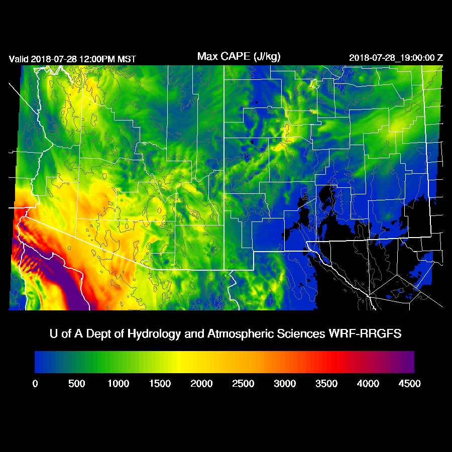
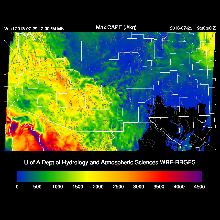
Forecast CAPE is moderate to high over much of southern Arizona with the highest just west of Tucson and Phoenix so perhaps that will be where all the action is later today. The question, as it has been for many days, is how strong the inversion/cap is at the top of the mixed layer and can it be broken at low elevations?
Both the WRFNAM and WRFGFS develop very strong/severe storms along the AZ/SON border during the afternoon and a few big storms over the high country.

The morning Tucson sounding had a fair amount of MLCAPE in spite of the overnight activity.
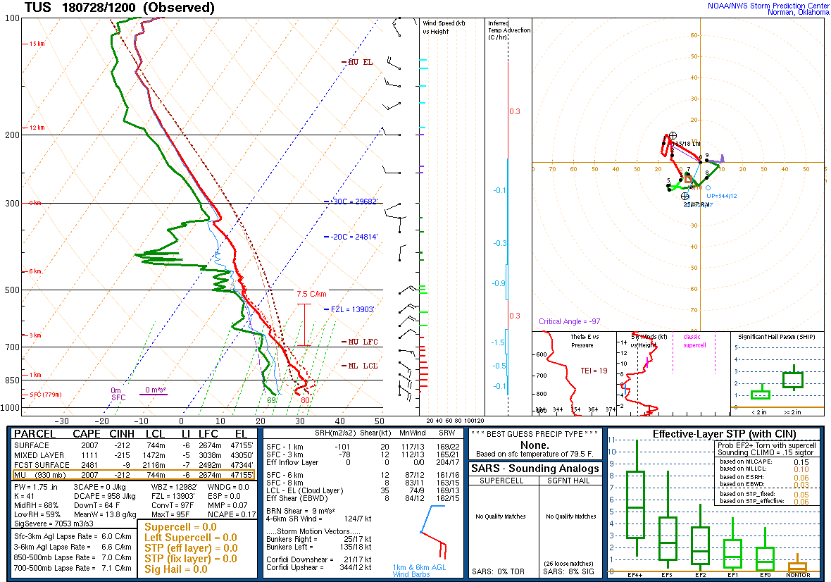
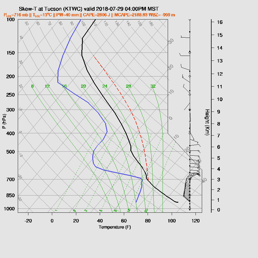
Later in the afternoon, Tucson is well mixed and nearing deep convection and the wind profile is again excellent and CAPE is good as it’s over 1000 J/kg. The only problem is that anvils from the big storms to the SW are likely to blow over thus reducing heating and slightly stabilizing the profile.

Both model runs agree on moving strong/severe storms along the border into western Pima County by late afternoon. They also both develop strong storms over or just northwest of the Tucson valley.
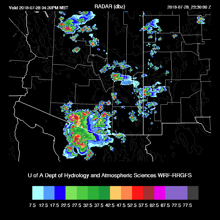
All these strong/severe storms in far southern Arizona produce strong outflow into southern Maricopa and Pinal Counties.

The WRFRR forecasts a moderate amount of CAPE for Phoenix this evening along with a good wind profile. However, the PBL isn’t mixed that deeply thus it will need outflow boundary intersections to get it to the LFC. This does look possible/likely as both model runs develop some storms to the north and outflows do intersect. Also, there is a pronounced inverted V profile thus strong/severe winds are likely.

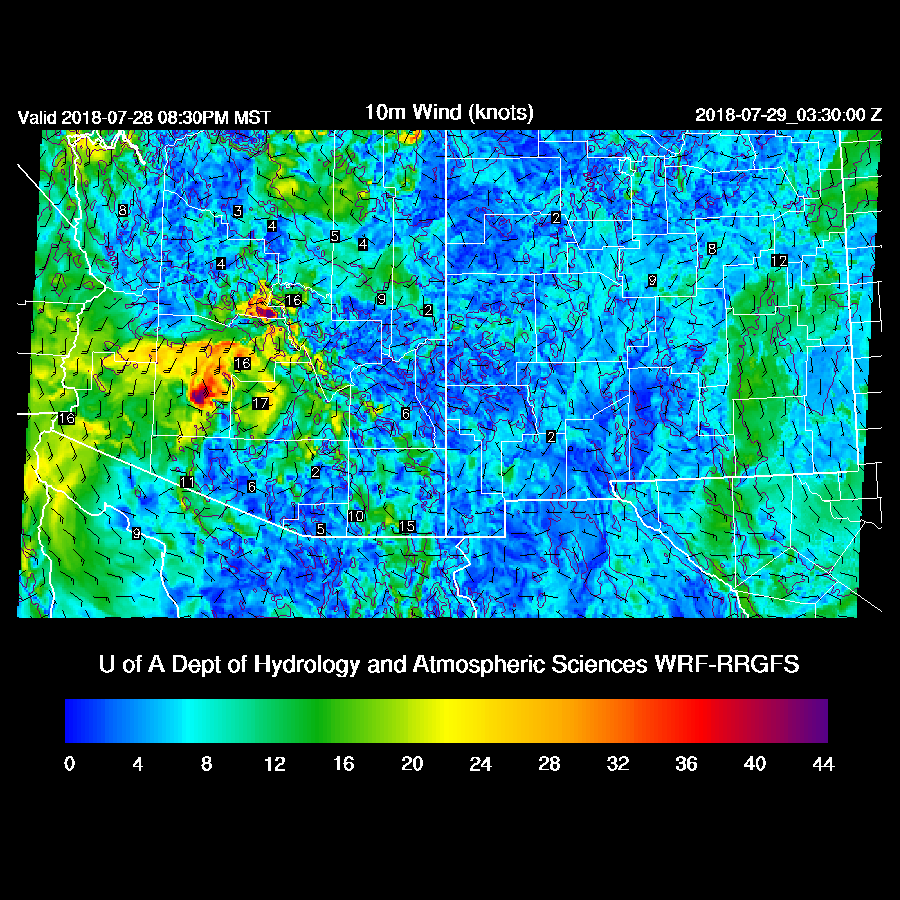
Both runs produce strong to isolated severe storms in or near the Phoenix area this evening.
Day 2
As today is so active, there is much uncertainty for Day 2. Typically, the next day also has reduced activity due to the debris clouds and cooling of the low levels. High moisture values continue as 850 dew-points are around 15C over much of central and southern Arizona as weak moisture advection continues from the GofC.

Well, the previous day’s activity didn’t impact CAPE much as it’s very high over much of southern Arizona.
A few strong/severe storms roam around over the higher terrain during the late afternoon.

Tucson seems to recover fairly well as the PBL is mixed to 700mb but there is a pronounced inversion at the top of the PBL. CAPE is very high and winds are very favorable so just based on the forecast Skew-T, storm activity is likely in and near Tucson again.
Storms form over the higher terrain near Tucson by late afternoon and strong to severe storms move into the Tucson area during the early evening.

Phoenix also becomes deeply mixed by early evening but will still need some outflows to trigger deep convection. That apparently doesn’t happen and Phoenix remains quiet.

No comments:
Post a Comment
Note: Only a member of this blog may post a comment.