Previous Forecast
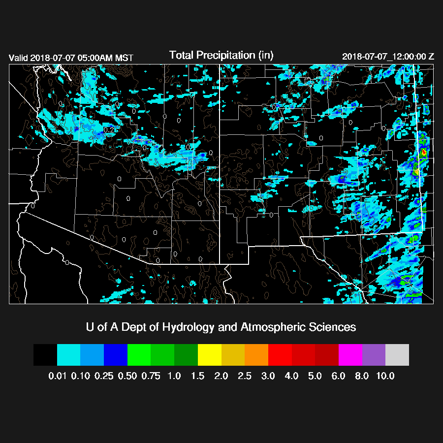
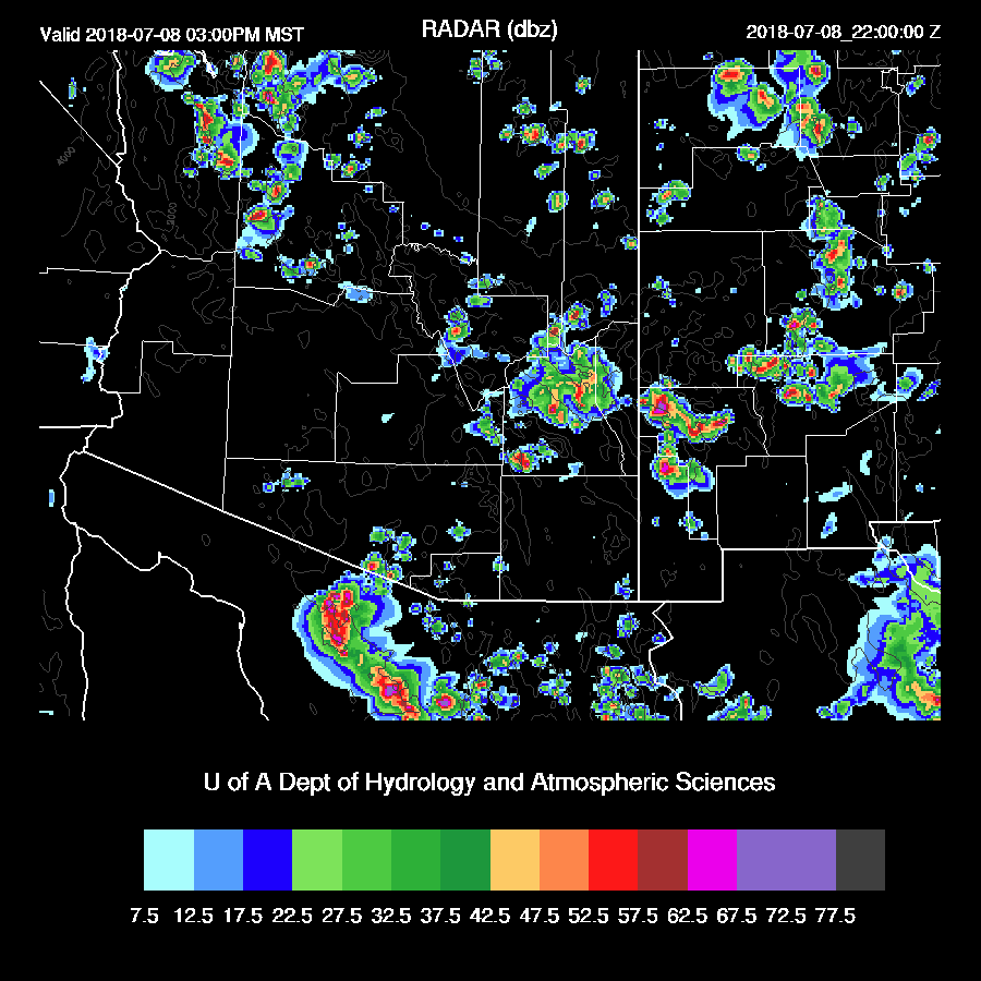
No storm activity was observed over the lower deserts yesterday but there was a lot of blowing dust between Tucson and Phoenix due to the strong easterly winds. Storm activity was restricted to areas along the Rim and westward into Mohave county with some activity continuing this morning.

All three of the 12Z model runs had the right idea with the WRFNAM looking to be the best.
Initializations
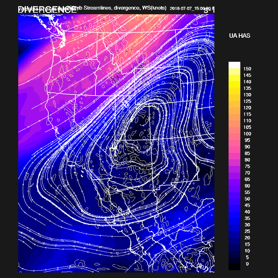
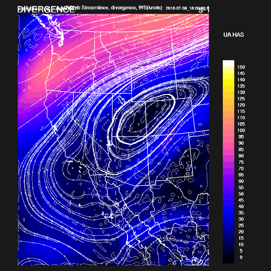
The upper air pattern has not changed much since yesterday as a strong ridge continues over much of the western CONUS. Cooler air and a weak shortwave are located over New Mexico and moving this way. The mid/upper circulation is located over far NE NM and is quite obvious in the WV imagery. A closed upper low/IT is located over far southern Sinaloa and has been responsible for storms there that may eventually produce a Gulf Surge. Another weak IT is over NW Arizona and is responsible for the continuing activity there. The RR (below) seems to have the best initialization of all the features but the NAM is also OK.
The RR also has the better initialization of PW with only minor errors observed. The NAM was too dry in Mexico and too wet over northern NM, but errors are not large enough to cause any trouble with the PW correction routine. The 12Z GFS was also too wet in Mexico. I received some more information about Empalme: the plan is to upgrade the equipment to a Vaisala system some time this summer so maybe this will help reliability. The area of activity in NW Arizona was initialized well by the RR and NAM. Elsewhere, it’s mainly clear except for southern NM and this area of clouds was not initialized well. Overall, the RR seems to have the best initialization but the others are also good.
Day 1
I’m writing this from Paradise, AZ and unfortunately, the power has gone out. I do have a small UPS as outages are common (one was 3 days long last summer!) so I can continue to work for awhile longer. It’s windy here again so maybe that has something to do with the outage. It’s humid too, as dew-points are up into the mid 50’s here and into SW NM. By early afternoon, easterly low level winds continue over SE Arizona while weak southerly flow is present over western Arizona and flow is advecting moisture in from both directions. The question is if the flow has weakened enough in SE Arizona to decrease the downslope effect.

850mb Td does indicate that this is the case as SE Arizona is around 10C, which is the magic number in my book for widespread deep convection.

Finally, there is a bit of CAPE over SE Arizona and into SW NM. The White Mountains and eastern Mogollon Rim have over 1000 J/kg so expect widespread activity there. Also note the CAPE and moisture in central and western Pima county. Besides that, there is a low level convergence zone thus this is likely to be another area for significant deep convection.

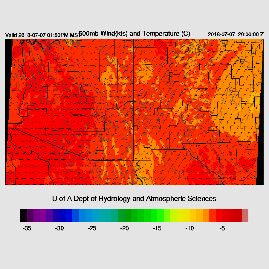
500mb steering flow is excellent over the eastern ½ of the state. The slightly cooler mid-level air and associated weak IT are moving into SE Arizona by early afternoon. Storms that form over the high elevations will be steered towards the lower deserts and there may be enough CAPE there for some lower elevation storms, mainly in SE Arizona.
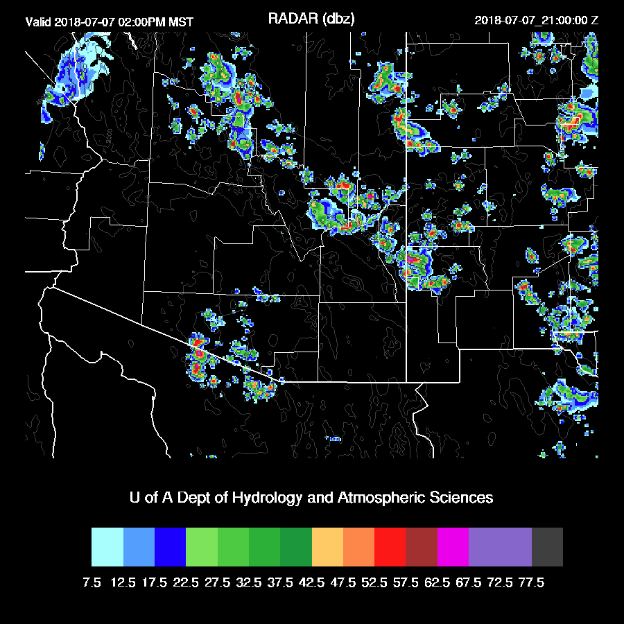
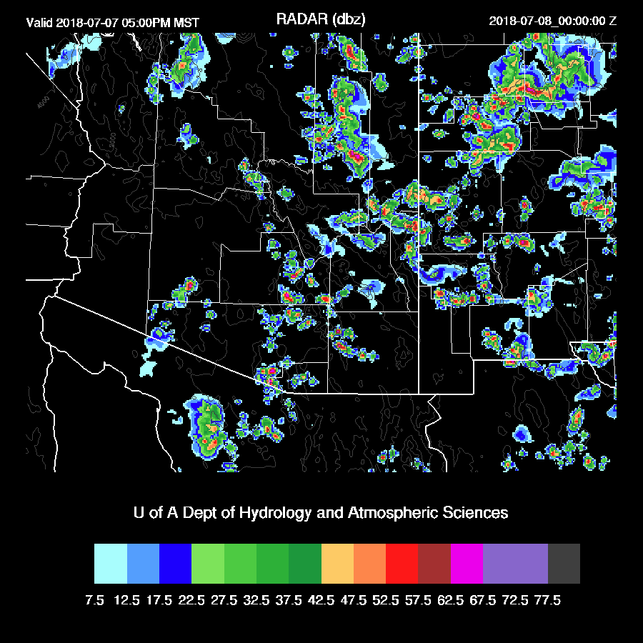
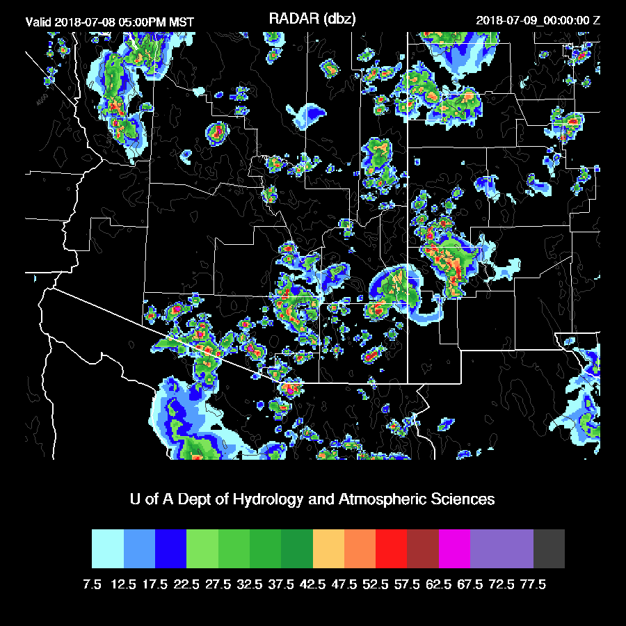
By 21Z or so, scattered strong storms are active all along the high country and also developing over central/western Pima county.
Tucson is forecast to have around 500-700 J/kg of CAPE later this afternoon which may be enough to support storms in the lower elevations as they move in from the NE. The mixed layer is fairly deep so strong winds are likely with the storms. The wind profile continues to lack the low level shear for really strong storms though.
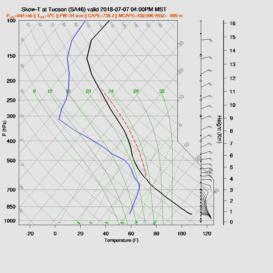
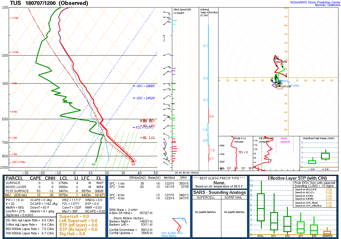
Just as a curiosity, the 12Z Tucson sounding is below. When I first looked at it, I thought it was the 0Z by mistake as the PBL looks like it is from a late afternoon sounding!
The general model consensus is for scattered storms to move into the Tucson area by around 4-6pm.
There is another possibility of a dust storm/haboob across Pinal county this evening.

CAPE is marginal (200-500 J/kg) for the Phoenix area but maybe a storm or two could develop as the outflows move through.

Isolated activity continues around Phoenix and Tucson into the evening. All 12Z runs develop very strong storms over NE Arizona. This is likely in response to the upper trough which is located over central NM.

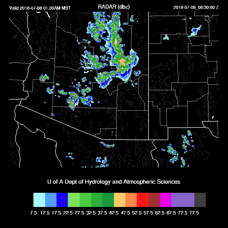
This area of deep convection moves towards the Phoenix area around midnight and the WRFRR and WRFNAM do have some scattered weak storms in southcentral during the early morning hours.
Day 2
SPC has a “Marginal” risk outlook for tomorrow. I’m only going to be able to do a quick look as Day 1 has taken so long. The mid/upper trough is over central NM tomorrow and puts much of southern Arizona under an area of upper difluence while mid levels continue to cool slightly.
One issue may be significant debris clouds left from the early morning activity reducing heating. The model runs mostly burn off the clouds during the morning hours. CAPE continues to increase and is quite high in some areas while others, like around Phoenix are low due to clouds and cooling from the overnight activity. However, most runs increase CAPE during the afternoon across central Arizona.

Low level easterly winds have finally quit thus Tucson has a bit of low-level shear plus excellent mid-level steering. CAPE could be higher, but is enough, 400-800 J/kg.

Phoenix has 500-1000 J/kg of CAPE by late afternoon and an excellent vertical wind profile with low level shear and good mid-level steering winds. Almost textbook for big organized tropical squall line like storms. 
Big storms during the afternoon over eastern Arizona, NW Arizona, and down into Mexico. Due to the complex nature of the weather overnight tonight, forecast confidence is low thus the model runs probably don’t have the location or timing quite right and will need to be fine tuned tomorrow.
Tucson is likely to be active during the late afternoon and early evening.
Phoenix might see some big storms during the evening if everything comes together. Both the WRFRR and WRFNAM get storms going later in the afternoon NE of Phoenix and with the good steering, move these into the valley around 8-10pm. Some storms are likely to be strong to severe. The WRFRR is between the WRFGFS which has only a little activity and the WRFNAM which has a lot. Phoenix needs the rain, Tucson needs the rain, we all need the rain!

No comments:
Post a Comment
Note: Only a member of this blog may post a comment.