Previous Forecast
It was a very active evening for the lower deserts near Tucson, through Phoenix, and to NW Arizona. Severe weather was reported in Phoenix with a gust to 86mph at Sky Harbor. Very heavy precipitation fell in Green Valley as many stations reported over 3".
Discussion
I am sorry to announce that this will likely be the last publicly available forecast discussion. The budget situation has been progressively worsening over the past few years as high UofA overhead rates have made the renewable energy forecast group and my contracts uncompetitive, so we've been unable to secure additional funding. The University of Arizona refuses to lower the rate and, even worse, has increased it! Some of our contracts now have a 63% rate. As these discussions are primarily unfunded, I need to focus my time on the remaining contracts. Like the others in our group, my position is 100% externally funded, with no significant support from the University of Arizona, so I can no longer justify writing these free discussions. The model runs will continue to be available to the general public. I've certainly enjoyed writing these over the years, and I hope you've enjoyed reading them.
Back to the weather. Yesterday's model runs all had an extremely active day today, and I wondered if they were overdoing it and not respecting the rule that the next day is mostly down after an active day (yesterday). I figured the dynamics were offsetting any stabilization. Both Tucson and Phoenix have quite worked over vertical profiles with minimal MLCAPE. The vertical shear wind profile is quite good, and if there was enough, CAPE would certainly support organization and mini-supercells.Phoenix has a good directional shear profile as well but limited CAPE. It is clear over most of southern Arizona now, so heating should result in better CAPE by afternoon. PW has also increased somewhat since yesterday morning but decreased since last night in the wake of the widespread storms.
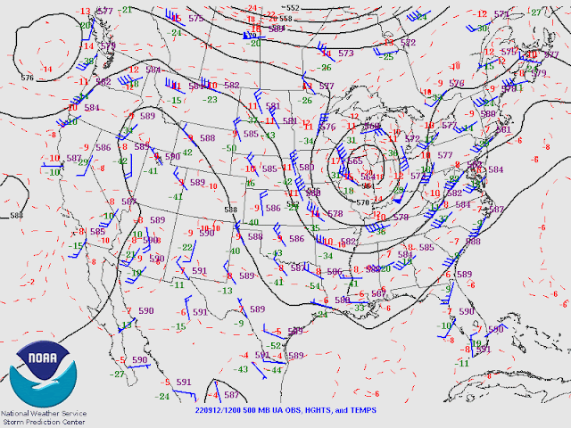
The 500mb trough is still located off the coast of California. This trough has been attributed to Kay, but I disagree as 500mb temperatures are way too cool for a remnant tropical system, as they are -8 to -9C. Perhaps it's a blend of a mid-latitude trough and tropical remnant?
It's more interesting at 300mb, as a sharp trough is moving into western Arizona and has been responsible for the widespread shower and storm activity during the morning hours over northern Arizona and southern Nevada. The trough will continue to provide favorable divergence for the state today.
Initializations
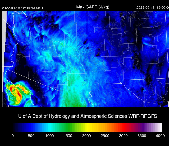
As mentioned earlier, it's mostly clear over most of southern Arizona. It's somewhat surprising to see the amount and extent of GOES CAPE as the soundings had only limited amounts. However, Tucson did have quite a bit of elevated CAPE (1300 J/kg), so perhaps this is what GOES sees. Cloud initialization was accurate by all as well as CAPE, except for the 12Z RR, which seems to not have enough. The 9 and 12Z initializations appear more accurate with the placement and structure of the mid/upper-level trough. Satellite imagery shows a closed circulation located NW of Los Angeles.
Day 1
Another difference between the forecast from yesterday is the amount of moisture, as it's not as high as the prediction, which was around 40mm. Instead, it's about 34-36mm by early afternoon. However, the forecast of decreasing low-level early flow appears to have been verified.
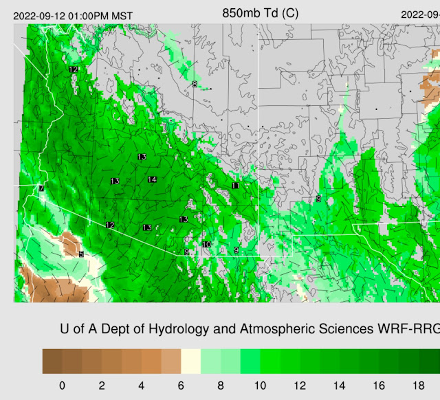
Despite PW not being as high as anticipated, 850mb dewpoint temperatures are favorable at 13 to 14C.
Most runs have moderate to high CAPE by mid-day, mainly over the southern 1/3 of the state, so this looks to be the most active area today.
The forecast Skew-T for Tucson has around 1000 J/kg of CAPE, but the wind profile doesn't have much directional shear as it did at 12Z. The mixed layer is near the LFC (700mb) by early afternoon, at least in the WRFHRRR. The WRFRR is not nearly as deeply mixed. It looks likely that storms don't develop as early as was predicted from yesterday's runs.
At 250mb, favorable divergence continues over the state this afternoon.
The mid-level trough slowly moves east, resulting in moderate SW flow over Arizona and favorable temperatures of -8 to -10C.
Model runs disagree on the timing of convective initiation around Tucson. The 12Z WRFHRR and other earlier runs, say around 3-4pm for Tucson.
The WRFGFS and 12Z WRFRR don't get going until early evening. In any case, storms are likely in and near Tucson.
The main threat seems to be heavy rain. Precipitation amounts could exceed 2" in some locations. Isolated borderline severe winds are also possible with a few storms.
IMO, a repeat performance of storms in Phoenix is going to be difficult due to the previous activity and all the reasons listed below. The forecast Skew-T, like in Tucson, doesn't have as good directional shear as earlier in the day. CAPE is also marginal, around 900 J/kg. The PBL isn't mixed very deeply (LFC 700mb), and there is a weak inversion on top of the mixed layer.
Like yesterday, the Tucson area storms try to make a run along I-10 towards Phoenix. Other parts of SE Arizona also see strong to severe storms.
Even though there was a lot of negativity regarding the Phoenix forecast sounding, we still have favorable dynamics from the trough. Some runs develop strong/marginal severe storms in the Phoenix area this evening, while others have nothing.
Day 2
A drying trend sets in as the trough lifts out. Far SE Arizona has a decent amount of CAPE, so widespread activity is expected there.


No comments:
Post a Comment
Note: Only a member of this blog may post a comment.