Previous Forecast
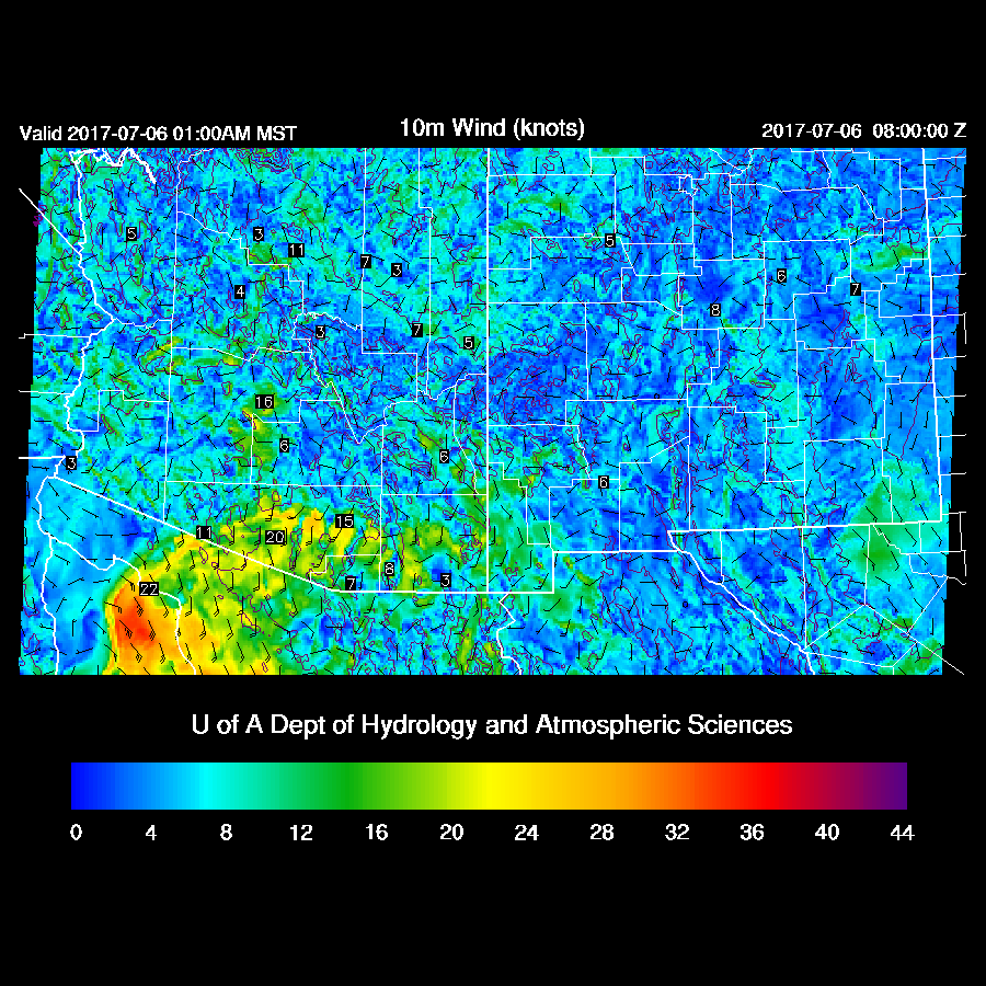
Not much to say as there has been very little activity. Thunderstorms in Sonora caused an outflow surge into southern Arizona overnight which was forecast well by the various runs.
Initializations
The monster high pressure that had been forecast to build over the western CONUS is here as Flagstaff and Grand Junction reported 5980m 500mb heights this morning. Neither Empalme or Chihuahua have been reporting at 12Z recently which is likely to be a major problem for model accuracy. I contacted my friend, Luis Farfan, and he called around and found that both sites are out of sondes and gas and will hopefully be resupplied in 2 weeks. Let’s hope!

Almost no clouds were present over Arizona or northern Sonora except a few near a weak IT/MCV moving westward across northern Baja. All morning model initializations look good, but it’s an easy day to get right.
Day 1
In spite of the weak outflow surge last night, moisture decreases today as low-level easterly winds develop due to the strong high to the north of Arizona.

A few areas of deep convection do develop over east central Arizona and along the border from Nogales westward along a low-level convergence boundary.

Day 2
The situation improves somewhat tomorrow as some moisture moves into eastern Arizona from southern NM.
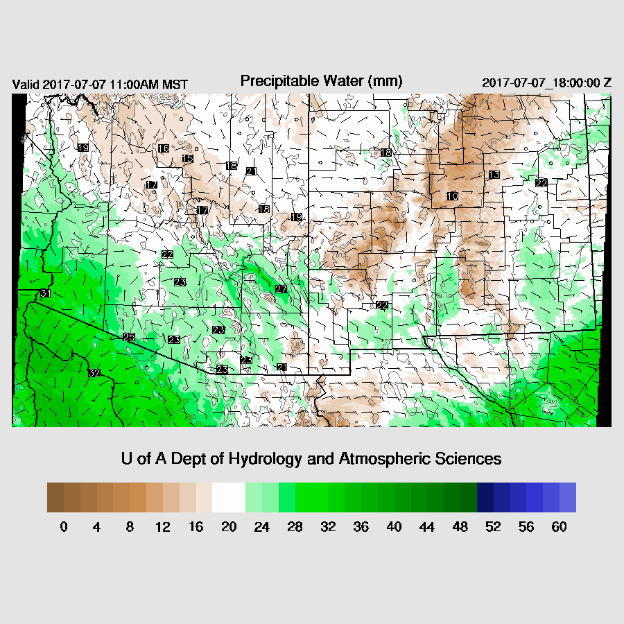
It doesn’t look like much when looking at the IPW plot, but 850mb Td plot shows 8 to 10C air moving into eastern Arizona which is enough to support deep convection.

This increasingly wet air does support more widespread convection over the White Mountains and by afternoon quite a few storms are present.
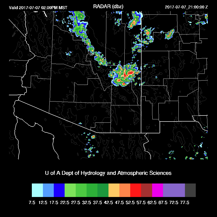
Mid level flow is ideal for steering these high elevation storms into the lower deserts as long as there is sufficient moisture/CAPE.

Tucson (and Phoenix) becomes very deeply mixed by late afternoon with a few hundred J/Kg of CAPE which may be enough to support some deep convection in the area. In spite of the mid level steering being very good, there isn’t much low-level shear as the flow is unidirectional 
By late afternoon, scattered storms do move close to both Tucson and Phoenix.

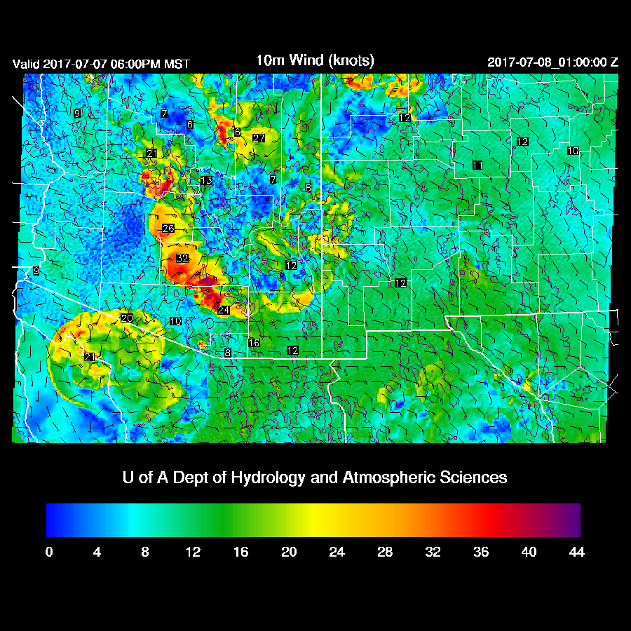
It is looking likely that some very strong outflows will move across Maricopa, Pinal, and eastern Pima during the early evening due to very deep inverted V vertical profiles in the lower deserts. Forecast confidence is high as all 4 of the most recent runs have very similar solutions. Finally, some action!

A few storms continue into the evening over the higher terrain of south-central Arizona. They appear to skirt the Tucson area.
There is an experimental 1.5km inner domain running over the summer to determine if the additional resolution produces better deep convection forecasts. So far, the difference between the 1.8 and 1.5km domains has been minimal. However, tomorrow, the 1.5km domain brings a more organized area of deep convection into far southern Pinal and into the northern parts of Tucson.
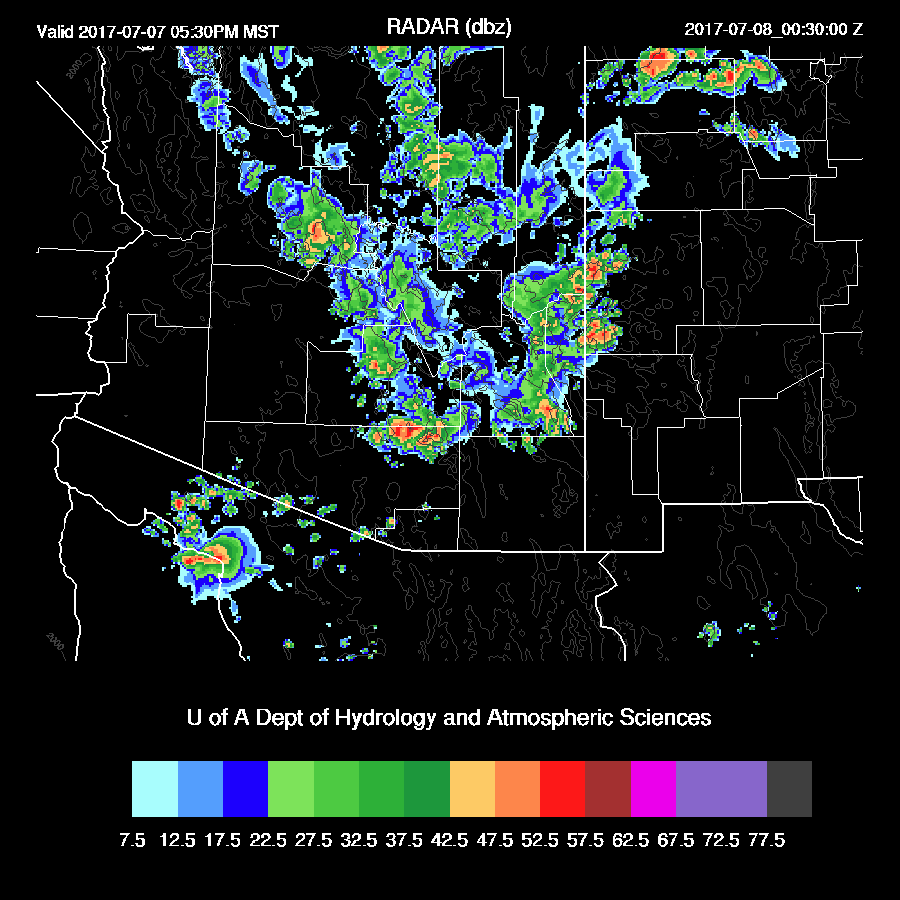
The storms don’t produce a lot of rain but do produce very strong winds. It will be interesting to see throughout the summer if the additional resolution will improve the accuracy of the forecast of deep convection.

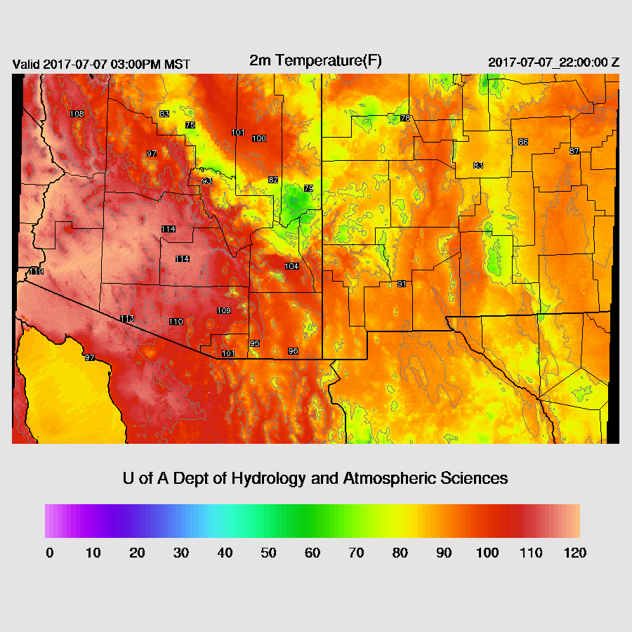
The other big news is the excessive heat tomorrow. 114-116 in Phoenix and almost 110 in Tucson.
Hi Mike: Up here in Phoenix we had a weak but visible (ACC/CC/Virga and on enhanced satIR) short wave move through between 07Z and 13Z. It wasn't in any model forecasts yesterday. The result was an refreshing influx of 55-60F dew pts into much of Maricopa County east of I-17 and north of I-10/US60. Given our dry pbl not much happened but in 5-10 days missing a feature like that could be result in a missed precip forecast or more. Most models have problems maintaining shorts that rotate out of Colorado into New Mexico and then Arizona during the summer. Thought you'd be interested. Will be watching for the evening/night outflow boundaries here in northern Maricopa County. Keep up the good work, Jack
ReplyDeleteThanks Jack. By the way did you see int inverted trough in the WV over the Big Bend of Texas? I just noticed it now and I took a quick look at the model runs to see where it goes. They move it into Sonora/Chihuahua. I was hoping it would come our way.
DeleteM
Saw some clouds in the sky this morning (Scottsdale).
ReplyDelete