Previous Forecast
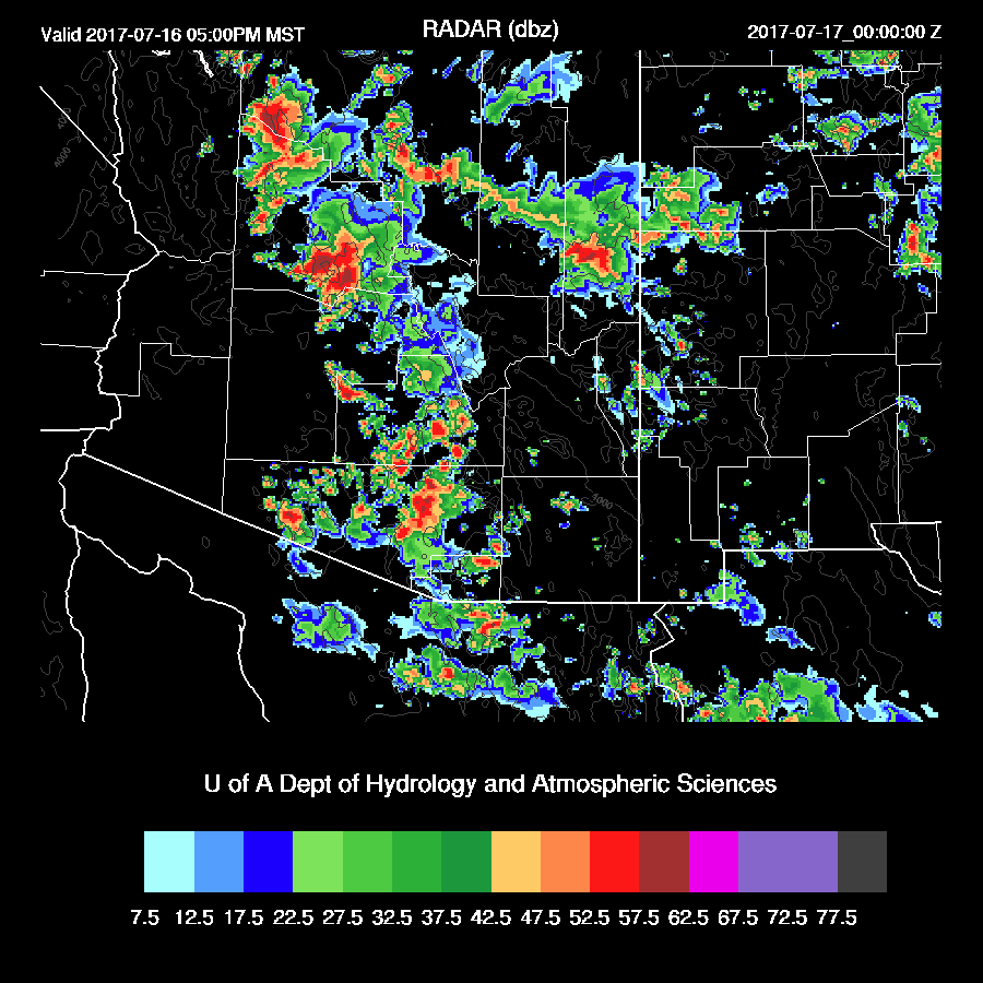
A very active day yesterday as storms came off of the high country and moved into the lower elevations. Most storms went around Phoenix but a few did pop up when outflows intersected. The second area of storms developed to the NE of Tucson and moved in during the late evening producing heavy rain and frequent lightning.

Model accuracy was very good with the WRFGFS (below) and 15Z WRFRRx being the best.

Initializations
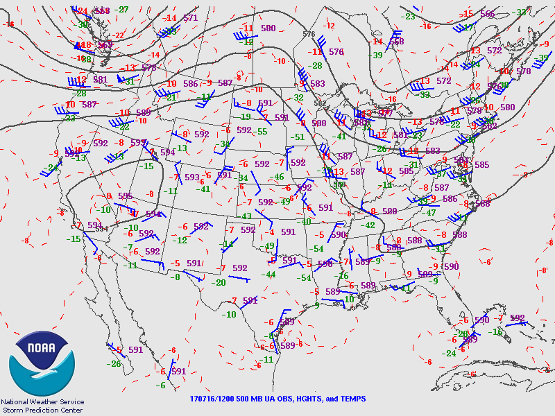
The upper air pattern is complicated with multiple short wave troughs rotating around a larger weak cyclonic circulation which is centered somewhere in northern Mexico. I counted 4 short waves using the WV imagery: eastern CO, far eastern NM, west of El Paso, and a MCV/IT southwest of Nogales! The main high center is located north of Las Vegas NV. The NAM, to its credit, has all troughs approximately in the correct position. The RR and GFS are missing the eastern NM IT, but that should be no factor for us.
There are some debris clouds across central Arizona and a few showers and clouds over far SE Arizona associated with the IT that is approaching that area. The NAM did not initialized enough clouds in far SE Arizona. The 12Z RR has too much cloud cover in eastern Pima county. This might work out OK as the Tucson Skew-t indicates an ‘onion’ type sounding meaning that the lower levels of the atmosphere have been stabilized so “right for the wrong reason” perhaps. The NAM continues with it’s wet bias but isn’t as bad as the last few days. The RR and GFS had minimal errors. Overall, the initializations look pretty good with the best being the RR and GFS. Confidence is ‘medium’.
Day 1
Mid level steering continues to be good and this is the longest streak in quite a while as usually this sort of set up only lasts a few days. The 12Z runs do have quite a difference in speeds across central Arizona as the RR is only 5 knots while the NAM is 10 to 15 knots. The IT slowly makes it’s way to the west and is still to the east of the state today as the forecast yesterday had it near the Nogales area.
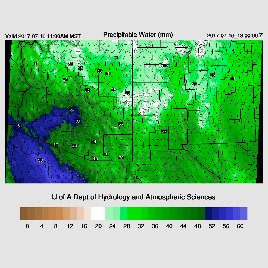
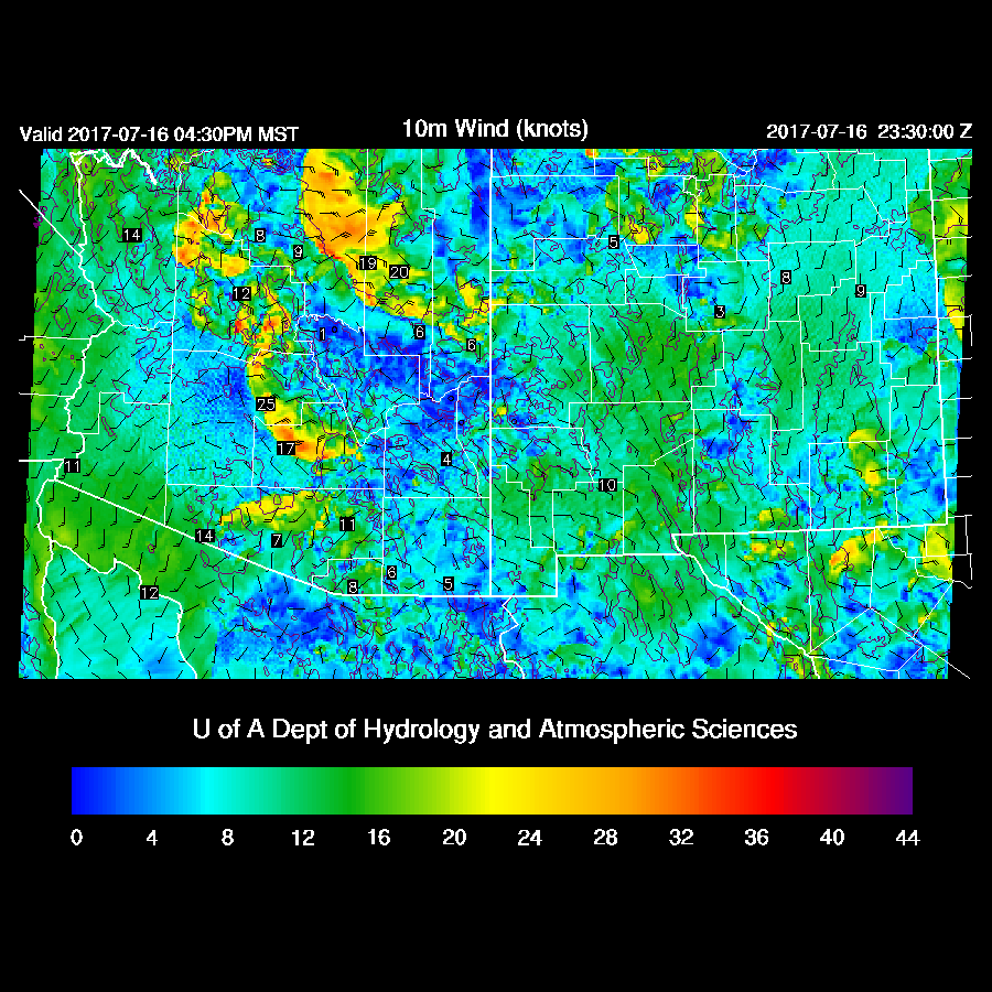
Can it get any wetter? Apparently it can as a strong outflow surge is underway with dewpoints in the low to mid 70’s around the Yuma area. Overnight, Tucson recorded on of the highest IPW values I’ve seen excluding tropical systems, of 53.7mm. Note that the low level easterly flow across far SE Arizona continues which will again act as a low level convergence zone. 
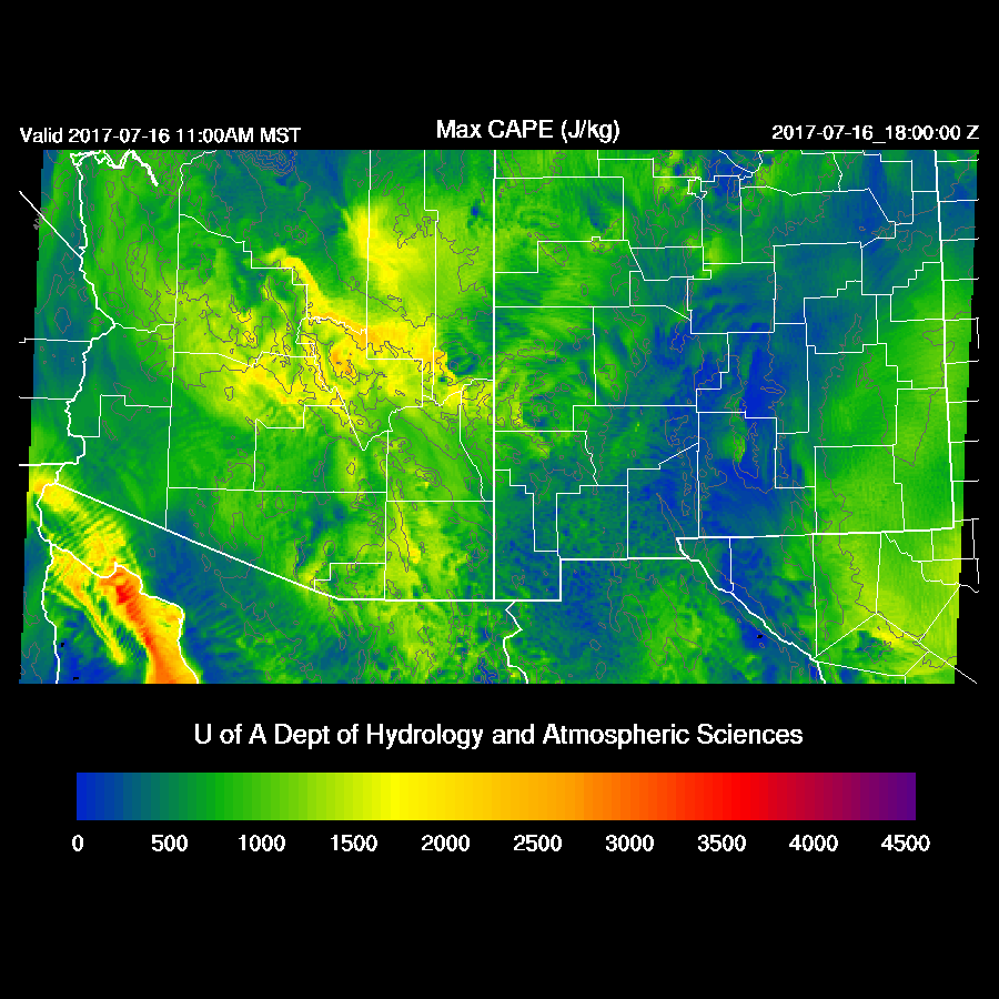
CAPE forecasts from the three morning runs vary significantly. The WRFRR has quite a bit more over the deserts while the WRFNAM has less, especially around Tucson. In any case, moderate to high CAPe over the higher terrain means early development and widespread strong storms for those areas.
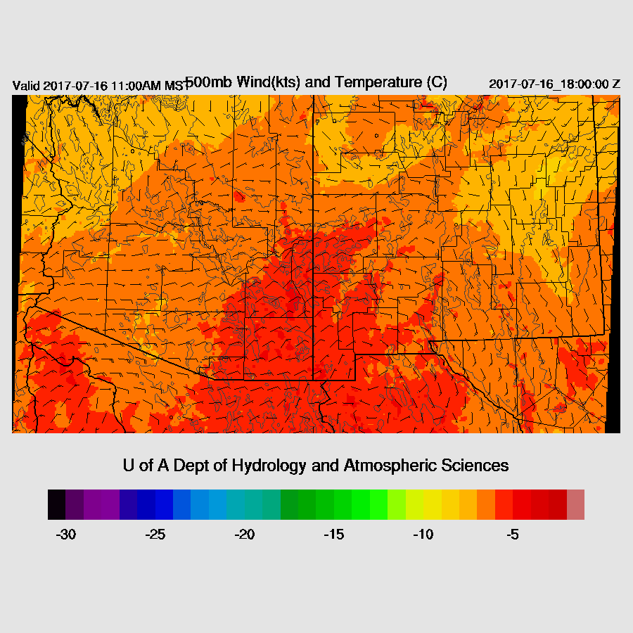
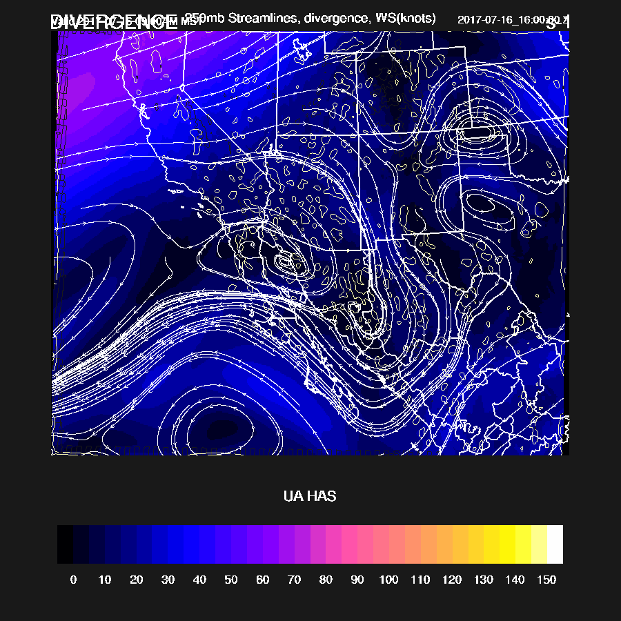
250mb forecast has the high center moving a little to the giving the state NW winds aloft which will blow anvils away from the storm motion. Also there is weak divergence which will also help support storms.
The forecast is remarkably similar to yesterday as storms form early and move towards the lower elevations of Pinal and Maricopa Counties.
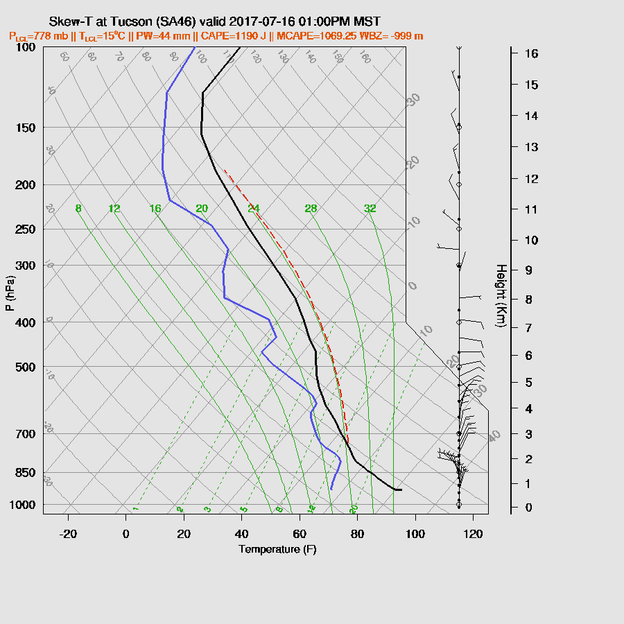
The vertical profile at Tucson this afternoon has a moderate amount of CAPE and continued excellent mid level steering so the potential for storms is there. After such a big night, I wonder if the NAM or GFS has enough surface and soil moisture present. Lots of incoming insolation is going to go to evaporating water today. It looks to me that the RR may have a better handle on that as is has quite a bit cooler and wetter PBL this afternoon.
Quite a bit of CAPE at Phoenix too but it’s going to take some strong outflows to get enough lift to the LFC. Also, upper winds become northeasterly and may blow anvils out in advance of the storms.

Thunderstorm outflow move across the Phoenix area again during the late afternoon. Winds are not predicted to be quite as strong as yesterday as the PBL isn’t mixed as deep and the sub cloud layer/inverted V profile is shallower because of the wetter air. Still, some severe winds especially with storms north of Phoenix and associated with wet microbursts.
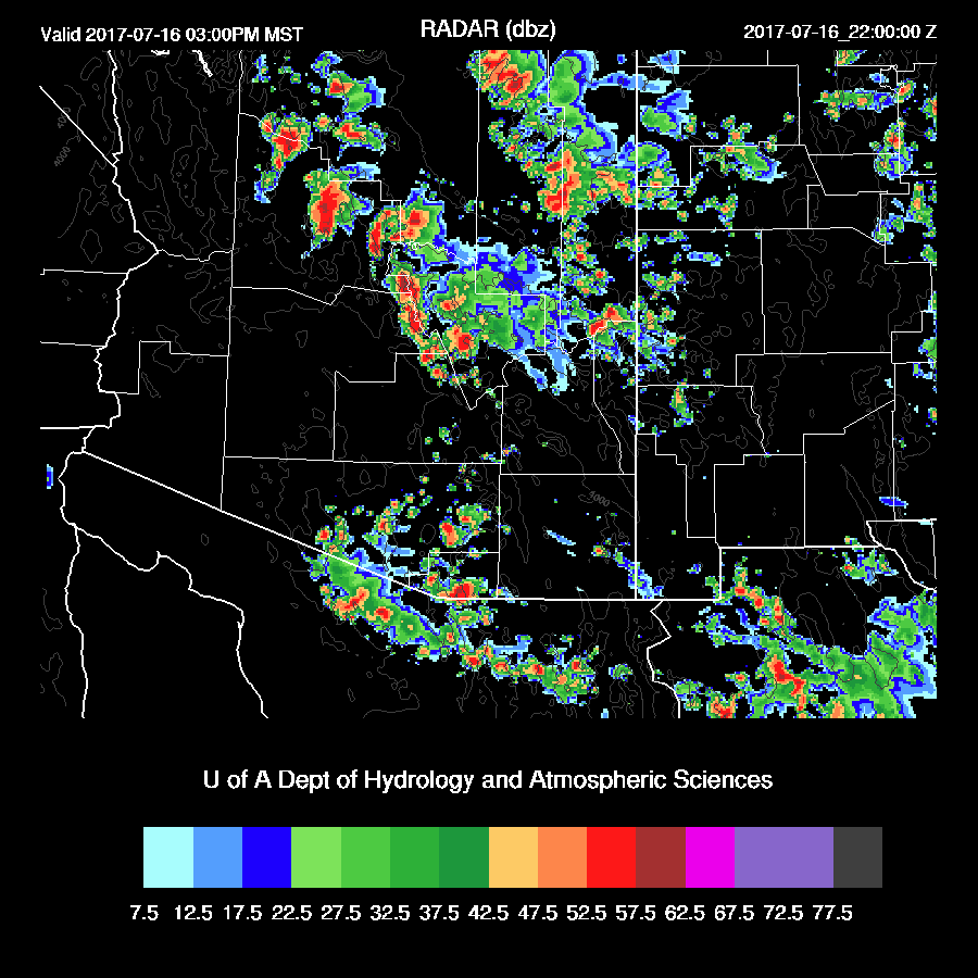
Strong to severe storms are again present just to the north of Phoenix and strong storms are over Pima and Maricopa Counties. Tucson is right on the edge and my guess is only limited activity there today. Again, only isolated to scattered storms in the Phoenix metro as the outflow move through.
The outlier today is the WRFRR as it is slower and more widespread with storms over central Arizona. In fact, it has quite a bit of activity over eastern Maricopa county early this evening. I feel this forecast is less likely then the WRFGFS/NAM, but I can’t rule it out. It will be interesting to see if the 15Z WRFRR has a similar solution. Note: I just took a quick look at the 15Z and it backs off somewhat on the intensity and is earlier with Phoenix area activity.
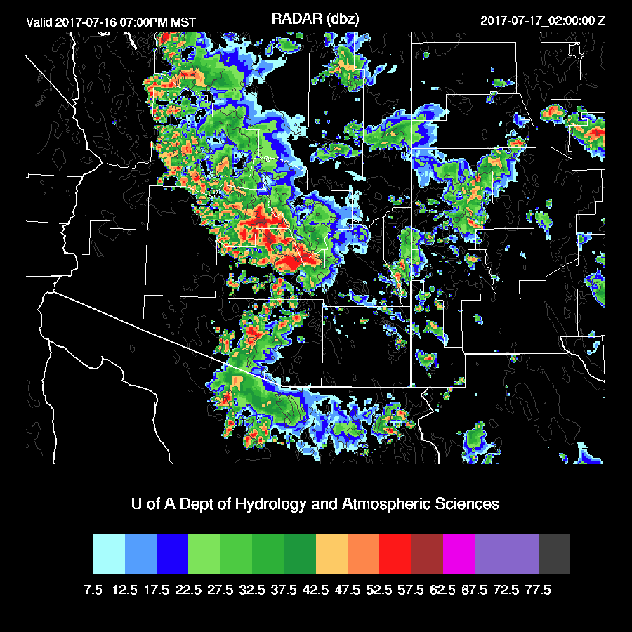
The WRFRR continues with this activity with some very strong/severe storms over central Arizona this evening.

One thing the runs agree on are very strong/severe storms along I-8 this evening. The WRFGFS looks nearly identical to what happened yesterday. Some storms develop during the evening hours over SE Arizona as was the case yesterday.

Lightning flash rates with evening storms is moderate to high.

Day 2
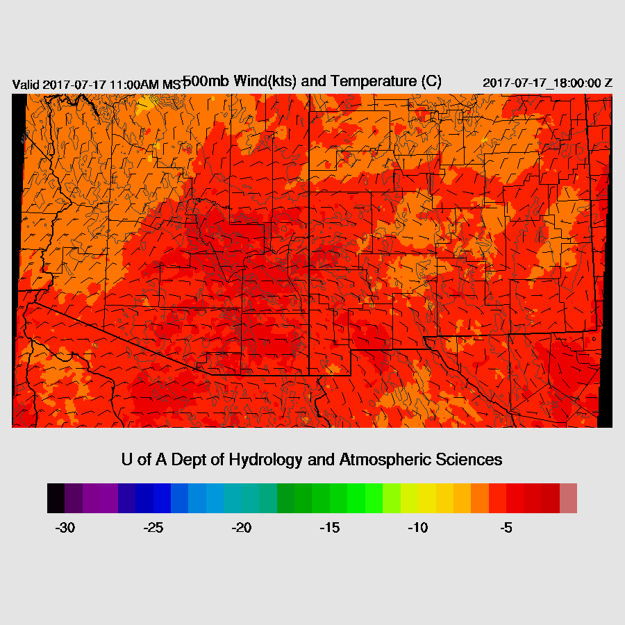
Different day, same situation. The high center moves a little to the west while the IT is located south of Nogales which continues the 10 to 15 knot NE flow across the state. A little warming occurs as 500mb temperatures are around -4 to -5 which is quite warm which will have a negative impact on storm activity in SE Arizona.
Moisture continues to be very high with IPW over 50mm over the lower deserts!

Same old, (good) story of deep convection forming over the high terrain and moving towards the deserts by early evening. SE Arizona continues to be suppressed with only isolated mountain activity during the day.

Once again, storms more or less go around Phoenix with only a few within the valley. In general coverage and intensity looks to be less and activity during the evening instead of afternoon.

No comments:
Post a Comment
Note: Only a member of this blog may post a comment.