Previous Forecast
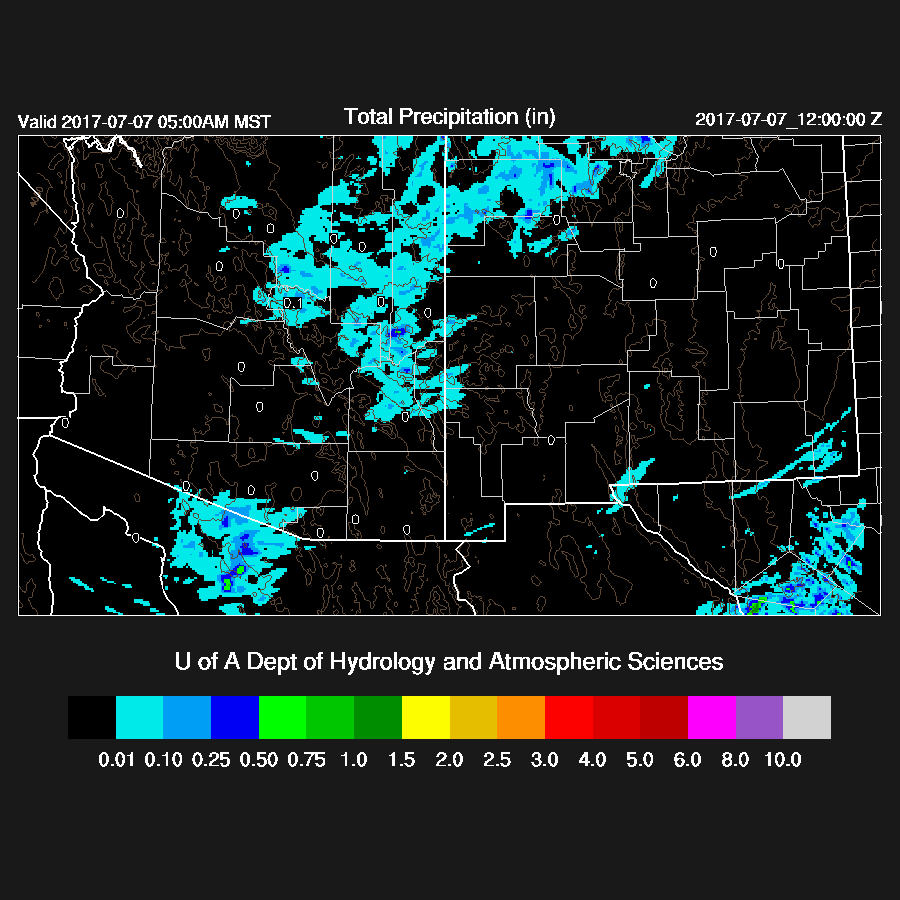
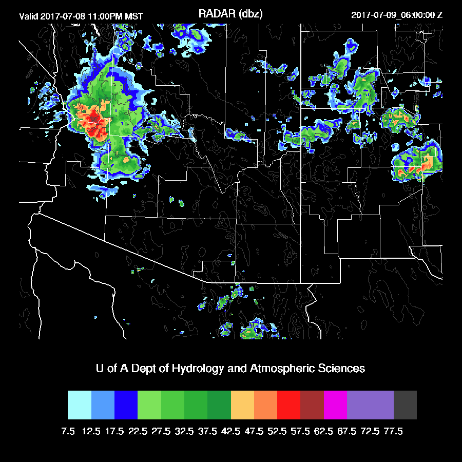
Storms developed just south of Tucson and in Pinal County during the late afternoon and early evening. All of the runs were a bit too conservative with activity in those areas and were fine elsewhere. (Lightning flash density from Bob’s blog)

WRFNAM
Initializations
The monster high continues to dominate the western CONUS. A couple of stations reported 500mb heights at 5990m at 0Z. A mid/upper inverted trough is moving slowly to the WSW across far southern Sonora. The NAM has initialized it a little too far to the west while the GFS has it in the correct position. It’s mostly clear across AZ and Sonora so no problems there. NAM IPW is not initialized very well in southern NM and SE AZ as it’s a few mm too wet. The IPW correction scheme should take care of the errors as they aren’t too large. The IPW initialization in the GFS looks fine.
Day 1
It appears that yesterday’s model runs were too optimistic in bringing in some moist air out of southern NM/Northern Chihuahua in the moderate easterly flow. Perhaps the lack of upper air data in northern Mexico is to blame. In any case, New Mexico and SE Arizona continue to be quite dry this afternoon with little or no convection expected. The central and western Mogollon Rim and areas west of Tucson do have sufficient moisture to support some deep convection.

600mb flow, while not very strong over central and northern AZ, does support a southwestward movement of storms today thus the possibility of a thunderstorm outflow continues for the Phoenix area.

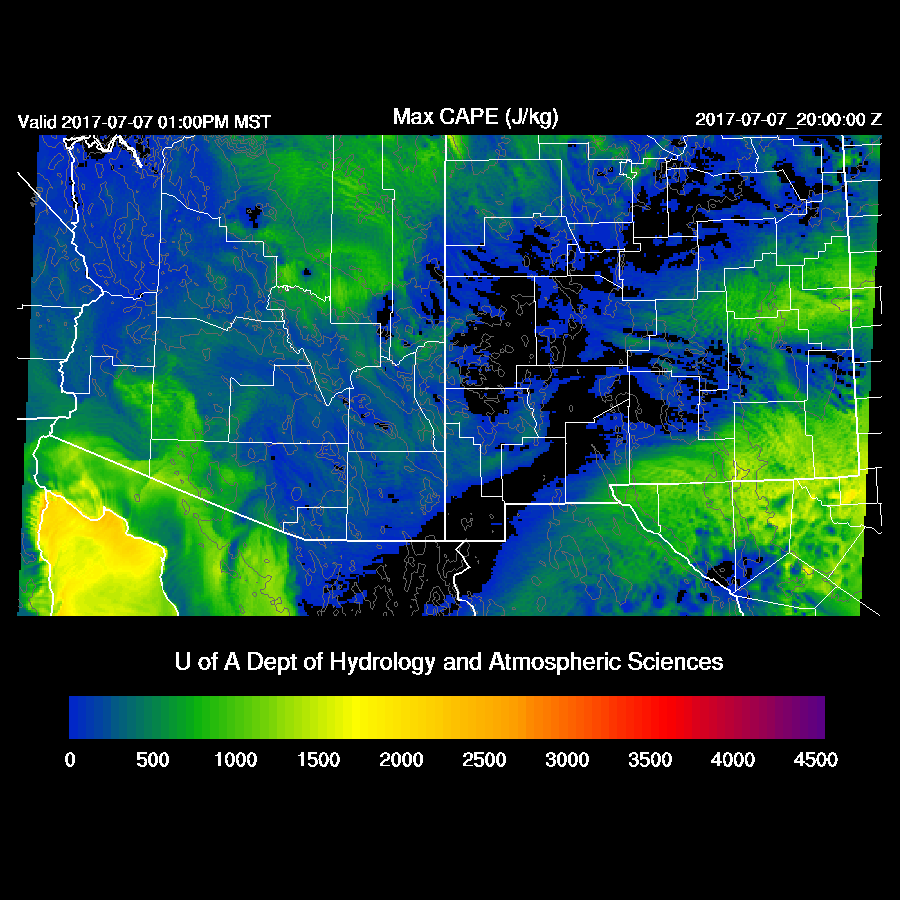
CAPE is lacking over the Phoenix area so storms that do move that way will probably not make it into the valley.
Both the WRFGFS and WRFNAM are similar as they develop some scattered deep convection over the Rim and a few storms west of Tucson this afternoon.

Thunderstorm outflows approach Phoenix by late afternoon. Outflows are not as strong as was being forecast yesterday, but Phoenix will probably see a dust storm and slight cooling. It’s hard to say how much dust there will be as the source region had lots of vegetation/root structure this past winter which may hold down the dust somewhat.
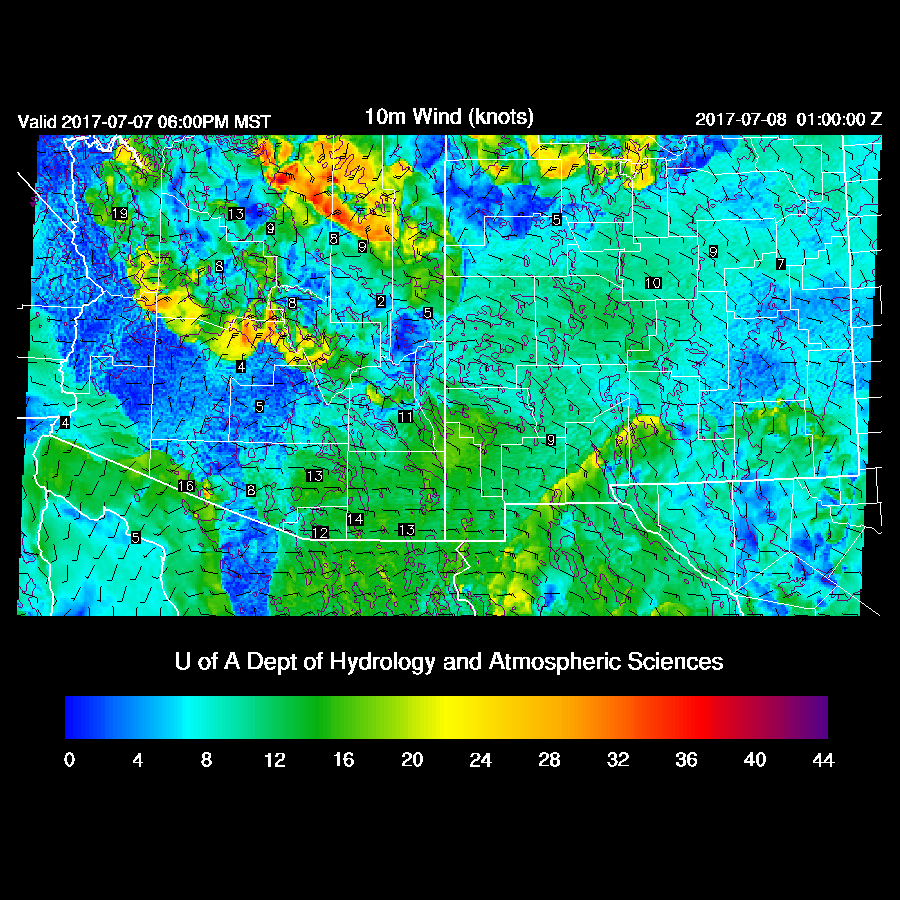
Hot in the deserts today with Phoenix around 115 and 108 in Tucson. The temperature here in Tucson is going practically straight up as the easterly downsloping winds have begun.

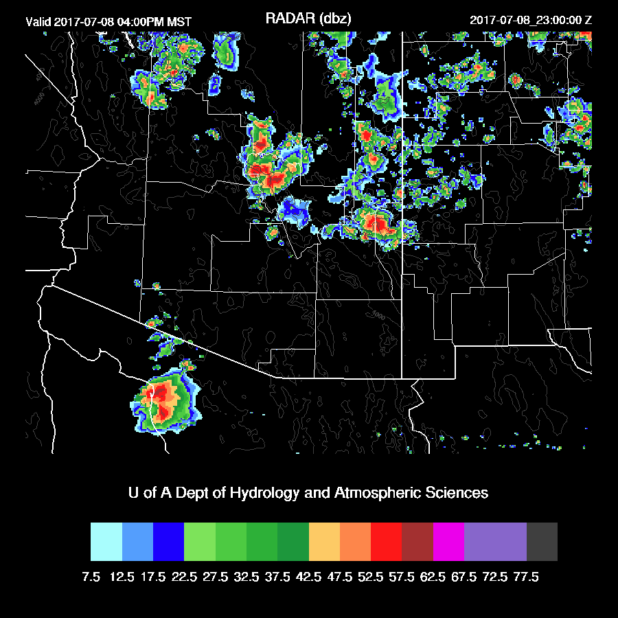
Storms develop this evening over the higher terrain of western Pima and southern Maricopa counties. The WRFNAM is the more active run (below).

Day 2
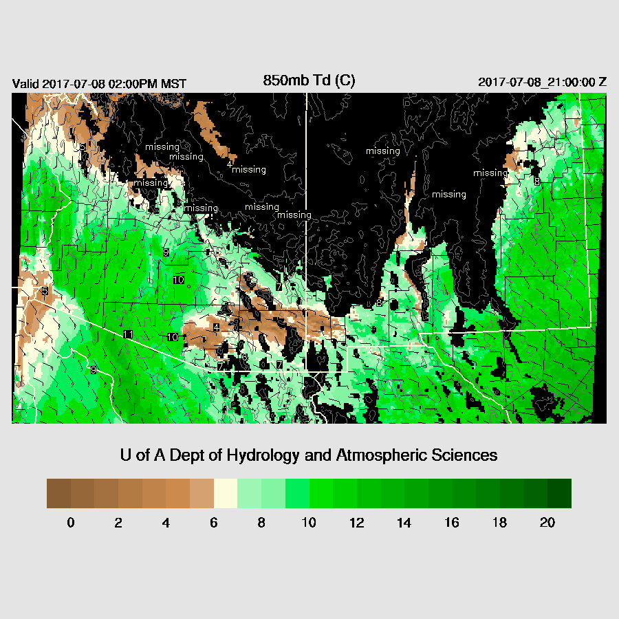
A moderate to strong Gulf Surge gets underway overnight and by early afternoon, moderate amounts of moisture have advected into much of the state except the SE corner where dry downsloping low-level easterlies continue. This backdoor dry line is likely to provide low-level convergence and act as a focal point for storm formation.

The surge shows up well at 850mb and dewpoint temperatures increase to around 10C which is sufficient to support some deep convection in lower elevations.
Deep convection takes awhile to get going due to the slightly cooler low-level air associated with the Gulf Surge. Storms that do form could be quite strong and mid level steering flow is ideal for moving them to the WSW towards central Arizona.
Will the storms make it into the Phoenix valley? It’s not an ideal setup as the slightly cooler/wetter lower PBL isn’t mixed deeply in the WRFNAM and CAPE is only around 500-1000 J/Kg. A good outflow into the valley should be able to trigger some isolated to scattered deep convection.

Areas just west of Phoenix have enough CAPE to support the development of deep convection as the outflows move through.

Both 12Z runs are similar as the develop new storms during the evening hours over Yavapai and down into central/western Maricopa counties.

Strong to severe storms move through western Arizona during the late evening.
No comments:
Post a Comment
Note: Only a member of this blog may post a comment.