Previous Forecast
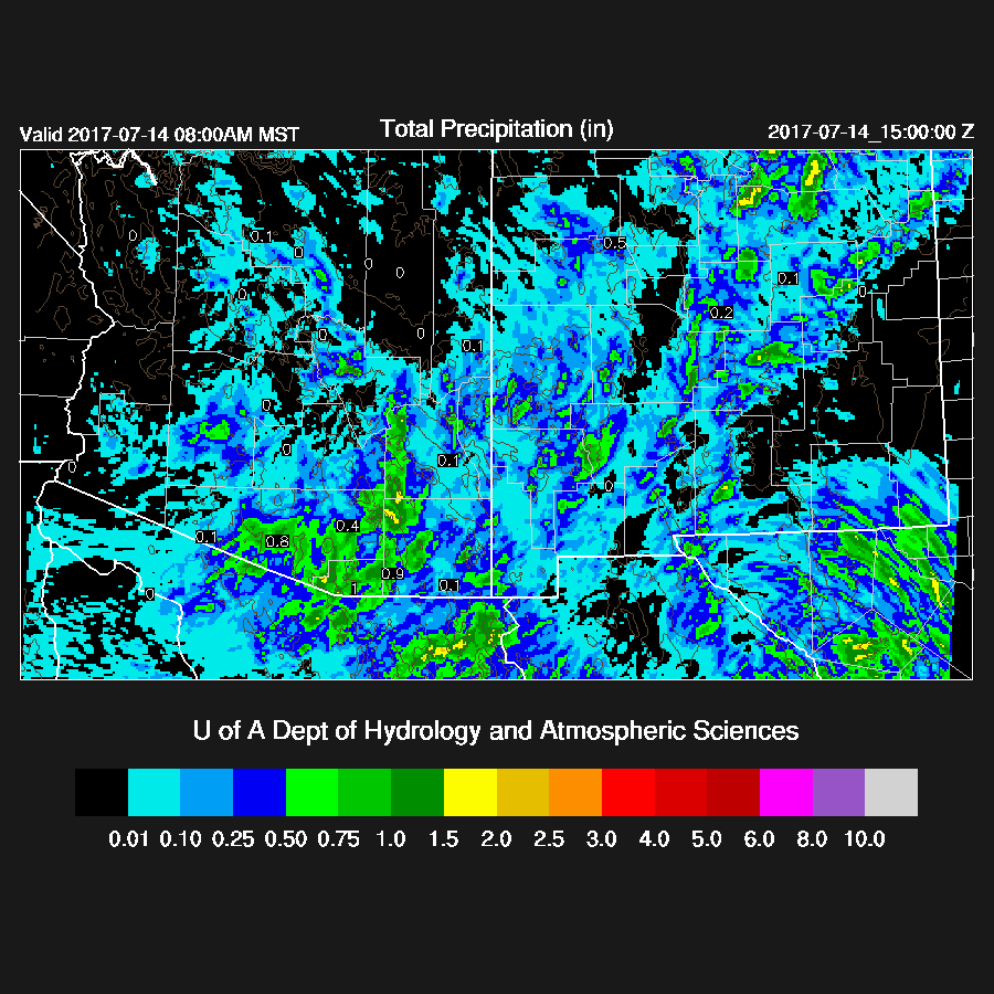
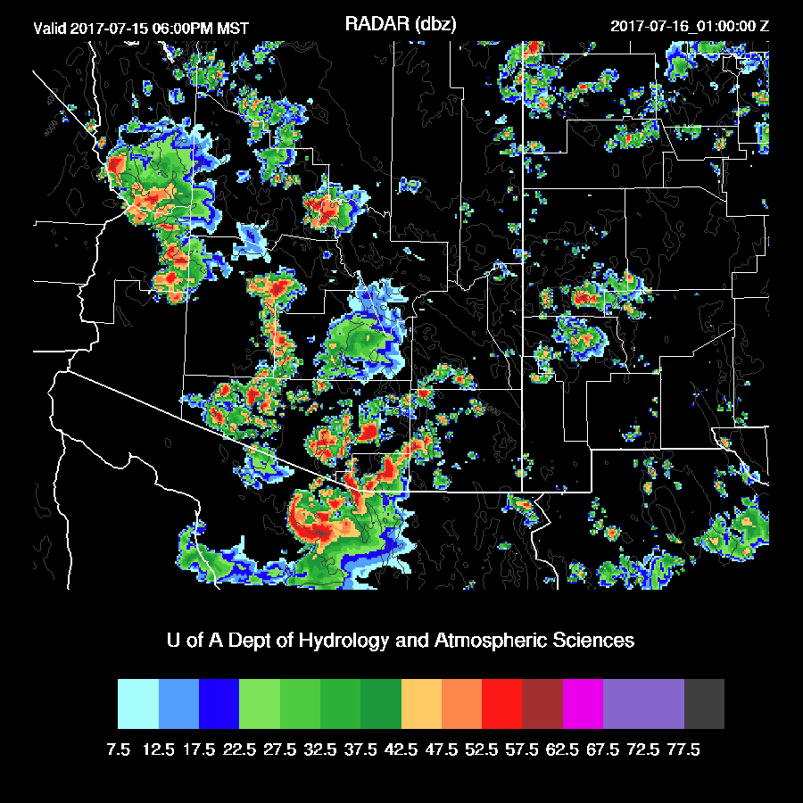
Most of the forecast package verified as strong and a few severe thunderstorms impacted southeastern and far southern Arizona during the late afternoon and evening. The failure was the predicted storms around the Phoenix area during the late evening which never materialized. The Phoenix IPW unexpectedly dropped to near 30mm during the early evening and the outflow from southern Arizona storms was weaker than forecast. Graphic from weather.graphics

The WRFGFS and WRFRRx (below) were quite accurate in the location of the precipitation with the only difference being amounts (WRFRRx had less precipitation).

Initializations
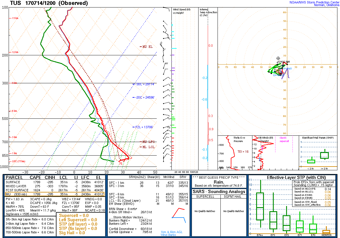
Scattered storms continued into the early morning over southern Arizona and while the clouds cleared out by 15Z, a modified cool layer was left behind as was seen by the ‘onion’ type Skew-T from Tucson at 12Z. The NAM and RRx initialized it accurately. The GFS didn’t have the near surface as modified as it should've been.
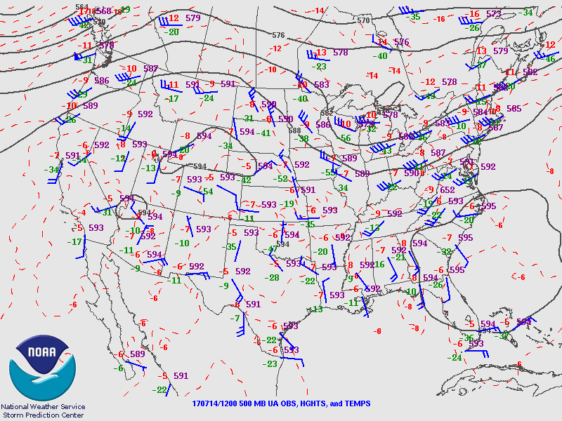
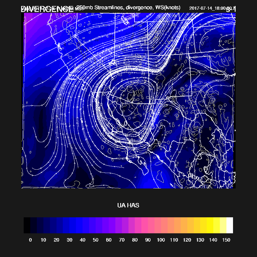
The western CONUS is dominated by a large area of high pressure with the center located far to the north in WY while a second center is located over western Arizona. A large cyclonic circulation, more of a westward moving cut off low than an inverted trough, is centered south of El Paso. Another is located east of La Paz at the mouth of the GofC. The El Paso low appears to have short waves rotating around it with one over the Big Bend and the other over southern Sonora. Of course, most of the area covered by the low is in the northern Mexico data void. The NAM seems to have the best handle on this complex situation.
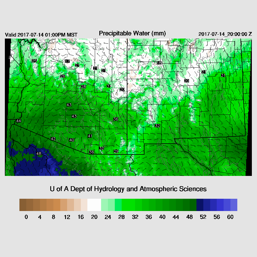
It’s now mostly clear over all of the state except for along the AZ/SON border. Only the RRx has enough clouds but the errors with the other initializations shouldn’t matter for the rest of the state. Once again, the NAM is more than 5mm too wet in Sonora. The other two initializations have IPW initialized well and I don’t understand why the NAM continues to have this bias. The IPW correction routine isn’t always able to correct for large errors like this so the WRFNAM may be suspect, especially in Sonora. Overall, the WRFRRx and the WRFGFS look pretty good. Confidence is ‘medium’.
Day 1
Wet air continues to advect into the state as a weak surge continues. Again, IPW ranges in the low 40mm range over the lower elevations of the deserts while northern Arizona is a bit drier due to NW flow. Low-level easterly flow is present over southern NM and just into SE Arizona. This wind shift line will act as a low-level convergence zone thus deep convection will form along it today.
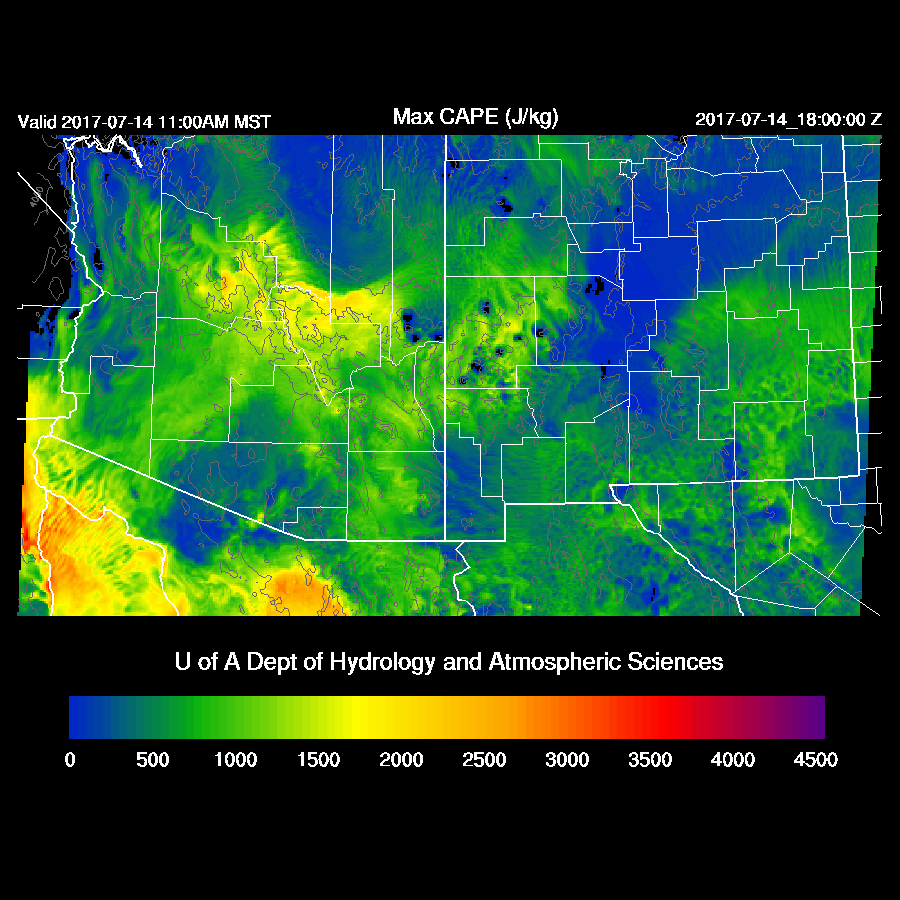
Moderate to high CAPE is forecast for the high country. CAPE in far south central Arizona is quite low as one would expect after the activity there last night and this morning. Areas around Phoenix seem to have a fair amount so maybe today is finally the day for Phoenix to get some activity.
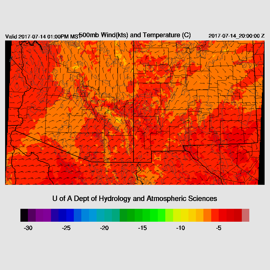
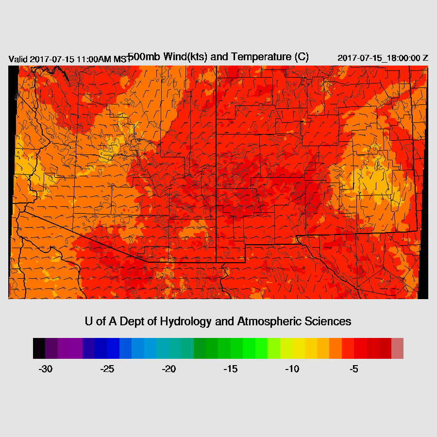
Steering flow is again excellent for much of southern Arizona due to the NE flow between the high centered over Bullhead City and low south of El Paso. High elevation storms will again move into the deserts this evening as long as there is sufficient CAPE.
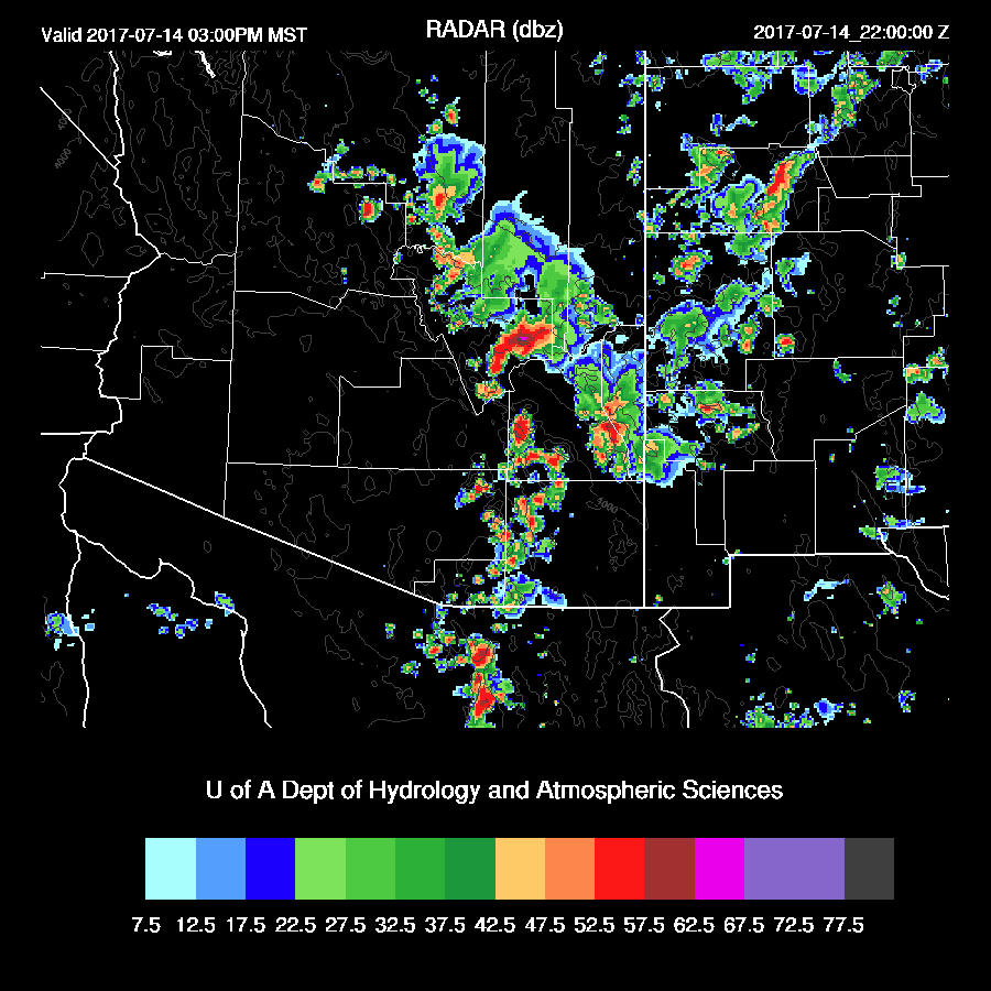
A few strong storms are present across the eastern ⅓ of Arizona this afternoon, including some in SE Arizona which appear to be forming along the low-level convergence zone.
At 250mb, there is a high centered on southern Arizona along with weak divergence which will assist storm formation and growth.
In spite of the modified lower boundary layer, the WRF is forecasting a well-mixed BL by late afternoon with a weak capping inversion. Above this, as in past days, another inversion is around 500mb. This second inversion has kept daytime deep convection to a minimum thus allowing stronger and more organized storms to move in during the evening. Steering and low-level winds continue to be very good for storm organization and movement.

Once again, a widespread area of storms moves into the Tucson area by late afternoon or early evening. The model runs have been a little too early and that may be the case again today.

Some of the runs are forecasting very strong/severe storms again. The WRFGFS has very strong/severe winds in the Tucson area after 5 pm. Sustained up to 50 mph and gusts over 65mph. My guess is it is too strong as the WRFGFS appears to have too much heating as the 17Z model temperatures are 3-4F too warm. The WRFRRx handles the cooling and wet ground the best of the three this morning.
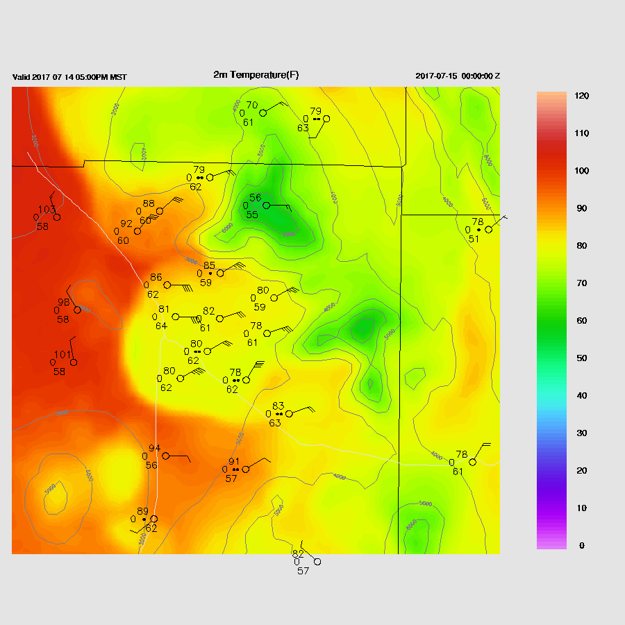
Storms also approach Phoenix by late afternoon and the vertical profile looks to be supportive of deep convection as CAPE is around 1000 J/kg. Phoenix will need a decent outflow or intersecting outflow boundaries to trigger deep convection.
There are some quite strong outflows associated with deep convection and some of the runs move these into the Phoenix area.

All three of the 12Z runs have some activity in or near Phoenix early this evening. Thunderstorms, some strong/severe, continue across far southern Arizona.

Day 2
Mid level flow continues to be favorable for steering high elevation storms into the lower elevations of southcentral and southeast AZ. Quite warm air is present over SE Arizona which is unfavorable for deep convection.
Very wet air is present over much of the state with IPW increasing over today. Weak easterly low level flow continues out of NM thus low-level convergence is again present over SE Arizona and that is a likely location for initiation.

Another active day as by late afternoon, areas of storms again move towards the deserts.

Scattered storms are again forecast for the Tucson and Phoenix areas.
No comments:
Post a Comment
Note: Only a member of this blog may post a comment.