Previous Forecast
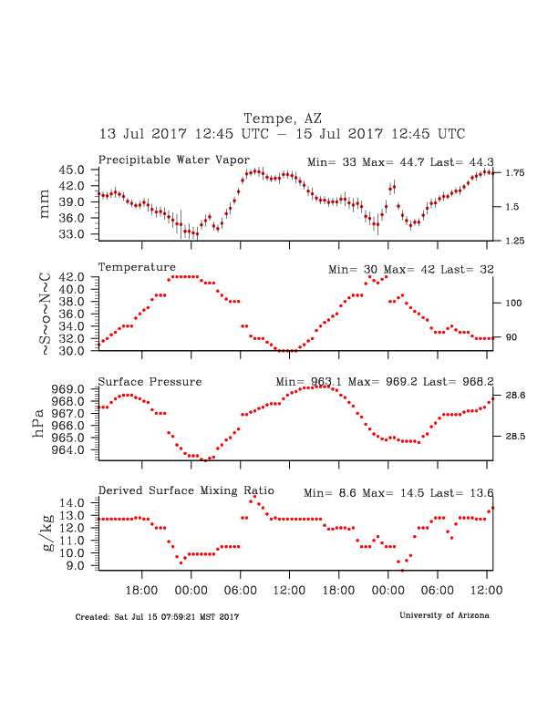
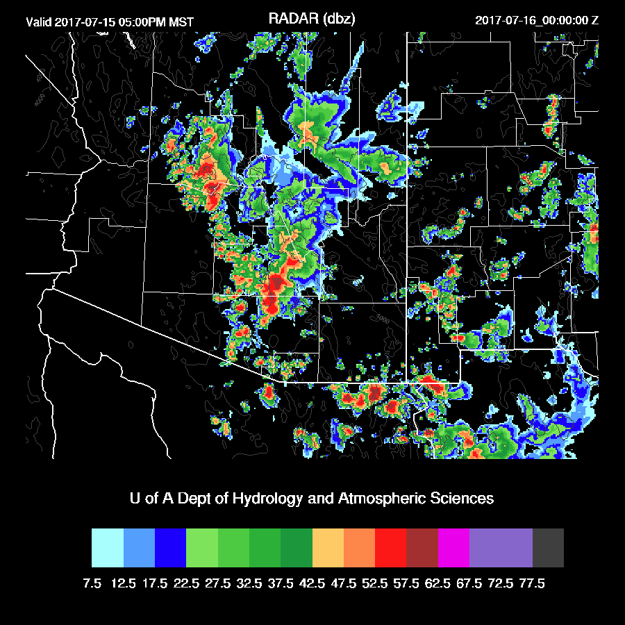
Another bust for the Phoenix area. At least the WRF runs were close as storms came up to the valley, dissipated, and send out a big outflow and associated dust storm. Yesterday, the IPW decreased all day and was down around 35mm by late afternoon, about 5mm below the forecast. Maybe someone can look at the afternoon events more closely and tell me where the moisture went. My guess is unforecast dry air entrainment at the top of the PBL.
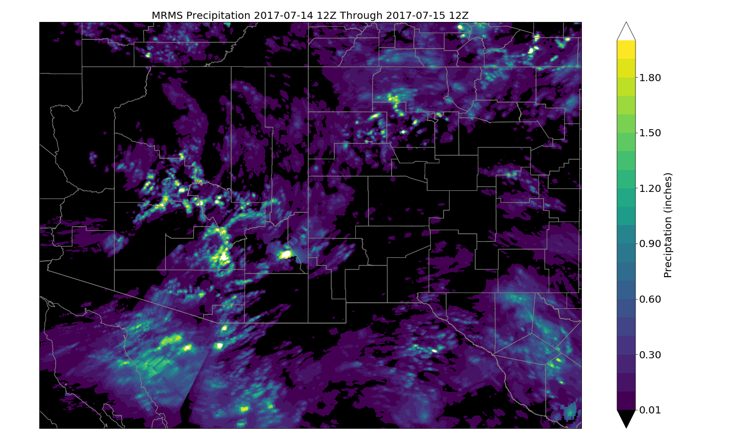
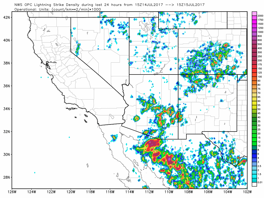
The runs had the general idea of activity over the higher terrain and then out over Pinal and Pima county later. 24-hour MRMS precip below from Will Holmgren and lightning from weather.graphics
Initializations
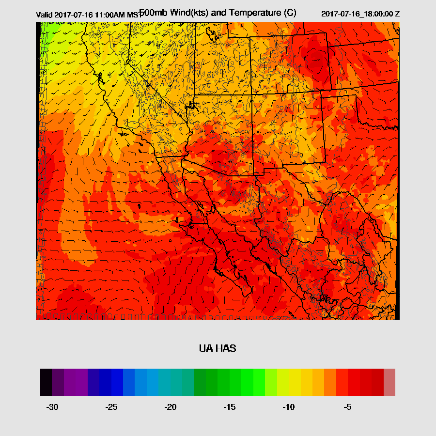
The western CONUS ridge has strengthened slightly since yesterday as the 594 contour covers much of the western US with one center continuing over far southern NV. Multiple inverted troughs are rotating a larger cyclonic circulation in northern Mexico. One IT stretches from the Big Bend all the way to northern CO. An MCV is located over southern Sonora. Another weak IT seems to be approaching SE Arizona from NM according to WV imagery.
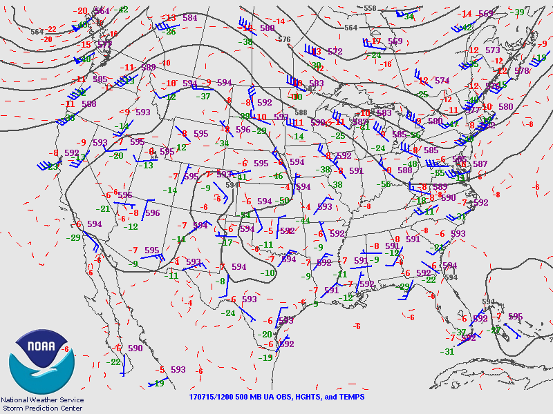
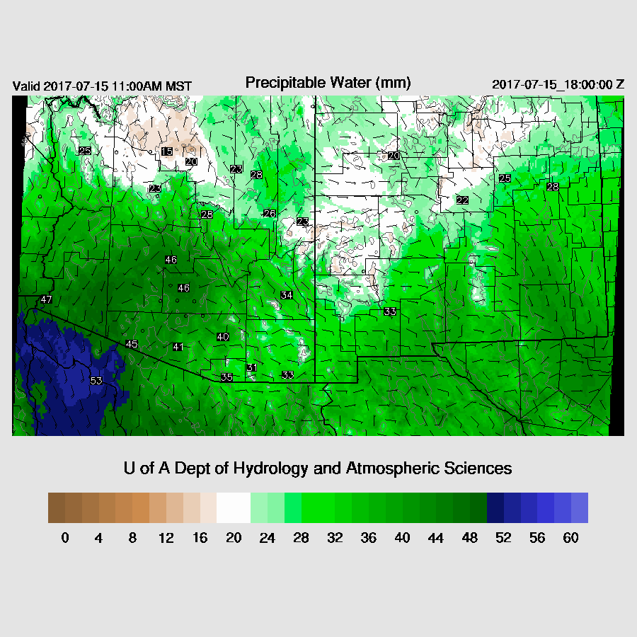
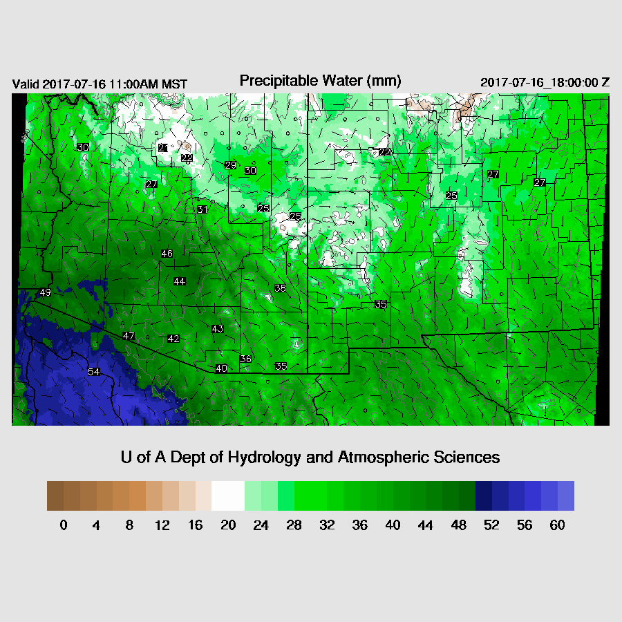
From what I can see, the NAM, GFS and RRx seem to initialize most features well. The RRx is too cool over southern NM and SE Arizona at around -6C at 500mb. The El Paso 500mb temperature was a warm -4. Skies are once again mostly clear across the state and this is initialized well. IPW has not initialized well at all in Sonora as both the NAM and RR are much too wet. This error shouldn’t impact today’s forecast too much, but it’s likely to impact the accuracy of tomorrow’s. It appears the GFS initialized the best and forecast confidence is medium.
Day 1
IPW remains very wet over much of the southern ½ of the state as a weak to moderate surge continues, driven by outflows from the large storms over northern Sonora. Again, a low-level convergence zone is located from Santa Cruz County northward and will provide a focal point for storms as it did yesterday. One question is if Phoenix can hold onto the moisture into the afternoon or will it decrease again?
500mb flow continues to be favorable to steer storm into the lower deserts. Warmer air is present over SE Arizona and with low level easterly downslope flow, storms will again struggle there.
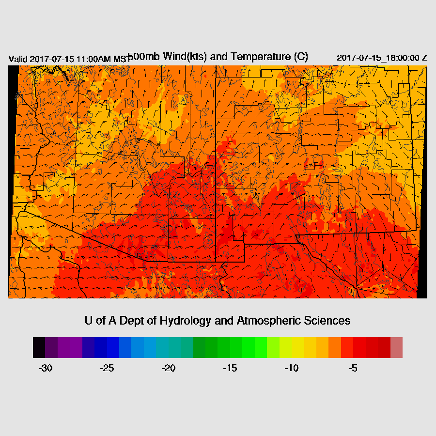
CAPE is again quite high, especially over the higher terrain, so expect storms to quickly form there before noon. The lower deserts have plenty of CAPE to support storms that move down off the Rim later this afternoon.

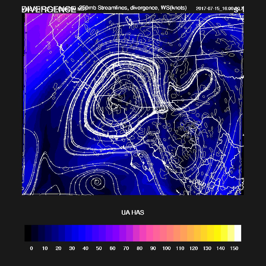
The 250mb high is centered over far SW AZ with an area of confluence over far eastern AZ. Most of the state is under weak divergence aloft.
Storms get going early over the high terrain and move slowly to the SW. By later in the afternoon, they are moving toward the lower elevations of Maricopa and Pinal County.

The afternoon vertical profile at Tucson has a moderate amount of CAPE, but the warm and drier air aloft seems to be keeping deep convection to a minimum.

Impressive vertical profile at Phoenix by later in the afternoon. CAPE is the highest it’s been so far this summer plus mid level flow doesn’t seem to be advecting in dry air. The slightly cooler air in the PBL is mixed fairly deeply. A good outflow or two should be able to trigger deep convection. Steering and shear are also good. WRF has to be right eventually so is today the day???

All three of the morning runs bring strong storms near Phoenix where they eject strong outflows much like yesterday.

There are minimal intersecting outflows and just a linear outflow doesn’t seem strong enough to trigger widespread deep convection on Phoenix in some runs. It’s somewhat puzzling as I would think the strong outflow would be enough. A giant dust storm seems certain in and around the lower elevations of the Phoenix area. Other very strong to severe storms form on the convergence line over the higher terrain of eastern Pima and Pinal and move out into the lower elevations, again, much like yesterday.
Tucson is right on the edge of the late afternoon early evening activity with most of the storms staying just to the west and north. However, later in the evening, some outflows move into SE Arizona and trigger redevelopment. Large strong to severe storms continue and move into western Arizona.

Day 2
Multiple inverted troughs just to our south tomorrow. The various runs vary on the locations, but the strongest seems to be located just south of Douglas tomorrow.
Lots of moisture once again.
Day 2 confidence is low due to all the activity that is expected today. The PBL is likely to have widespread cooling thus more stable conditions will produce later, less widespread, and lower intensity storms.
No comments:
Post a Comment
Note: Only a member of this blog may post a comment.