Previous Forecast
A fairly active day which included both Phoenix and Tucson. The west side of Phoenix had severe thunderstorms during the late afternoon and Tucson had some storms that again produced very heavy rain.
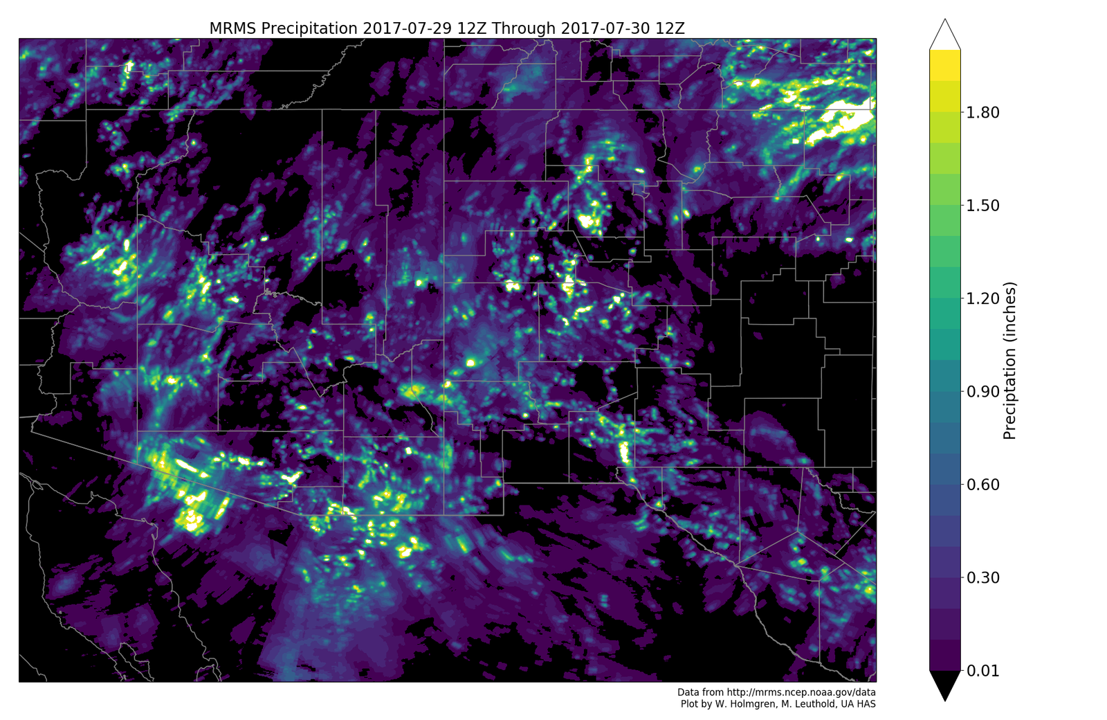
No forecast really was that good. The WRFRR was doing well up until the outflows converged over SE Phoenix. The WRFRR then forecast widespread strong storms along the convergence zone which never materialized as the WRFRR had too much CAPE. The WRFNAM had a similar problem. The sounding from 0Z indicated only 300 J/kg thus only a few weak storms were able to form along the convergence line. A wasted opportunity. Something I didn’t mention was the forecast of strong winds associated with the storms that moved across the west side of Phoenix as most of the runs did have strong winds, but a little further to the west.
Initializations
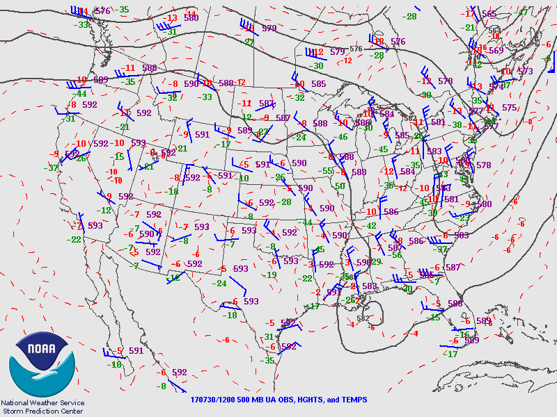
“Too wet to rain” is the message for today. Widespread clouds are present this morning across almost all the state due to the record setting (Tucson) amount of moisture plus the weak trough across southern Arizona and into Sonora. Mid level flow is weak over much of the SW US with no well defined high center. The 12Z mid-level initiations look OK at 500mb.
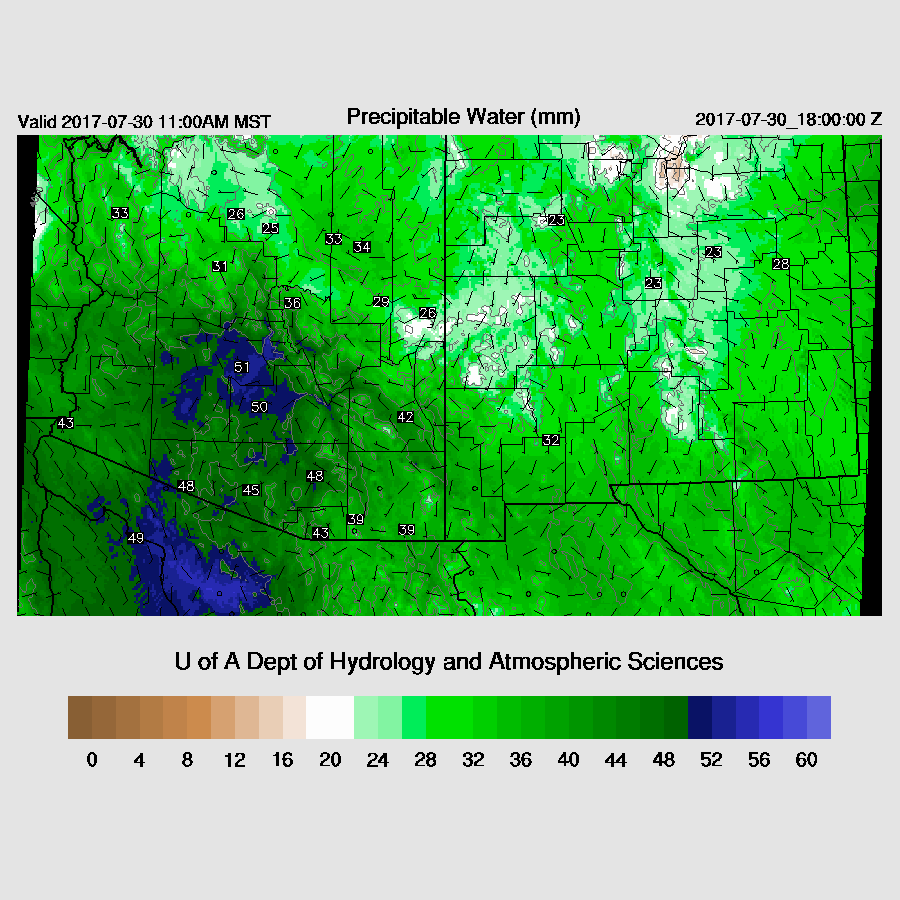
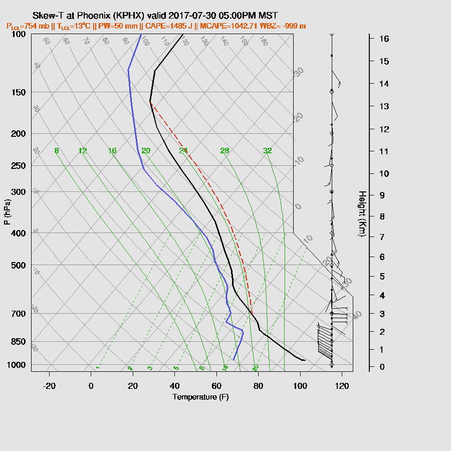
The WRFRR is doing a fair job with the thick mid level clouds this morning. The WRFNAM and WRFGFS don’t have enough coverage. This summer, I’ve implemented a modified option to better model these mid level clouds as morning debris clouds in the model have always been too sparse. So far this monsoon season, it’s been an improvement over the default. The NAM continues to have issues with too much moisture and that is again the case today as it’s a few mm too wet. The RR and GFS have only minor errors. It is amazing to see that Tucson/Phoenix have higher PW than just about anywhere along the west coast of NW Mexico! The WRFRR seems to have the best initialization today.
Day 1
Like I said above, it’s “too wet to rain” today which means there is so much moisture and associated clouds thus not enough heating will occur to develop storms over the lower elevations.
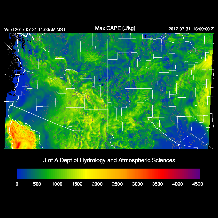
CAPE is very high over much of SE Arizona thus areas that see some heating will see some strong storms with very heavy rain.

Steering flow is mainly light and variable except over SE Arizona as winds are SSE at 10 to 15 knots. That area is likely to be the hot spot for storms today as they are also getting some insolation.

Storms develop by late morning over SE Arizona and continue into the early afternoon. A few are possible along the Rim too.
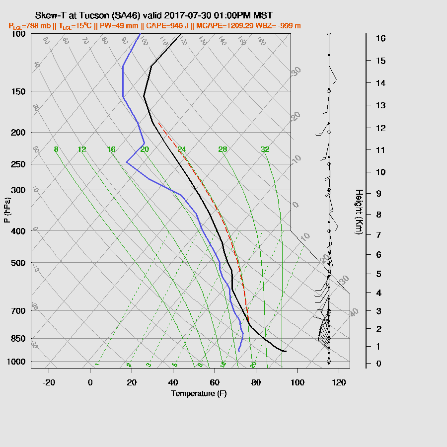
The potential is there for Tucson as the atmosphere remains extremely wet along with around 1000 J/kg of CAPE so it’s not out of the question that a storm or two may pop up over Tucson. Mid-level steering flow is poor and any storms that form won’t move much.
A few storms continue over the higher terrain of the state into the late afternoon. None of the model runs forecast storms for Tucson.

Phoenix also continues to be very wet today and this evening with over 1000 J/kg of CAPE. Mid level steering winds are poor and there is a fairly strong inversion above the mixed layer which will need significant intersecting outflows to break and this is very unlikely to happen today.
Day 2
There is a big difference between the WRFGFS/NAM and the WRFRR as the WRFRR is quite a bit drier over the western part of the state. I don’t know which is correct but my guess is that it’s not going to dry out that much. In any case, the eastern ½ of the state has more than enough moisture to support deep convection.

CAPE is again quite high over the eastern part of the state. The morning cloud cover is forecast to be less so there should be more heating thus more storms tomorrow.
Mid level steering flow continues to be light with 5 to 10 knots mainly from the SSE.

Some runs do have a fair amount of activity during the late afternoon and into the evening over SE Arizona and into the Phoenix area.


No comments:
Post a Comment
Note: Only a member of this blog may post a comment.