Previous Forecast
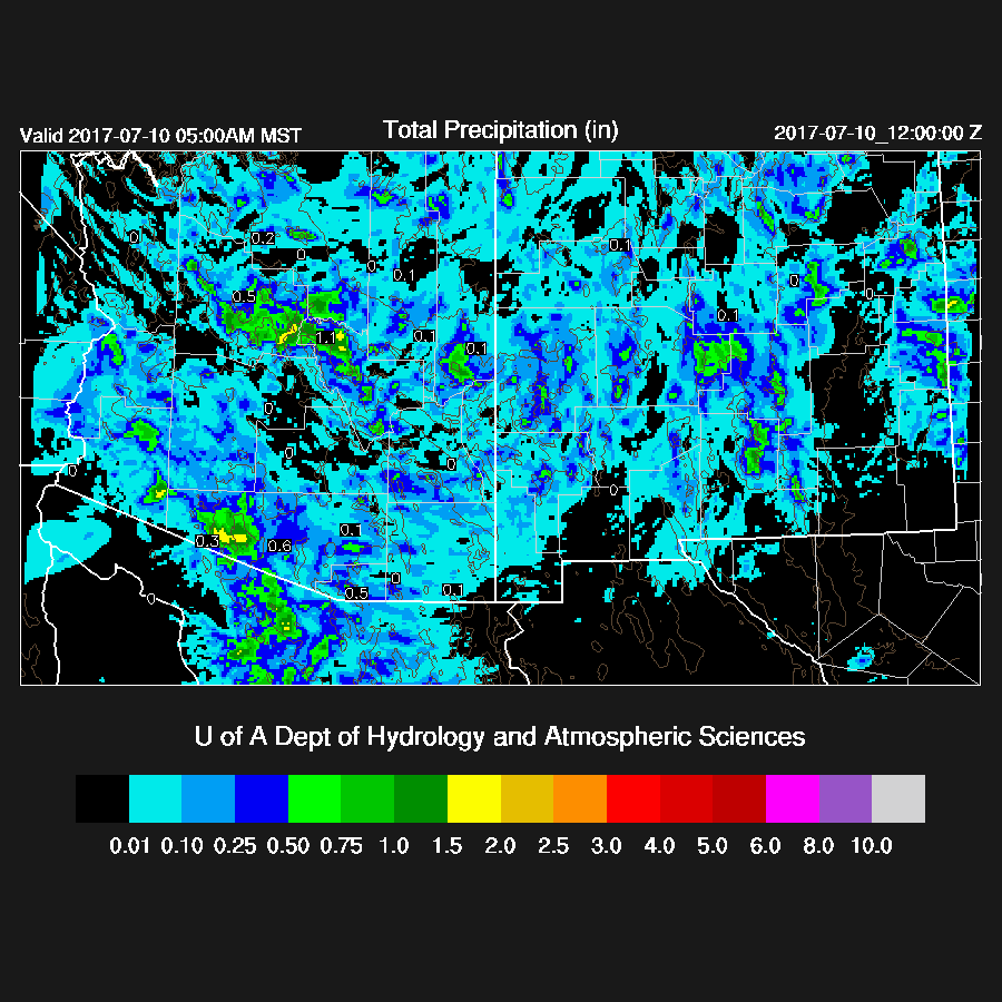
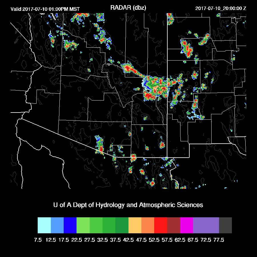
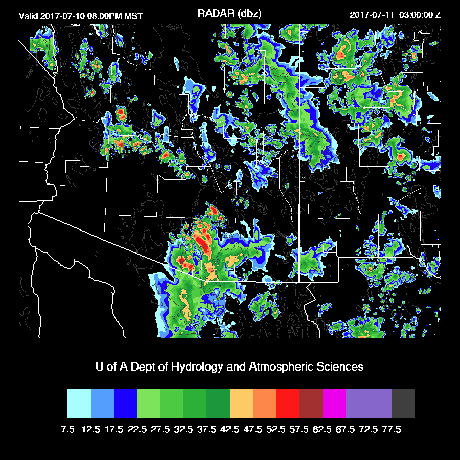
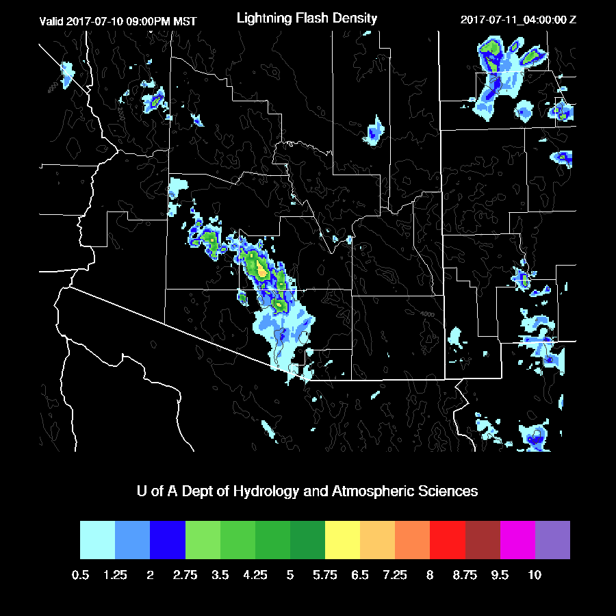
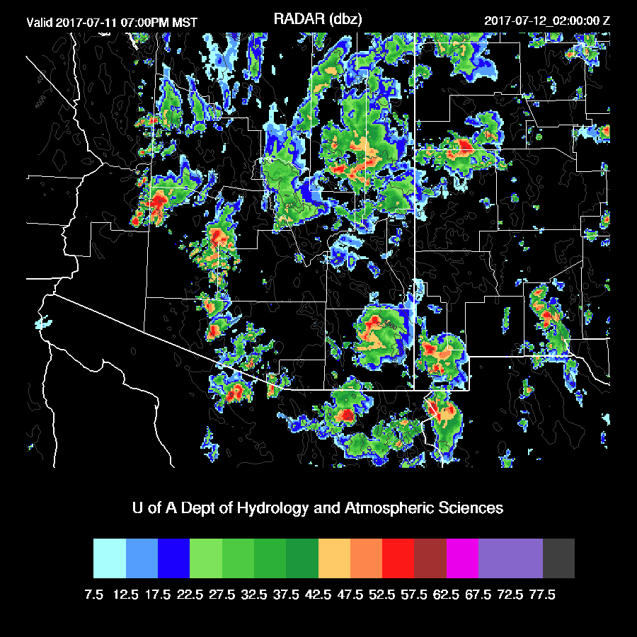
Sometimes, a forecaster when presented with a variety of outcomes, like yesterday, sees what they want to see. The model runs had a widespread and instead of going conservative like the 12Z WRFNAM, I went with the more active 6Z WRFNAM (the Eric P effect) in spite of the fact that usually, the more recent run is the more accurate run. At least I hedged by talking about the less active 12Z runs. Storms didn’t quite make it into the Tucson valley for whatever reason (Beamish anvil shading, not enough CAPE, too weak outflows) but were active around the area as well as out in central Pima County. Storms took their time getting going over the higher county north of Phoenix and were active during the evening. The WRFNAM, in spite of what I thought was a poor initialization, performed well. (weather.graphics lightning flash density)

Initializations/Discussion
What happened to the 5940m 500mb contour that we’ve loved to hate!? Finally, the heights have come down some and the center of the ridge had moved slightly east thus the heatwave is over for Arizona. The bad is with very little gradient, wind speeds are now light thus steering is poor. Upper air data continues to be missing for all of northern Mexico and I do believe this is partially to blame for some of the poor model forecasts recently.
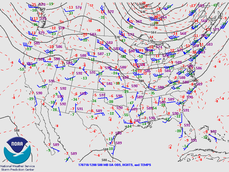
An MCV from the north central Arizona activity is moving to the NNW and is initialized fairly well by the 12Z NAM. WV and upper air data indicate a broad IT located from Texas into northern Chihuahua and looks to be initialized OK by the NAM/GFS. This feature may play a factor in SE Arizona weather in a few days if it decides to move this way. Scattered to broken clouds extend from this feature down to southeastern Arizona. The NAM and GFS have clouds with the MCV but are mainly clear elsewhere which shouldn’t be a major problem as most clouds are relatively thin and should burn off. However, checking the surface temperatures at 16Z indicates that the WRFGFS is a couple of degrees too warm at most locations. Both the 12Z NAM and GFS have initialized IPW well. Overall, initializations are fair with no clear favorite.
Day 1
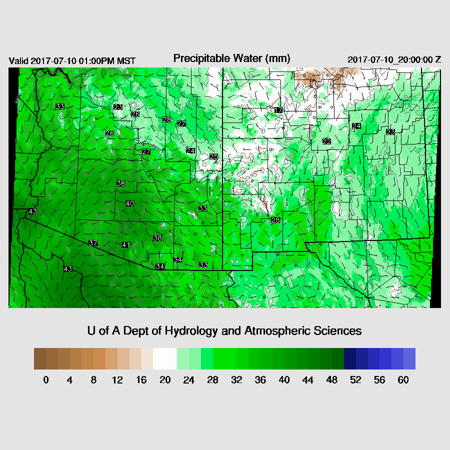
A weak surge continues to advect moisture into the state with just about every location plenty wet enough to support deep convection and even western NM has moistened up.
The problem today is a lack of steering as there are multiple weak high centers with one in southern AZ and another in NE Arizona.

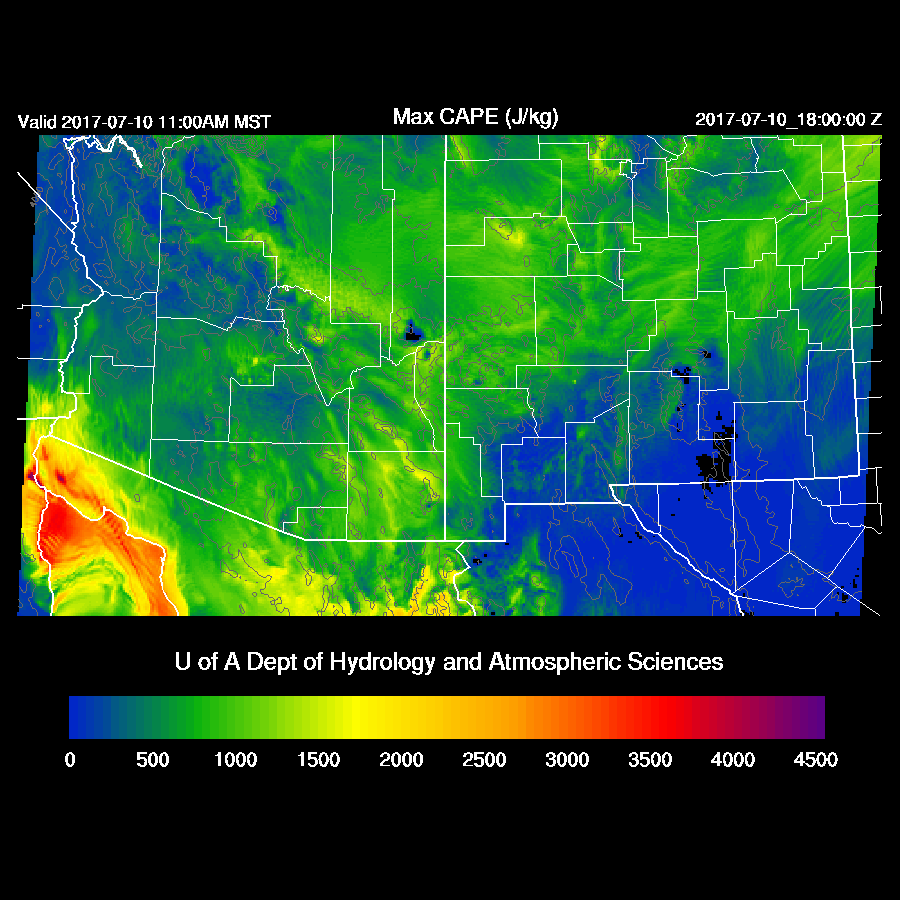
Moderate amounts of CAPE are forecast for much of the eastern ½ of the state thus deep convection should get a quick start over the higher terrain today.
And it does as by early afternoon, storms are ongoing over the highest terrain.
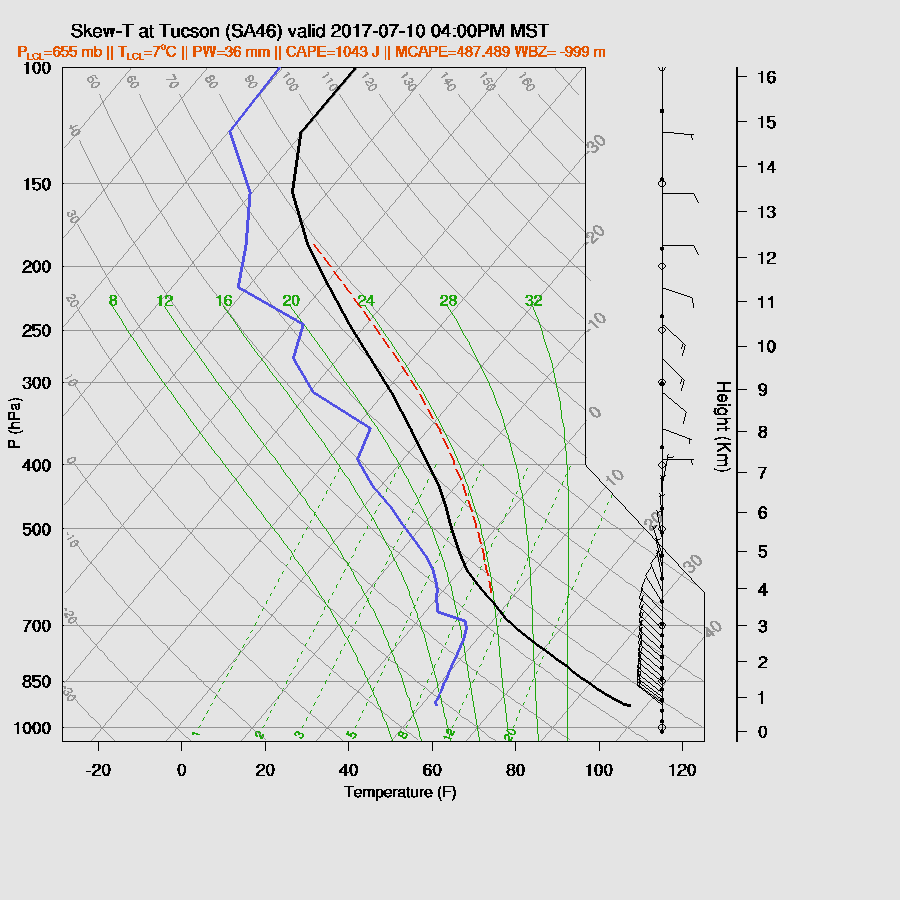
By late afternoon, the Tucson area has around 500-1000 J/Kg which is marginal for deep convection in the valley, especially with weak steering. However, low-level NW winds are very deep and fairly strong, thus providing some inflow to storms that form to the east and as Bob Maddox said this morning, storms may form on the outflow boundaries.
Storms continue over much of the higher terrain of the eastern ½ of the state and, again, very strong storms near the AZ/Sonora border.
There is a chance for outflow intersections over eastern Pima and Pinal late this afternoon which may be able to trigger development in the lower elevations.
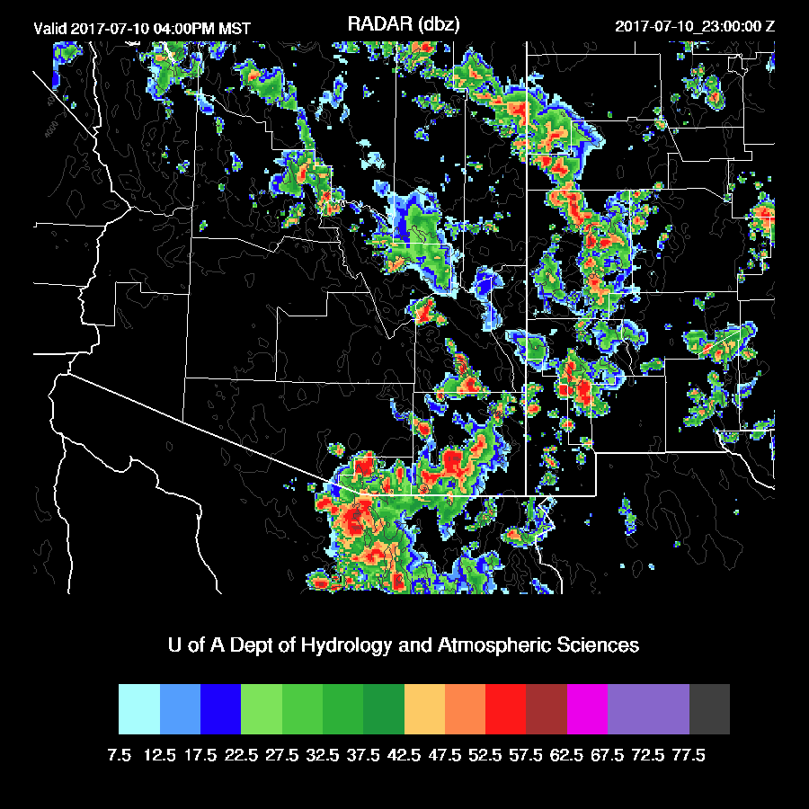
The two runs vary on the intensity, but both have deep convection in the Tucson area this evening.
Phoenix, too, may get in on some of the action as the PBL is mixed deeply as well as some CAPE. Low-level inflow/shear is excellent while steering is poor. As in Tucson, storms will need to form on outflow boundaries and as the PBL is mixed nearly to the LFC, around 650 from this morning’s sounding, this may indeed happen.

The two runs have significantly different forecasts for the Phoenix area as the WRFNAM is much more conservative with only scattered weak storms around Phoenix. With somewhat limited CAPE, I’m leaning this way. Still, some strong storms continue in south central Arizona into the late evening.

Lightning flash rate forecast is for low to medium with the storms this evening.
Day 2
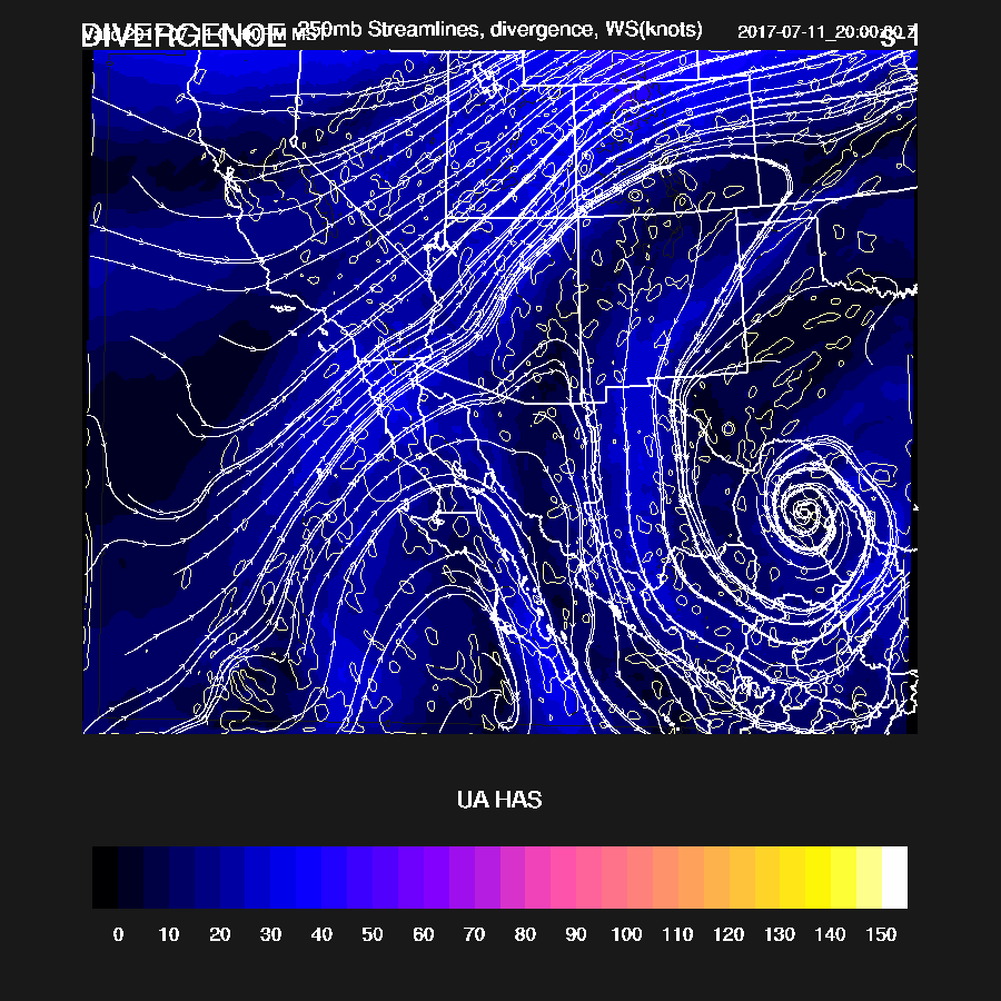
Tomorrow looks interesting, at least at first, as steering flow is from the NE over much of eastern Arizona at around 10-15 knots.

At 250mb, a weak trough moves over the SW US thus shifting high-level winds to the SW which results in favorable advection of anvils opposite of storm motion. In addition, some divergence is present over much of eastern Arizona.
The potential problem is that widespread mid level clouds will reduce heating.

No wonder there are so many clouds. IPW increased overnight and is around 40-45mm over the lower deserts.

In spite of all the moisture, CAPE is forecast to be mainly low to moderate.

In spite of the clouds, the high terrain gets enough heating to develop scattered storms. With all the moisture present and light steering, there is a flash flood risk with these storms.
A few storms are able to develop in the lower deserts during the evening.
The next 48 hours looks to be very wet for the border region as well as east central Arizona.

No comments:
Post a Comment
Note: Only a member of this blog may post a comment.