Previous Day
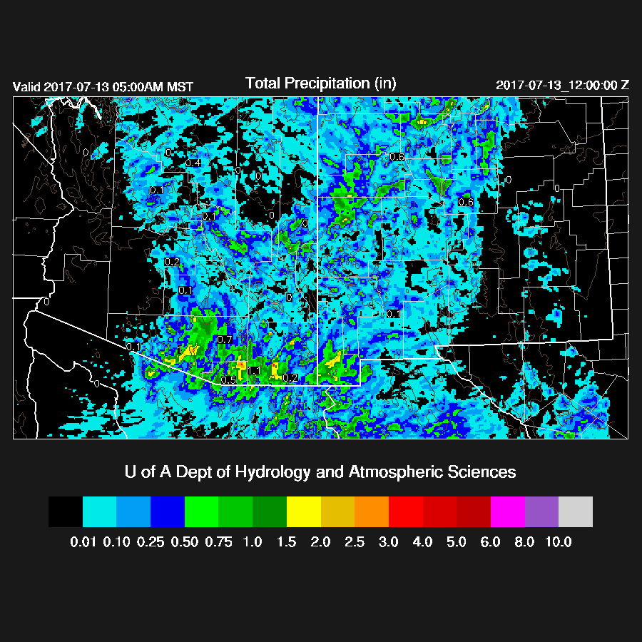
In general, model performance was fairly good as most of the runs moved scattered deep convection off the high terrain of eastern Arizona into eastern Pima County. Timing was a bit off as storms didn’t get going until after dark and only the WRFRRx had storms moving in later. A few storms also formed in the Phoenix area around sunset which was a few hours too early. The WRFNAM is below as it had the best coverage.

Shelf cloud moving into NE Tucson around 7:30 pm.

My ipad camera is old and crappy. Too bad as this updraft base was impressive.

Initializations
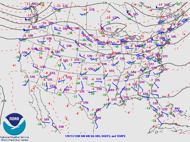
The Texas inverted trough has moved to the NW and is just east of El Paso. Another weak trough is lifting out over the 4 Corners. I don’t see much else in the morning satellite image in the northern Mexico data void. The IT is going to be a big player in Arizona weather the next day or two so it’s important to get it initialized correctly. The 12Z NAM looks good as it has a closed circulation at 500mb as this is how it appears from the satellite. The RRx is also pretty good except maybe a bit too far south. The GFS was not available at the time of this writing.
Only a few areas of scattered clouds are present over Arizona and they shouldn’t impact heating much. If anything, the RRx might have a little too much cloud coverage west of Tucson. The NAM is again too wet in Sonora and over parts of SE Arizona and into southern NM. This has been an ongoing problem over the last week or so. The GFS and RRx have only minimal errors. I’d say the WRFRRx and WRFGFS have the better initializations, but the WRFNAM should also be OK. Model confidence is medium. Normally, today would be ‘high’ if the northern Mexican upper air data was present.
Day 1
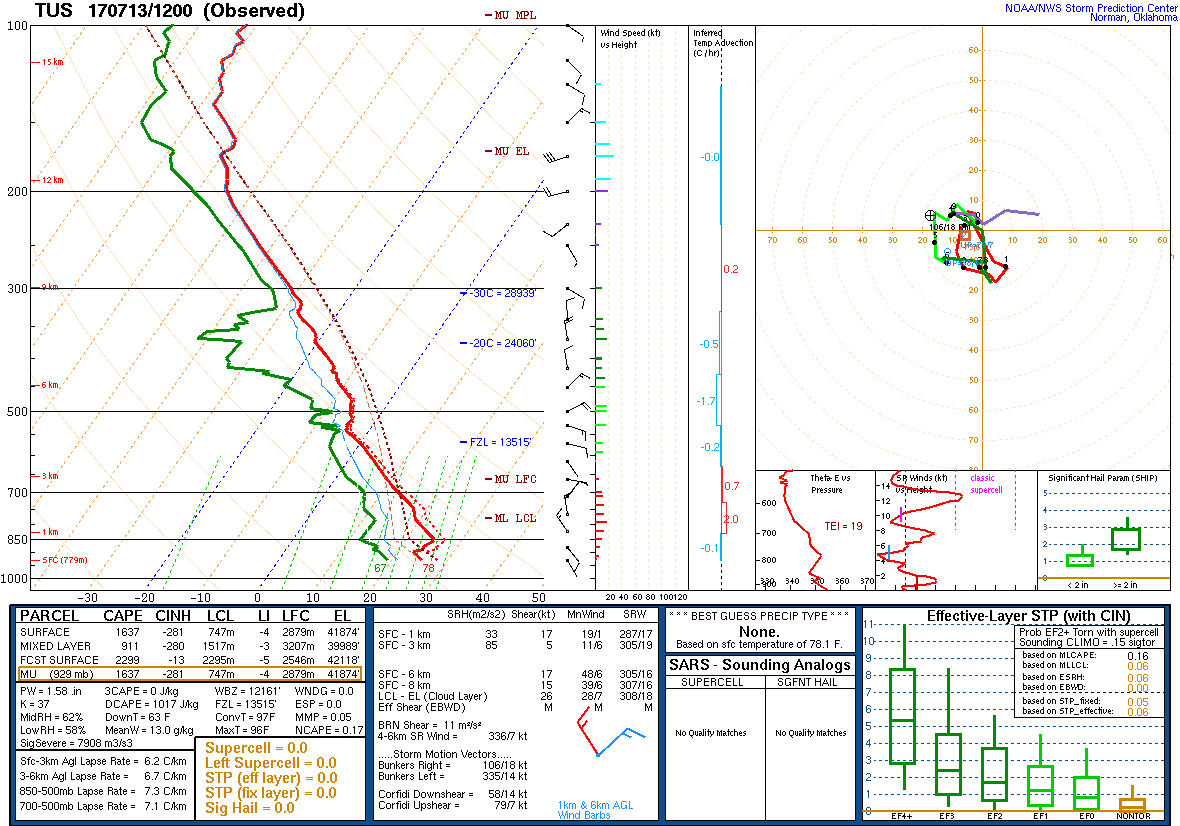
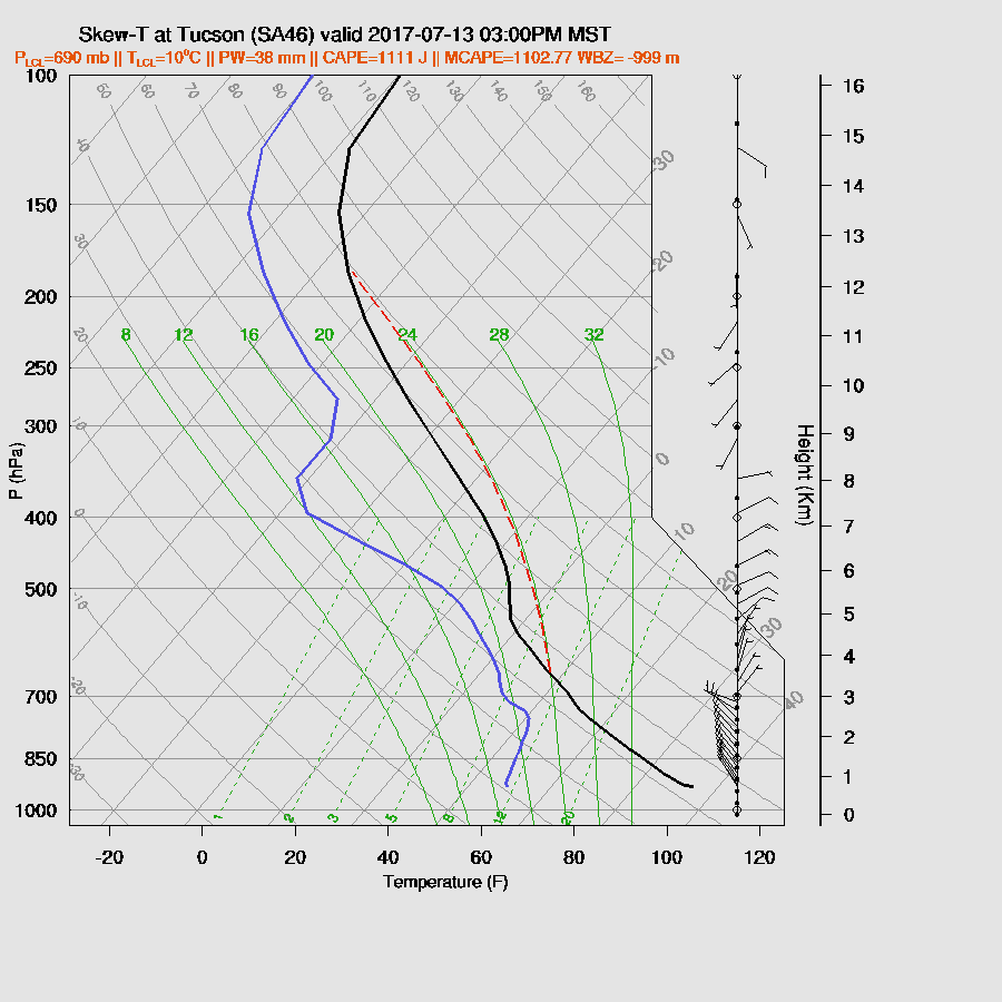
In spite of the widespread activity over eastern Pima County, the 12Z Tucson sounding has only a shallow modified layer thus should recover with full insolation. Moisture/CAPE and mid level steering winds are good. There is still an inversion around 500mb which may be a good thing as it could keep local deep convection in check until stronger storms move in from the NE, much like yesterday.
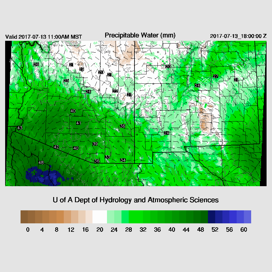
As was being predicted yesterday, a stronger surge event has begun as winds at Yuma are quite strong and dewpoints in SW Arizona are around 70F. So far, the surge is somewhat shallow as IPW at Yuma hasn’t increased all that much. More moisture isn’t far away as Puerto Penasco is almost 50mm. Moisture continues to stream into the state which leads to quite high IPW over much of the southern ½ of the state.
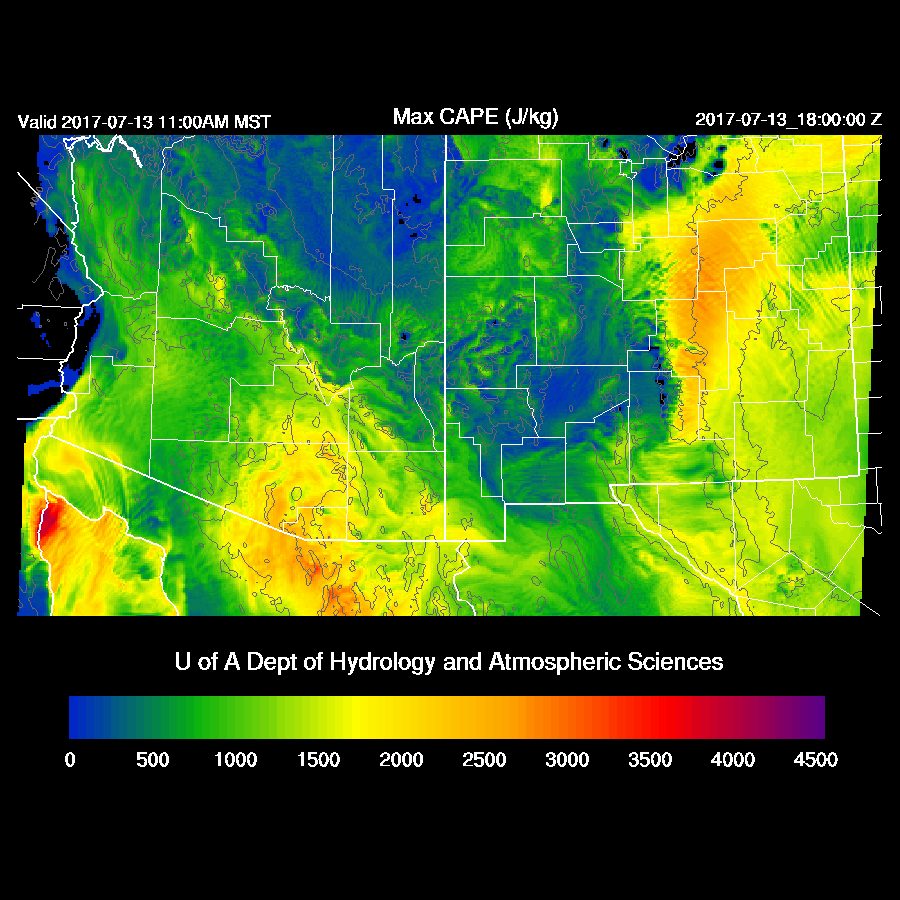
Wow, forecast CAPE over much of SE Arizona is very high, about as high as it gets. Both the WRFNAM and WRFGFS are similar. The WRFRRx is crashing thus not available. Drier air and less CAPE is present north of the Rim and White Mountains. There is enough CAPE to support deep convection over the high terrain thus storms will form there by early afternoon. It’s also interesting to see that CAPE is very high in eastern NM too. An active day in store for parts of AZ and NM.
Steering flow is very good for much of SE Arizona and into SW NM as it’s from the NE at 10-20 knots as the Texas IT moves closer to AZ while the southwestern Arizona high center remains in place. Plus, there is a slight bit of cooling at 500mb.

Scattered storms form over far eastern Arizona and into western NM during the afternoon and these will be steered to the SW into the lower elevations of SE Arizona. The higher elevations of SE Arizona also develop strong storms.

The Tucson vertical profile has a classic severe weather look with a fairly well mixed BL, low-level NW winds to provide shear and outflow convergence, 10 to 15 know NE mid-level flow, more than 1000 CAPE, and weak upper-level flow so little or no anvil shading. The WRFGFS is below. The WRFNAM is even better as it is a bit wetter and has 1500 J/Kg of CAPE!
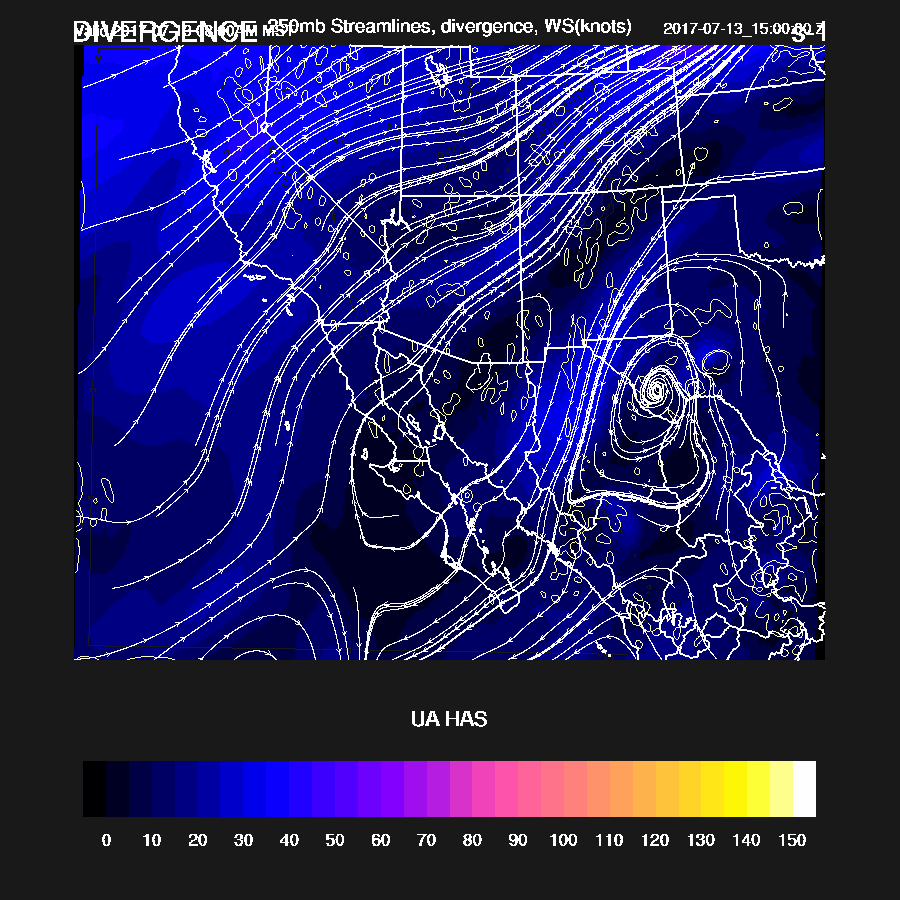
The 250mb map has a high centered over SE Arizona and northern Sonora providing some divergence aloft. It certainly looks like all the ingredients are there for a major thunderstorm outbreak for SE Arizona today.
By late in the afternoon, the storms from the NE move into SE Arizona and interact with the strong ongoing convection present and forms widespread strong to severe storms across Pima Santa Cruz and Cochise Counties.
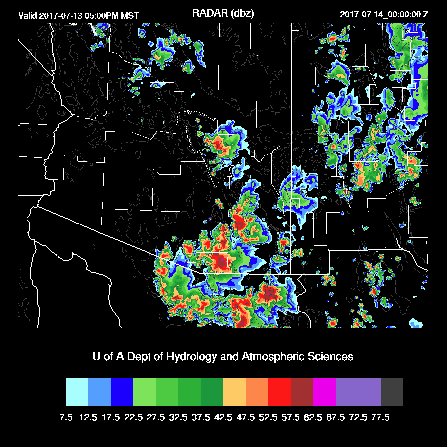
Very strong to severe storms continue across eastern Pima county into the evening.

Many threats from the storms such as very heavy rain/flash flooding, isolated severe winds associated with wet microbursts, and frequent lightning.

The lightning flash rate forecast for the storms is about as high as I’ve seen it so expect frequent cloud to ground lightning. Again, the lightning forecast is an hour or two early.

Larger scale outflow winds develop during the evening and become extremely strong/severe as the storms move away from Tucson. This is likely to produce a very large haboob across I-8 and perhaps into Phoenix.

Phoenix is not mixed that deeply, but there is some CAPE present and some activity is possible when the outflow moves into the valley later this evening.

In fact, some strong storms do develop in and around Phoenix as the outflow passes through. Both the WRFNAM and WRFGFS have similar forecasts so there is a fair amount of confidence in this forecast.

Day 2 will follow later this morning.
No comments:
Post a Comment
Note: Only a member of this blog may post a comment.