Previous Day
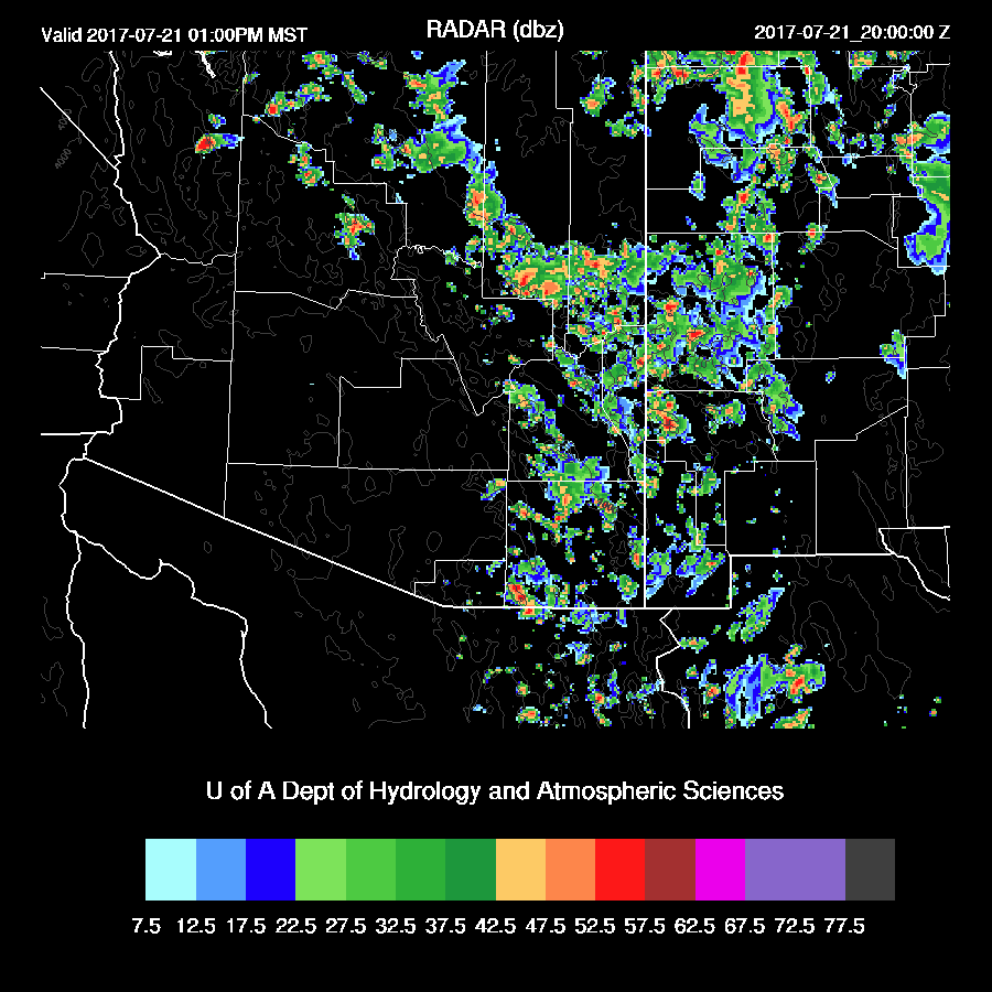
Another strong thunderstorm hit parts of Tucson yesterday and some foothills sites reported over 1.5 inches of rain. A few storms popped up in the Phoenix area too.
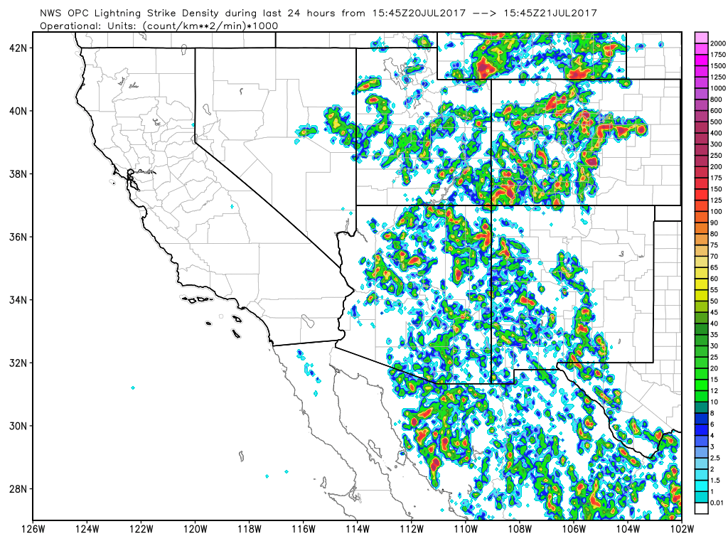
The WRFNAM was the best performer in spite of its perceived initialization problems, as it had some activity over Phoenix as well as quite a bit in SE Arizona. The WRFRR was too dry and the WRFGFS too wet in Maricopa and Pinal Counties. The 15Z WRFRR was also pretty good.

Initializations
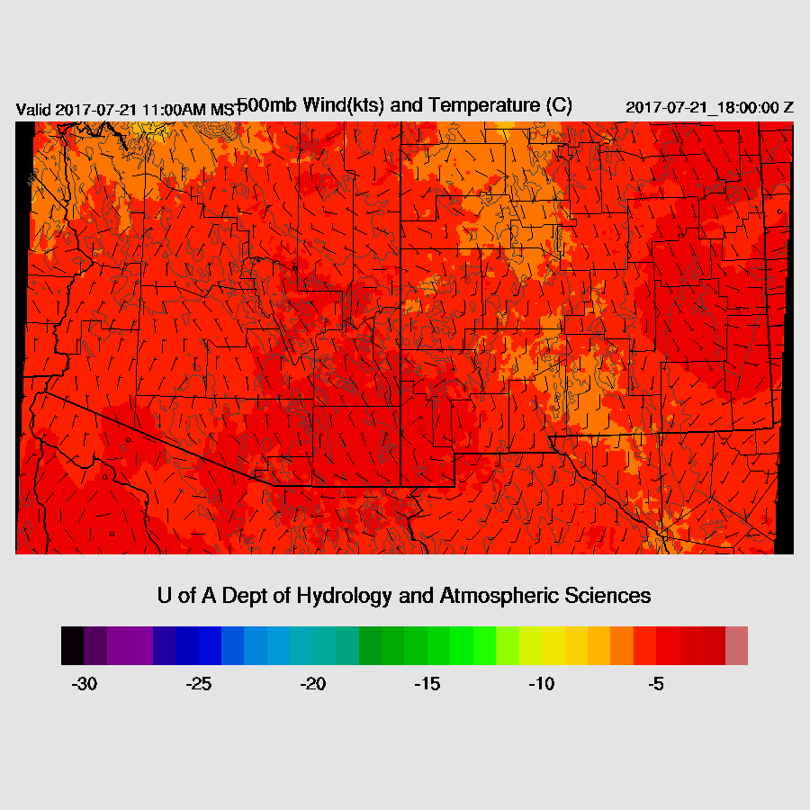
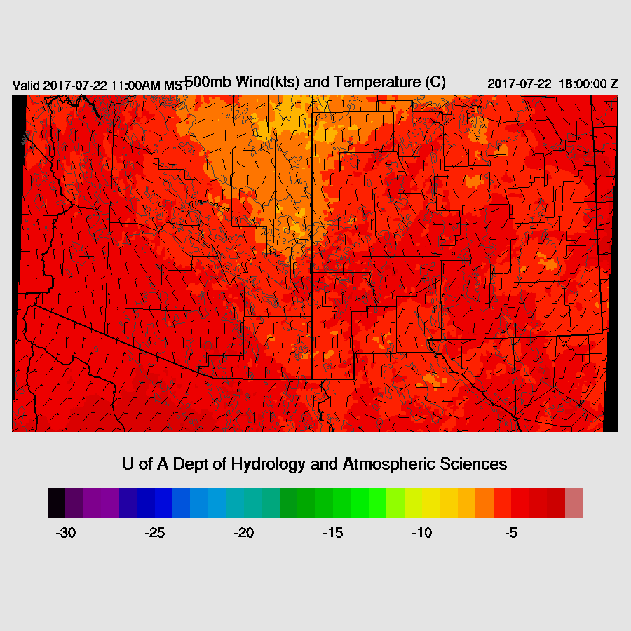
A weak trough lies across most of the AZ/NM border putting Arizona in mainly light northerly flow. 500mb temperatures continue to be tropical like as they are around -5C. There is also an IT over southern Sonora. When I played the “find the MCV” game this morning, I was only able to come up with one which was in NE Arizona. All three 12Z initializations initialized these features well. 
There are a lot of morning clouds across eastern Arizona and into Mexico, associated with the multiple troughs and the MCV. The NAM had a fair amount of clouds over EC and NE Arizona but was mostly clear in SE AZ and into Mexico which is a quite bad error. The GFS was the opposite as it was missing most of the clouds over NE Arizona. The RRx was the best as it had widespread clouds all across eastern Arizona into Mexico. All three IPW initializations were good. The RRx has initialized well and is the model of choice. The WRFNAM is likely to be too active in SE due to lack of morning clouds resulting in too much heating and that is the case as the WRFNAM is running a few degrees too warm while the other two runs are quite close to observed.
Day 1
The morning GOES 16 “Low-Level” imagery indicates drying and subsidence over much of SW Arizona which will likely result in limited or no activity there and may also impact areas to the east of Tucson and Phoenix. (dry is orange/yellow, wet is blue)

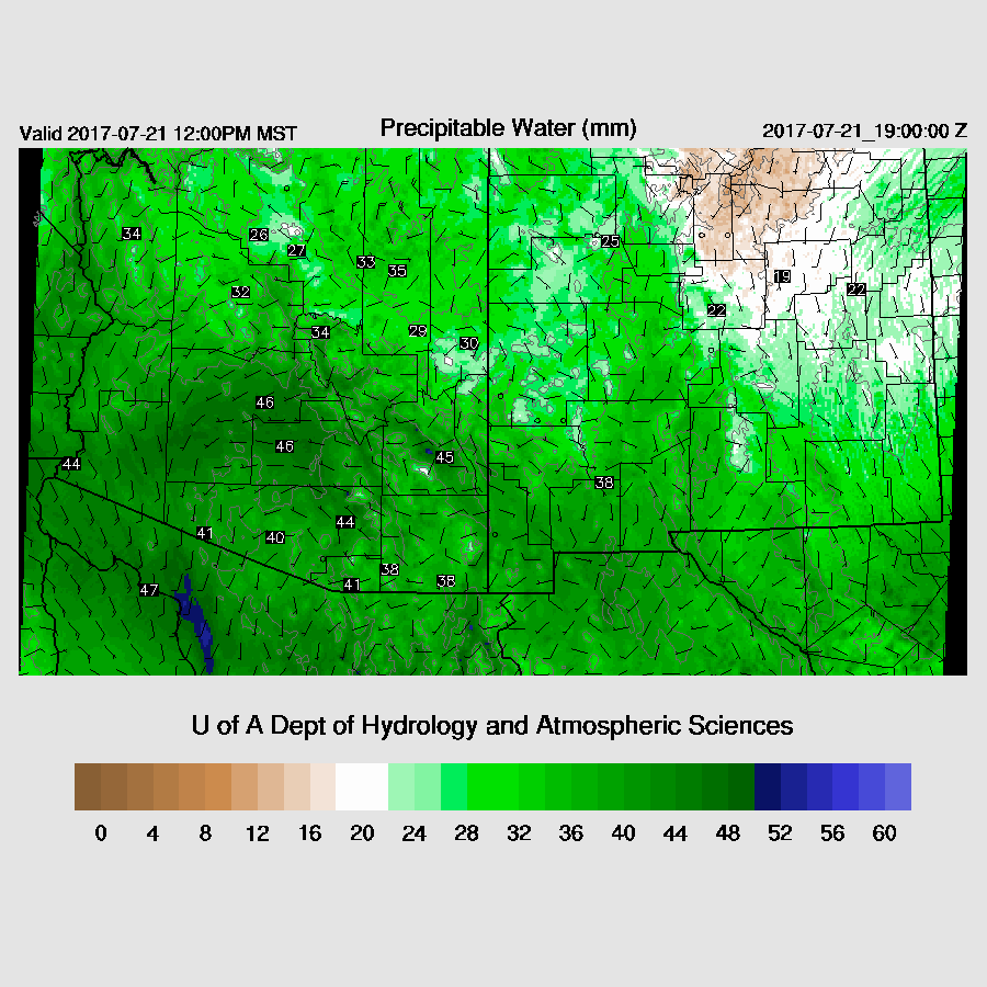
IPW continues to be high over much of the eastern two-thirds of the state with the Tucson area being especially wet with an IPW of 48mm. The WRFRR is a little drier by mid day compared to the WRFGFS and WRFNAM. As there is some quite dry air out to the SW, perhaps the WRFRR is correct (below).

Low to moderate CAPE is forecast for much of the eastern part of the state and into NM thus they’re likely to be the most active areas, especially where there can be some heating. 
Most of Arizona is under light northerly flow today which, like yesterday, may be enough to push a few storms off the mountains into the lower elevations.
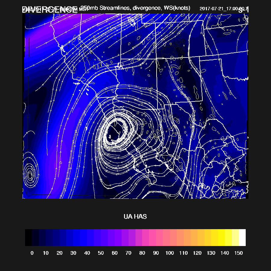
250mb divergence is minimal today.
As of 17Z, satellite observations indicate that deep convection is already forming over the high terrain of eastern Arizona and into NM. All of the morning WRF runs develop deep convection early and by early afternoon, scattered storms are present over much of the eastern ⅓ of the state. The WRFRR (below) has storms a bit farther to the east than the other two runs.
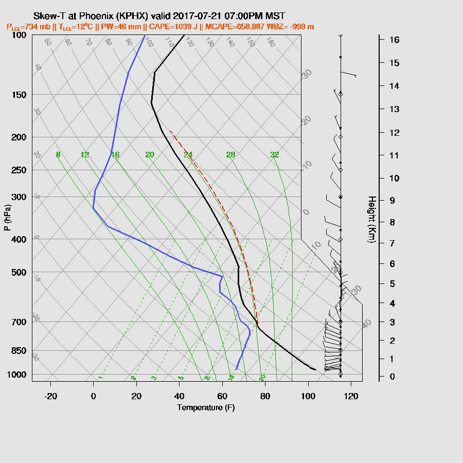
The WRFRR has almost no CAPE forecast for Tucson this afternoon due to the warm air aloft and slight drying. The winds are also poor as they are mainly weak from the NW.

Also possible is the WRFGFS forecast which is a bit wetter and slightly cooler in the mid levels thus resulting in quite a bit of CAPE at around 1400 J/kg. I can’t rule this out as Tucson appears to be right on the edge of the dry air thus it could go either way.

The wetter WRFGFS develops some strong storms over parts of the state, including Tucson, by late afternoon and into the early evening.

The WRFRR (below) has little or no activity over SE Arizona during the late afternoon/early evening. Watching the IPW trace at Tucson should help to better determine the outcome. If it drops into the low 40’s this afternoon, the WRFRR is probably the correct outcome.
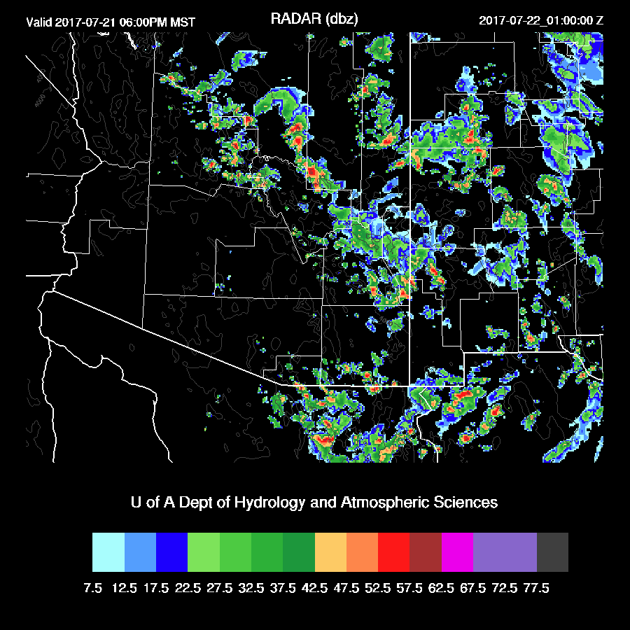
The WRFRR has little or no activity around Phoenix this evening due to nearly 0 CAPE while the WRFGFS has around 700 J/kg, which is enough to support a few storms around, much like last night.
The WRFGFS does develop a few storms in the Phoenix area this evening. It will be interesting to see what the 15Z WRFRR says later this morning and I’ll post the results on Twitter.
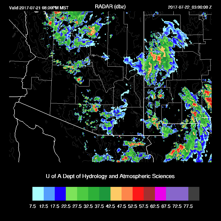
All the runs have a few early morning storms around SE Arizona.

Day 2
Slightly drier air is present over much of western Arizona while the eastern ⅓ remains very wet.

Sufficient CAPE to support storms is only present over the high terrain and over far SE Arizona. Day 2 forecasts have been quite poor recently as the situation is quite complicated.

Mid level flow remains light northerly.
Storms mainly over the higher terrain of Arizona and in the SE.

No comments:
Post a Comment
Note: Only a member of this blog may post a comment.