Previous Forecast
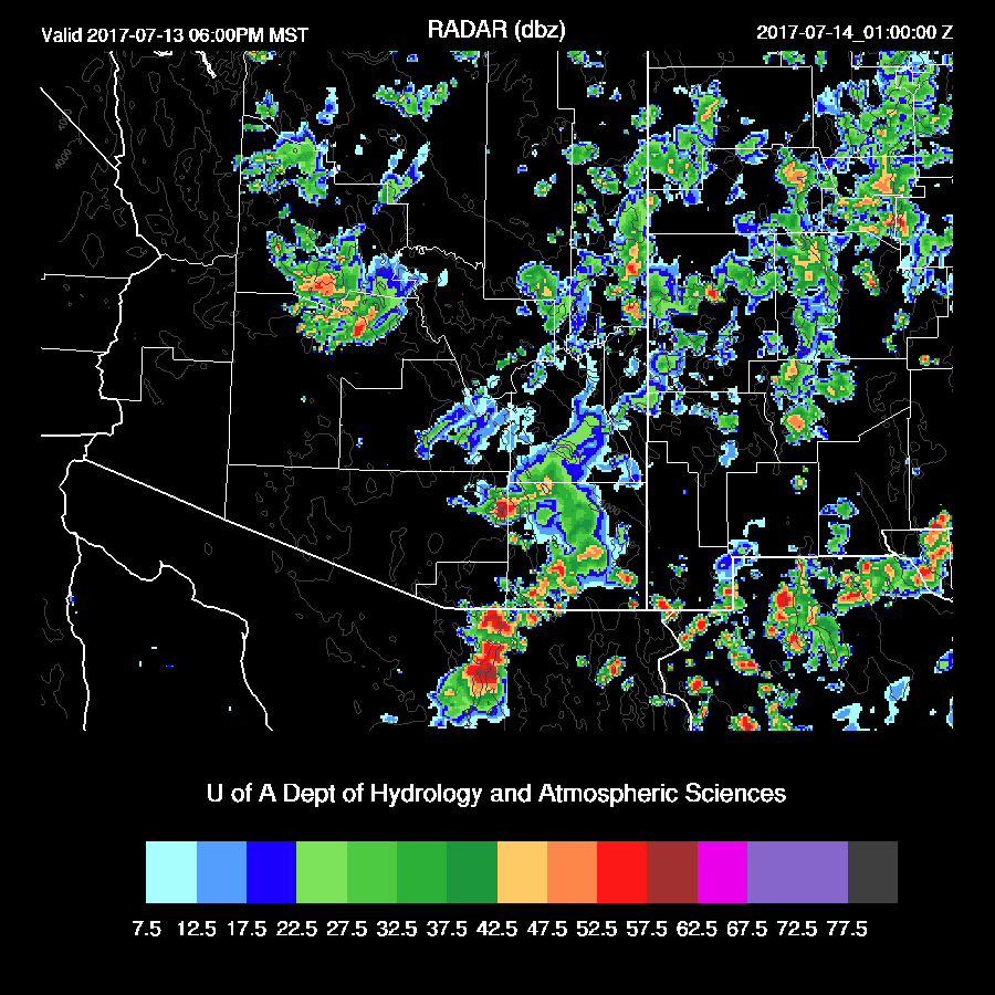
A mainly down day for much of the lower deserts while the high country of northern and eastern Arizona was very active. (weather.graphics)
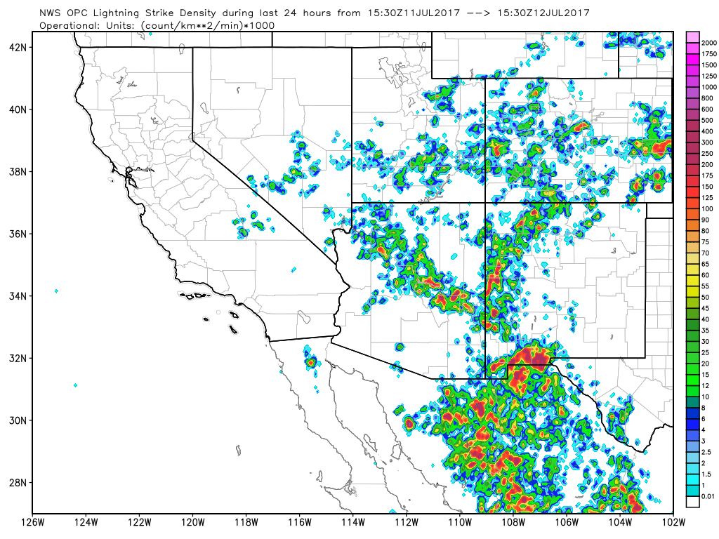
The model runs did OK with the high terrain convection, but all did poorly over SE Arizona. The 12Z WRFGFS was the least bad as it kept afternoon convection out of the Tucson area but was completely wrong about Cochise County. The precipitation shown over Pima County was from the morning activity and not the evening. All the model runs were consistent with keeping activity out of the Phoenix area. The problem, as is so often the case, was a poor initialization of clouds and this drives home my point about how users of the models, not just the Arizona WRF, need to pay close attention to the accuracy of the initial conditions, especially cloud cover.

Initializations
Speaking of initializations…. This morning’s visible imagery indicates a complex situation over northern Mexico, right in the data void. A broad area of cyclonic circulation, too large to be called an inverted trough, stretches from the Big Bend region all the way to southern Arizona. It appears that there are two smaller circulation centers within the larger circulation. One is located over the Big Bend region. The other is over far NE Sonora and is associated with the ongoing deep convection just south of the border. The 12Z NAM has both of these areas initialized OK. I started running the WRFRR based on the ESRL RRx and it does not have the northern Sonora IT. The 12Z GFS looks the best of the three for the upper air initialization.

As mentioned above, there are ongoing showers/storms in far NE Sonora. None of the model runs have much activity but they did have extensive clouds from northern Mexico into SE Arizona. Recent satellite imagery indicates the clouds are burning off rapidly thus they are unlikely to reduce insolation much. The 12Z NAM continues to initialize a little too wet. Almost every IPW station is 2-3mm too wet. The GFS had minimal errors. From what I’ve seen so far, the WRFGFS has the best initialization out of the three but the other two are not too bad. Model confidence is medium today.
Day 1
A weak surge continues to import moisture into Arizona today, keeping IPW values around 40mm over the lower elevations. In fact, IPW has been increasing to our south as Hermosillo has increased to 50mm, perhaps indirectly associated with the tropical depression Eugene. We’re starting to get close to the “too wet to rain” scenario where we have so much moisture that deep convection forms in the morning over nearby mountains which then cuts off lower elevation heating and prevents storms for the rest of the day.

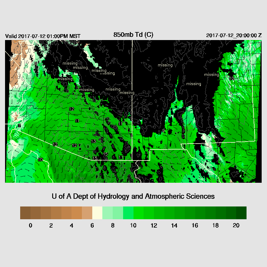
850mb moisture is very high, greater than 12 C, over much of SE Arizona thus storms will have very heavy rain and wet microbursts associated with them.
As Bob Maddox mentioned in his post this morning, the morning soundings are not that great with respect to mid level steering winds and mid level temperatures. As the day goes on, the wind improves for SE Arizona between the high over Yuma and the IT over (now) far NW Chihuahua. All three of the 12Z runs are similar.

The morning Tucson sounding has quite a bit of CAPE with the MLCAPE at 1100 J/Kg. The early afternoon MCAPE forecast has moderate to high CAPE over much of SE Arizona and up over the White Mountains and along the Rim. I try not to get excited about situations, but this one looks pretty good for SE Arizona.

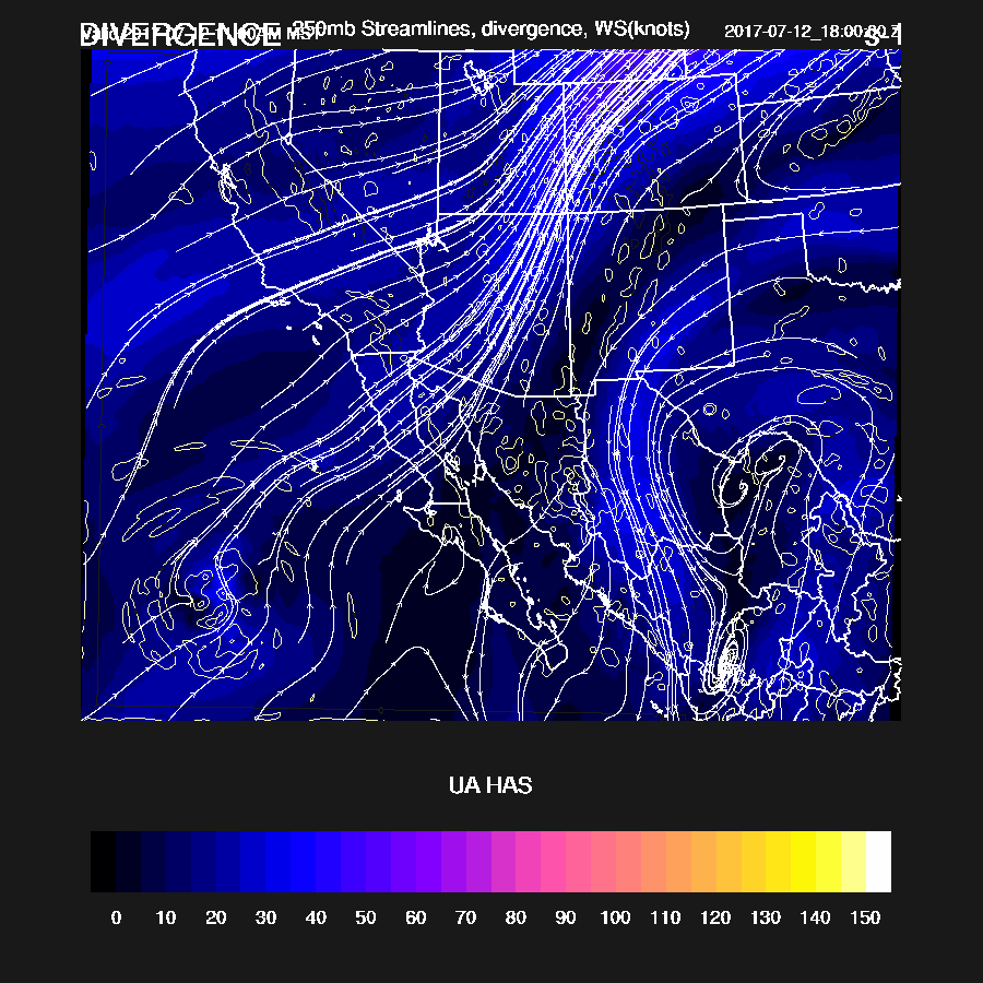
A broad col stretches across NM into Sonora with weak areas of 250mb divergence and this is another positive for storms in these areas.
Deep convection is underway over the highest elevations by noon. By late afternoon, strong storms are present in Cochise County and also working their way slowly to the SW over east central Arizona. All three runs have the same general idea, but differ somewhat in timing and coverage.

Later in the afternoon, Tucson still has around 40mm of IPW and 1000 CAPE. The vertical wind profile is also very good with winds out of the NE at 15 knots and a mixed layer nearly to saturation. The low-level NW flow provides excellent low-level shear and convergence for any westward moving outflow boundaries.
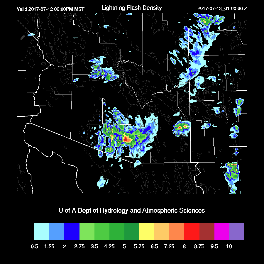
Strong storms move/develop in eastern Pima County during the early evening. Timing is a bit uncertain, but it looks like around 6-8pm. The main threat is very heavy rain (up to 1.5 inches) and isolated strong winds associated with wet microbursts.

Moderate to high lightning flash rates are also expected. Note that the lightning forecast is probably a couple of hours too early.
Storms continue into the late evening over south central Arizona and perhaps some weak ones as far north as Phoenix.

There is some CAPE in the Phoenix area, but not enough to support widespread/strong storms. Plus, steering is weaker and there is an unfavorable warm layer between 500 and 400mb.

Day 2
Moisture stays about the same or increases slightly as a surge continues. This is one of the longer lasting surges I can remember.

CAPE is again moderate to high from SE Arizona up to NW of Flagstaff thus those areas should again be active. The Tucson area may have another “down day” due to the previous evening’s activity.

There is a big difference between the runs with respect to moisture and CAPE at Phoenix tomorrow. I took the middle of the road WRFRR which has about 700 J/Kg of CAPE. The PBL is mixed nearly to saturation but mid level steering is poor. My guess is more of the same which is a few scattered storms around the Phoenix area during the evening hours. 
A few storms are over SE Arizona during the early evening but it’s unlikely they move into the Tucson area due to the worked over boundary layer from today’s storms. We'll see if that is the case tomorrow.
No comments:
Post a Comment
Note: Only a member of this blog may post a comment.