Previous Forecast
There was a big increase in thunderstorm activity over parts of the state, especially SE Arizona. Strong storms with very little movement developed over parts of Tucson with some areas receiving over 2 inches of rain. Yavapai County also got soaked again.
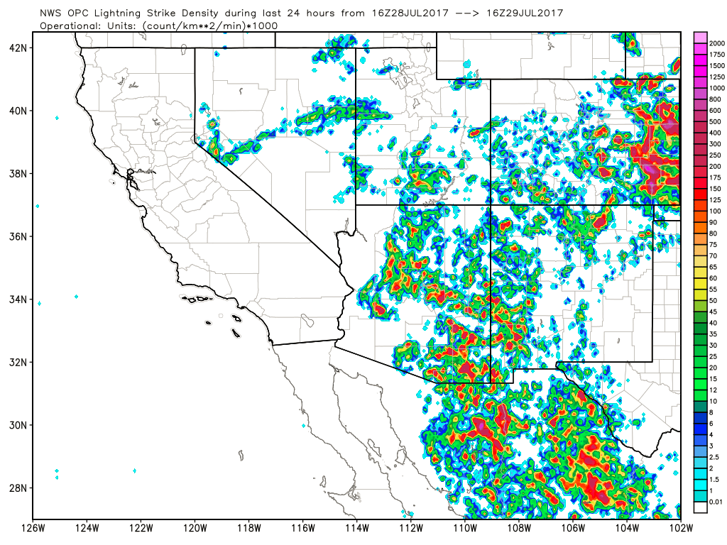

Model performance was poor as most 12Z runs did not have nearly enough activity over SE Arizona and Yavapai County. The exception was the WRFGFS (below)as it did OK over most areas. Unfortunately, I thought it was going to have too much activity. It’s hard to sift the wheat from the chaff sometimes.
Initializations
The 500mb pattern is a mess with light flow and multiple MCSs and ITs. The high center is ill defined, somewhere over NV/UT. One IT is located over much of eastern Arizona and satellite imagery indicates the center is between Tucson and Phoenix. An MCV is moving out of far NW Chihuahua towards SE Arizona. I’m sure there is another under the ongoing area of convection located in Sonora. A broad cyclonic circulation continues across much of NW Mexico while another upper-level trough is located over Baja California Sur and another over the Big Bend. Crazy! None of the initializations get the Chihuahua NCV very well but at least the GFS and RRx have it as a weak trough. The Arizona IT is initialized OK by all three and 250mb is initialized OK by all three models too.

Widespread clouds are located over much of western Arizona up to NE Arizona and there are a lot of clouds over SE Arizona which are now burning off. Showers and storms continue south of the border and there are a lot of clouds associated with the Chihuahua IT. It will be a miracle if any initialization gets all of this. The RRx is the best of the three as it has the storms and clouds in Sonora and It also has some clouds associated with the Chi IT. It is OK with western and central Arizona clouds but is missing the thick cloud across NE Arizona. The GFS is OK in Mexico but not quite enough clouds in Arizona. The NAM is similar except missing the Sonora clouds and storms and the NAM is a little too wet over NW Mexico again. The other two have minimal IPW errors. No initialization was great but it could've been worse. I have no clear favorite except to say the WRFGFS and WRFRRx have been better over the past few weeks.
Day 1
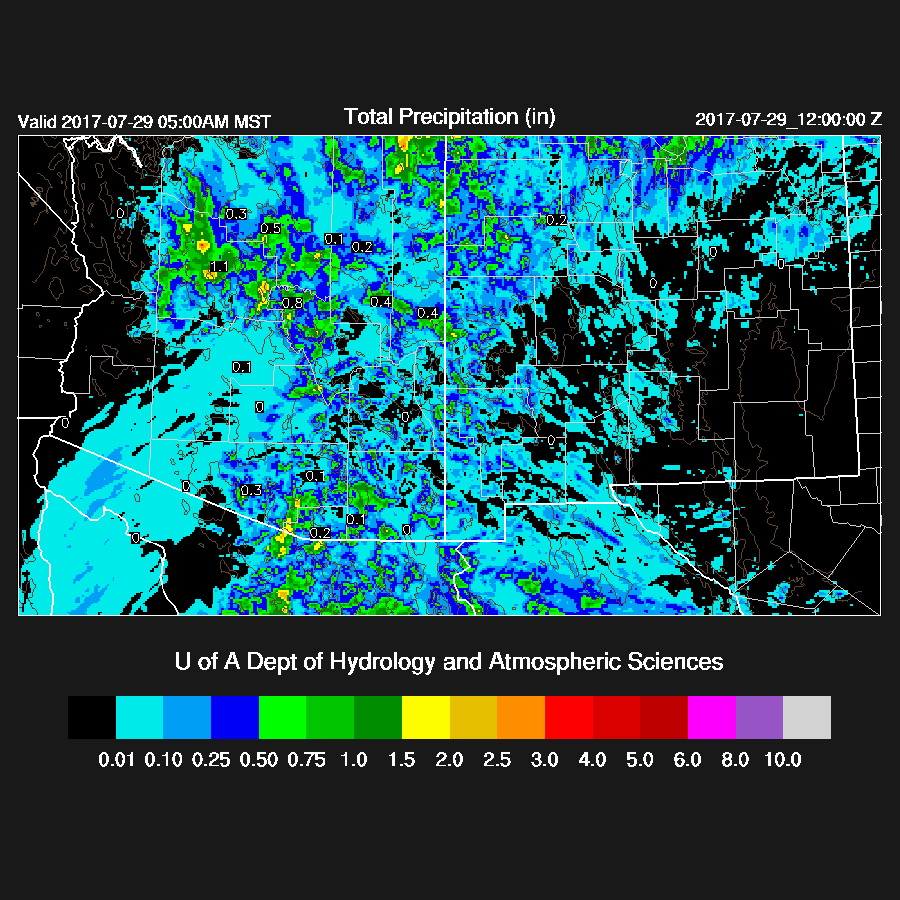
Impressive amounts of moisture continue in the state as a weak surge continues to advect in moist air. This has got to be some sort of July record as I never remember such a long period of time with IPW so high. Very heavy rain is again likely with storms.

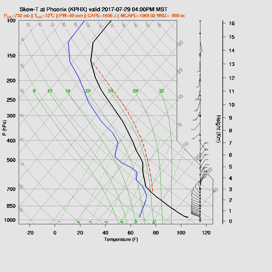
850mb dewpoint temperatures are again high over SE Arizona and also now over central Arizona thus it is more likely for storms in the Phoenix vicinity later today/tonight.

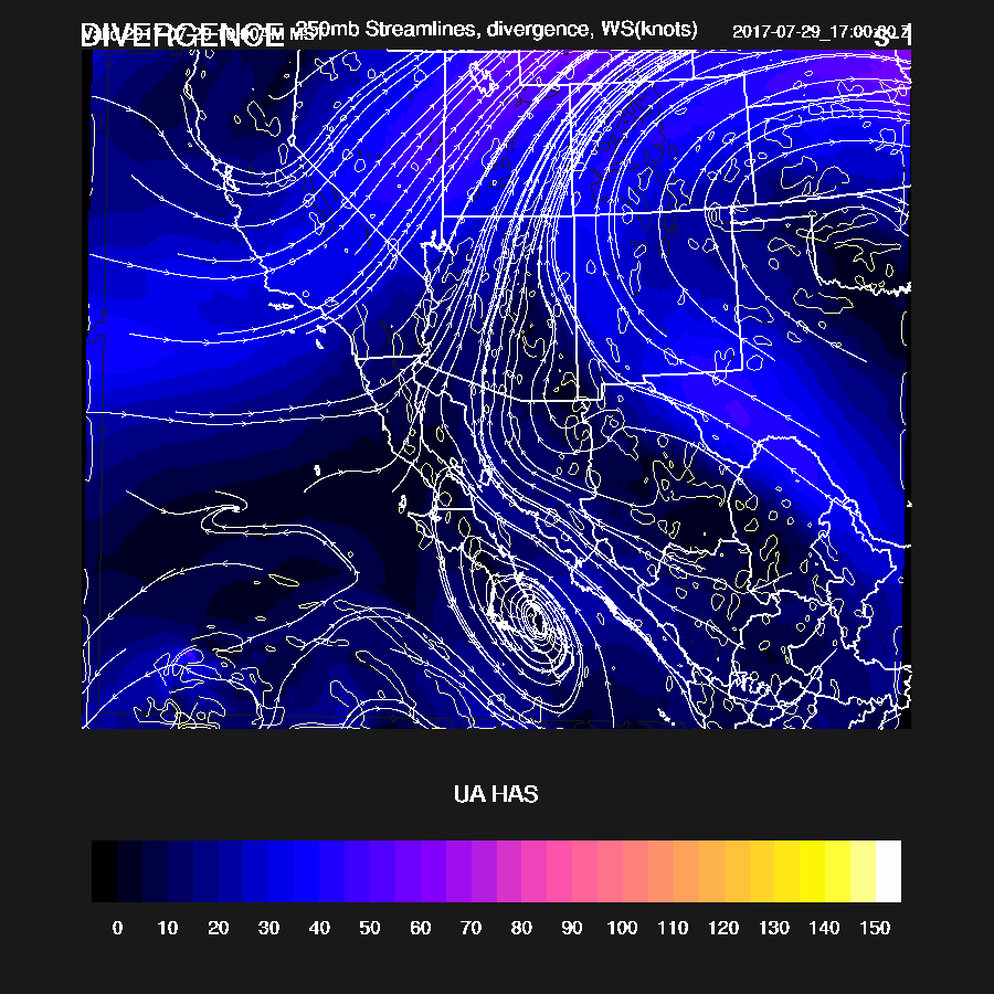
The 500mb pattern looks pretty good for the Phoenix area as 10 to 20 knot NE steering is forecast by some of the 12Z runs. Mid level temperatures have also cooled slightly thus a more favorable thermodynamic profile. SE Arizona is under light and variable flow thus storm organization is going to be lacking there. The one unknown is the MCV moving out of Chihuahua as it was not well initialized. The WRFGFS (below) has something SE of El Paso, but that is not in the right location. Convection usually forms just on the outer cloud band of these features and looking out the window here in Paradise I see deep convection already underway over the Chiricahuas. That is a good indicator for an active day in SE Arizona.

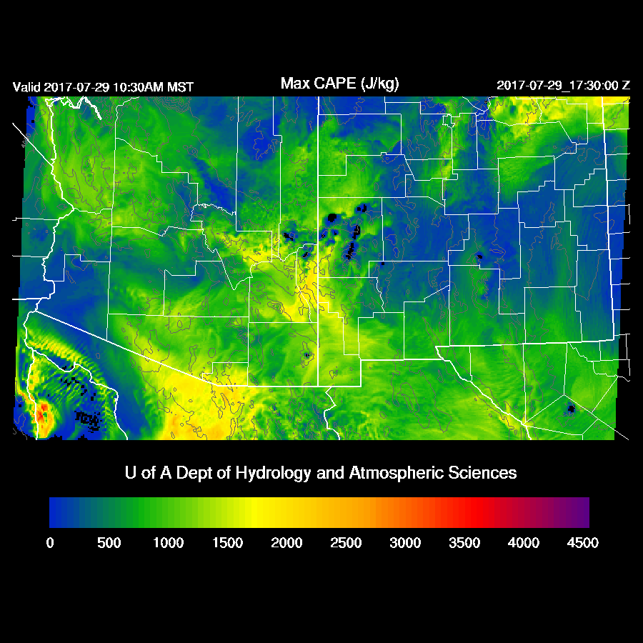
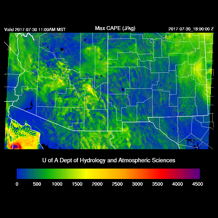
Moderate to high CAPE is in place over much of the state thus it should be a quite active day.
250mb flow will shear anvils off to the NE away from storm motion, thus another positive for today. Areas of upper divergence are also forecast for much of the state.
The various runs disagree on exact locations but the general message is that storms start early over the high terrain of eastern and southeastern Arizona. By mid afternoon scattered very strong storms are over much of SE Arizona and in and near Yavapai County.
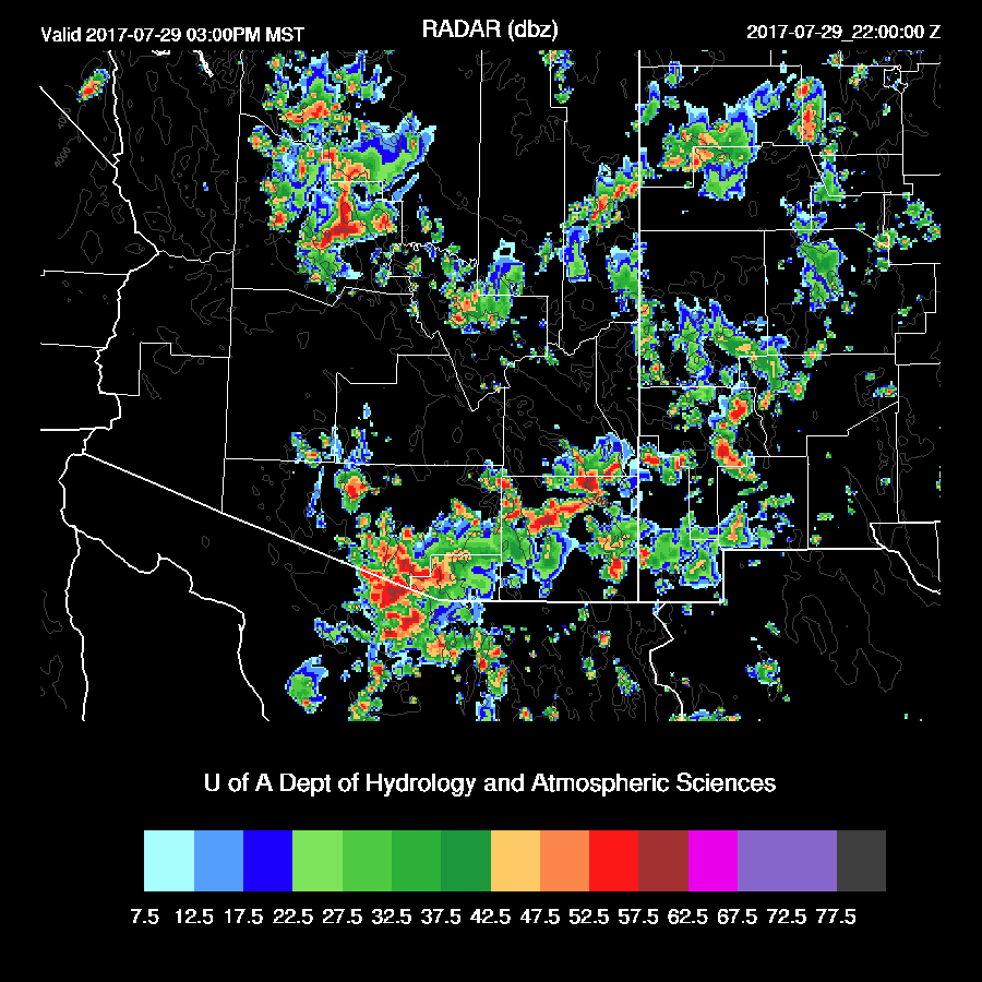
An impressive amount of CAPE for Tucson by midday. The PBL is mixed well and all that is needed is a strong outflow from nearby mountain activity to initiate convection. Like yesterday, storms won’t move much and new storms will form on outflow boundaries.

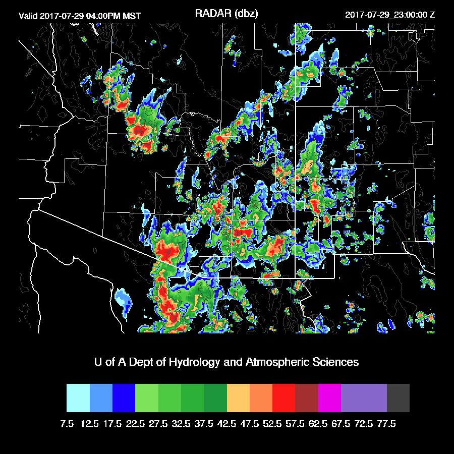
Later in the afternoon, activity shifts to central Arizona where large storms are underway and an organized area of storms moving into western Maricopa County.
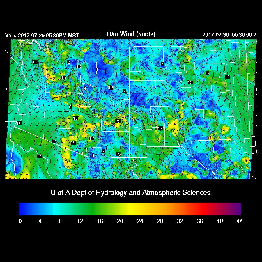
The Phoenix area has enough CAPE to support storms as well as a well mixed PBL which is fairly deep, thus supporting strong winds. Steering and shear are also very good.
Some model runs have outflows converging and intersecting in Maricopa and Pinal counties this evening and with the moderate amount of CAPE, big storms are possible.
Strong/severe storms are present over parts of Pinal and Maricopa Counties this evening.

Day 2
A quick look at Day 2 shows a moderate amount of CAPE. However, with all the activity today, it could be a down day tomorrow as well as low confidence in the forecast.
An IT remains more or less stationary over Arizona keeping western Arizona under decent NE steering flow. Southern Arizona stays in light flow with somewhat warmer temperatures aloft resulting in less activity and storms mainly over the mountains.

Most activity is restricted to areas of northern Arizona.

No comments:
Post a Comment
Note: Only a member of this blog may post a comment.