Previous Forecast
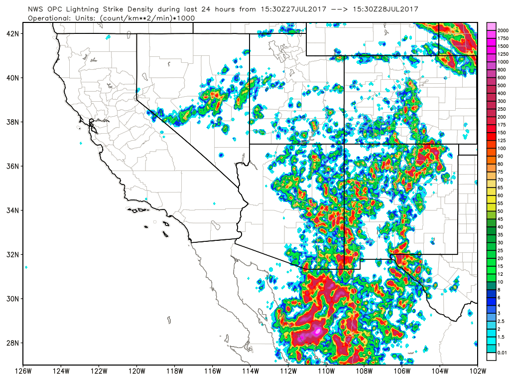
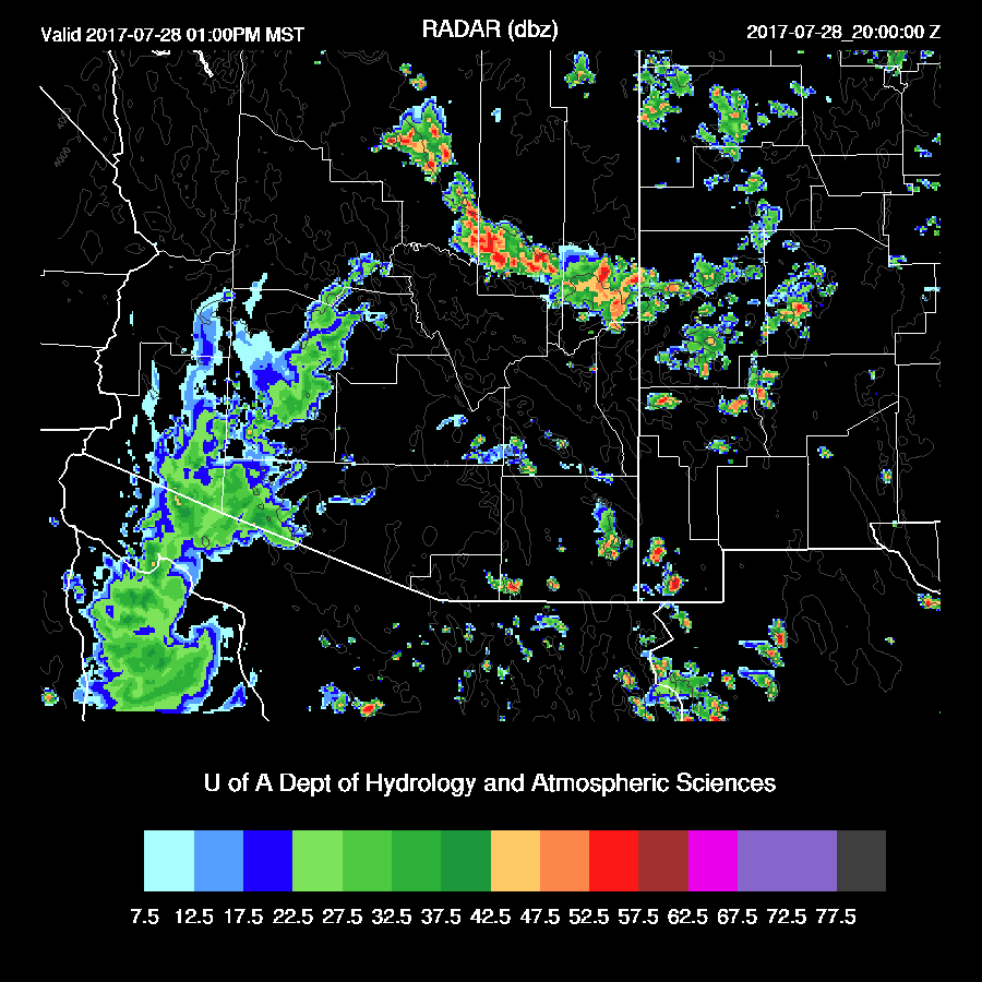
Activity increased significantly over the higher terrain of Arizona with some very strong storms in far SE Arizona.
I’m in Paradise AZ which is in the Chiricahua mountains. All day long, deep convection formed over the highest peaks and then moved east.
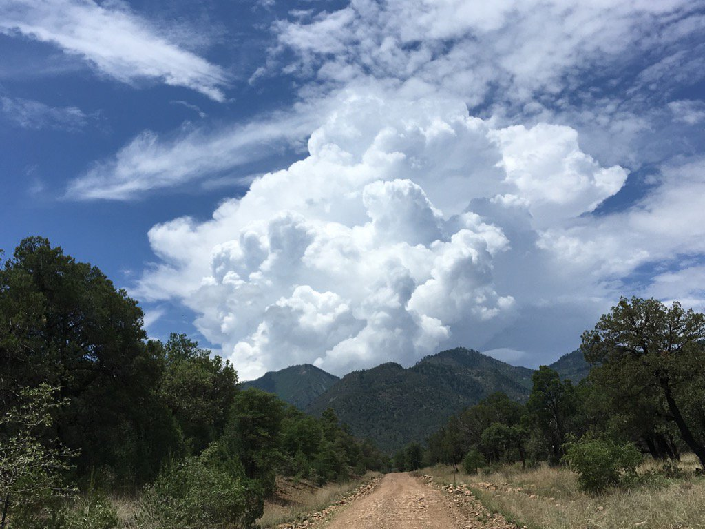
By late afternoon, storms were forming over in far SW NM and then moved over the mountains and unleashed torrential downpours. The creek here flash flooded and large rocks could be heard washing down the creek bed.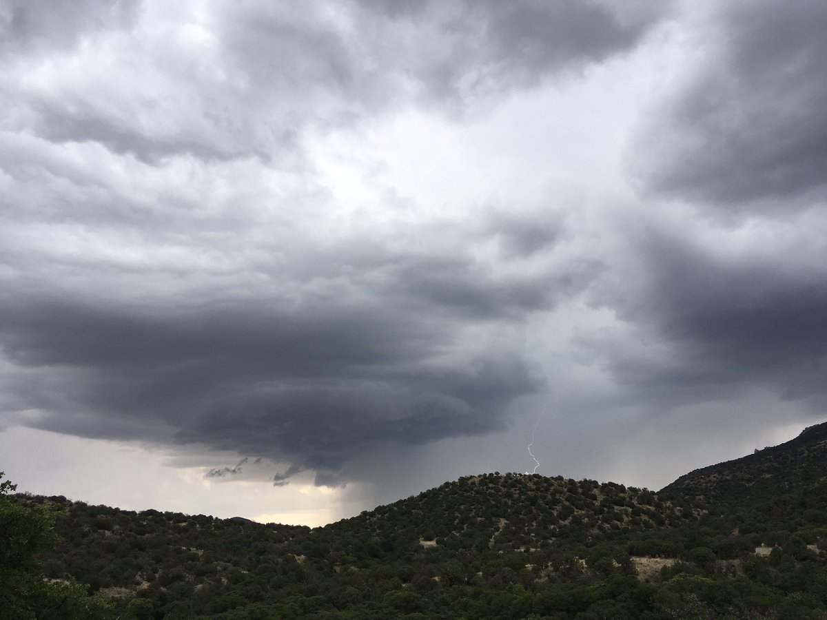


In general, the 12Z runs were fairly good except around Tucson as the WRFNAM and WRFGFS allowed too much deep convection to form there. The WRFRR was much better and kept storms out of Tucson.
Initializations
The 500mb pattern has the high center around the Four Corners region while a large upper IT is located somewhere over north central Mexico. An MCV is over the northern GofC embedded in the general cyclonic circulation. 12Z initializations look similar to observed.
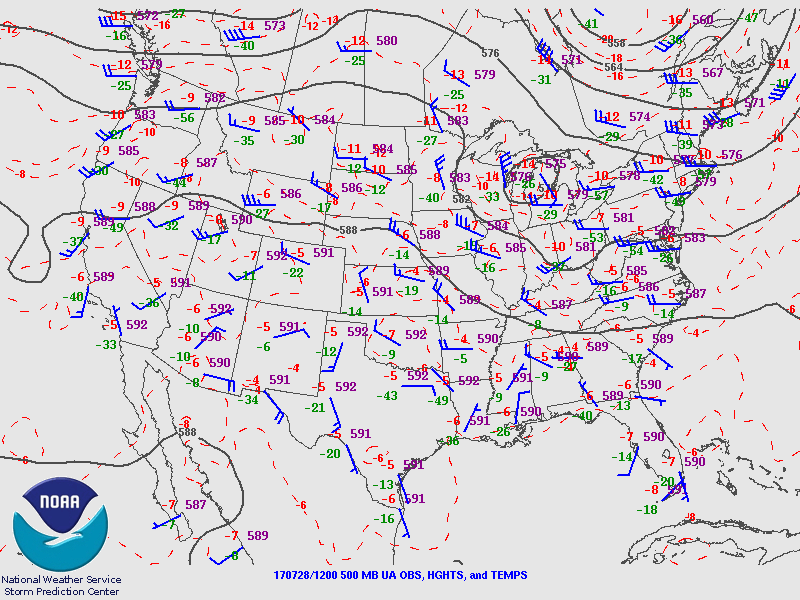
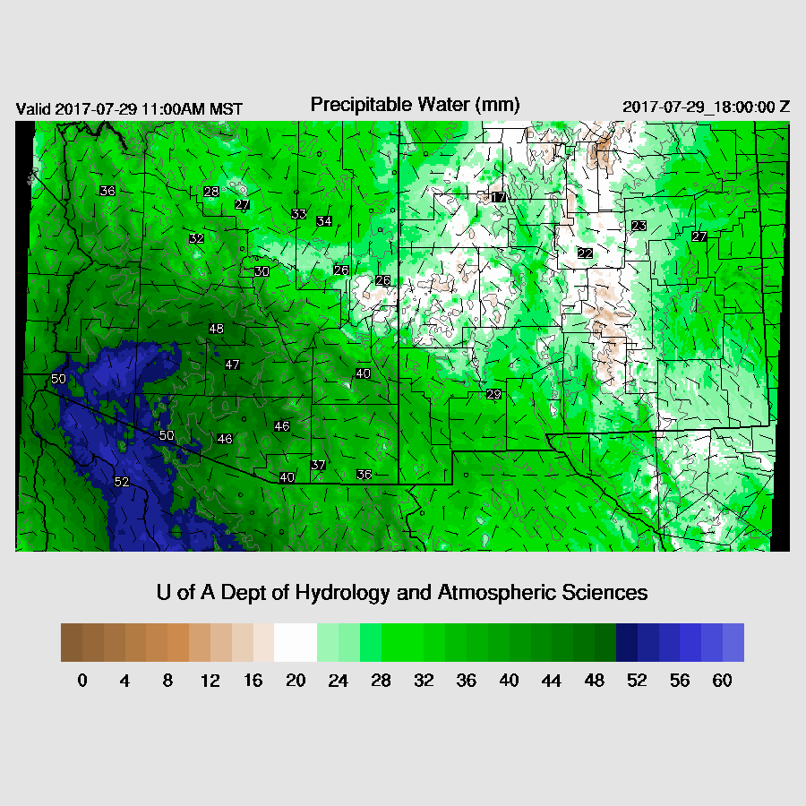
There are widespread clouds are over much of western and up to northeastern Arizona and the GFS and RR cloud initializations are fairly good while the NAM does not have enough clouds. The NAM continues to initialize too wet over Mexico and New Mexico while the other initializations also have some moderate dry and wet errors randomly scattered in the domain. The WRFRR and WRFGFS initialized the best today. This is opposite of last year as the WRFNAM was usually the model run of choice.
Day 1
Far eastern Arizona has had some drying while a strong surge is underway over western/central Arizona. Bob Maddox discusses some of these topics over on his blog.
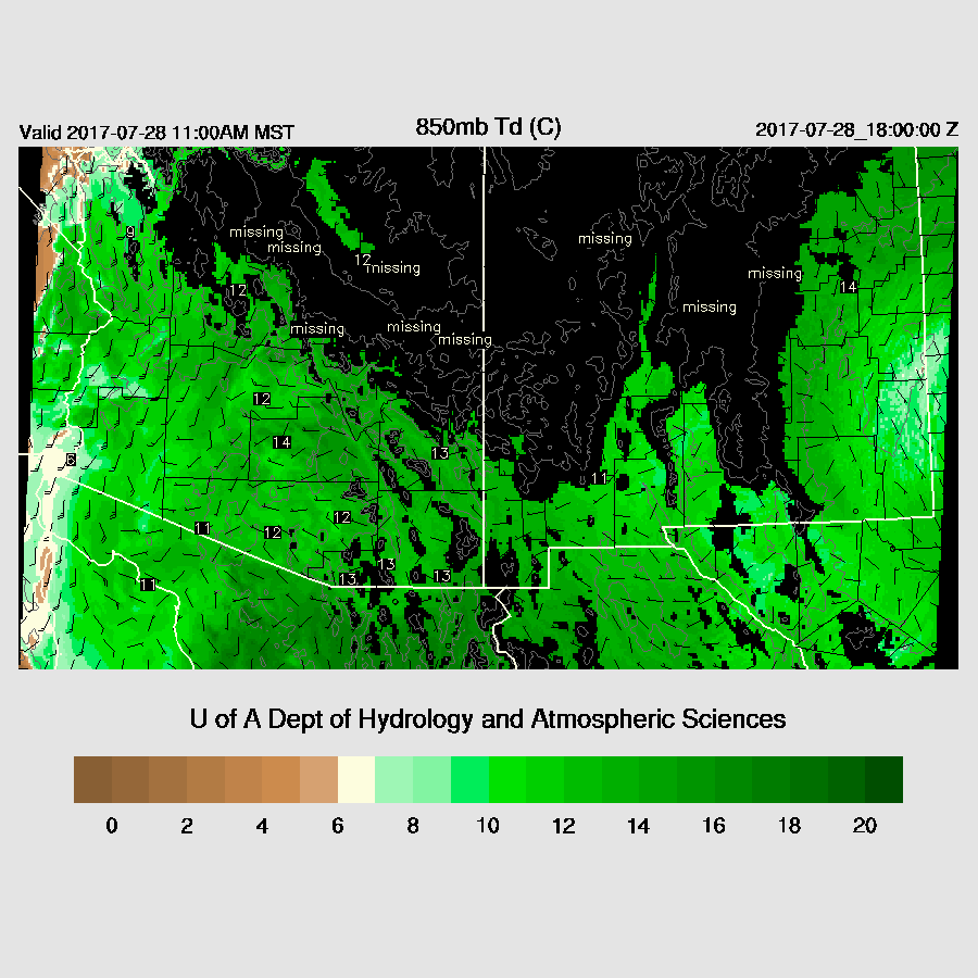
850mb dewpoint temperatures have also decreased over eastern Arizona but are still above the 10C threshold. Dewpoints have increased to over 10C in the Phoenix area since yesterday.
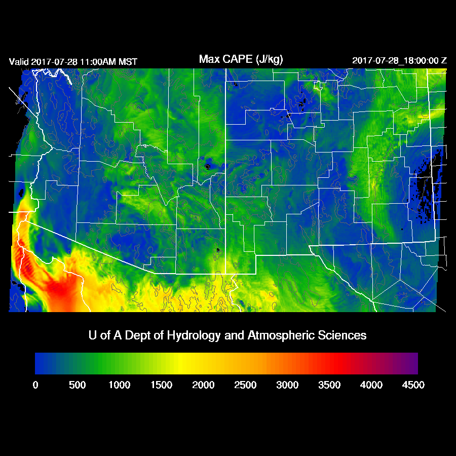
The morning runs disagree on the location and amount of CAPE as the WRFNAM and WRFGFS have quite a bit over north central Arizona. The WRFRRx (below) looks more realistic but that is just an educated guess. It has low to moderate CAPE over much of the eastern ½ of the state which is sufficient for afternoon storms.
There has been some slight cooling at 500mb as seen on the 500mb plot above and the forecast for around midday has around -6 over southern Arizona. The IT is over southern Arizona which puts the eastern part of the state in mainly light SE flow while the west has light NE flow. Wind speeds are only 5-15 knots so storms may have some trouble moving off higher terrain.

250mb flow is difluent over southern Arizona with some areas of divergence which continues to be favorable to support storm organization. The strong jet over SE Arizona has rotated out around the ridge and replaced by another over southern NM. 250mb wind speeds are lower in Arizona today so anvil shading will be less of a problem. 
Eastern Arizona receives nearly 100% of possible isolation this morning and with the moderate amount of CAPE, deep convection is underway over the highest terrain by early afternoon.
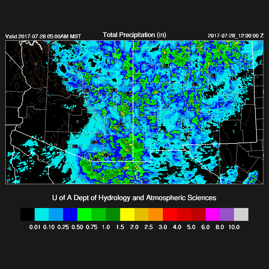
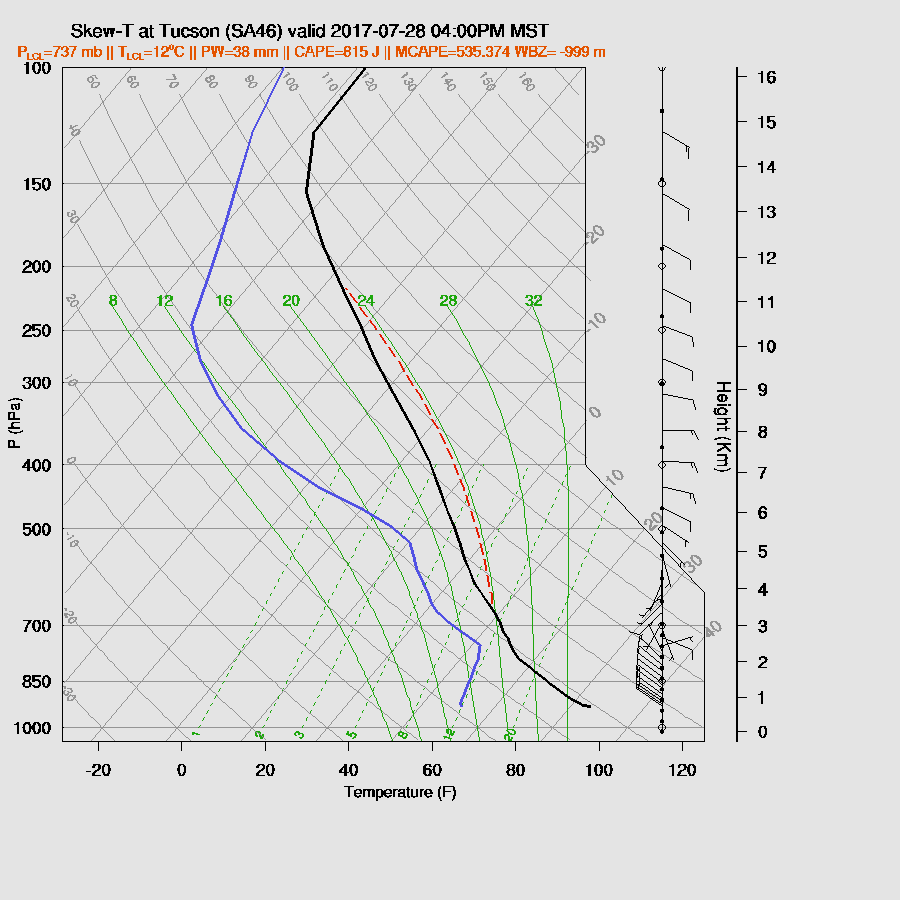
Later in the afternoon, the Rim storms move slowly towards central Arizona. SE Arizona sees limited activity as that area was hit hard yesterday and the lower atmosphere has been cooled and dried out slightly as Tucson’s morning MLCAPE is only 300 J/kg. (see Bob’s discussion).

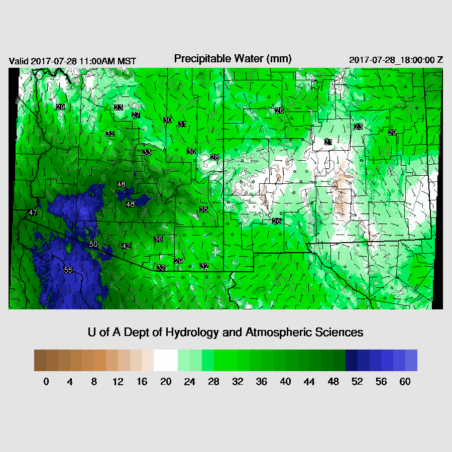
The various runs disagree about Tucson as some have quite a bit of CAPE by afternoon and moisture increases to 42mm. Winds are fairly good too as there is some mid-level steering and low-level shear. The morning sounding has a high LFC at around 650mb. It’s going to be tough to mix to that depth today.
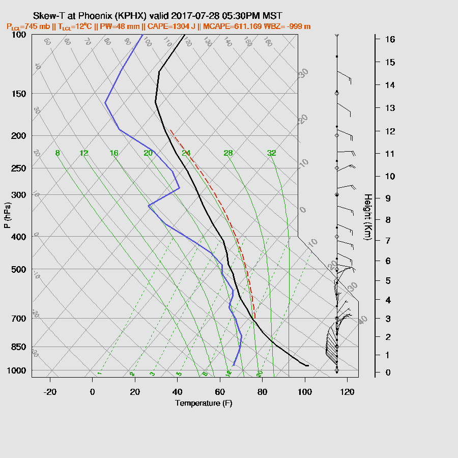
The northern AZ storms weaken as they move towards the lower elevations around Phoenix. A few storms continue over SE Arizona.

The cooler lower level air associated with the surge prevents much if any activity around Phoenix as the PBL is not mixed very deep plus the slightly warmer air aloft keeps deep convection from warming. This is in spite of around 500-1000 J/kg of CAPE and a good wind profile.
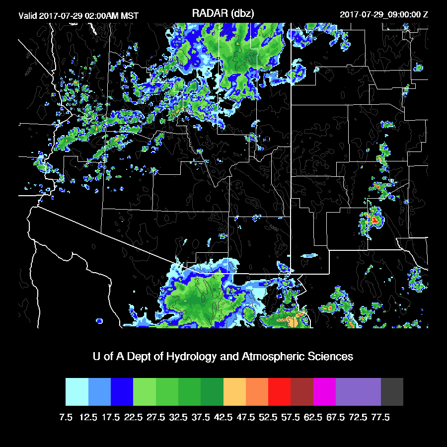
Showers and a few storms may develop to the north of Phoenix during the early morning hours due to the IT. Other showers continue near the Mexican border.
Day 2
Very wet air continues to be advected into the state due to a gulf surge.
Moderate to high CAPE is over most of the state except the far SW.

Tucson PW increased to around 45mm and CAPE is a high 1400-1700 J/kg. The wind is also good with mid level easterly flow and some low-level shear. If it is clear in Tucson tomorrow morning, deep convection will develop in SE Arizona quickly as heating will be able to overcome the weak inversion at the top of the BL. Many of the runs are forecasting mainly cloudy skies over southern Arizona thus restricting heating. My guess is that there will be big storms for SE Arizona including Tucson at some point tomorrow afternoon or evening. We’ll just have to wait and see.

The situation for Phoenix is even less certain. The various model runs go from having no storms to widespread activity. The potential is there as the PBL looks to be deeply mixed but capped thus needing some outflows to kick off deep convection. Steering winds are poor as they are light and variable. Low-level shear is good though. Like Tucson, “wait and see” due to the complex nature.

No comments:
Post a Comment
Note: Only a member of this blog may post a comment.