Previous Forecast
The various runs had the right idea of bringing storms off the Rim towards Phoenix and then ejecting a moderate outflow. In real life, storms were only isolated and weak thus produced only weak outflows. A few storms continued into the evening over western Pima county. There was a lot of activity in Sonora and a strong outflow surge had begun in SW Arizona.(lightning flash density from weather.graphics)
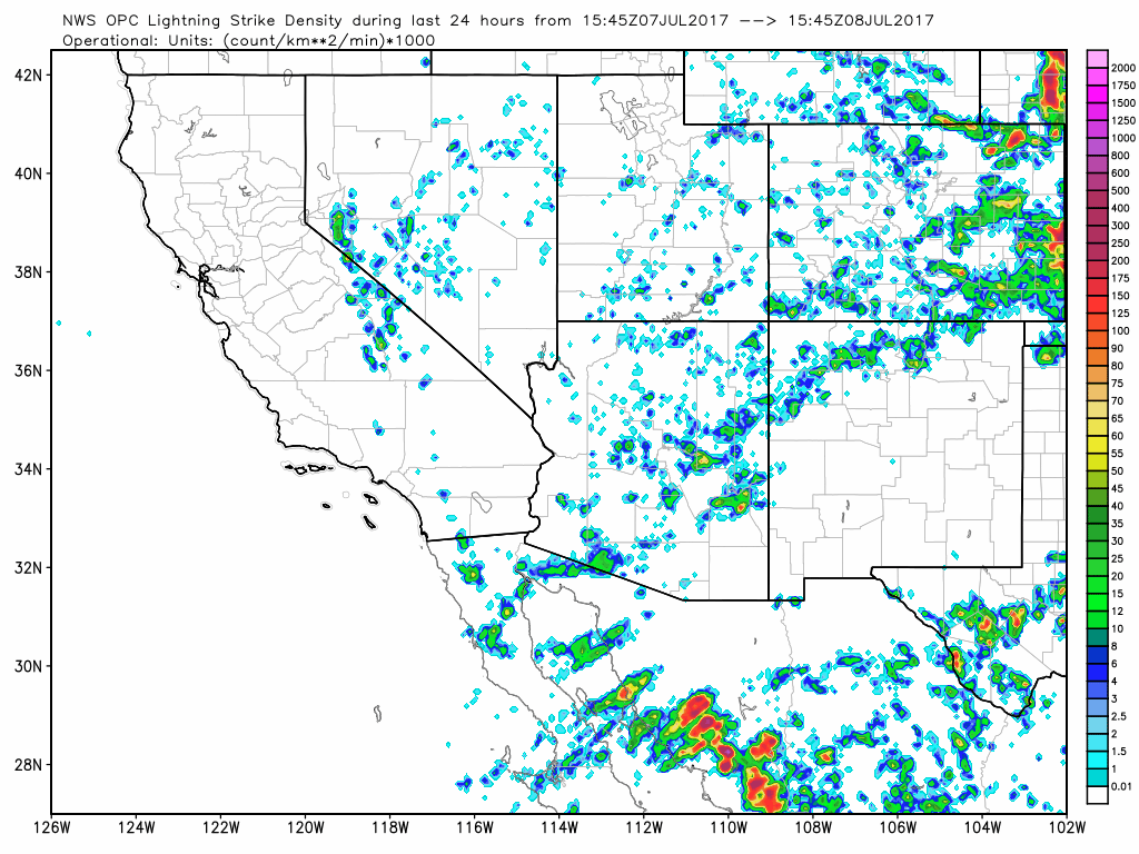
In spite of having too strong outflows around Phoenix, the WRFNAM verified pretty well with regards to timing and locations.

Initializations
Scattered debris clouds are present over much of western Arizona and near the large IT located over southern Baja. Both the GFS and NAM initialized the clouds correctly. Neither model initialized the IT strong enough as satellite imagery indicates the IT has a closed circulation while the initializations have an open wave at mid levels. This sort of initialization errors are likely until the upper air data (hopefully) returns at Empalme and Chihuahua. This error shouldn’t impact Arizona as the IT continues to move to the west, away from Arizona (for now). Besides no upper air data, a majority of IPW stations are missing in Sonora. The NAM is quite a bit too wet in SE NM otherwise other locations initialized OK. The GFS was a bit better and has only minimal errors. Overall, the initializations are fairly good and model confidence is high.
Day 1
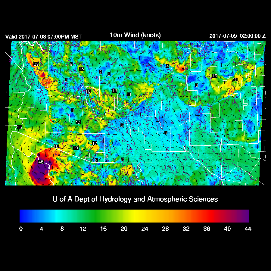
As mentioned earlier,, a fairly strong outflow surge is underway over SW Arizona with surface Td around 70F and 20 knot winds. IPW is around 32-37mm so the surge isn’t very deep. There is quite a bit of uncertainty with the moisture forecast as the WRFNAM is quite wet by early afternoon while the WRFGFS (below) is a bit drier. At 15Z, both runs are a couple of mm too wet in SW Arizona so maybe too active this afternoon? In any case, moisture continues to increase slowly over much of the state except the southeast where low level dry air advection continues from New Mexico. Again, expect this back door dryline to be to initiation point for deep convection this afternoon.

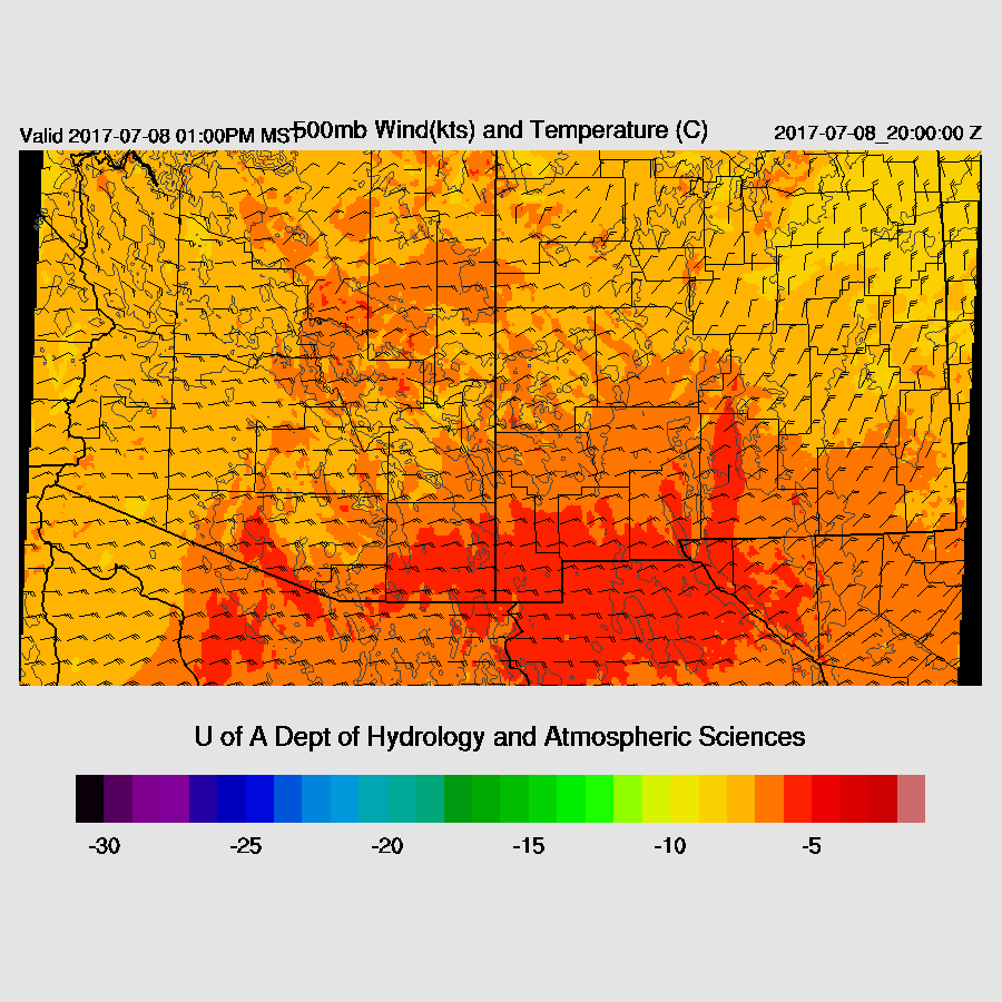
Mid level steering flow continues to be excellent with 15-20kt ENE flow. Another negative for SE Arizona is the warm air at 500mb.
Moderate CAPE is present over the Rim/White Mtns and with clear skies, deep convection should get underway by mid afternoon. Moderate to high CAPE is present over much of SW Arizona, but is likely capped due to the cooling of the low levels and warm air aloft.

Both the WRFNAM and WRFGFS develop some strong storms over the high terrain of AZ and just to the west of the convergence line in central Pima county/far northern Sonora.

By late afternoon strong outflows move into Maricopa and Pinal Counties. Will they be strong enough to trigger additional deep convection?

The WRFGFS (below) had a moderate amount of CAPE present by late afternoon along with favorable steering. The lack of low level shear plus no outflow convergence makes me think that only isolated storms will occur in the immediate Phoenix area. The WRFNAM had less CAPE.

As was the forecast for today from yesterday, storms develop to the west of Phoenix in the areas of higher CAPE and better low level shear. The 12Z WRFNAM has much more activity than the WRFGFS and my guess is that the WRFGFS might be more accurate.
WRFGFS

WRFNAM

At some point during the afternoon (WRFNAM) or evening(WRFGFS) very strong/severe storms move across far northern Sonora producing severe winds as CAPE is present and perhaps some mid/upper support from the Baja IT. SPC now has parts of south east/central Arizona in a “slight risk” convective outlook. The WRFGFS does eject a strong outflow from Mexico towards Tucson while outflows move south from activity to the north, much like the intersecting outflows that happen in Phoenix.
Strong storms then develop over eastern Pima County in spite of CAPE being marginal at around 500 J/Kg. In my opinion, this is not likely to happen as very specific events need to happen and I expect severe weather to be located in central/western Pima County as well as far NW Sonora thus the SPC outlook is too far to the east.

Day 2 will be posted later this morning.
No comments:
Post a Comment
Note: Only a member of this blog may post a comment.