Previous Forecast
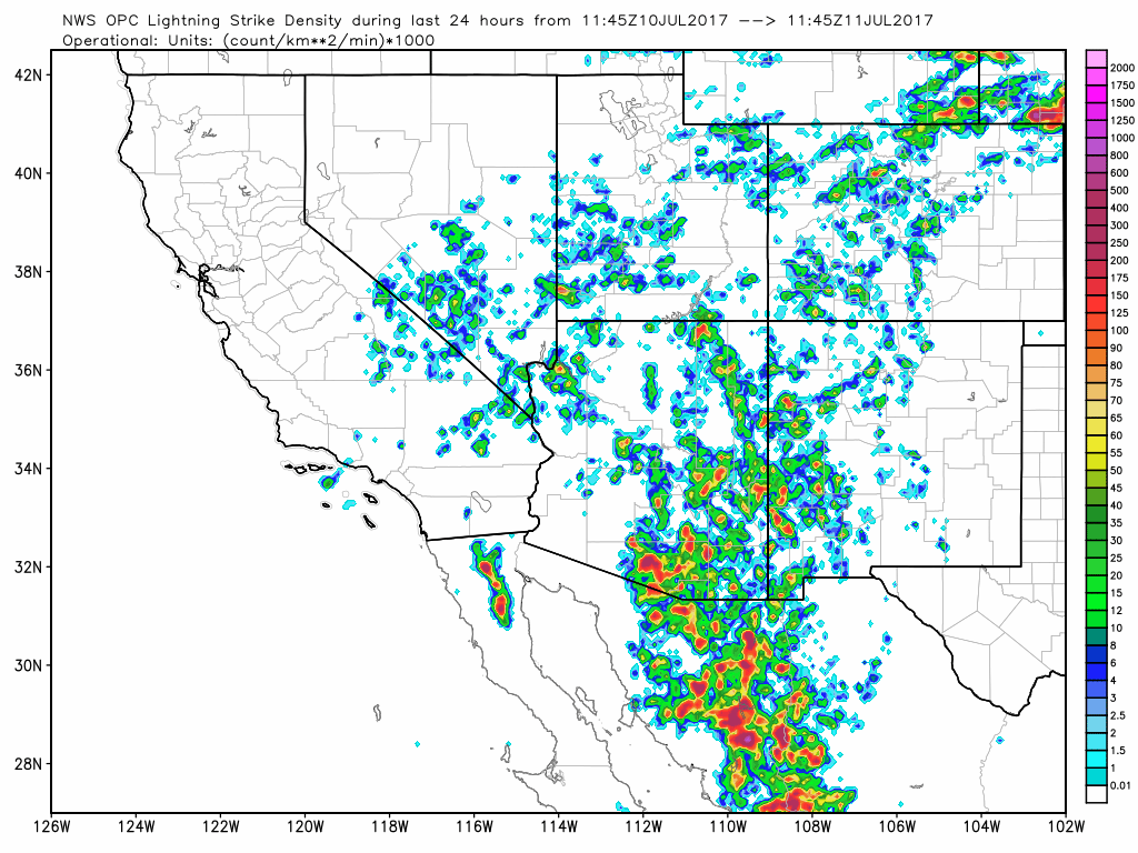
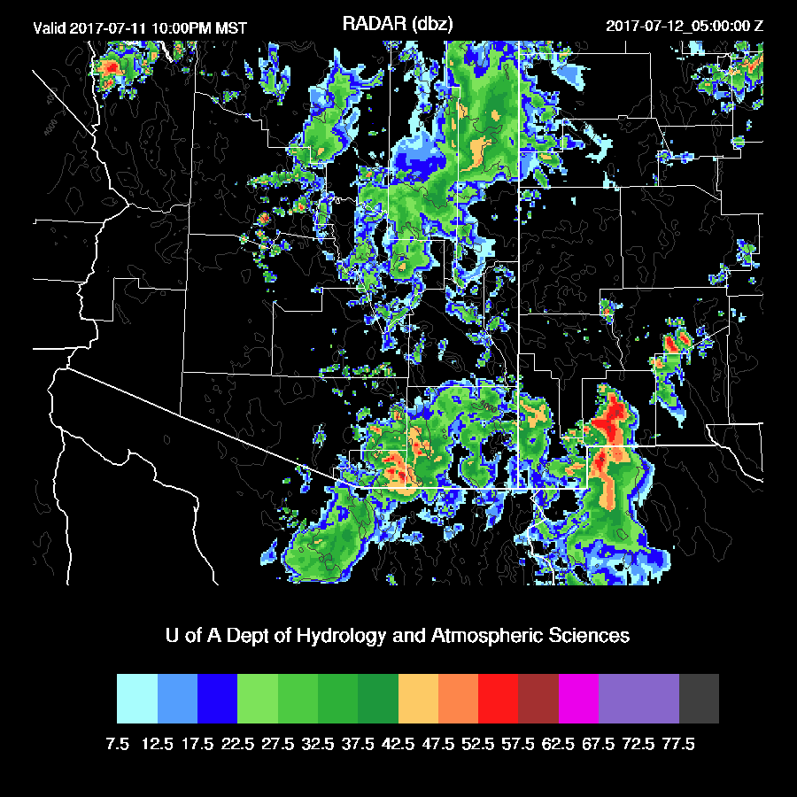
Very active over SE Arizona yesterday evening and into the late night. Storms moved into Tucson around 6 pm and lasted on and off, much of the night.
The WRFNAM (below) was the best and the WRFRRx was also pretty good. The WRFGFS was much too active around the Phoenix area.
Initializations
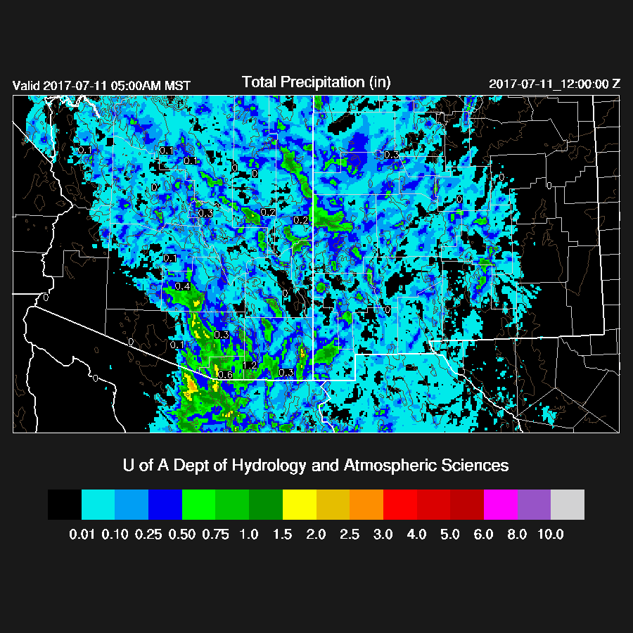
Widespread clouds with some showers are present over much of central and eastern Arizona as well as a large area of rain cooled air over southern Arizona which is going to be trouble for the model runs. There is an especially thick area of clouds east of Phoenix which may be a weak MCV. Another MCV (from yesterday!) is located north of Las Vegas NV and another in Sonora. Also, an area of cyclonic rotation, larger than an MCV, is located over southeastern AZ. The 12Z GFS and NAM have the SE AZ IT but are mostly missing the other MCVs. The NAM cloud/shower initialization was very poor as it had very few clouds over the entire area. The GFS was much better. I also took a look at the 6Z runs and both had more clouds than the 12Z NAM, but still not as good as the 12Z GFS. The GFS also had a significantly better IPW initialization as the NAM was much too wet in Sonora. Lastly, there was no Tucson sounding this morning thus no upper air data for SE Arizona and all of northern Mexico. I’d say the 12Z WRFGFS will be the model of choice, but confidence is low due to the complex situation and the lack of data.
Day 1
Wet air continues to be advected into the state from a continuing surge. IPW is moderate to high over much of the state.

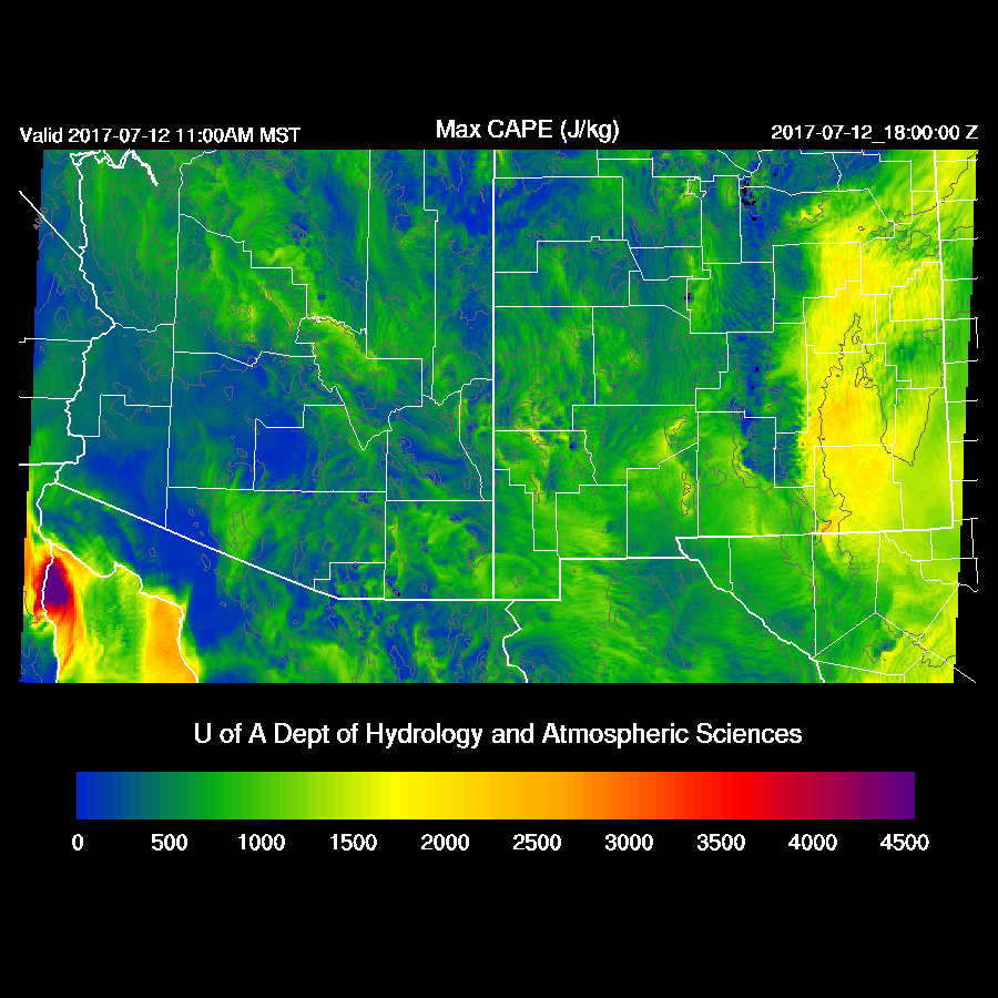
CAPE is moderate to high over the eastern ½ of the state thus the potential is there for some big storms with very heavy rain over the higher elevations. It won’t take much heating to develop deep convection and areas that have some sun, like far eastern Arizona, will develop storms quickly today. In fact, storms appear to be developing as of 17Z.

Another important feature is the SE AZ IT which will assist storm development and organization. Elsewhere, steering winds are light and variable thus storms will be mainly over the higher terrain.

For most of the afternoon, storms are limited to the eastern ⅓ of the state.

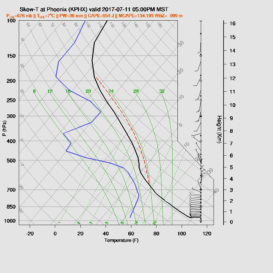
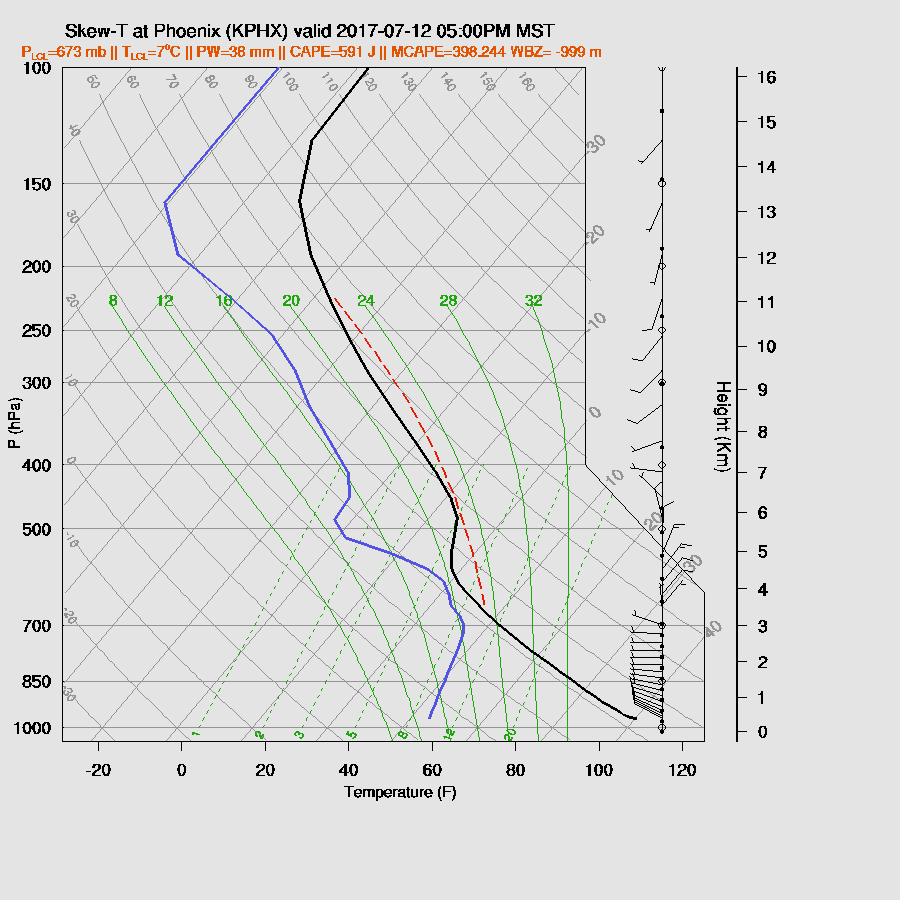
The late afternoon Tucson vertical profile forecast has some CAPE and a deeply mixed PBL. There are some decent mid level winds from the NE and some low-level shear so, in spite of all the cooling that has occurred, there is still a chance for storms in and around Tucson, especially if it clears off this afternoon.

The situation in Phoenix isn’t any better in spite of a bit more heating. CAPE is limited and steering flow is weak. The surge is still providing decent low-level westerly flow which could interact with any outflows moving in from the east.
A few showers and weak storms do try and develop near the Phoenix and Tucson areas this evening.

With the IT in the area, showers and storms continue over SE Arizona into the night.
Day 2
Confidence in the Day 2 forecast is especially low due to missing upper air data and the uncertainty in the Day 1 forecast. The SE AZ IT remains mostly stationary while a high center is over far SW Arizona. Steering flow is fairly good for central and south central AZ.

A Gulf Surge continues but does look like it’s beginning to dry out over western Arizona. The rest of the state is still plenty wet.

CAPE is high enough for high elevation storms but lacking over central Arizona. SE Arizona may be too worked over and cloudy to support much activity there. Both runs have widespread clouds over much of SE Arizona tomorrow.
Storms move towards the Phoenix area during the late afternoon due to favorable steering flow.

Limited CAPE and a strong inversion around 500mb should result in limited storm activity for Phoenix.

No comments:
Post a Comment
Note: Only a member of this blog may post a comment.