Previous Forecast
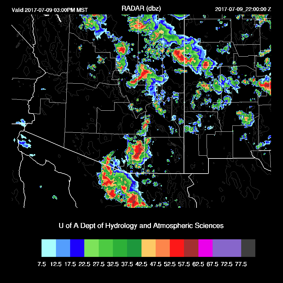
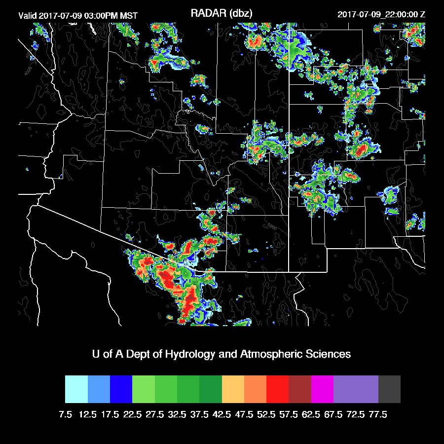
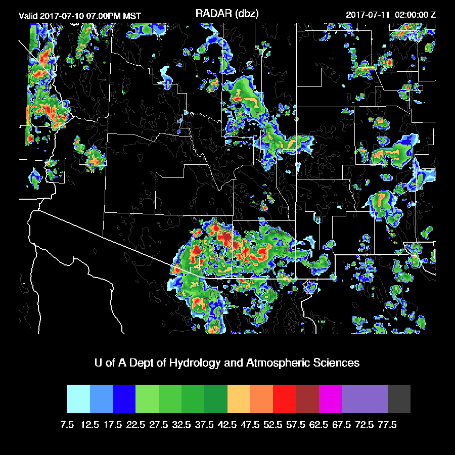
As moisture increased yesterday, so did storm activity with much of the high country seeing storms. Storms made it as far west as the CO river around Bullhead City and very strong/severe storms moved across far northern Sonora and along the border of western Pima County. (lightning flash density from weather.graphics)

The model runs were mixed as the WRFNAM was way too active west of Phoenix. The WRFGFS turned out to be OK as it had some successes like the severe weather along the border and storms out west, but did forecast strong storms around Tucson later, which turned out not to be the case as I mentioned yesterday.

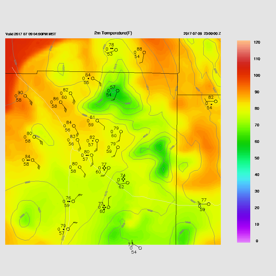
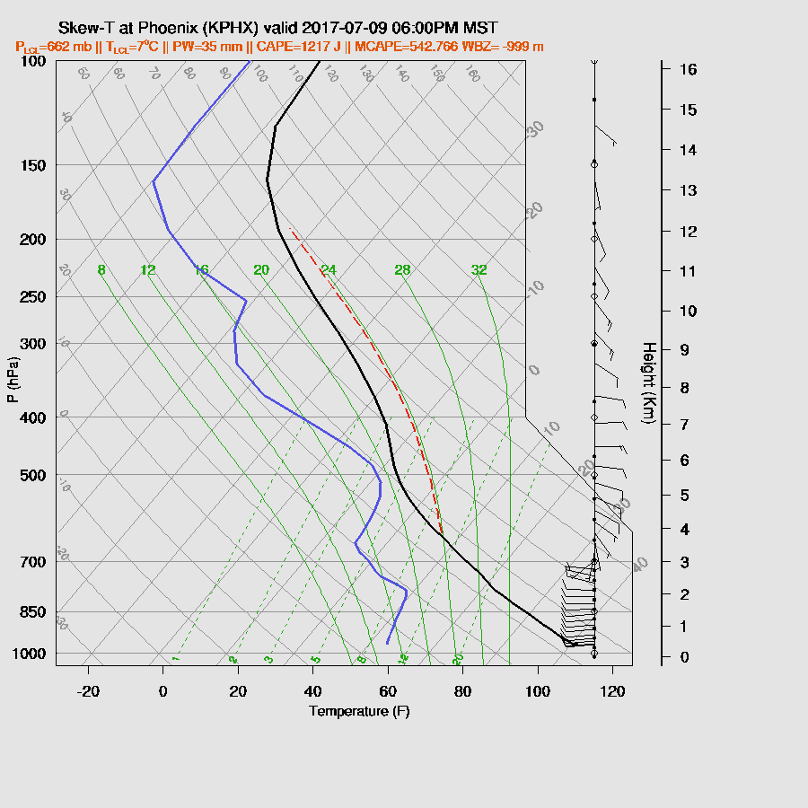
Another forecast bust was the temperatures in Tucson. The WRF did not handle the very high temperatures we had here during our downsloping easterly winds over the past few days. It wasn’t even close and normally, WRF high temperatures are quite accurate.

Initializations/Discussion
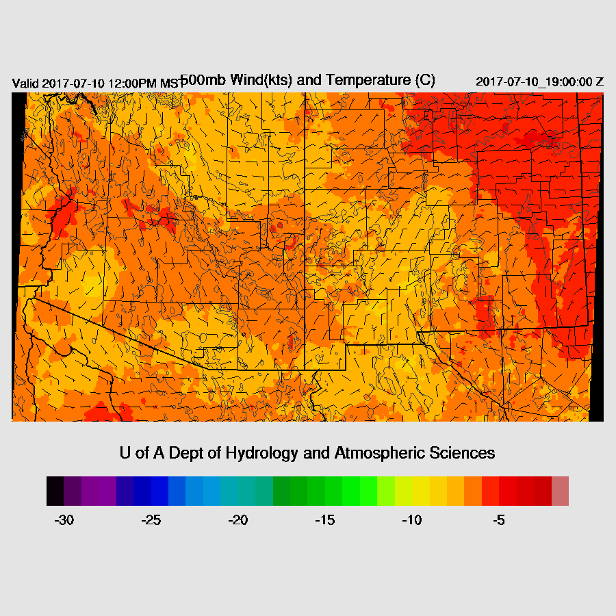
The monster high that has dominated our weather the past 5 days is starting to weaken somewhat but hasn’t moved. It’s still located near the UT/AZ border. The northern Mexican IT is now moving NW and is located over northern Baja and it continues to trigger showers and storms over southwestern AZ. As the 500mb map shows, there continues to be a huge data void in northern Mexico and this is likely to degrade the WRF forecasts. An example of this is the IT as the various models initialize it as a broad trough extending all the way down to about 24N whereas the WV imagery shows a more compact trough.
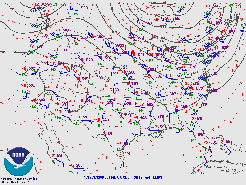
One of the concerns for today is the amount of debris clouds and their impact on heating. Clouds and showers continue over much of the western ⅓ of the state while a few areas of scattered to broken clouds are elsewhere except SE Arizona where it’s clear. The 6Z WRFNAM run looks good while the 12Z NAM and GFS are missing most clouds and showers over southwestern AZ and the scattered clouds elsewhere. As of 17Z, broken clouds continue east of Phoenix.
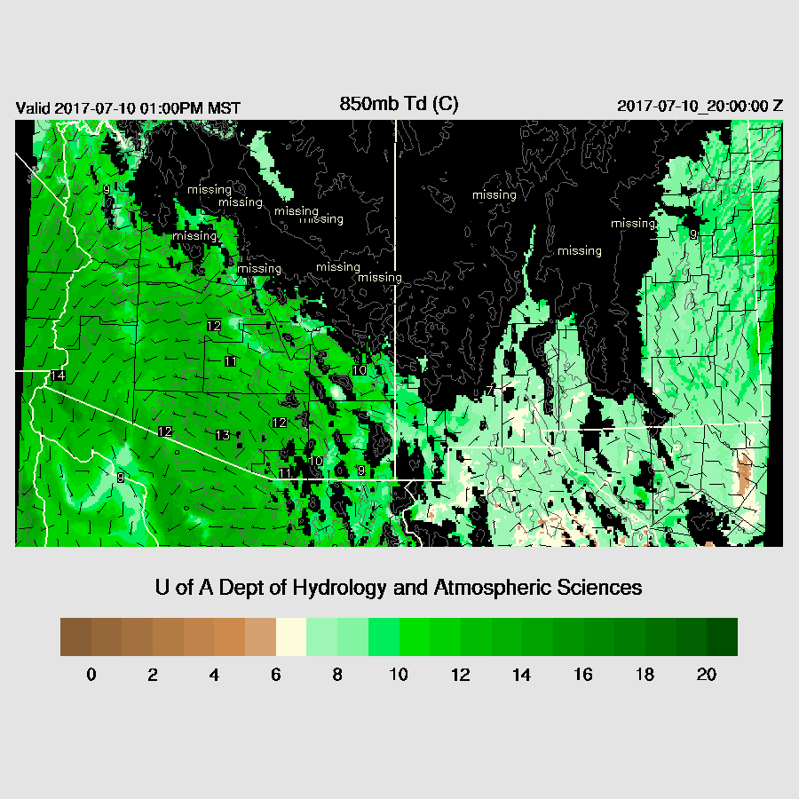
Moisture has increased a lot over SE Arizona with Tucson up to 36mm. Lower deserts also continue to moisten as IPW is now around 40-45mm. Both 6 and 12Z NAM were a bit too wet over Arizona and Sonora.
Model confidence is low with the 12Z runs due to initialization problems and lack of Mexico data. To make it worse, there is little consistency between the runs from 6 and 12Z as the 12Z runs are cooler and more stable over central and northern Arizona. Looking at the Phoenix and Tucson forecast vs observed temperatures show that at 16Z, the forecasts are running a couple degrees C warmer than observed mainly in central and western Arizona.
Day 1
Plenty of moisture is present over the state to support deep convection including most of SE Arizona. 850mb dewpoints are above the 10C threshold that I consider favorable, including the Tucson area.

Moderate amounts of CAPE are forecast for the higher terrain of Santa Cruz and eastern Pima aw well as much of northern Arizona and thunderstorms should begin around noon. 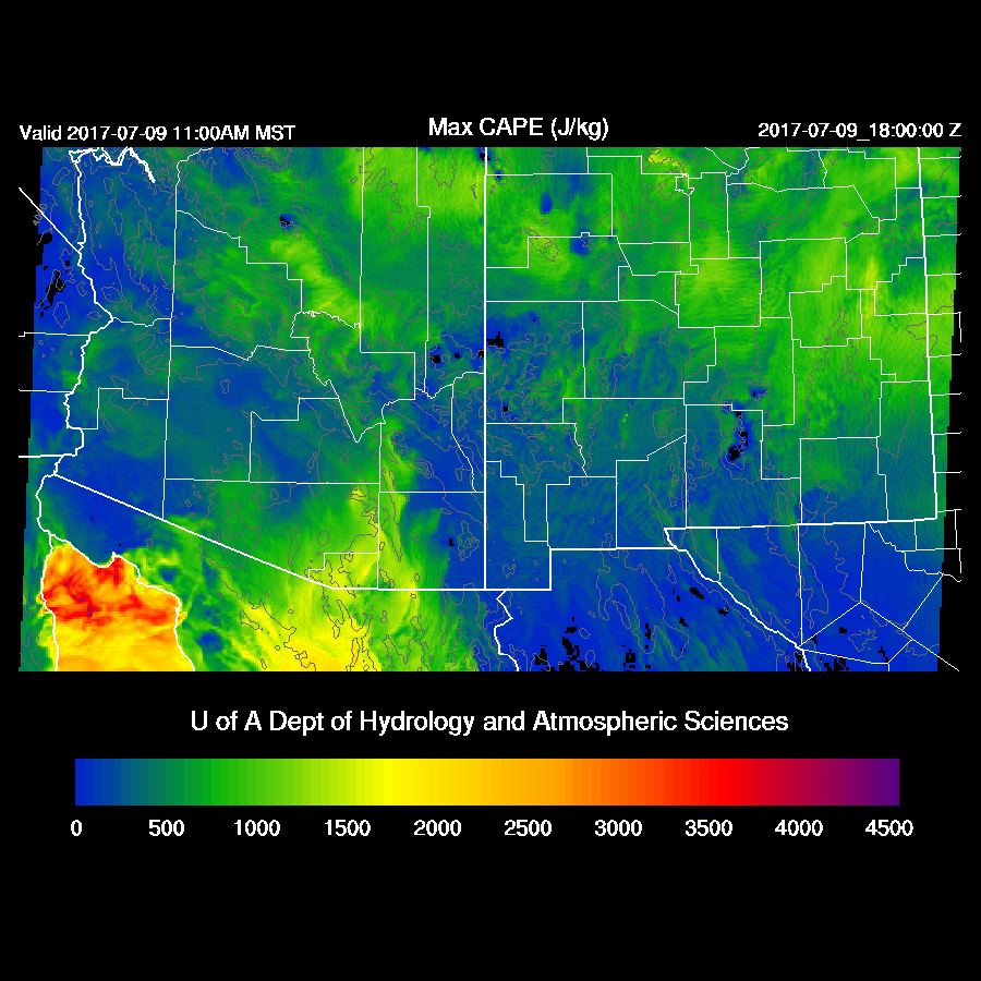
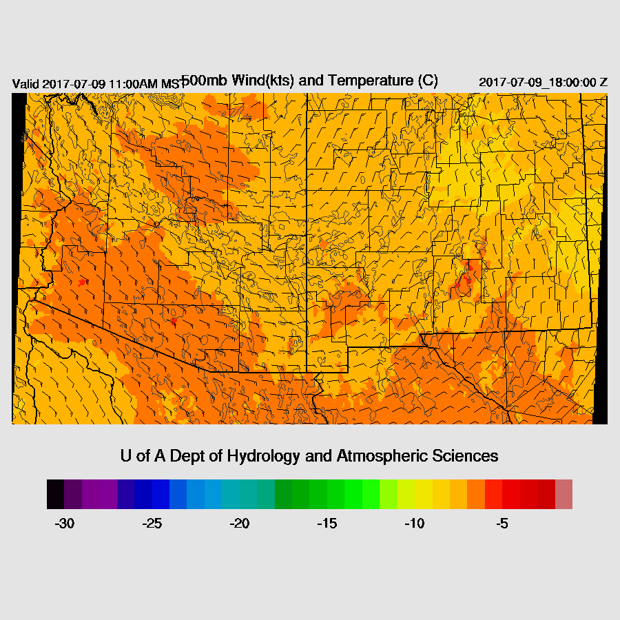
The 500mb high is beginning to move east slightly thus steering flow becomes more southeasterly today with speeds around 10 to 20 knots which are sufficient in moving storms off the mountains.
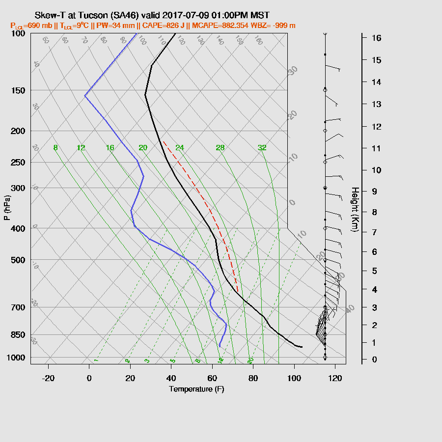
It looks like today will be the first decent day for Tucson as there is around 800 J/Kg of CAPE as well as moderate low-level shear and good steering.
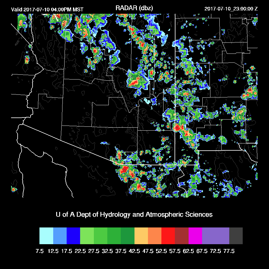
Storms form early over the high terrain of northern Arizona and SE Arizona. By mid-afternoon, scattered strong storms are moving towards the lower elevations of SE and Central Arizona.
An especially strong storm moves through the Tucson area producing very strong winds and very heavy rain. Isolated severe winds associated with wet microbursts are possible too.
Storms are lined up perfectly to eject outflows into Maricopa County for the classic outflow convergence scenario.

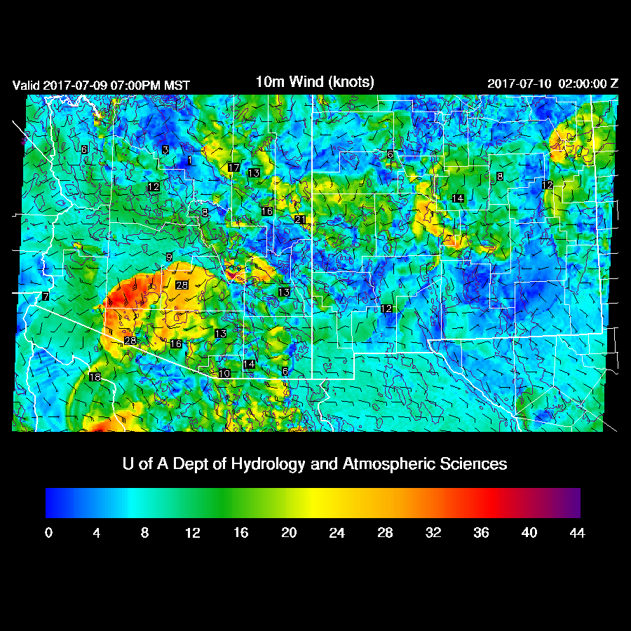
Thunderstorm outflows make their way into the Phoenix valley this evening probably accompanied by a haboob. Outflow winds are not as strong as they could have been as the PBL heights are lower today.
Is there enough moisture and CAPE for Phoenix? The model runs from the past few days did have lots of CAPE and thus storms but the more recent runs have backed off as there was more activity out west, which turned out to be the case. Will this cooler and more stable air keep deep convection from forming in Phoenix? The forecast is for around 500 to 1000 J/Kg with a deeply mixed layer and decent low level shear which should support scattered deep convection.

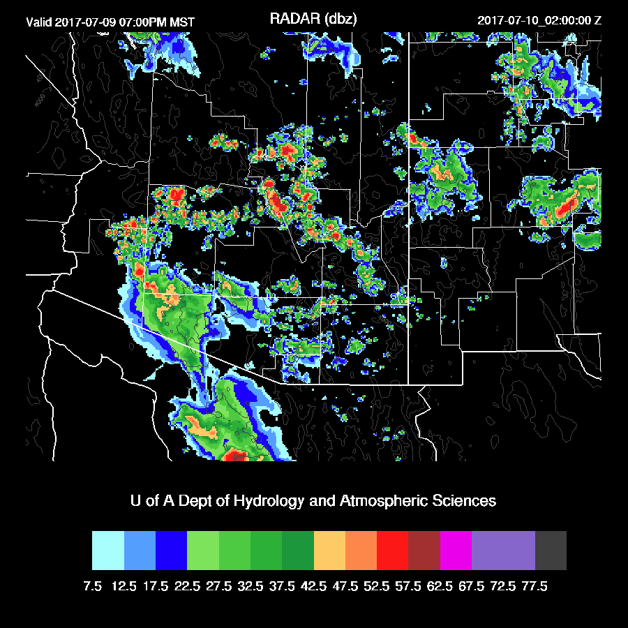
Deep convection does form over the Phoenix area during the evening. Not quite as strong as was forecast a few days ago, but more than was being predicted by the runs yesterday.
The only problem with the above sequence of events is that the 12Z WRFNAM is significantly different. It has much less activity over the Rim and White Mountains this afternoon in spite of decent CAPE. There was a lot of activity in that area yesterday so maybe they were worked over? It seems strange to me as the mountains seem to form deep convection every day as long as there is heating and moisture.
The 12Z WRFGFS is similar to the 12Z WRFNAM as it has very strong/severe thunderstorms from Tucson southward into Sonora and very little activity (in spite of full heating) along the Mogollon Rim. Weird! The southern Arizona/Sonora storms are likely too strong as the model received too much heating.

All I can think of is that CIN is quite high over that area, thus preventing deep convection. The early evening Phoenix profile forecast indicates a relatively shallow PBL far from the LFC (600mb from the PSR 12Z sounding) so maybe the whole region is like this.
The 12Z WRFNAM and WRFGFS has a strong outflow moving into Phoenix from the south during the evening, thus no outflow intersections which results in limited activity. About the only weather event that is likely for Phoenix is a big dust storm/haboob. Other than that, who knows!?
Storms develop during the late evening north of Phoenix as the outflow interacts with higher terrain.

Lightning flash rate forecasts indicate moderate to high flash rates with storms this afternoon and evening.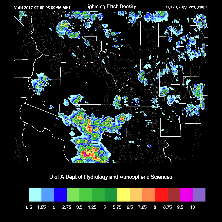
As confusion reigns today, I decided to take a look at the HRRRX run as it’s been doing a fair job so far this summer (see http://cimss.ssec.wisc.edu/hrrrval/ for HRRR validation info). It has strong storms moving through Tucson like the other models but weakens the storms as they move to the west thus only weak outflows move north towards Phoenix. Deep convection remains north of the Phoenix area this evening.

Day 2
What a mess Day 1 was thus confidence in the Day 2 forecast is going to be low. Plenty of moisture and moderate CAPE across the state will support widespread storms.
Mid level flow weakens thus less organization is expected.
During the afternoon, both 12Z runs keep scattered storms over the higher terrain of the state.
Tucson may see some evening storms as CAPE is sufficient and the PBL is deeply mixed. Steering is weak, but may be enough to move storms from the east into the valley.

Both runs have quite a bit of activity around SE Arizona tomorrow evening. Maybe a good lightning show?
No comments:
Post a Comment
Note: Only a member of this blog may post a comment.