Wednesday, August 31, 2016

20160831

Previous Day
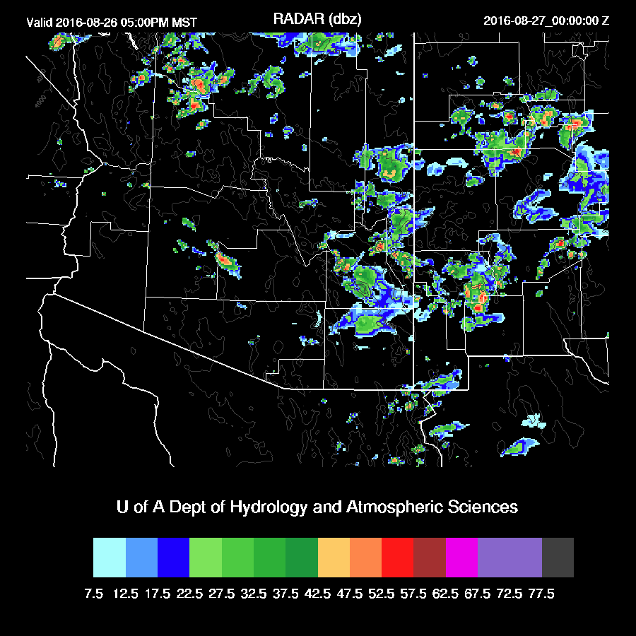
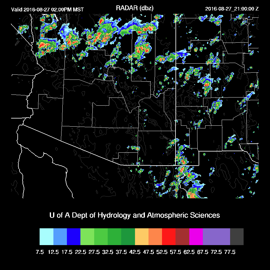
A bit more activity in eastern Phoenix than forecast by most runs.  The WRFNAM had the most and turned out to be quite good.

Initializations
It’s quite cloudy along with a few showers across far SE Arizona and into SW NM as the IT over Sonora seems to be providing some synoptic scale lift.  The NAM cloud cover was quite accurate while the other two runs did not have enough.  Elsewhere there were little or no clouds.

A broad IT continues to be located over NW Mexico and has moved further to the east into far SW NM.  There has been some warming of the mid levels recently and southern Arizona is around -6 to -7C @500mb.  Very warm over far southern Baja into mainland Mexico with -2C@500mb.  The NAM and GFS have the 700-500mb IT initialized well.  The consistent presence of the Guaymas upper air sounding data has certainly been a great help in initializing and verifying these sorts of features this summer.

There was quite a bit of deep convection over central Sonora last evening which has left behind a blob of wet air.  Unfortunately, the 12Z NAM is struggling with its IPW initialization as it’s quite a bit too wet in the area.  The GFS and RR are better.

Each initialization has a problem so model confidence is only moderate.  Also, no clear favorite except to say the WRFNAM has performed well recently and may be OK in Arizona as the IPW errors are in Sonora.

Day 1
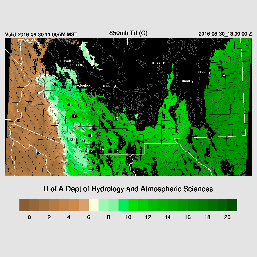
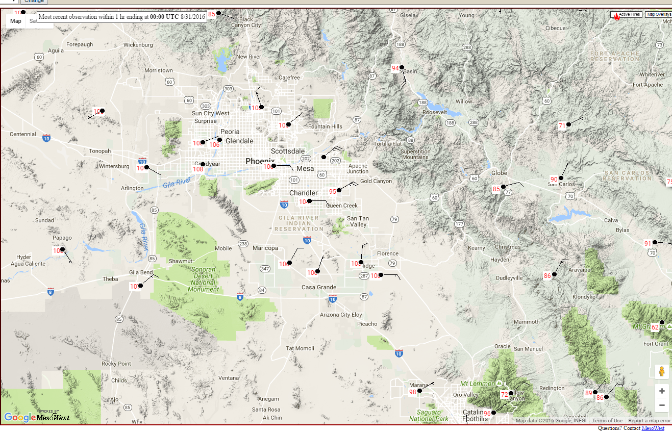
Moisture continues to increase as easterly flow continues to transport wet air from southern NM into Arizona.  There was even a shallow outflow surge at Yuma where the surface dewpoint climbed into the low 70F range.


Looking at the first few hours of the runs, the WRFGFS and RR seem to have the best handle on the moisture as the WRFNAM is somewhat too wet around southern Arizona.  By early afternoon, moisture continues to increase and is quite high over much of the southern part of the state.

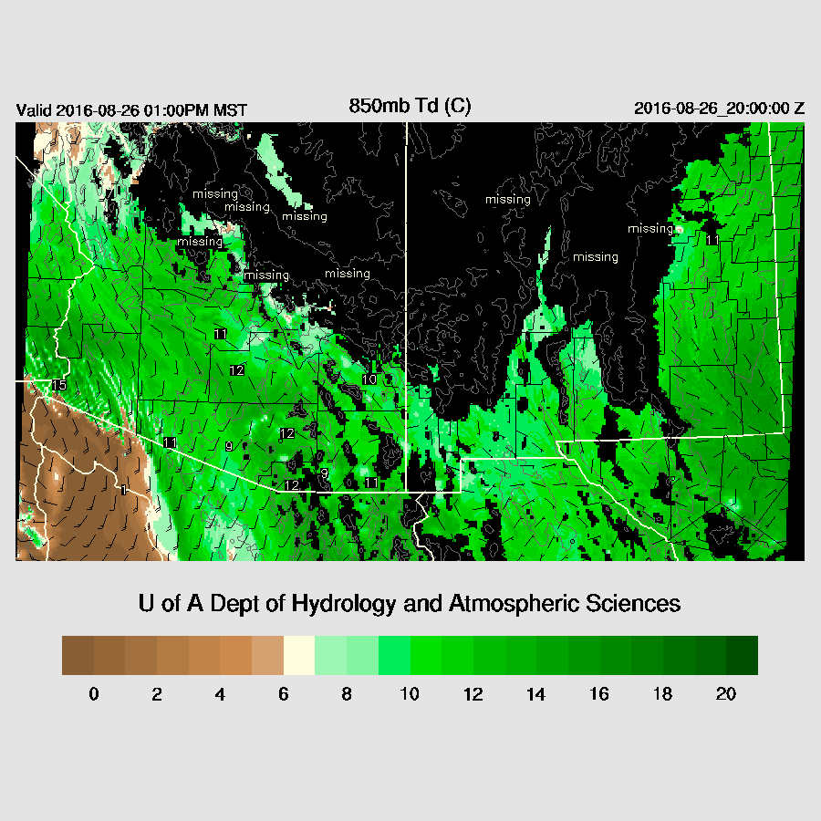
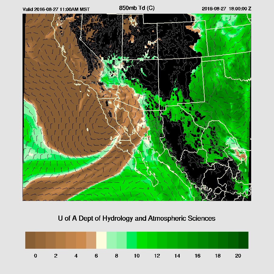
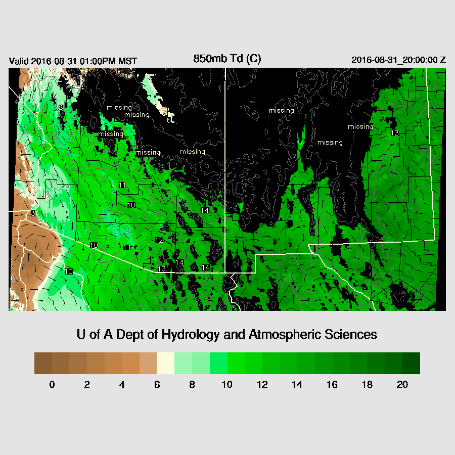
850mb dewpoint temperatures are as high as 14C over SE Arizona.

As Bob Maddox pointed out, mid level temperatures continue to slowly warm. Winds continue to be weak and become mainly southeasterly so less favorable for rim storms to propagate into the Phoenix area. Higher terrain storms that form over SE Arizona could move into the Tucson area.

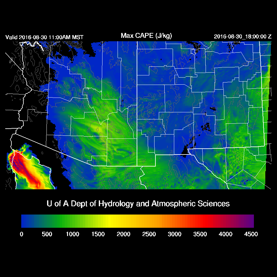
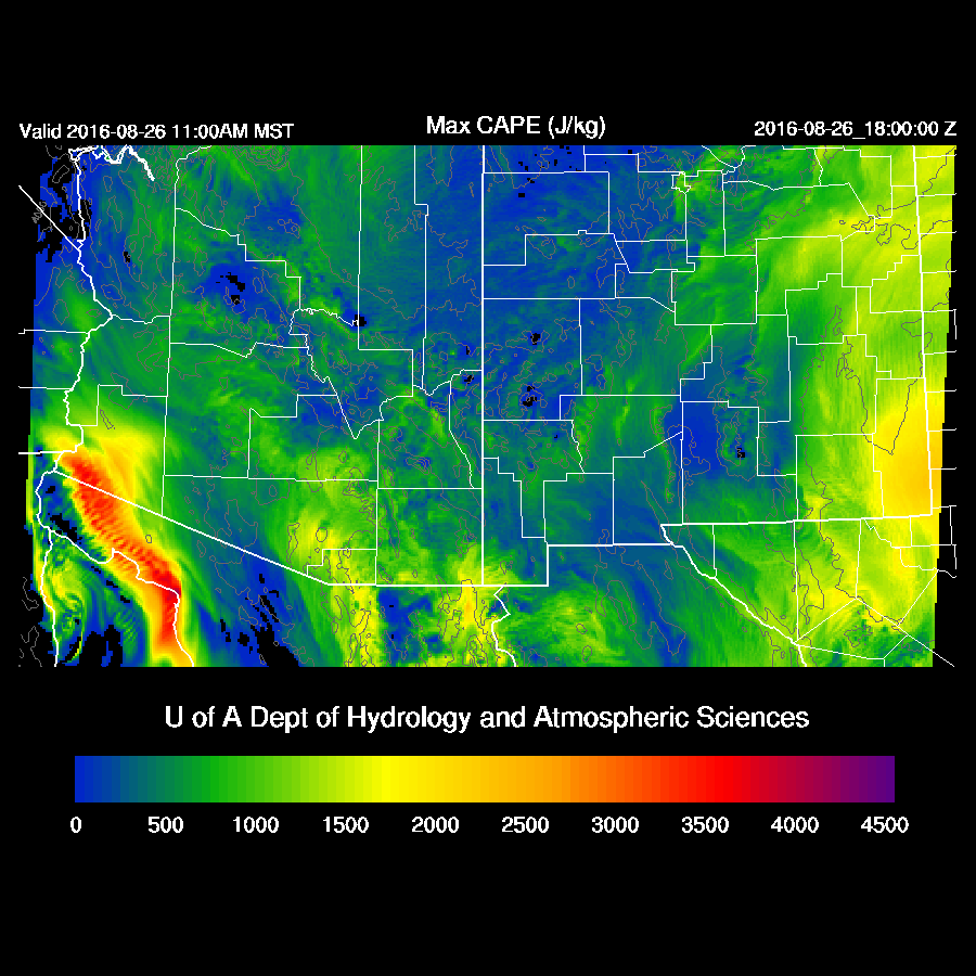
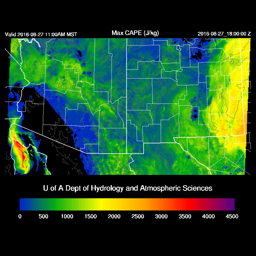
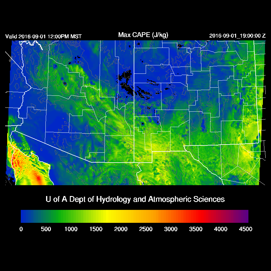
Models are similar in predicting that the highest CAPE will be across SE Arizona.  

All three of the 12Z runs have scattered strong storms over SE Arizona during the afternoon.  This might be somewhat overdone due to the lack of model clouds. (WRFNAM below)

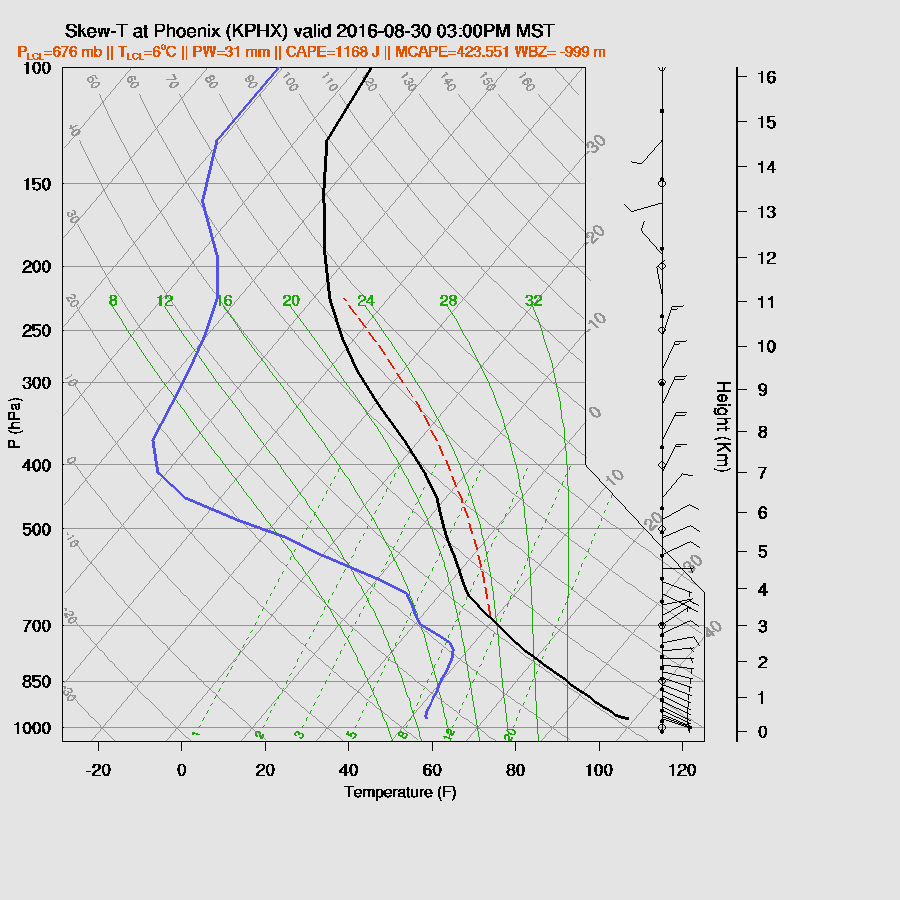
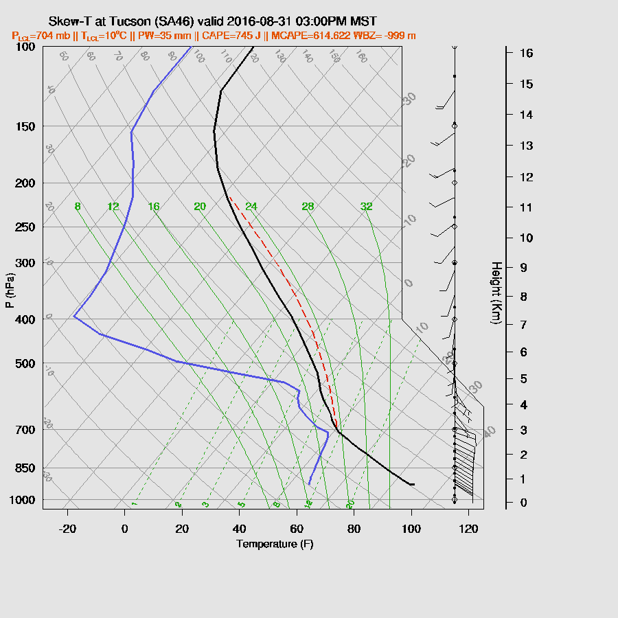
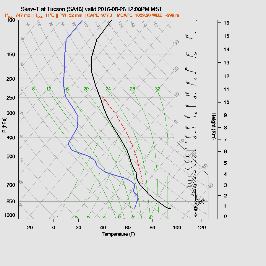
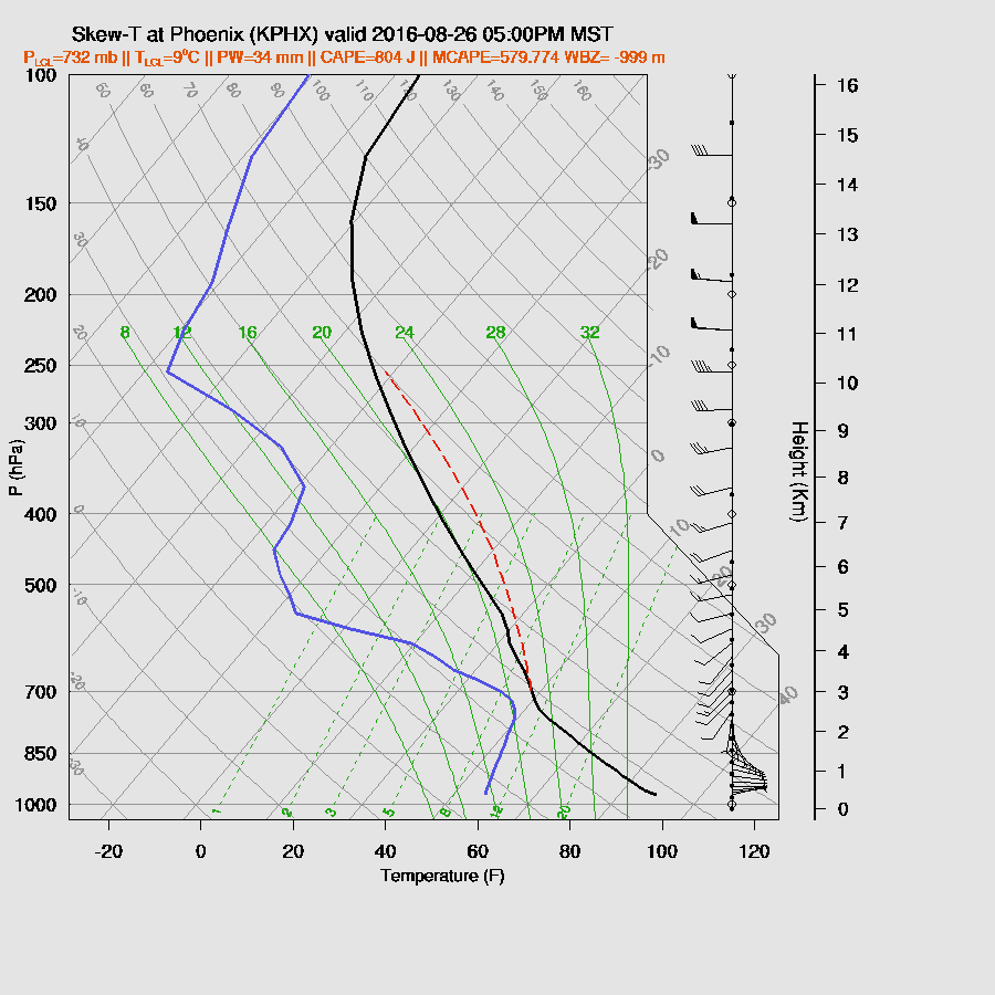
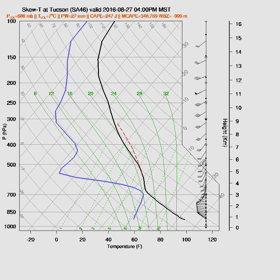
The Tucson afternoon vertical profile has some CAPE present along with a well-mixed PBL.  The inversion around 600mb, as seen on the morning 12Z sounding, continues and may keep deep convection in check.  This inversion is missing in the WRFGFS and RR.

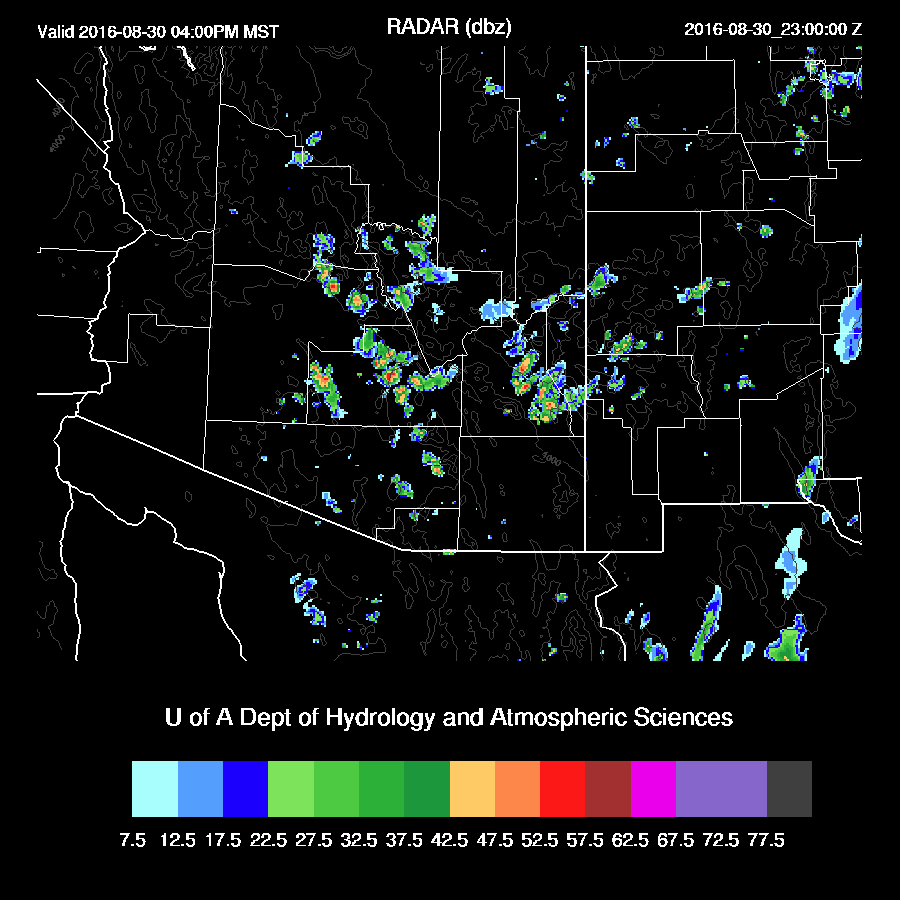
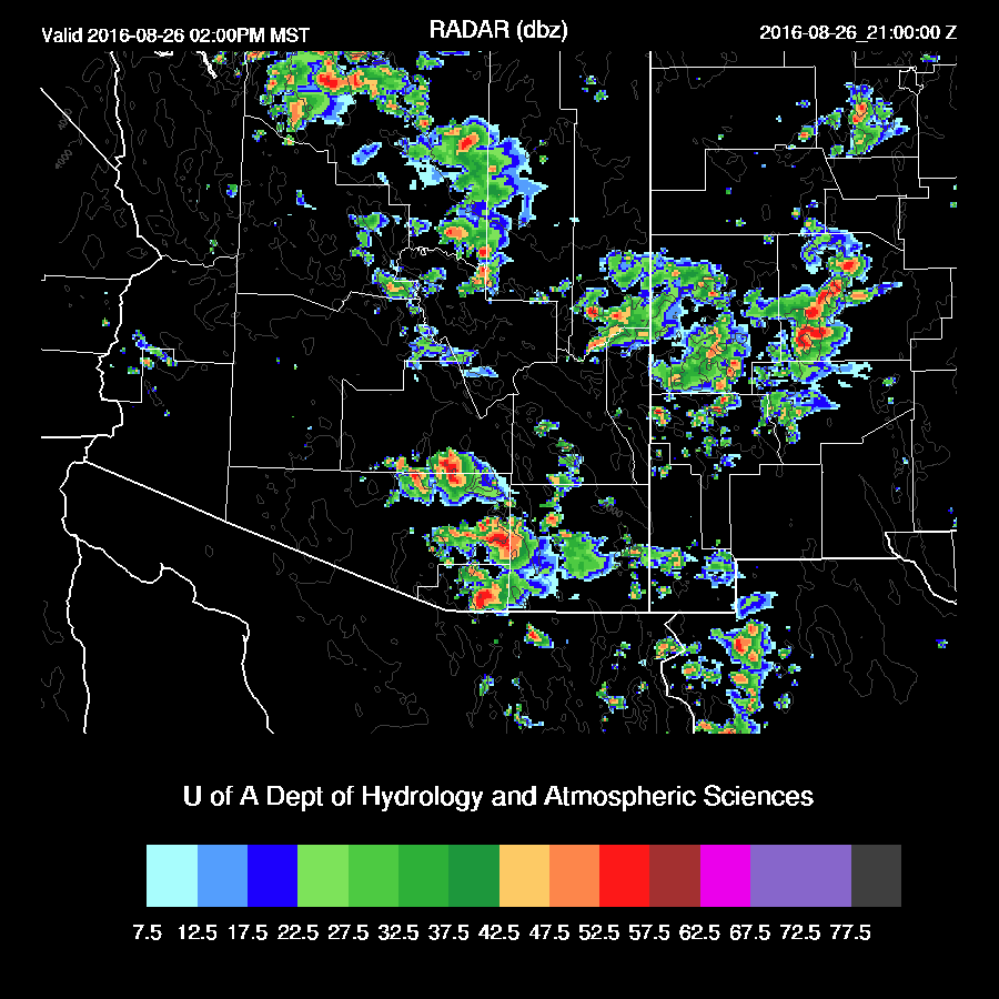
Scattered storms are roaming around eastern Pima county by later in the afternoon.  With only 500 J/Kg of CAPE to work with, storms are not that strong.  Still, a wet microburst could produce some isolated strong winds.(WRFNAM below). The WRFNAM is in the middle with the WRFGFS having more activity while the WRFRR has less.

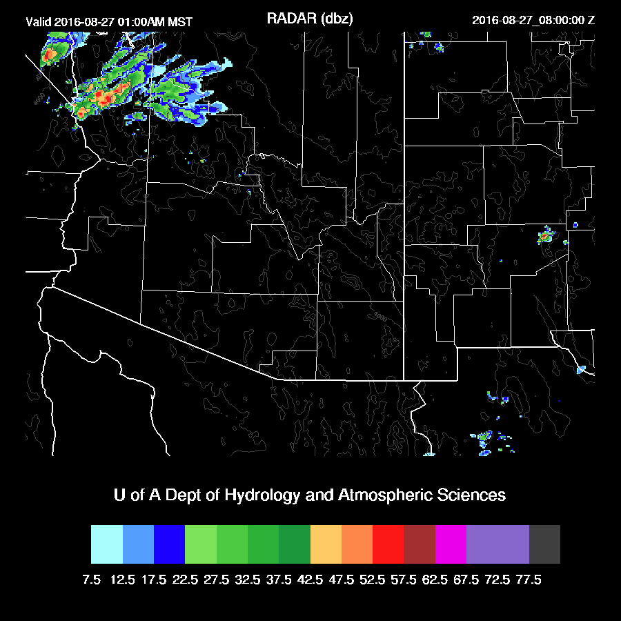
Activity quickly decreases around sunset.

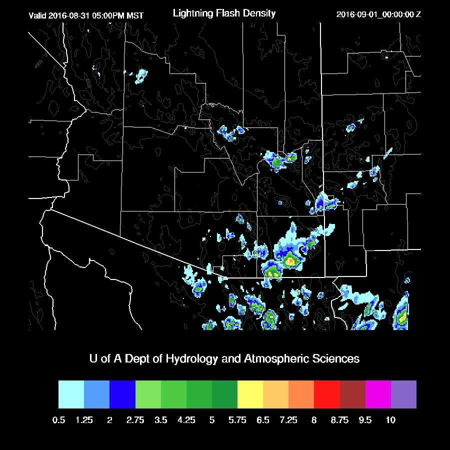
Below is the experimental lightning flash density forecast.  It shows that the storms in Cochise county could have quite high lightning activity associated with them.

Day 2
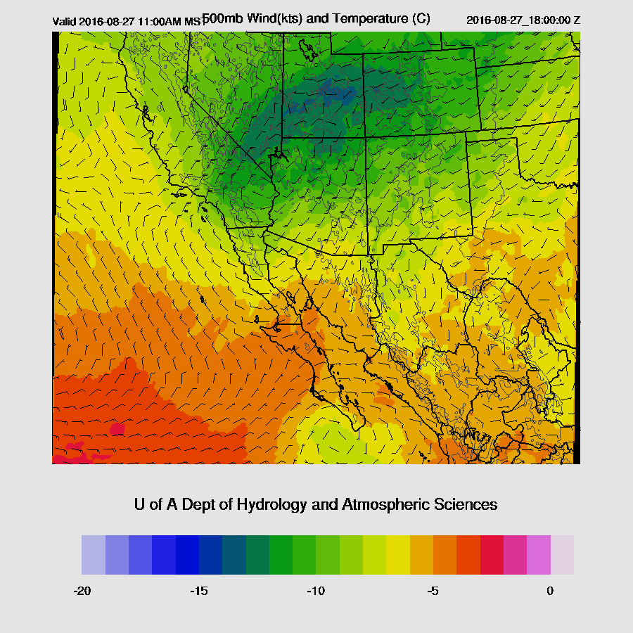
CAPE/moisture continue to be sufficient to support deep convection over SE Arizona and up towards Yavapai county. The model runs are considerably different as the WRFNAM (below) has less CAPE than the WRFGFS.


In either case, activity shifts to the White Mountains and up along the Rim to north of Flagstaff.

Maybe some early evening activity over SE Arizona?


Tuesday, August 30, 2016

20160830

Initializations
The 500mb pattern has returned to a somewhat summer configuration with a ridge in place across much of the country. There is an inverted trough over NW Mexico stretching up into far eastern Arizona with light northerly to northeasterly flow over the state.  Upper air initializations look good.

There are few if any clouds present to mess up the initializations and precipitable water errors are minimal too.  All three of the morning 12Z initializations look good with no clear favorites.

Day 1
The broad IT across NW Mexico into the SW US has advected slightly cooler mid level air into eastern Arizona as well as favorable, but weak, NE steering flow.


Moisture has increased due to moist easterly low-level flow.  A somewhat unusual source of low-level moisture, but we’ll take it.  It’s quite west in southern and eastern NM with 850mb dewpoint temperatures in the 12-14C range.


CAPE is moderate across much of SE Arizona and up towards Flagstaff.  Thus with good heating, deep convection should initiate over the higher terrain of these areas by early afternoon. Steering is light, but should be sufficient to move some storms into the lower elevations of eastern Pima/Pinal/Maricopa during the late afternoon.


Low-level easterly flow is typically poor for well-organized storms as there is much less low-level convergence generated by outflows.  CAPE is sufficient to support some storms in the lower elevations as it’s around 500 J/Kg.  As mentioned above, mid-level steering direction is good, especially around the Phoenix area.  So some positives and some negatives.  Some storms may make it into both Tucson and Phoenix, but strong organized storms are not expected.


The WRFNAM has the most activity for later this afternoon as its outflows are a bit stronger than the other two model runs and trigger more secondary convection.  The WRFNAM forecasts a moderate outflow into the Phoenix area later this afternoon with only a few storms developing.


WRFNAM


Day 2
The broad SW US IT is located over northern Sonora into southern Arizona while another trough in the westerlies moves across the western US.


Moisture increases slightly over today with quite high 850mb dewpoint temperatures over NM and the eastern ½ of Arizona.


In spite of slightly higher low-level moisture, CAPE is a bit lower due to warming aloft.  Only SE Arizona has sufficient CAPE to support more than isolated deep convection.


Mainly weak storms are present during the afternoon over eastern Arizona.


A well-mixed PBL at Tucson with a bit of CAPE should lead to a few storms during the afternoon.  Steering flow is weak and during more westerly thus no strong organized convection is expected.


Friday, August 26, 2016

20160826

Previous Day(s)/Daze
Will has been handling the discussions and forecasts the past few days as I had a hard disk crash in my head.  The restore process is going along and I’ve recovered most of my medium and long term memories, but there are still holes.  When I’m reminded of what I have forgotten, I usually remember.  Saturday to Monday is mostly blank.

Most precipitation was restricted to northern Arizona yesterday.  However, some late night/early morning showers and weak storms developed around both the Tucson and Phoenix areas.


Both the WRFNAM (below) and WRFGFS were pretty good and both had the late night activity.  As has been the case this summer, the WRFGFS was a little too widespread with precipitation coverage.


Initializations
Thick clouds and embedded showers were present from near Yuma to east central Arizona.  The 12Z RR and NAM had the right idea, but not quite enough clouds.  

I was quite surprised once I started looking at the upper air maps again to see a large trough over the western US.  I think it was Bob who said the pattern looks like late September rather than late August.  Multiple short waves are dropping into the mean trough with one over UT/CO and another over the Pacific NW.  One interesting feature is a 700mb low located just west of San Diego and this may play an interesting role in the weather later today.  There is also an upper inverted trough located just south of Cabo San Lucas which is probably not a factor now that westerlies dominate, but my mind is still back in early August mode. The RR and NAM have these features initialized well.

This 700mb low seems to have played a part in increasing the IPW over Arizona the past 12 hours.  IPW is now in the mid 30mm range across southern Arizona. Most of Suominet is back and the IPW initialization errors are minimal.

Overall, initializations are OK with the main issue being not quite enough clouds.  However, the model runs’ heating rates haven’t been impacted that much.  Model confidence is medium.

Day 1
Upper-level winds continue to be strong with the 12Z 300mb map showing areas of upper divergence over the SW US.  The WRFNAM shows a few areas of upper divergence along with diffluence in the flow across Arizona which is likely to help enhance convection today.  It’s likely this feature is what is responsible for the AM activity across central Arizona.

The 850-700mb trough continues to pull up moisture from Mexico as 850mb dewpoints increase and become quite high, around 12C.


CAPE is forecast to be moderate over much of the state with high values over SE Arizona.  As this area is mostly sunny now, it’s likely to be the most active area today.


Impressive looking profile at Tucson as decent CAPE is present by early afternoon along with a fair amount of directional shear which should result in some organized convection.

The WRFNAM develops scattered deep convection over SE Arizona and around the Flagstaff areas by early afternoon.   As these areas are mainly clear, this looks likely to occur.  SE Arizona storms could be quite strong and produce very heavy rain with a risk of isolated damaging wet microburst winds.

Storms move fairly quickly to the NE and by late in the day, activity is winding down.

It’s hard to say if Phoenix will see another round of storms later this afternoon or evening as the model runs disagree on the amount of CAPE that will be present.  Even in the best case, it’s limited.  Like Tucson, the wind profile is fairly good.  My guess is limited or no activity as that area is not getting much heating.

It appears that NW Arizona will see activity overnight as sufficient moisture interacts with a shortwave dropping down into the mean trough position over Arizona.  Where was this pattern when we needed it back last winter/spring???


I started writing this before the WRFGFS was available because I knew I would need longer than usual and I wanted to get an early start. The WRFGFS is now running and is quite a bit less active than either the WRFRR or WRFNAM because it is a bit drier. Taking a quick look at the 14Z GPSIPW obs vs forecast, the WRFGFS looks slightly too dry. Reality might be between the WRFNAM and WRFGFS.


Day 2
An interesting pattern as a strong shortwave continues to move SE into Arizona.  Also, the upper IT is still present just south of Baja California Sur.


Dry air wraps around the 850-500mb low leaving only the eastern ⅓ of the state wet.


Moderate CAPE is present in this band of wet air and those are the only areas likely to see much activity.  


Little or no CAPE over Tucson or Phoenix thus no activity expected there.


The upper jet is position over northern Arizona and with the moderate amount of CAPE, it’s likely to be a very active day.  There are areas of strong upper divergence over that area which will result in some organized convection.


Storms restricted to far SE Arizona and over northern Arizona.

Wednesday, August 24, 2016

20160824

Initializations

Relatively simple situation with clear skies over almost all of Arizona. The IPW errors are no larger than 2 mm, but unfortunately many of the SuomiNet sites didn’t make it into the data assimilation routine. We'll check on that later. Overall, confidence is high today.

12Z WRF GFS IPW initialization

Day 1

The Arizona is now on the back side of the trough and under northwesterly flow.


Storms form on the rim in the mid afternoon.


While northwesterly steering flow is generally not favorable for organized convection in the lower deserts, the storms are still somewhat able to “move” off the rim on outflow boundaries. Prime time in the deserts is between 4 and 6 PM today. Dust storms are likely in Pinal county.


The PBL is well mixed in Phoenix, 500 mb temperatures are a cool -11 C, and the vertical profile exhibits good directional shear. 12Z WRFNAM followed by 12Z WRFGFS.


Below, the 12Z WRF GFS shows a handful of isolated storms in the lower deserts around 6 PM.

12Z WRF GFS

It looks like it will be a little too dry in the lower levels and a little too warm in the mid levels for Tucson to see much activity.


Day 2

Isolated storms possible in southeastern AZ, mostly over higher terrain, with a few stronger storms in northern AZ.