Initializations
The 500mb pattern has returned to a somewhat summer configuration with a ridge in place across much of the country. There is an inverted trough over NW Mexico stretching up into far eastern Arizona with light northerly to northeasterly flow over the state. Upper air initializations look good.
There are few if any clouds present to mess up the initializations and precipitable water errors are minimal too. All three of the morning 12Z initializations look good with no clear favorites.
Day 1
The broad IT across NW Mexico into the SW US has advected slightly cooler mid level air into eastern Arizona as well as favorable, but weak, NE steering flow.

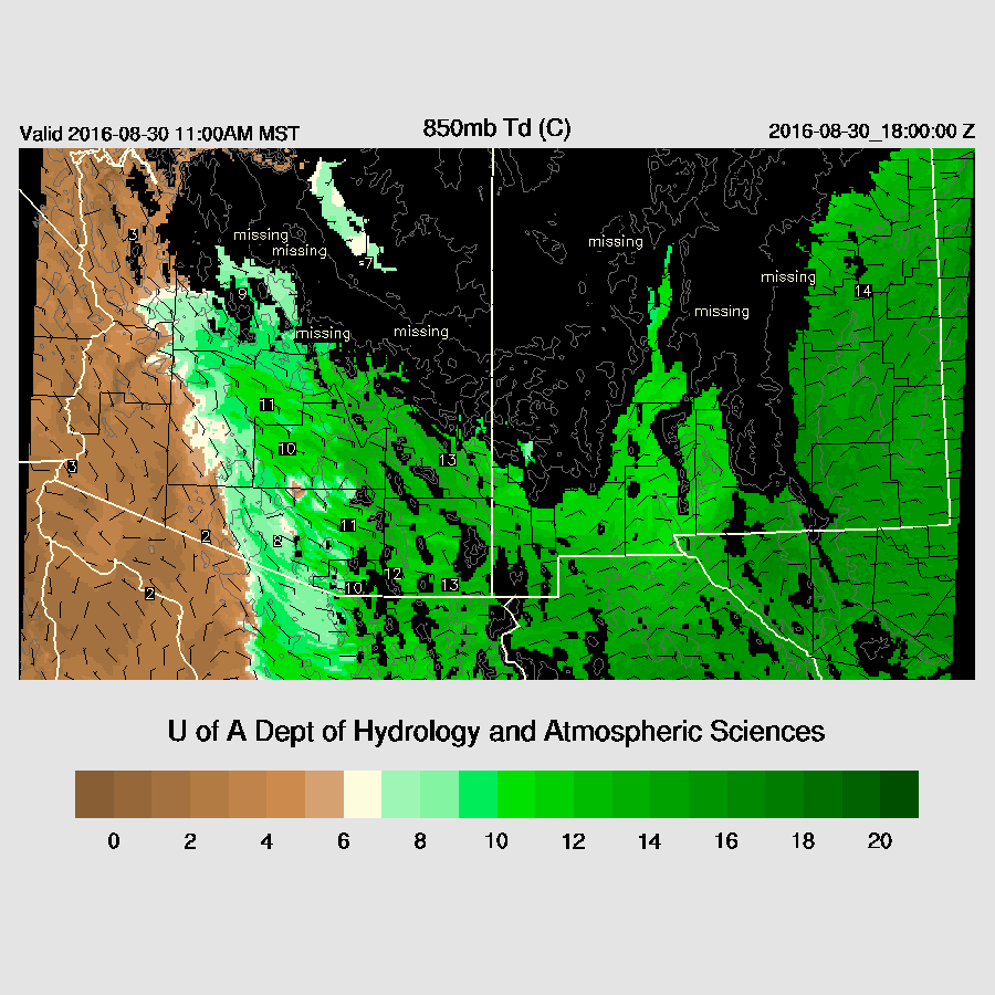
Moisture has increased due to moist easterly low-level flow. A somewhat unusual source of low-level moisture, but we’ll take it. It’s quite west in southern and eastern NM with 850mb dewpoint temperatures in the 12-14C range.
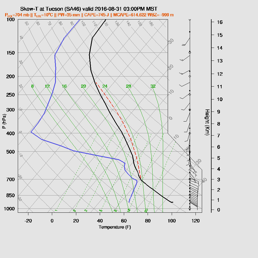
CAPE is moderate across much of SE Arizona and up towards Flagstaff. Thus with good heating, deep convection should initiate over the higher terrain of these areas by early afternoon. Steering is light, but should be sufficient to move some storms into the lower elevations of eastern Pima/Pinal/Maricopa during the late afternoon.
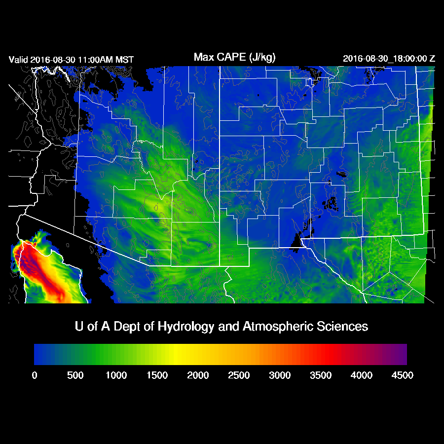
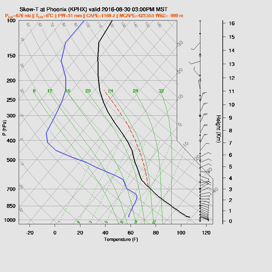
Low-level easterly flow is typically poor for well-organized storms as there is much less low-level convergence generated by outflows. CAPE is sufficient to support some storms in the lower elevations as it’s around 500 J/Kg. As mentioned above, mid-level steering direction is good, especially around the Phoenix area. So some positives and some negatives. Some storms may make it into both Tucson and Phoenix, but strong organized storms are not expected.
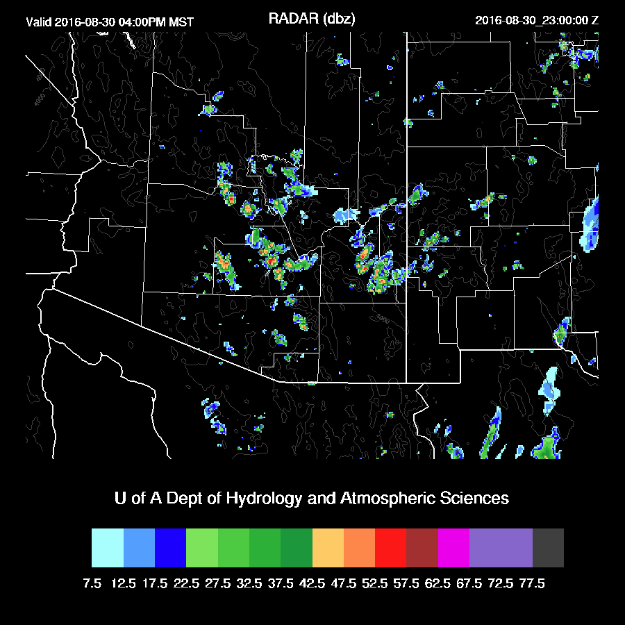
The WRFNAM has the most activity for later this afternoon as its outflows are a bit stronger than the other two model runs and trigger more secondary convection. The WRFNAM forecasts a moderate outflow into the Phoenix area later this afternoon with only a few storms developing.

WRFNAM
Day 2
The broad SW US IT is located over northern Sonora into southern Arizona while another trough in the westerlies moves across the western US.

Moisture increases slightly over today with quite high 850mb dewpoint temperatures over NM and the eastern ½ of Arizona.

In spite of slightly higher low-level moisture, CAPE is a bit lower due to warming aloft. Only SE Arizona has sufficient CAPE to support more than isolated deep convection.

Mainly weak storms are present during the afternoon over eastern Arizona.

A well-mixed PBL at Tucson with a bit of CAPE should lead to a few storms during the afternoon. Steering flow is weak and during more westerly thus no strong organized convection is expected.
No comments:
Post a Comment
Note: Only a member of this blog may post a comment.