Previous Day(s)/Daze
Will has been handling the discussions and forecasts the past few days as I had a hard disk crash in my head. The restore process is going along and I’ve recovered most of my medium and long term memories, but there are still holes. When I’m reminded of what I have forgotten, I usually remember. Saturday to Monday is mostly blank.
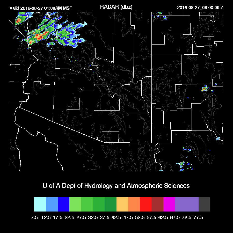
Most precipitation was restricted to northern Arizona yesterday. However, some late night/early morning showers and weak storms developed around both the Tucson and Phoenix areas.
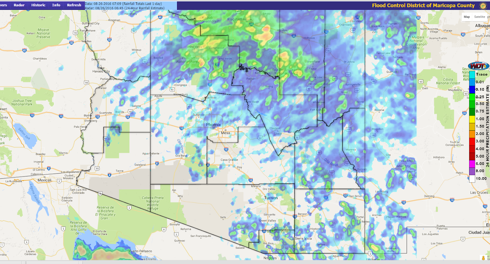
Both the WRFNAM (below) and WRFGFS were pretty good and both had the late night activity. As has been the case this summer, the WRFGFS was a little too widespread with precipitation coverage.
Initializations
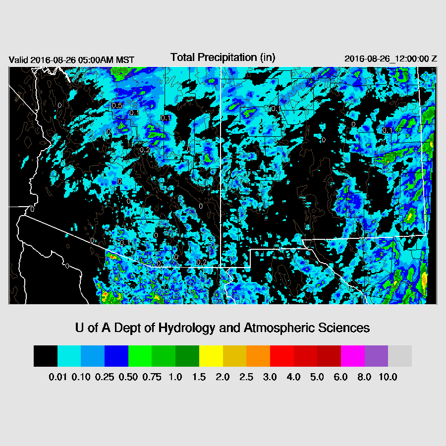
Thick clouds and embedded showers were present from near Yuma to east central Arizona. The 12Z RR and NAM had the right idea, but not quite enough clouds.
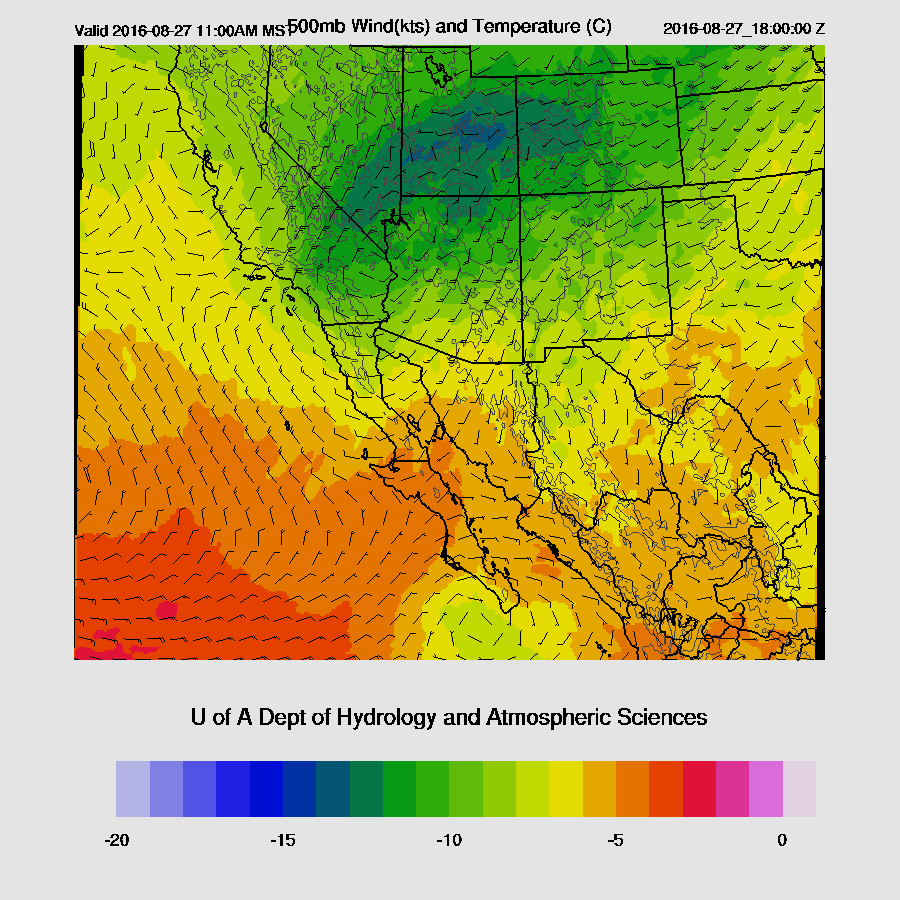
I was quite surprised once I started looking at the upper air maps again to see a large trough over the western US. I think it was Bob who said the pattern looks like late September rather than late August. Multiple short waves are dropping into the mean trough with one over UT/CO and another over the Pacific NW. One interesting feature is a 700mb low located just west of San Diego and this may play an interesting role in the weather later today. There is also an upper inverted trough located just south of Cabo San Lucas which is probably not a factor now that westerlies dominate, but my mind is still back in early August mode. The RR and NAM have these features initialized well.
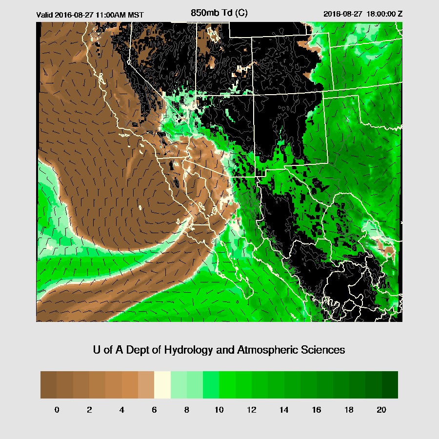
This 700mb low seems to have played a part in increasing the IPW over Arizona the past 12 hours. IPW is now in the mid 30mm range across southern Arizona. Most of Suominet is back and the IPW initialization errors are minimal.
Overall, initializations are OK with the main issue being not quite enough clouds. However, the model runs’ heating rates haven’t been impacted that much. Model confidence is medium.
Day 1
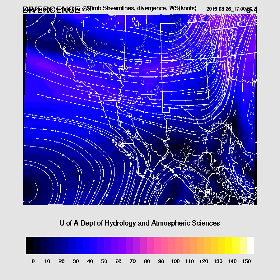
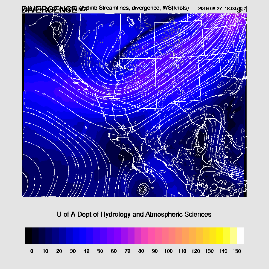
Upper-level winds continue to be strong with the 12Z 300mb map showing areas of upper divergence over the SW US. The WRFNAM shows a few areas of upper divergence along with diffluence in the flow across Arizona which is likely to help enhance convection today. It’s likely this feature is what is responsible for the AM activity across central Arizona.
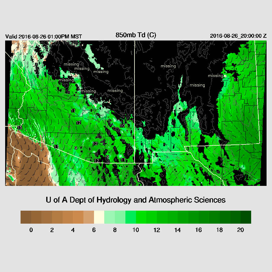
The 850-700mb trough continues to pull up moisture from Mexico as 850mb dewpoints increase and become quite high, around 12C.
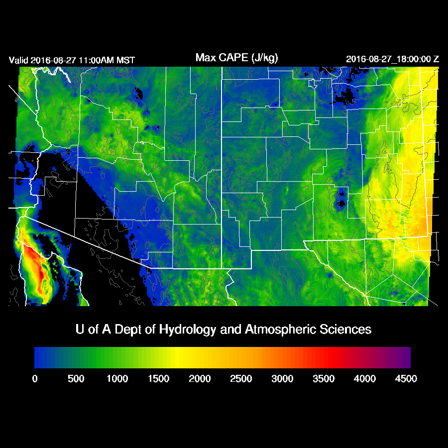
CAPE is forecast to be moderate over much of the state with high values over SE Arizona. As this area is mostly sunny now, it’s likely to be the most active area today.
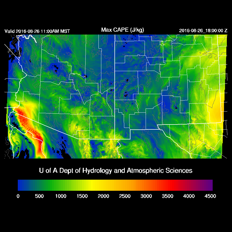
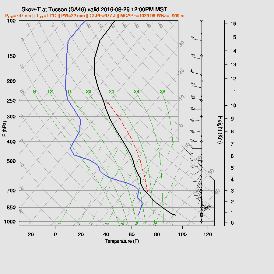
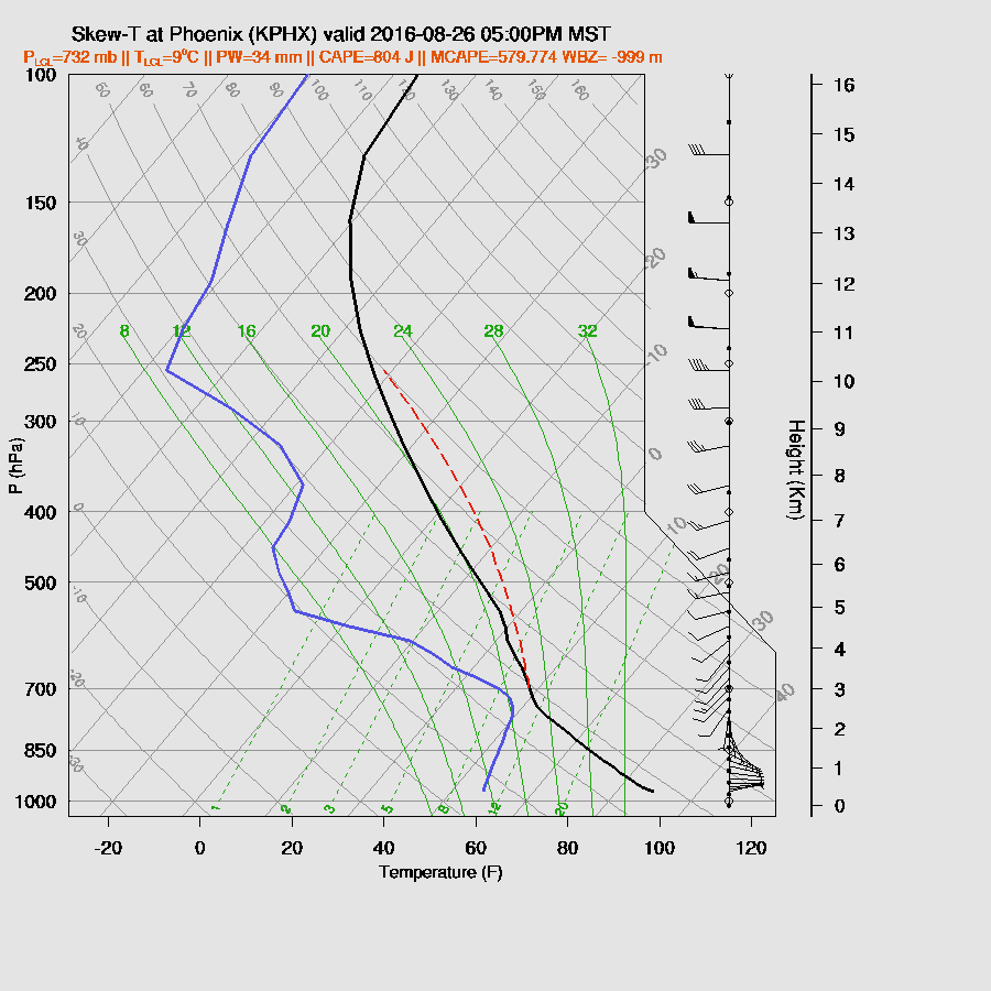
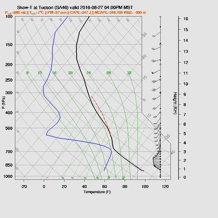
Impressive looking profile at Tucson as decent CAPE is present by early afternoon along with a fair amount of directional shear which should result in some organized convection.
The WRFNAM develops scattered deep convection over SE Arizona and around the Flagstaff areas by early afternoon. As these areas are mainly clear, this looks likely to occur. SE Arizona storms could be quite strong and produce very heavy rain with a risk of isolated damaging wet microburst winds.
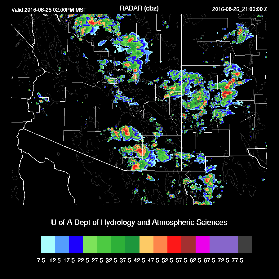
Storms move fairly quickly to the NE and by late in the day, activity is winding down.
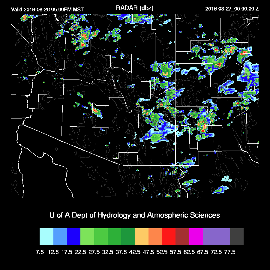
It’s hard to say if Phoenix will see another round of storms later this afternoon or evening as the model runs disagree on the amount of CAPE that will be present. Even in the best case, it’s limited. Like Tucson, the wind profile is fairly good. My guess is limited or no activity as that area is not getting much heating.
It appears that NW Arizona will see activity overnight as sufficient moisture interacts with a shortwave dropping down into the mean trough position over Arizona. Where was this pattern when we needed it back last winter/spring???

I started writing this before the WRFGFS was available because I knew I would need longer than usual and I wanted to get an early start. The WRFGFS is now running and is quite a bit less active than either the WRFRR or WRFNAM because it is a bit drier. Taking a quick look at the 14Z GPSIPW obs vs forecast, the WRFGFS looks slightly too dry. Reality might be between the WRFNAM and WRFGFS.
Day 2
An interesting pattern as a strong shortwave continues to move SE into Arizona. Also, the upper IT is still present just south of Baja California Sur.
Dry air wraps around the 850-500mb low leaving only the eastern ⅓ of the state wet.
Moderate CAPE is present in this band of wet air and those are the only areas likely to see much activity.
Little or no CAPE over Tucson or Phoenix thus no activity expected there.
The upper jet is position over northern Arizona and with the moderate amount of CAPE, it’s likely to be a very active day. There are areas of strong upper divergence over that area which will result in some organized convection.
Storms restricted to far SE Arizona and over northern Arizona.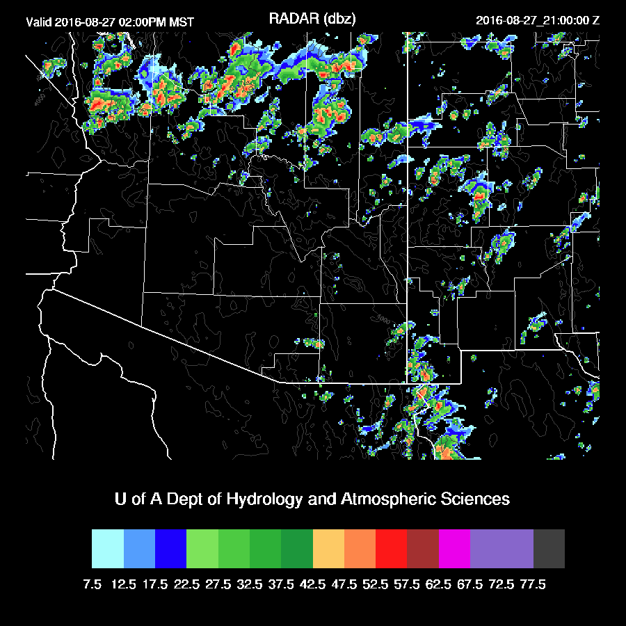
No comments:
Post a Comment
Note: Only a member of this blog may post a comment.