Previous Day
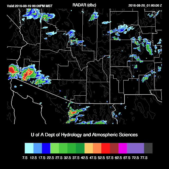
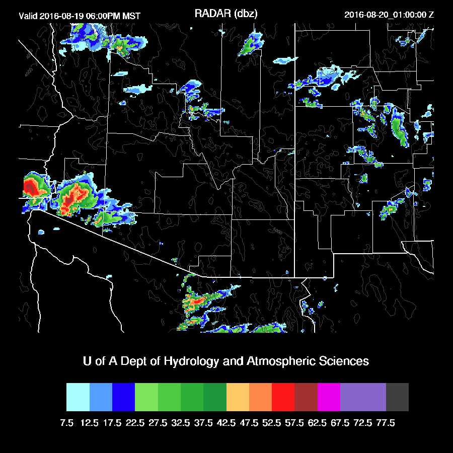
As anticipated, the various runs of the RR were not very good. The WRFNAM struggled a bit too as it did not have activity far enough to the west. The WRFGFS was the best as it had the timing and locations down. There have been questions regarding the accuracy of the Q3 QPE product that I've been using for subjective verification. Bob Maddox suggested using Maricopa county's website to get QPE so here it is.


Initializations
The upper trough continues over the SW US with multiple weak shortwaves rotating through. Why couldn't this split flow pattern have been like this in Febuary instead of now!?
 One short wave or maybe a MCV is moving into east central Arizona. The various initializations have this feature more or less in the right location. Some clouds are over northern Arizona and associated with the MCV while much of the rest of the state is clear. The NAM or GFS didn't have enough clouds over northern Arizona thus deep convection may form too early in the model runs.
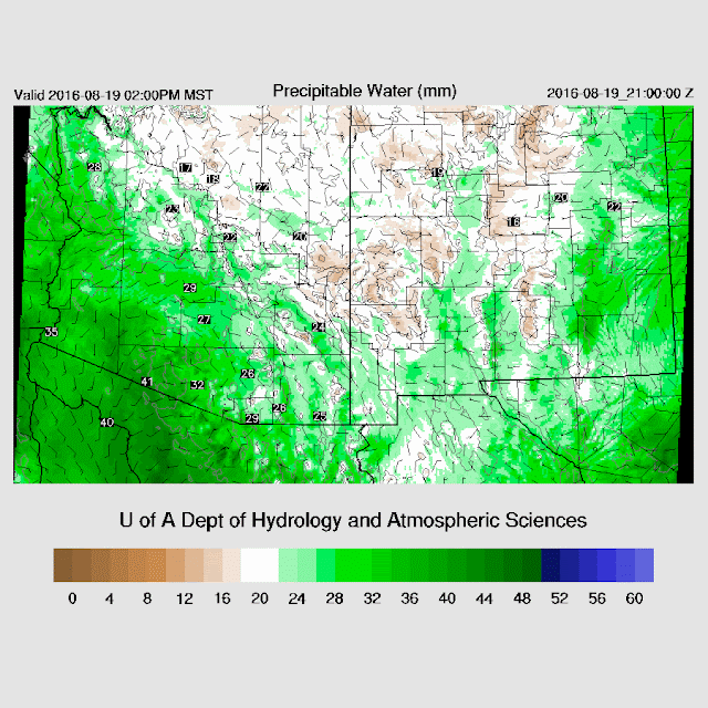
IPW initializations look fine. However, I happened to take a look at the 850mb RR Td field and it was way too dry around the Tucson area. Overall, the initializations are OK. The WRFGFS and NAM should perform well today.
Day 1
As was being forecast yesterday, a moderate gulf surge gets underway this afternoon bringing in somewhat wetter air into SW Arizona.
 A classic low-level surge flow pattern over southern Arizona at 850mb as the surge is quite strong. However, moisture is lacking somewhat except for SW Arizona.

A weak mid-level trough is located over northern Arizona with a continued light flow and temperatures a cool -9 to -10 C.

Upper flow continues to be split with the jet moving off into the central US and only weak areas of divergence over central and northern Arizona.

Moderate to high CAPE across SW Arizona and as far east as Santa Cruz county. This area is the most likely spot for strong deep convection today and this evening.

Deep convection develops this afternoon over higher elevations along the border in the WRFNAM.

The WRFGFS is more active late this afternoon as it has widespread storms west of Phoenix during the afternoon. I believe this is unlikely as this area had a fair amount of activity yesterday and the model runs are too warm in this area.

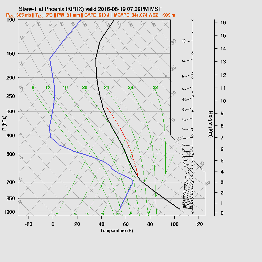
CAPE continues to be limited at Tucson thus activity is also limited there. Along with that, the wind profile is more or less unidirectional and out of the west, which is not favorable for storms.

It looks like Phoenix has a better chance as somewhat more CAPE is present this evening. Winds are unfavorable as they are unidirectional with very little speed shear in the midlevels.

Is today the day that Yuma gets it's entire monsoon rainfall in 3 hours? Perhaps. All three of the runs have big storms at various locations around SW Arizona this evening. The locations and areal coverage differ across the models. The WRFGFS is most active and earlier with storms. It looks unlikely that storms will be this widespread and early, but if a big surge of moisture comes in as it forecasts, perhaps.

The WRFNAM has less activity over SW Arizona and later in the evening. Maybe reality is somewhere between the two?

The WRFRR slams the Yuma area.
Day 2
It looks like the WRFGFS has a better intensity forecast for TS Kay which is SSW of southern Baja today and moves WNW to a position SW of Baja tomorrow. It appears that it will be close enough to trigger a new surge/continue the old one. The wettest air remains far to the south, though.

Boundary layer moisture increases somewhat and the 850mb dewpoints increase to a decent 10-13C over much of southern Arizona.

A typical day 1 surge vertical profile at both Tucson and Phoenix with a cooler/wetter and somewhat shallow PBL. CAPE increases, but so does CIN. Mid level winds are very poor thus it looks like a day where big storms are possible over high terrain but don't propagate. The low elevations remain mostly quiet due to the lack of a trigger.

There are a few very weak shortwaves here and there, but I doubt they will able to provide any significant lift needed for deep convection around Tucson and Phoenix.

CAPE increases significantly over much of northern and western Arizona.

The high elevations of northern and eastern Arizona have widespread strong storms during the afternoon.

By early evening, some storms work their way south towards Phoenix while deep convection develops in the very high CAPE areas of SW Arizona.

By early evening, the PBL does become deeply mixed at Phoenix. CAPE is also moderate. If the convection to the north does eject halfway decent outflows, deep convection is certainly a possiblity.

Both the WRFGFS and WRFNAM are forecasting quite strong outflows into Phoenix from the north thus it looks possible for development.

Both runs do develop storms near the Phoenix area so there is some confidence in this forecast.

As anticipated, the various runs of the RR were not very good. The WRFNAM struggled a bit too as it did not have activity far enough to the west. The WRFGFS was the best as it had the timing and locations down. There have been questions regarding the accuracy of the Q3 QPE product that I've been using for subjective verification. Bob Maddox suggested using Maricopa county's website to get QPE so here it is.


Initializations
The upper trough continues over the SW US with multiple weak shortwaves rotating through. Why couldn't this split flow pattern have been like this in Febuary instead of now!?

IPW initializations look fine. However, I happened to take a look at the 850mb RR Td field and it was way too dry around the Tucson area. Overall, the initializations are OK. The WRFGFS and NAM should perform well today.
Day 1
As was being forecast yesterday, a moderate gulf surge gets underway this afternoon bringing in somewhat wetter air into SW Arizona.


A weak mid-level trough is located over northern Arizona with a continued light flow and temperatures a cool -9 to -10 C.

Upper flow continues to be split with the jet moving off into the central US and only weak areas of divergence over central and northern Arizona.

Moderate to high CAPE across SW Arizona and as far east as Santa Cruz county. This area is the most likely spot for strong deep convection today and this evening.

Deep convection develops this afternoon over higher elevations along the border in the WRFNAM.
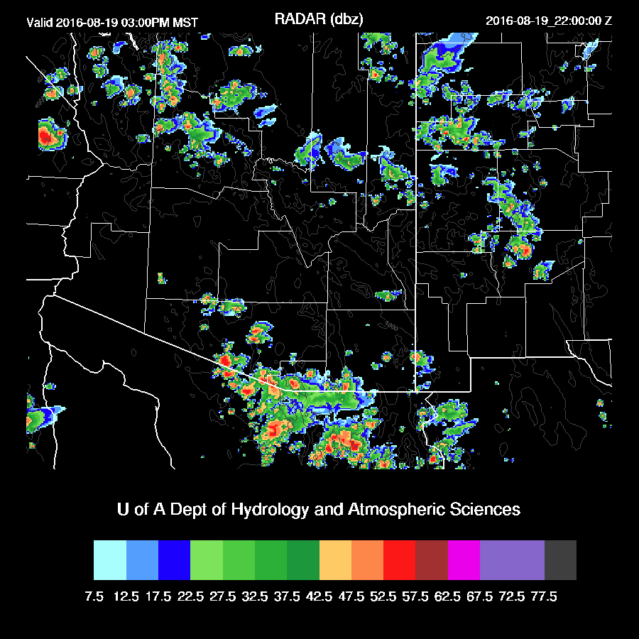
The WRFGFS is more active late this afternoon as it has widespread storms west of Phoenix during the afternoon. I believe this is unlikely as this area had a fair amount of activity yesterday and the model runs are too warm in this area.

CAPE continues to be limited at Tucson thus activity is also limited there. Along with that, the wind profile is more or less unidirectional and out of the west, which is not favorable for storms.

It looks like Phoenix has a better chance as somewhat more CAPE is present this evening. Winds are unfavorable as they are unidirectional with very little speed shear in the midlevels.
Is today the day that Yuma gets it's entire monsoon rainfall in 3 hours? Perhaps. All three of the runs have big storms at various locations around SW Arizona this evening. The locations and areal coverage differ across the models. The WRFGFS is most active and earlier with storms. It looks unlikely that storms will be this widespread and early, but if a big surge of moisture comes in as it forecasts, perhaps.

The WRFNAM has less activity over SW Arizona and later in the evening. Maybe reality is somewhere between the two?

The WRFRR slams the Yuma area.
Day 2
It looks like the WRFGFS has a better intensity forecast for TS Kay which is SSW of southern Baja today and moves WNW to a position SW of Baja tomorrow. It appears that it will be close enough to trigger a new surge/continue the old one. The wettest air remains far to the south, though.

Boundary layer moisture increases somewhat and the 850mb dewpoints increase to a decent 10-13C over much of southern Arizona.

A typical day 1 surge vertical profile at both Tucson and Phoenix with a cooler/wetter and somewhat shallow PBL. CAPE increases, but so does CIN. Mid level winds are very poor thus it looks like a day where big storms are possible over high terrain but don't propagate. The low elevations remain mostly quiet due to the lack of a trigger.

There are a few very weak shortwaves here and there, but I doubt they will able to provide any significant lift needed for deep convection around Tucson and Phoenix.

CAPE increases significantly over much of northern and western Arizona.

The high elevations of northern and eastern Arizona have widespread strong storms during the afternoon.

By early evening, some storms work their way south towards Phoenix while deep convection develops in the very high CAPE areas of SW Arizona.

By early evening, the PBL does become deeply mixed at Phoenix. CAPE is also moderate. If the convection to the north does eject halfway decent outflows, deep convection is certainly a possiblity.

Both the WRFGFS and WRFNAM are forecasting quite strong outflows into Phoenix from the north thus it looks possible for development.

Both runs do develop storms near the Phoenix area so there is some confidence in this forecast.

No comments:
Post a Comment
Note: Only a member of this blog may post a comment.