As Bob Maddox noticed, much cooler air is present in the mid levels with -11C at Flagstaff and -8 at Tucson which was initialized well by the 12Z model's initializations. A couple of 700mb high centers were over northern Arizona and NM with 10-15 knot easterly flow across southern Arizona and NM. The 12Z RR had problems with the placement as it had on center over SW Arizona with northern flow from Tucson to Phoenix which isn't correct.
No problems with clouds. All 12Z IPW initializations are also good. The WRFNAM and GFS are the favorite model runs today with confidence being high.
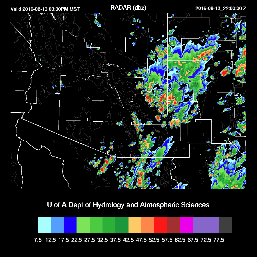
Day 1
Moisture is hanging on over eastern Arizona with sufficient amounts for afternoon convection. Also, note the fairly moist low-level easterly flow which sets up an area of convergence over eastern Arizona, which is likely to help trigger deep convection.

850mb moisture has also increased somewhat over eastern Arizona with dewpoint temperatures in the 12-14C range.

Combine this with cooler air aloft and CAPE is moderate to high over a large part of southeastern Arizona.

There is a layer from above 850 to near 500mb where the flow northeasterly. Even though it's light, it's enough to help move storms slowly to the SW.

Strong storms form over the higher elevations of eastern and southeastern Arizona and move/develop towards the southwest.
The Tucson afternoon profile shows a steep lapse rate and moist air in the PBL. Strong outflows will be required to lift to the LFC. Steering is favorable, from the NE at around 10 knots. Upper flow will steer anvils away from the storm motion.

Strong to severe outflows are likely with storms. Both models bring these outflows into eastern Pima county during the late afternoon which will trigger additional deep convection in the area. The Tucson area is likely to see a few storms, but the majority will stay over higher terrain.

The main risk is for very strong to severe winds. The WRFGFS is forecasting 35 knot winds thus gusts above 50 knots are possible.

Thunderstorm outflows move out into Pinal and Maricopa county and weaken.

No comments:
Post a Comment
Note: Only a member of this blog may post a comment.