Tuesday, October 5, 2021

20211005

 Discussion

Moisture has increased significantly since yesterday and is now around 30mm for most southern Arizona locations.  Showers and some thunderstorms are present over much of the state this morning as the moisture is interacting with the approach of the California closed low, which is now near San Diego.


Impressive upper divergence is mainly responsible for the shower and thunderstorms activity ahead of the low.


Surface-based CAPE is non-existent, but both the Tucson and Yuma 12Z soundings indicated 6-900 J/kg of elevated CAPE,  thus the ongoing thunderstorm activity, especially in SW Arizona.


Initializations

The NCEP initializations have their work cut out for them today, for sure.  To my surprise, all the initializations were fairly good at the placement of morning activity and clouds.  The best was the 12Z HRRR, as the other runs didn't have enough/any activity in SW Arizona.  All initializations had minimal PW errors.  The 12Z WRFHRRR appears to be the best initialization, but none are poor enough to exclude.


Day 1

So far, so good, from a model accuracy perspective as the band of clouds and showers moved across the state.  This band continues to move north, while activity continues over southwestern Arizona.   PW remains around 30mm into the early afternoon hours.  850mb dewpoints are highest in a band from far SE Arizona, along the base of the Rim, up towards Payson/Prescott.  A (near) surface low didn't seem to materialize over south-central Arizona, but moderate low-level SE flow is present in the area of higher dewpoints, resulting in a favorable vertical shear profile.

CAPE is quite high in the same areas, especially for this time of year.  Some areas are approaching 1500 J/kg.  Along with quite cool air in the mid-levels, some storms could have large hail.

By early afternoon, the mid/upper low begins to eject to the northeast, across NW Arizona, resulting in moderate to strong upper divergence/difluence over much of the state.  Everything is in place for a big severe event for parts of the state especially if there is some heating.   Satellite trends do indicate clearing over central and northern Arizona and the model runs generally have the right idea.

The afternoon vertical profile forecast is looking good for organized strong to severe storms in/near Phoenix.  There is both directional and speed shear, and >1000 J/kg of CAPE.   


Tucson doesn't look as favorable as there is limited directional shear and not much speed shear.  CAPE is also lower, but perhaps sufficient to support some storms.

The other hot spot for activity is eastern and far southeastern Arizona.  The directional shear is very good, as well as CAPE.

By mid-afternoon, strong to severe storms develop over southeastern Arizona as well as parts of Yavapai County.  RADAR reflectivity indicates large hail with some of the storms.  

Storms begin to develop in and around Phoenix by late afternoon, with some potentially severe storms.  Storms also move towards the Flagstaff area and continue in eastern Arizona.  Most runs are similar so forecast confidence is high.  

Besides hail, some storms could produce high lightning flash rates.  A tornado or two is also possible with a few of the storms, especially the ones north of Phoenix where shear is the best.


15Z WRFRR doesn't have as much activity for the Phoenix area.

Strong storms continue into the evening hours for far eastern Arizona and areas around Flagstaff.

The event is still on track to produce widespread moderate rain over northern Arizona, and some areas approaching 2".


Monday, October 4, 2021

202101004

 Discussion

A large mid and upper cut of low is slowly making its way towards the state, which will result in a transition-type event including the risk for severe weather over parts of Arizona tomorrow.  WV imagery and upper air plots place it SW of San Diego.  This has already resulted in an increase in moisture over the state as PW has increased to around 20mm for many locations in southern Arizona.  GOES-derived PW is increasing over Sonora as well, but no CAPE exists north of Sinaloa.

WV imagery indicates that the low may be a bit further to the south compared to the 250mb analysis.  This is also the case with the morning initializations as they have a position similar to the analysis.

Day 1

PW continues to increase slowly today, and by late afternoon, is in the mid 20mm range over southern Arizona.  


It's still dry at the lower levels, except for far SE Arizona.


Despite limited moisture and low CAPE, many runs manage to develop a few high-based showers and storms around the Tucson area later this afternoon and into the evening.


Low-level moisture continues to increase overnight and by early morning, there is an area of higher 850mb dewpoints from SE Arizona into central Arizona. This will result in scattered showers and storms for many parts of the state overnight.


Day 2

Now the fun begins!  The cut-off low has made its way to around San Diego by 12Z tomorrow, with temperatures as cold as -17C.


Moisture continues to increase and by 18Z, it is around 25-35mm for much of the southern 1/2 of the state.  In addition, a weak surface low is present over south-central Arizona, resulting in low-level southeasterly flow over eastern Arizona.  With the mid-level winds from the SW and low-level winds from the SE, there is going to be significant low-level directional shear.

The lower troposphere also moistens up, especially in a band from far SE Arizona to around Flagstaff.  This results in a band of moderate CAPE which is more than enough to support strong to severe storms, despite earlier widespread showers and storms.  Most of the model forecasts move the clouds and showers into NE Arizona during the morning hours, resulting in heating and recovery.


The forecast vertical profile exhibits classic severe weather and mini super-cell event for parts of Arizona later tomorrow afternoon.  CAPE is surprisingly high for the Phoenix area and the amount of directional and speed shear low topped organized severe storms are possible, with frequent lightning, hail, and some strong winds.

The various forecasts are in general agreement that southeastern Arizona and areas north of Phoenix are most likely to see strong to severe organized storms at some point tomorrow afternoon and into the early evening.  It's not possible to be more specific as the situation is so complex and dependent on how much activity occurs tonight, and on how much heating will be realized tomorrow.

48-hour precipitation amounts could be over 2" for the orographically favorable locations of northern Arizona.


Saturday, September 18, 2021

20210918

 Discussion

A western CONUS trough has finally pushed the 500mb anticyclone center to the east of Arizona, resulting in quite a strong southerly flow.  Temperatures have decreased to -6 to -8C.


The 12Z soundings from Phoenix and Tucson are unimpressive, even sad.  While moisture has slowly increased over the state, there is still limited CAPE available.  Worse, there is a mountain of an inversion to overcome above 500mb.  Why the model runs are going crazy with convection later today is a mystery to me, at least so far.


Model Initializations
There has been quite a bit of trouble over the past two days as there were problems with missing initialization files from NCEP.  Those were solved last night, so most runs succeeded.  As mentioned recently, the NAM is slowly being phased and replaced by a mix of the RR and HRRR.  This morning, clouds are scattered about the state, making for a bit of a challenge for the initializations.  Also, GOES-derived CAPE is present over parts of southwestern Arizona, so that is a positive development.  The RR and HRRR do not have any clouds over far western NM but are OK elsewhere, including the far NW Arizona convection.  The 6z GFS did have thick clouds in far eastern Arizona, which isn't correct either as clouds are further east and not as thick.  The WRFGFS also had scattered showers over eastern Arizona this morning, in error.  CAPE was initialized accurately by all.  There is no clear favorite, and the errors don't seem significant enough to impact accuracy.

Day 1
Something has to change for storms to form today as moisture and CAPE are lacking, and the strong inversion above 500mb isn't going to allow much activity.  A band of high 850mb dewpoints is present this afternoon over central and western Arizona. Typically, this would be enough to support widespread deep convection, especially over the higher terrain.

Moderate CAPE is associated with the area of high moisture.

Now the important bits-the model forecast Skew-T plots.  This afternoon it's not looking very favorable for deep convection at Tucson despite moisture increasing to nearly 40mm.  The inversion above 500mb is very strong.  Another big question with the forecast is the increase of moisture to almost 40mm in Tucson.  It's only 32mm now, so it has a long way to go to make it to 40mm, which is probably the minimum needed for deep convection.

The story is better at Phoenix as the inversion is weaker as the mid/upper trough moves closer to Arizona.  This results in quite a bit more CAPE.


The OLR plot is interesting as it has widespread shallow convection below the inversion with scattered areas where the inversion is overcome, resulting in deep convection.

Most of the WRF runs forecast storms in and around the Tucson area by late afternoon despite the marginal-looking Tucson Skew-T.  Again, I have my doubts that moisture can increase by another ~8mm by this afternoon.


Phoenix is looking good by late afternoon as the PBL is mixed well, and CAPE is around 1000-1500 J/kg.  The inversion also weakens.

Most runs develop strong storms in and around the Phoenix area tonight.


The 4-panel plot shows precipitation for both Tucson and Phoenix is likely.  As the increase in moisture at Tucson to 40mm looks unlikely, the less active runs are most likely.


Day 2
Much warmer air is advected into the state behind the departing trough.  This is likely to shut down any deep convection, except for the far southeastern part of the state.


Sunday, September 5, 2021

20210905

 Discussion

Moisture has gradually increased for much of the state over the past day or two.  Tucson is up to around 40mm this morning, as well as a considerable MLCAPE of 1300 J/kg.  The vertical wind profile is also moderately favorable to steer higher elevation storms into the Tucson area.  There is a significant subsidence inversion at 500mb, but it shouldn't be a problem with the amount of CAPE available.  DCAPE is moderately high at 1300 J/kg, so storms will likely produce strong outflow boundaries, assisting in propagation. 

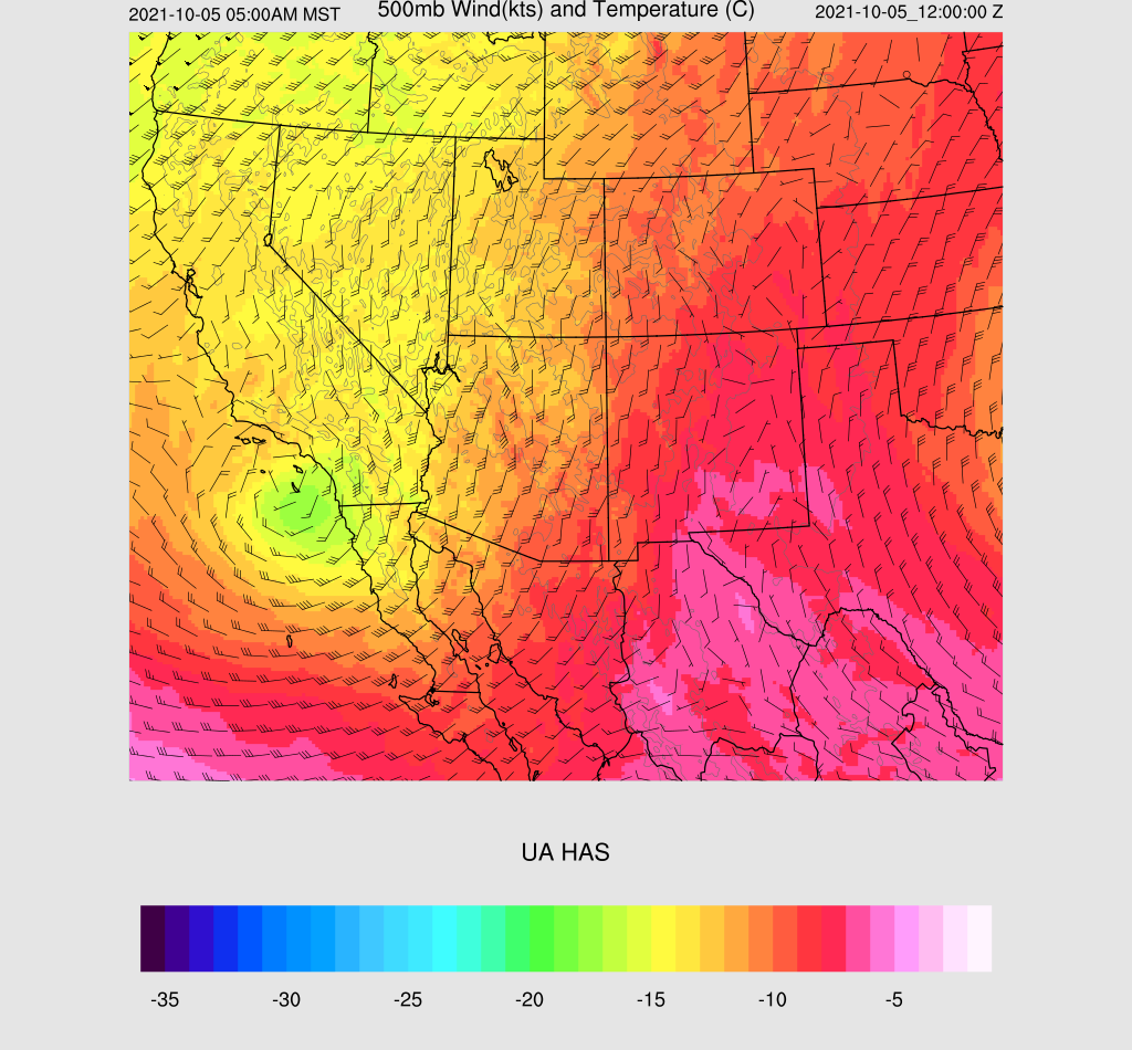
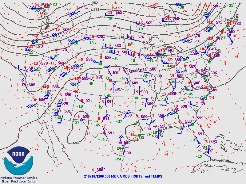
The 500mb map shows the anticyclone is centered over California, generally north to northeasterly flow over the state.  The inversion is obvious with warm air at around -3 to -5C.  Cooler air is upstream, though.  There is a weak IT located over the far northern Chihuahua/Big Bend area, which is responsible for the ongoing showers and storms over far southern NM. This feature is likely to enhance thunderstorm activity in southern Arizona later today/tonight.  Another IT/MCV is located over far northern Sinaloa and is responsible for the ongoing activity there.


Initializations

Remarkably, all initializations did well with both the clouds and ongoing showers/storms over southern NM.  Most did well initializing the cyclonic circulations except for the 12Z HRRR, which had the IT a bit too far to the east.  The HRRR and 12Z RR also didn't have enough clouds over far southeastern Arizona.  Yes, you read that right; I've replaced the 12Z NAM with the HRRR and used the 0Z GFS for lateral boundary conditions to extend the run to 84 hours.  From the first few runs, the WRFHRRR is usually quite similar to the HRRR, at least for the first 6-12 hours.  After that, they start to diverge.  Model accuracy is expected to be good, with the favored runs being the GFS and RR.


Day 1

Most, if not all, model runs over the past day, or two have been quite consistent in increasing storm activity for southeastern Arizona today.  A surge is underway but is shallow and weak.  The 850mb shows the wet/dry boundary quite well, with most of southeastern Arizona having dew points at or above 10C.  Very dry air is still in place from about Phoenix and westward.  


CAPE is low to moderate throughout much of SE Arizona.  CAPE is minimal west of El Paso due to the ongoing activity there this morning.

Scattered storms develop during the early afternoon hours, mainly over the higher terrain of SW NM and southeastern Arizona.  This may be a little too fast as the runs cleared out too quickly.

It looks good for the Tucson area as CAPE is from 900 to 1400 J/kg, the PBL is mixed deeply, and the vertical wind profile is excellent.  There is low-level shear, mid-level northeastern 10-15 knot steering flow, and NW winds aloft keep anvils from advancing ahead of storms.

The Chihuahua IT moves a bit to the west, bringing cooler air at 500mb and NE steering flow over much of the state.

Later in the afternoon, storms move off of the higher terrain into the Tucson area, while other storms move off of the higher terrain of SW NM into eastern Cochise county.

Generally, outflow winds aren't too strong, at around 30-35 knots.  A few locations could see stronger winds due to microbursts.

The runs have been quite consistent over the past 36 hours, and the most recent four runs continue that way.  Some runs have precipitation amounts exceeding 2" for a few locations.

Storm intensity decreases into the evening.  Storms cannot propagate down I-10 even with a favorable OFB due to the lack of CAPE.  


Day 2
PW decreases over southern Arizona, resulting in mostly low CAPE, but maybe enough for a few storms.


At Tucson, it's not looking good for storms for multiple reasons.  The first is the old rule that the next day after a big day is usually down.  The other issues are a strengthening of the 500mb inversion and very dry air aloft.  The wind profile is mainly unidirectional.

Little or no activity is forecast.