Initializations
The 500mb high center is over central NM and a large IT/MCV is located north of La Paz. At 300-250mb there is a very strong jet with over 50-knot winds over west Texas. This is creating areas of strong divergence and difluence over much of northern Mexico and was responsible for the widespread strong storms over much of NW Mexico overnight. All models appear to have the mid and upper levels initialized well.
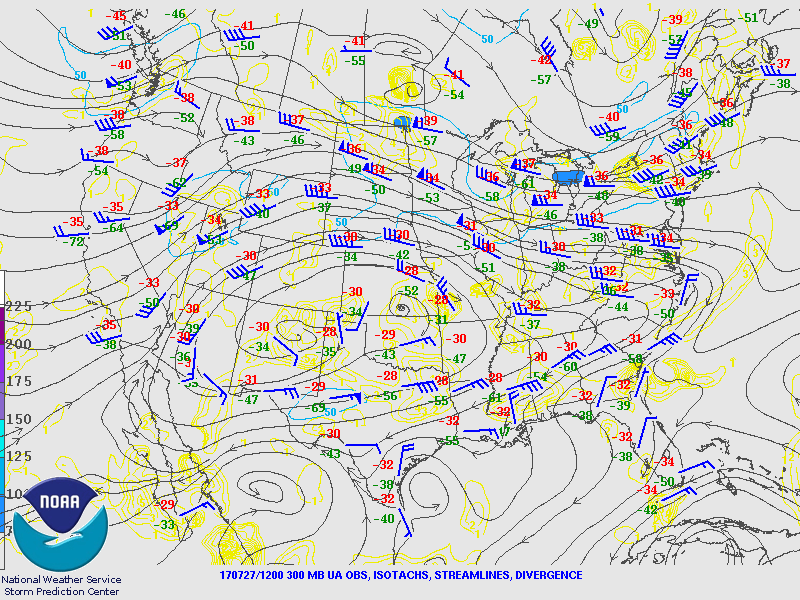
There are clouds and ongoing activity over far SE Arizona and into western NM which was initialized fairly well by the GFS and RR. The NAM didn’t have enough clouds or showers. IPW initialization errors were small except for the NAM where it was a bit too wet in Mexico. Overall, the RR and GFS look to be the best of the three.
Day 1
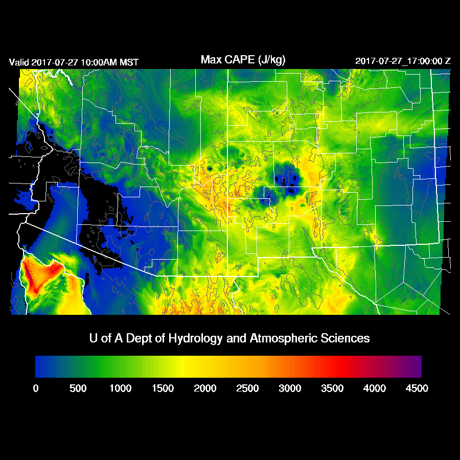
Drier air continues over much of western Arizona and is best seen on the 850mb Td plot. The eastern ⅓ of the state is very wet and that looks to be the best area of activity today and tonight.

What is of great interest is the strong jet moving under the ridge with the nose of the jet moving into SE Arizona by mid day. Strong difluence is over much of the southern part of the state and divergence over SW NM enhancing storms. The big negative will be anvils that will race out ahead of the storms reducing heating. This may not be a big issue if storms wait until later in the day to get going and allow most areas to receive nearly full heating.

CAPE is quite high over far eastern Arizona and that will be the area where strong storms form. Tucson is right on the edge thus may or may not see storms later today.
There is quite a bit of model spread as the WRFRR (below) is least active over SE Arizona this afternoon as it had significant cloud cover this morning. 17Z 2m forecast temperatures are fairly close to observed in the WRFRR and 5-7F too warm in the WRFNAM and GFS.

The WRFGFS (and WRFNAM) have more activity over SE Arizona with strong to severe storms later in the afternoon. I think this solution is less likely but not impossible.

The forecast for Tucson ranges from almost nothing (WRFRR) to some strong storms by late afternoon. There is some CAPE forecast for the afternoon but not much. Low and mid level winds are favorable with some shear and easterly mid level winds. The big unknown is the strong upper jet which could either bring anvils across and shut off heating or help enhance storms.

Besides storm intensity, models have different solutions for timing as the WRFRR has a few storms during the early afternoon around Tucson while the WRFNAM (below) and WRFGFS have strong storms in and around Tucson later in the afternoon. Again, I think these two are overdoing it in/around Tucson.

Big storms continue in SE Arizona into the evening.

No Day 2 today
No comments:
Post a Comment
Note: Only a member of this blog may post a comment.