Previous Forecast
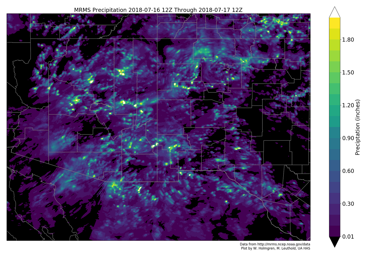
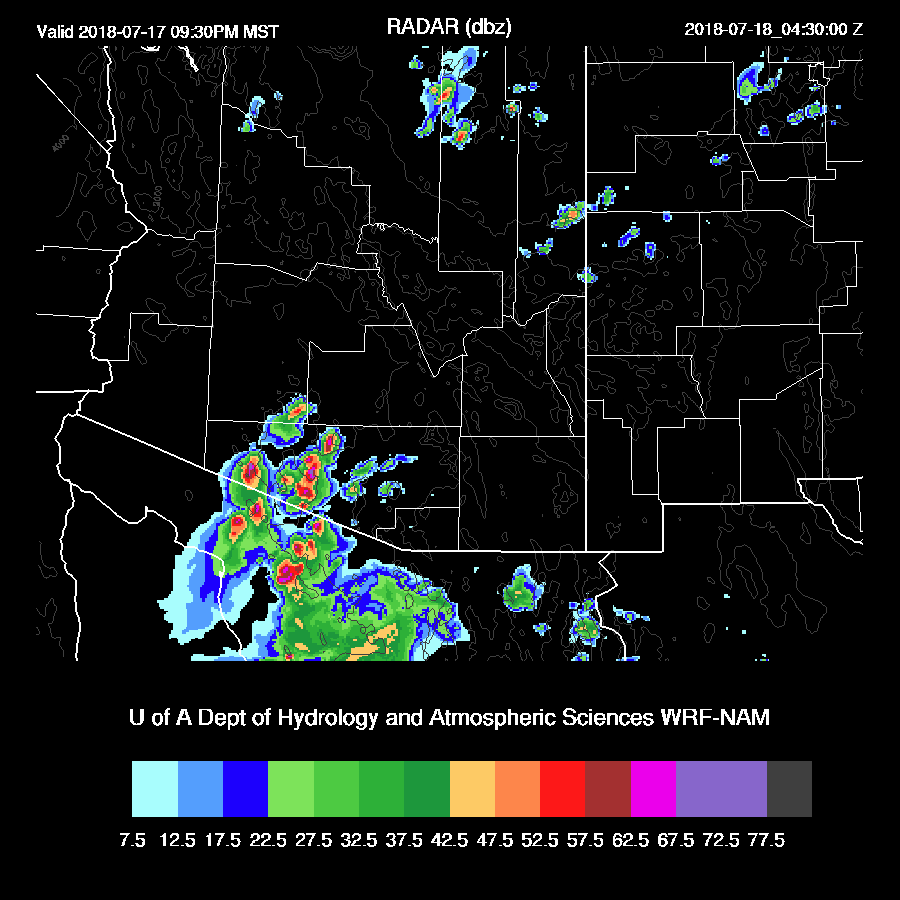
Widespread activity over the state yesterday with some localized areas of very heavy rain. Storms moved into the Tucson area around 4-5pm and promptly split and went around on the higher terrain. Some activity continued over SW Arizona into the morning hours.
All three of the 12Z runs had the right idea with the WRFRR looking the best. However, none of the runs forecast the late night/early morning activity over southwestern Arizona.

Initializations
The 12Z 500mb map indicates the center of the ridge is over central California while a large inverted trough is located somewhere around southern Sonora. There is no upper air data from Mexico this morning so we’ll see how well this feature gets initialized. It has a significant amount of deep convection associated with it over the Gulf of California and I would assume this is going to trigger a Gulf Surge at some point. Both the NAM and RR seem to have initialized the center a little too far south but who knows for sure. In any case, the general circulation is broad so any minor error won’t matter much.
Clouds and showers are ongoing over southwestern Arizona but moving to the southwest with clearing behind. Another area of clouds is over northcentral Arizona. The RR initialization of the cloud/showers was very good and also included the outer domain deep convection in Mexico. The NAM missed the Mexican activity but did an OK job with the clouds and showers over Arizona.
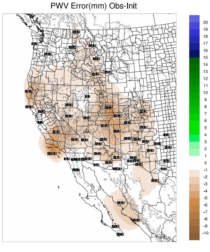
The string of bad NAM PW initializations continue with many areas again too wet with some errors as high as 10mm and looking back at the error plots, this issue began about 10 days ago. Below is a plot of the errors with the shaded areas showing the amount of PW removed from the initialization and the point values at the GPSMET sensors.
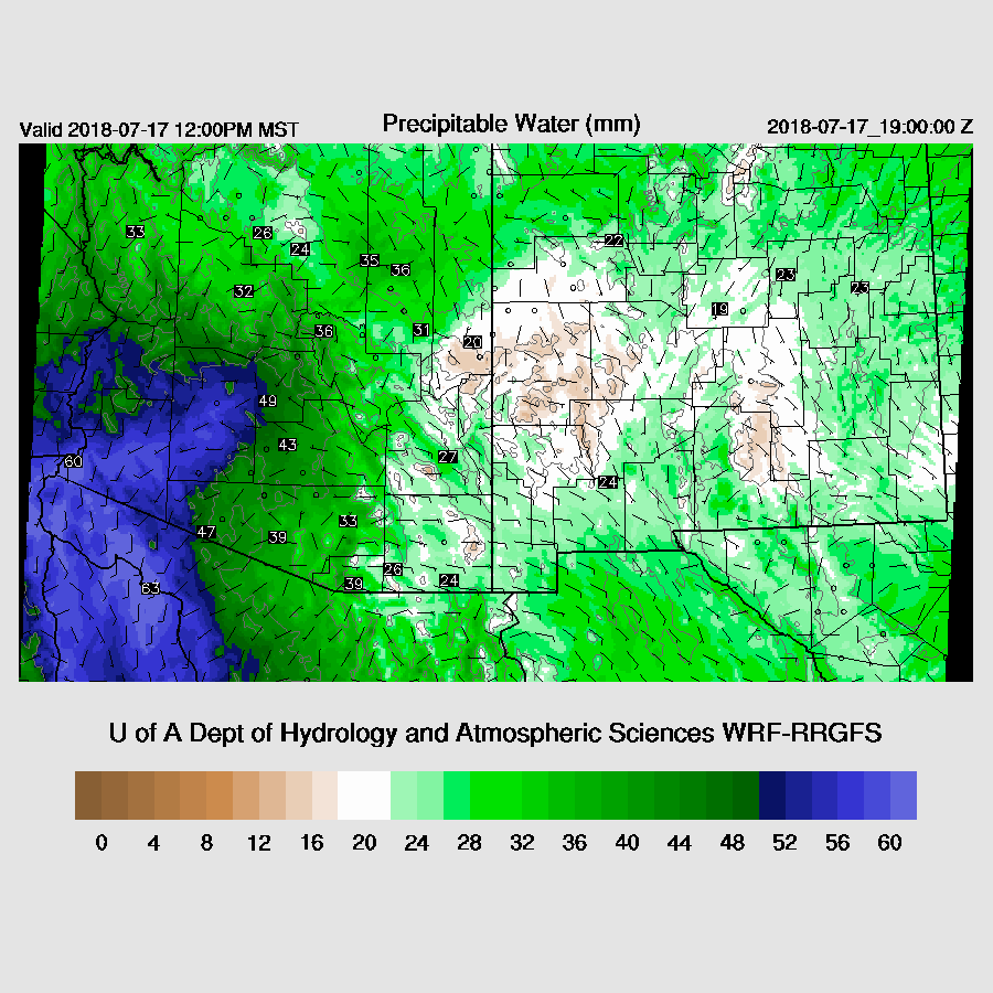
Below is the error plot for the RR which indicates most stations have only minor errors this morning. If anyone has a contact at NCEP that I can alert to this issue, please let me know.

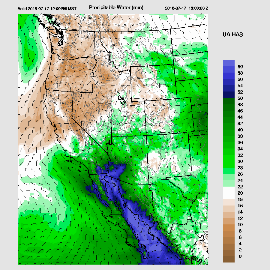
And the 12Z GFS from today.

Overall, the WRFRR seems to be initialized the best.
Day 1
Moderate low-level southeasterly winds are advecting in dry air over much of New Mexico and eastern Arizona thus not much activity is expected there today. What really catches my eye is the extremely wet air moving into SW Arizona. Morning GPSIPW plots already have 56mm at Buckeye and 54mm at Yuma so 60mm is certainly possible.
This dry air appears to stretch all the way back into Texas and all throughout NE Mexico. Extremely wet air is all the way down the Gulf of California and I might have to increase my PW plot scale as 60mm may be too low!
There is a very impressive backdoor dryline that really stands out in the midday CAPE plot. High to extreme CAPE exists west of the line which is around the Pima/Cochise County line. The NAM, in spite of its initialization faults, is quite similar to the WRFRR (below). The 15Z Yuma sounding has a shallow surge underway with a strong cap so, in spite of all the CAPE, it’s going to be very difficult to get widespread deep convection over the low elevations. However, the higher terrain of central Pima and far southern Maricopa look favorable as deep convection should initiate there at some point today/tonight.

Mid-level steering flow is good as it’s about 10 to 20 knots from the east thus storms that form will propagate towards lower elevations.

Deep convection initiates over far south-central Arizona this afternoon along with some big storms over Yavapai county where CAPE is also very high. However, these storms soon die off as they apparently move into a strongly capped environment. 
Using Phoenix as a proxy for much of western Arizona, the PBL just isn’t mixed deeply enough and must still be capped. The existing higher terrain convection driven outflows apparently aren’t strong enough to break the cap. Forecast surface temperatures are only in the 90’s for much of western Arizona and the convective temperature from the 15Z sounding at Yuma is 105F.

The potential is still there by late afternoon and early evening as CAPE is about as high as it gets in Arizona with values above 2500 J/kg. Any storms that do get going will be monsters.

Both the WRFGFS and WRFNAM develop severe storms just across the border and move them into central and western Pima County this evening.

These continue over the higher terrain of western Pima county but once they move off the higher terrain, they die. However, the WRFRR continues to redevelop storms over western/central Pima County well into the night.

The WRFNAM as a remarkably similar solution except it is more widespread which I attribute to the continued wet bias of the initialization. A quick look at the 12Z WRFGFS is also very similar to the WRFNAM with respect to timing, coverage, and intensity. Looks like great storms for chasers but the rest of us are out of luck.
Day 2
Somewhat drier air moves into central Arizona with the wettest (and strongly capped?) air over far western Arizona.

Isolated mountain activity is all that is expected tomorrow except over far NW Arizona where some strong storms form by late afternoon.

It does look like this penetration of dry air from the east will be short lived as unstable air sloshes back to the east tomorrow evening.
No comments:
Post a Comment
Note: Only a member of this blog may post a comment.