Previous Forecast
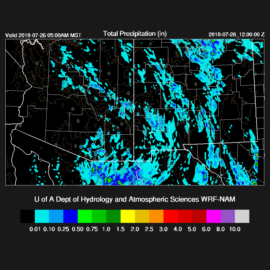
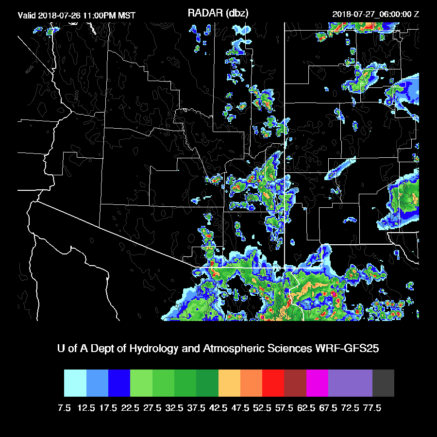
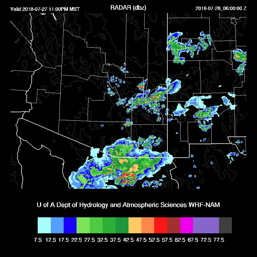
Most activity stayed out of the lower elevations except for some brief showers in Tucson that were triggered by thunderstorm outflows. An enormous MCS developed over Sonora overnight. 
All the runs had the right idea with the distribution of the activity but were somewhat too light with amounts. The WRFNAM and WRFGFS were the better runs.
Initializations
The model runs are quite late this morning so I only have a short amount of time to look at the initializations. The big story is the MCS over Sonora and this morning, there is now a large MCV over southern Sonora with a moderate amount of debris clouds. Arizona is mostly clear and the RR and NAM initialized both the MCV and the clouds (or lack of) well. The RR had only minor PW errors except for southern Sonora where it was way too wet. The NAM was also pretty good except for in Mexico where it also had a very large wet bias. I don’t think this will be much of a problem today in AZ. It might be an issue for the forecast tomorrow as the correction routine is unable to fix an error of this magnitude so Day 2 confidence is decreased.
Day 1
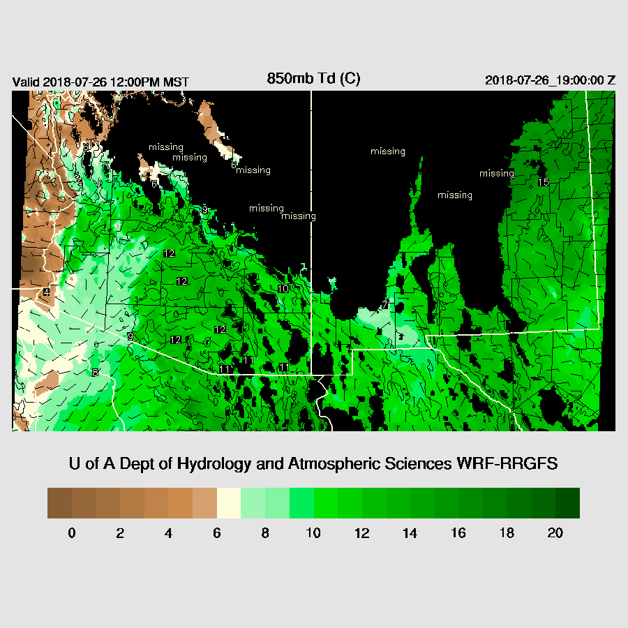
A surge is underway according to the 12Z Yuma sounding but is quite shallow and only reaches to 900mb. PW has generally increased over the past 12 hours and is now mostly around 40mm over the lower elevations of Arizona. The noon forecast of 850mb Td has dry air over most of western Arizona while central and east are quite wet along with generally westerly low-level flow thus those areas have a better chance of storms mainly over and near higher elevations.
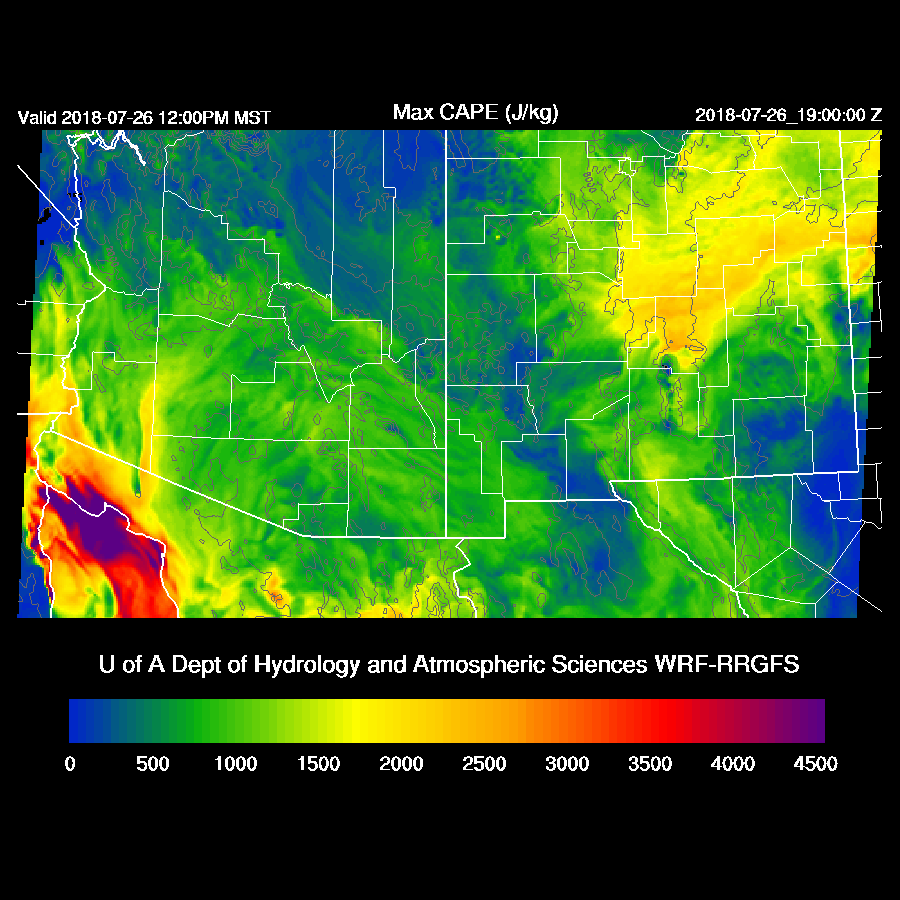
CAPE is mainly low to moderate and sufficient to support some strong storms.
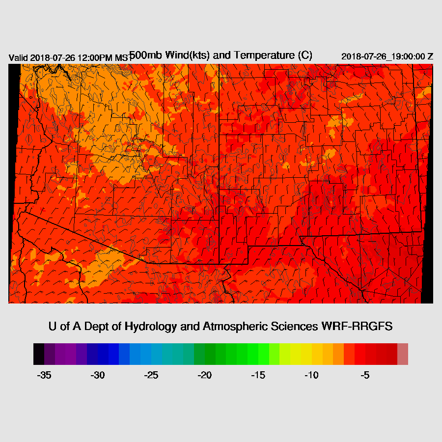
Mid-level steering is good as the anticyclone center has moved to northwestern Arizona which results in 10-15 knot northeasterly flow over much of the state.
So far, conditions look pretty good for storms but the morning model runs only forecast scattered activity present over the higher terrain for much of the afternoon.

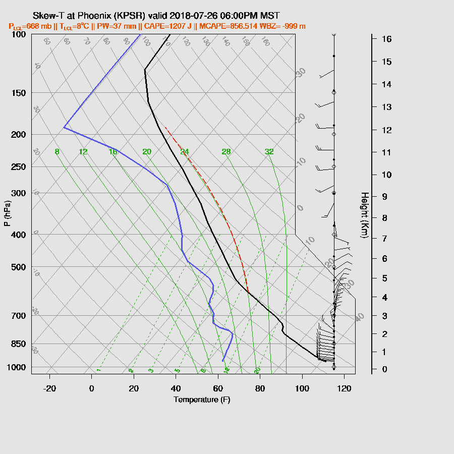
As was forecast yesterday, the cap/inversion is back due to the surge of wetter/cooler low-level air and can clearly be seen in the late afternoon Tucson vertical profile forecast. The wind profile is excellent with high-level westerlies, mid-level easterlies, and low-level northwest winds along with plenty of CAPE. What a waste!

It’s the same story for Phoenix.
Both of the 6Z runs develop some late night activity around SE Arizona. However, the 12Z runs back off and only have a few showers so it’s a low probability event but at least it’s something.
Day 2
A weak surge continues and keeps PW around 40mm at most low elevation locations. Weak but moist, easterly flow is present over NM which results in low-level convergence over SE Arizona. This may result in enhanced storm activity.

500mb flow is again favorable for steering high elevation storms into the lower deserts, plus temperatures are fairly cool.
CAPE is also quite high over SE Arizona and up along the Rim and the White Mountains.

Activity develops over the high terrain during the afternoon and some storms become strong to severe. Areal coverage is also greater than today.

Tucson is deeply mixed by late in the day with moderate to high CAPE as well as a good wind profile. Just based on this, storms look likely by late afternoon and early evening. PW is around 40mm so storms will produce very heavy rain.

By early evening, strong storms are scattered about SE Arizona as they either move off of the high terrain or develop on thunderstorm outflow boundaries. Both the WRFNAM and WRFRR are quite similar so confidence is high.

The wetter WRFNAM appears to develop another MCS just south of Nogales late tomorrow night.
No comments:
Post a Comment
Note: Only a member of this blog may post a comment.