Previous Forecast
Activity was mainly restricted to the western ⅓ of the state and in some of those locations, the storms were strong to severe. A large complex moved out of Yavapai County last night while other large storms roamed across central and western Pima County.

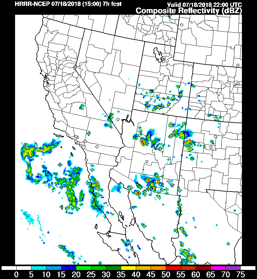
All three of the morning runs were generally accurate except none of them were able to forecast the activity that moved into La Paz County. The 12Z HRRR was also unable to forecast these storms but the 15Z run was a bit better as it did have some activity.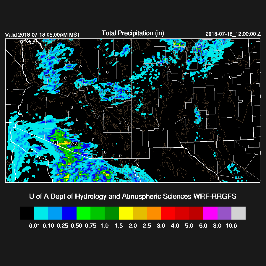
Initializations
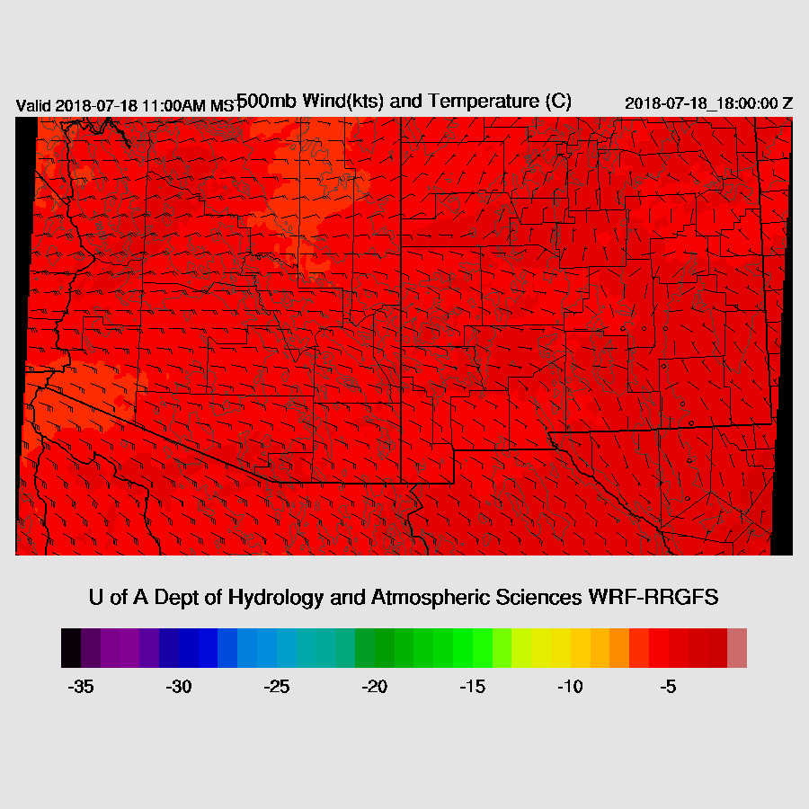
The 500mb ridge axis stretches from off the central California coast to west Texas with a large inverted trough over much of NW Mexico. The center can be seen spinning of the southern Baja coast and is moving slowly westward. The RR and NAM had no obvious problems.
Widespread clouds, showers, and some storms were over far SW Arizona this morning and it was mostly clear elsewhere. Both the RR and NAM were initialized well.
The NAM continues to have an overall wet bias but the magnitude of the errors are smaller today while the RR had only minor errors. The WRFGFS error plot is available now and it has mainly small errors except in So Cal where it’s too dry. Overall, the WRFRR has minimal errors thus confidence in it is high but the other two runs should also perform OK.
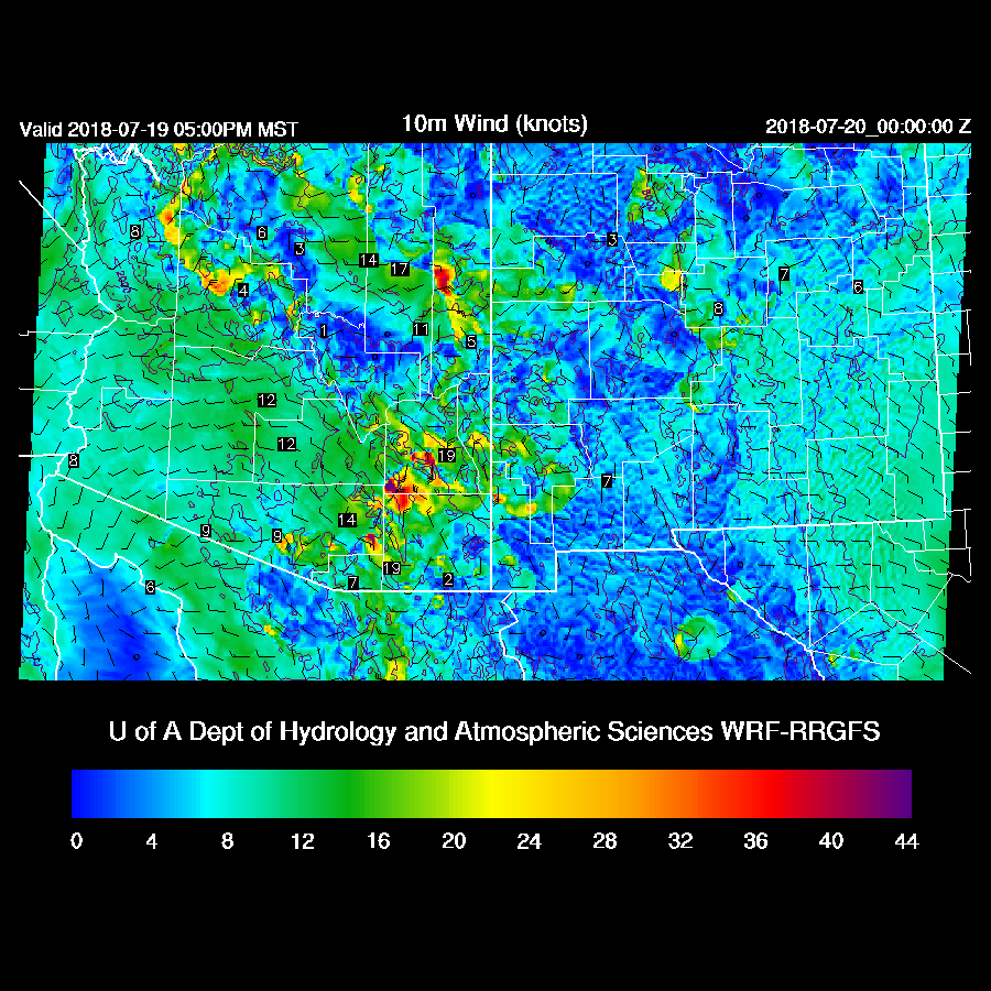
Day 1
PW remains very high over southwestern Arizona while somewhat drier air is over eastern Arizona and into New Mexico. GPSIPW plots indicate there has been a slight increase over eastern and central Arizona the last 12 hours as the easterly winds out of New Mexico weaken and moisture sloshes back to the east.

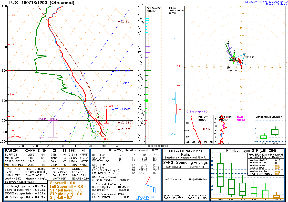
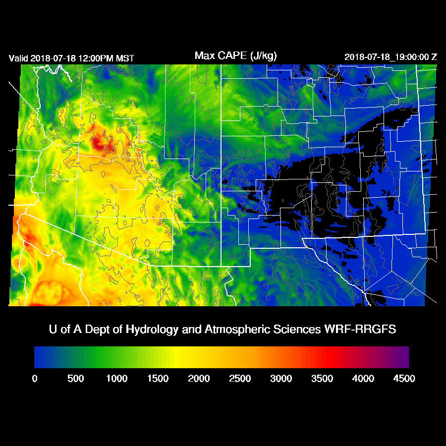
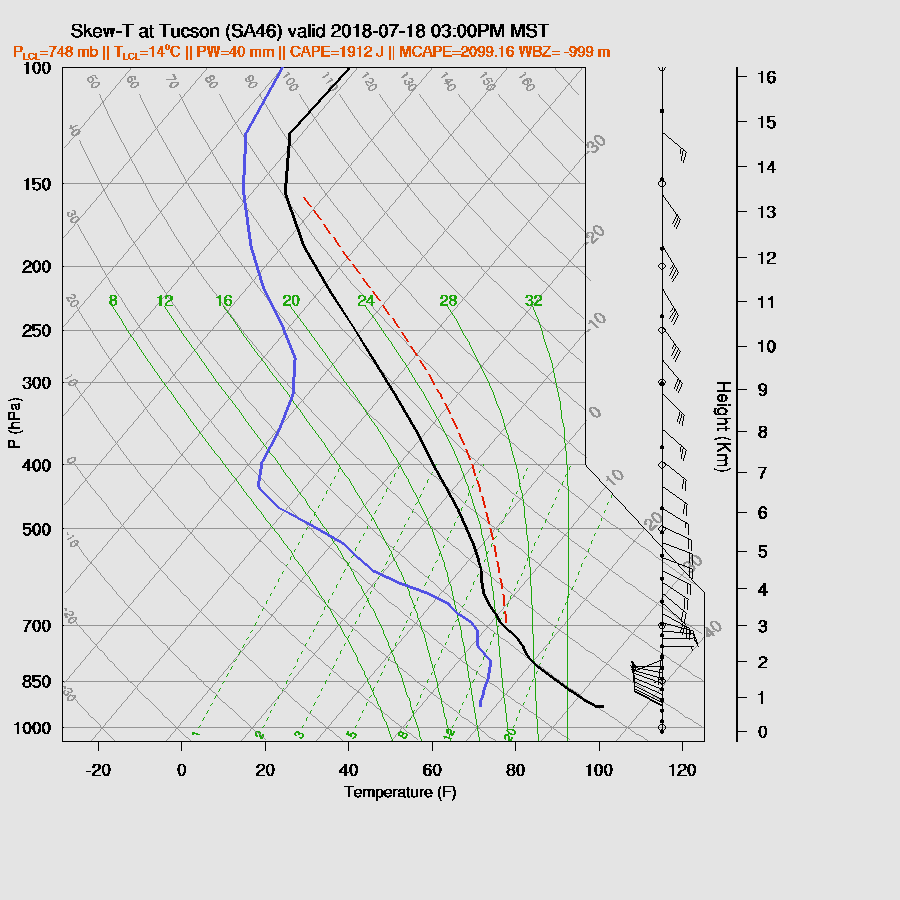
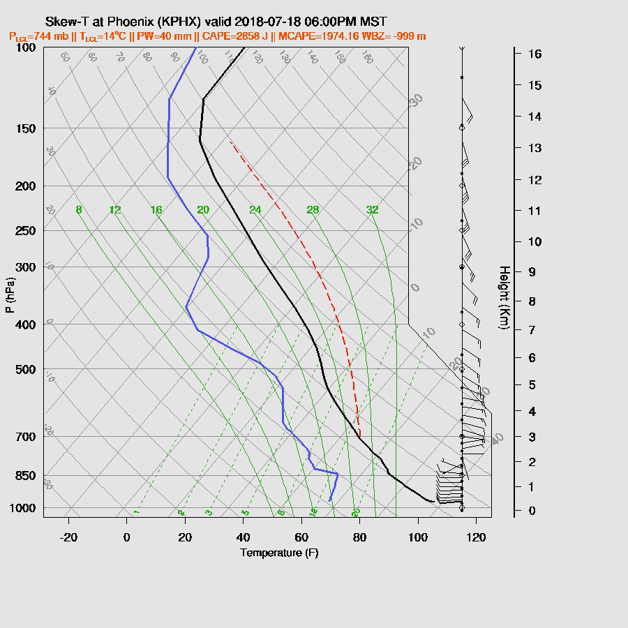
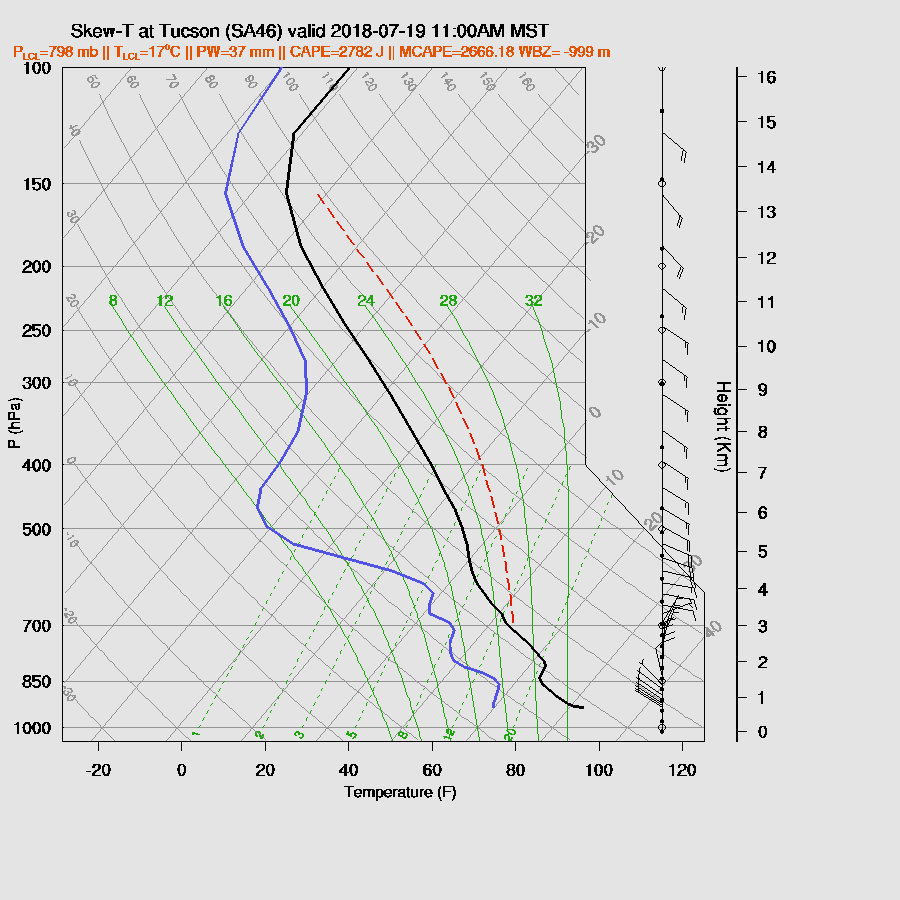
CAPE is forecast to be high to extreme over parts of central and western Arizona today. The morning soundings from both Tucson and Phoenix have a strong cap on top of the shallow mixed layer -- it looks like an Oklahoma summer sounding (except the winds of course). So, like yesterday, the big question is if/when/where will the cap will break?
Steering flow is generally from the east southeast which is favorable for storms to propagate from the higher terrain of Cochise/Graham Counties into the Tucson area but much of this area is still in the somewhat drier and more stable air.
Deep convection struggles to initiate over the eastern Rim/White Mountains and SE Arizona and by mid-afternoon only isolated storms are underway. This situation is giving me the willies as CAPE is so enormous plus all of the state is receiving full heating and if the cap busts, well, we know what the storms were like in western AZ and Pima County yesterday.
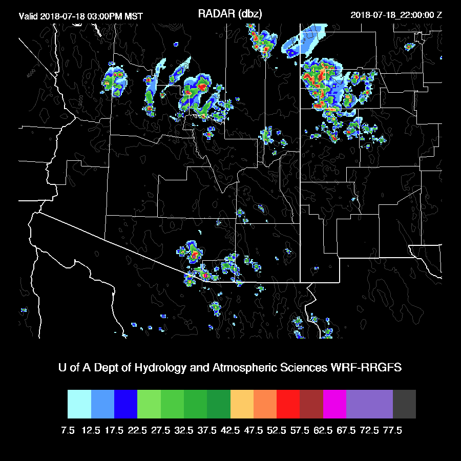
The WRFNAM has a bit more activity, probably because it’s a bit wetter. It has the same general idea of only a few storms around the Tucson area and in Yavapai County. Note the anvils extending the the northwest of the storms.

The WRFGFS is now available and it’s more similar to the WRFRR.
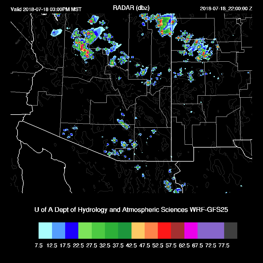
Well, Tucson is close to having a big day. CAPE is huge with around 2000 J/kg, winds are favorable with low level westerlies and good mid-level steering. What is needed is some sort of mesoscale lifting from outflow boundaries or local low level convergence. Normally, that would be provided by storms moving in from Cochise county but none in the model forecast today. As the easterly low level winds have slackend, there is no low level convergence zone either.
Only a few storms are present during the late afternoon and early evening. Maybe one or two will drift into the Tucson area.
It’s typical for the day of a surge that there is little activity over the lower deserts due to the cooling of the low levels but this is ridiculous! The atmosphere must even be capped over most of the high terrain.

Just to rub salt into the wound….here’s Phoenix with enormous CAPE. They are a long way from the LFC. The winds are excellent as anvils, if there were any, would be blown away from the direction of movement.
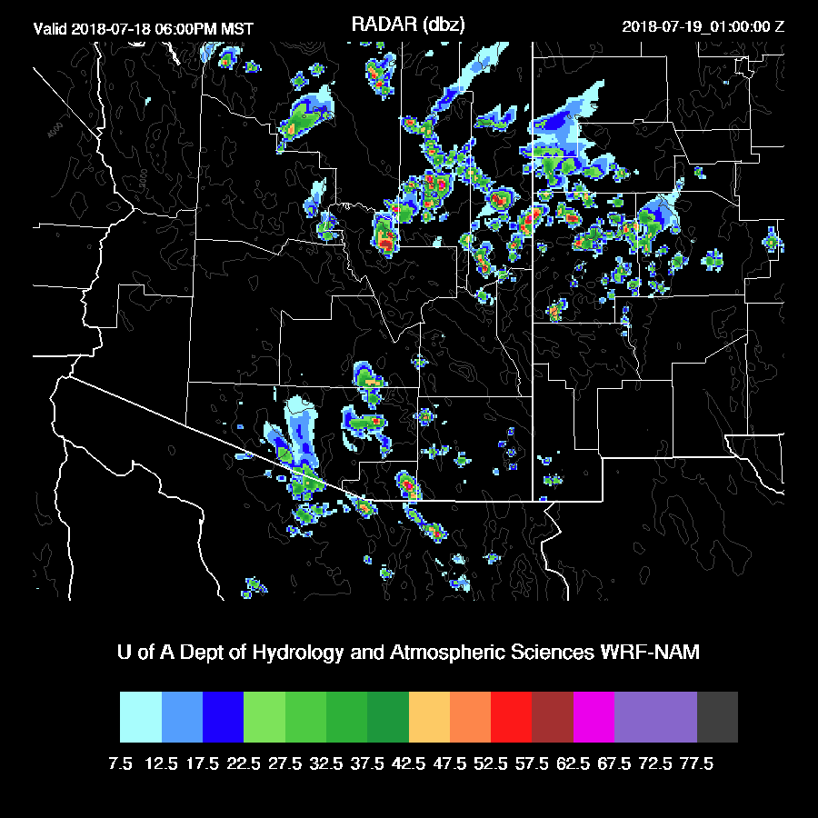
I also looked at the HRRR and it has a bit more activity than the WRF runs in and around Tucson during the late afternoon as deep convection develops over the higher terrain of Santa Cruz and far SE Arizona.
Day 2
Holy crap! 
Steering flow is still good with 10 to 20 knot southeasterly flow over much of the state. No obvious mid or upper troughs were seen to help enhance storms.

The lower deserts are still strongly capped tomorrow.
Enough heating does mix the PBL a bit better but strong outflow boundaries are still going to be needed to lift to the LFC.

It appears that the heating will be sufficient to initiate deep convection over the high terrain including SE Arizona. Both the WRFRR and WRFNAM are very similar.

Very strong and severe storms are scattered about SE Arizona and are moving towards the lower elevations. All the 3 of the 12Z runs are quite similar so forecast confidence is high.
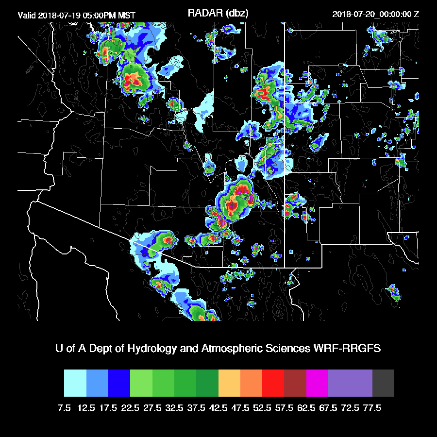
The PBL heights are quite low thus large scale outflow boundaries are not likely. However, localized wet microburst winds will be strong to severe. Not having large scale outflows is a big negative as it’s going to be hard for storms to propagate far into the lower elevations.
Even with these severe storms and strong localized winds, storms are unable to move into the lower elevations!

No comments:
Post a Comment
Note: Only a member of this blog may post a comment.