Previous Forecast
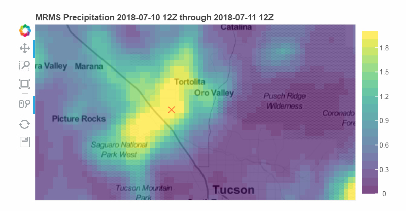
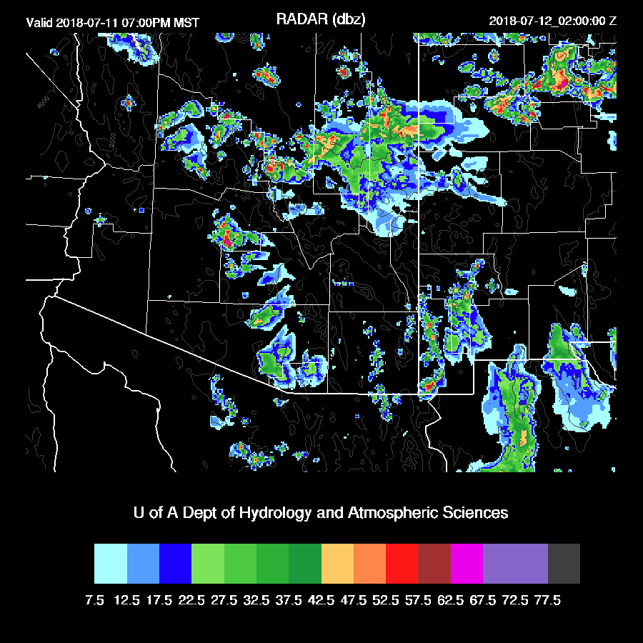
A localized extreme precipitation event struck NW Tucson yesterday with amounts over 2 inches and areas near Magee and I-10, over 3 inches. Graphic from Tony Lorenzo’s ARTSy page.
It was an active day for mainly SE Arizona, higher elevations of northern Arizona. A storm or two did sneak into southern Phoenix.

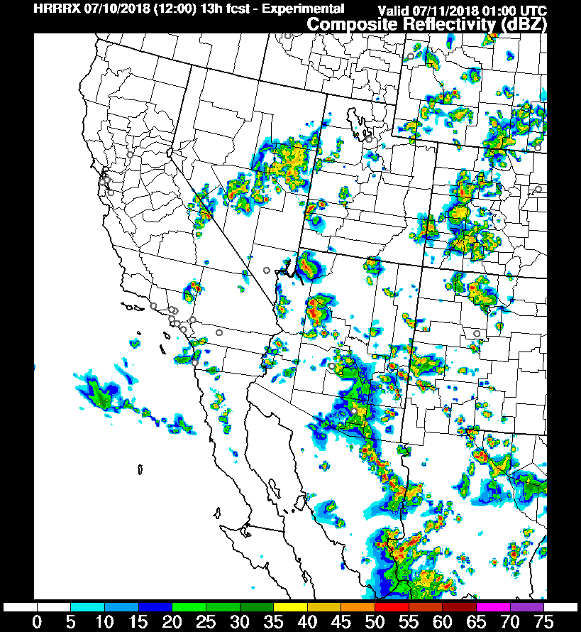
All of the runs struggled with the details and the WRFGFS was especially poor as it was too cloudy and didn’t allow enough heating resulting in not enough precipitation. The WRFNAM (below) was the best, but timing were way off around SE Arizona as it had most of the precipitation later in the day. The 6Z WRFNAM did an OK job especially with the timing of the activity around Tucson up to Phoenix.

I’ve also been keeping an eye on the HRRR and the experimental run also did well predicting the activity that moved up and into parts of Phoenix.
Initializations
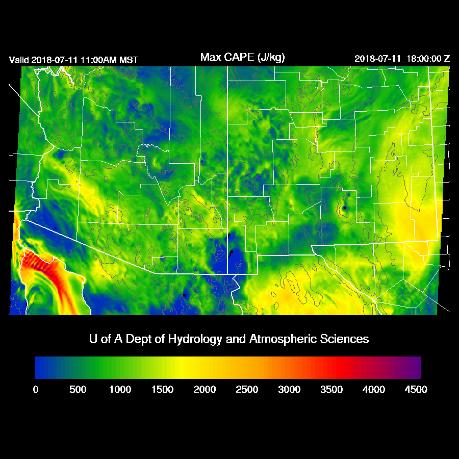
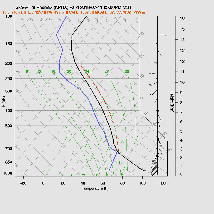
The IT that has been in our neighborhood the past few days, is located over the Colorado River valley with another IT located over SE Colorado. A large MCV was observed in the visible channel just south of Douglas with widespread clouds and some showers. The RR is missing this feature but is initialized in the NAM. Widespread clouds and a few showers are present over all of the state except for the far SW. The NAM has the right amount of clouds but not quite in the right places. The RR is too cloudy and has too much showers over both eastern and western Arizona. This is a difficult situation for the model due to the widespread clouds and the very wet and unstable (1100 J/kg MLCAPE at Tucson) air-mass. Like yesterday, some locations that receive sun will develop strong storms with very heavy rain and it’s not possible to accurately forecast that sort of small scale, almost random low elevation activity.
PW was initialized a little too wet by both the RR and NAM and both had quite a large error in southern Sonora and overall, the NAM had the best initialization. As the 12Z GFS is not available as of this writing, I took a quick look at the 6Z WRFGFS and it’s PW and cloud initialization looks good so it may be useful.
Day 1
We are back in the regime we had last July where the atmosphere is extremely wet. Morning observed PW was around 50mm in the lower deserts and that continues during the day as moist advection continues from the Gulf of California.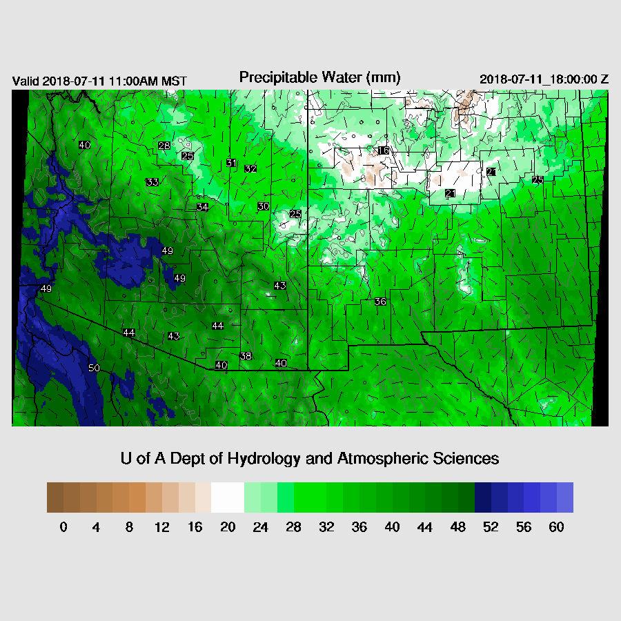
CAPE is also moderate to high over most of the southwest thus storms that form are going to be strong producing heavy rain.
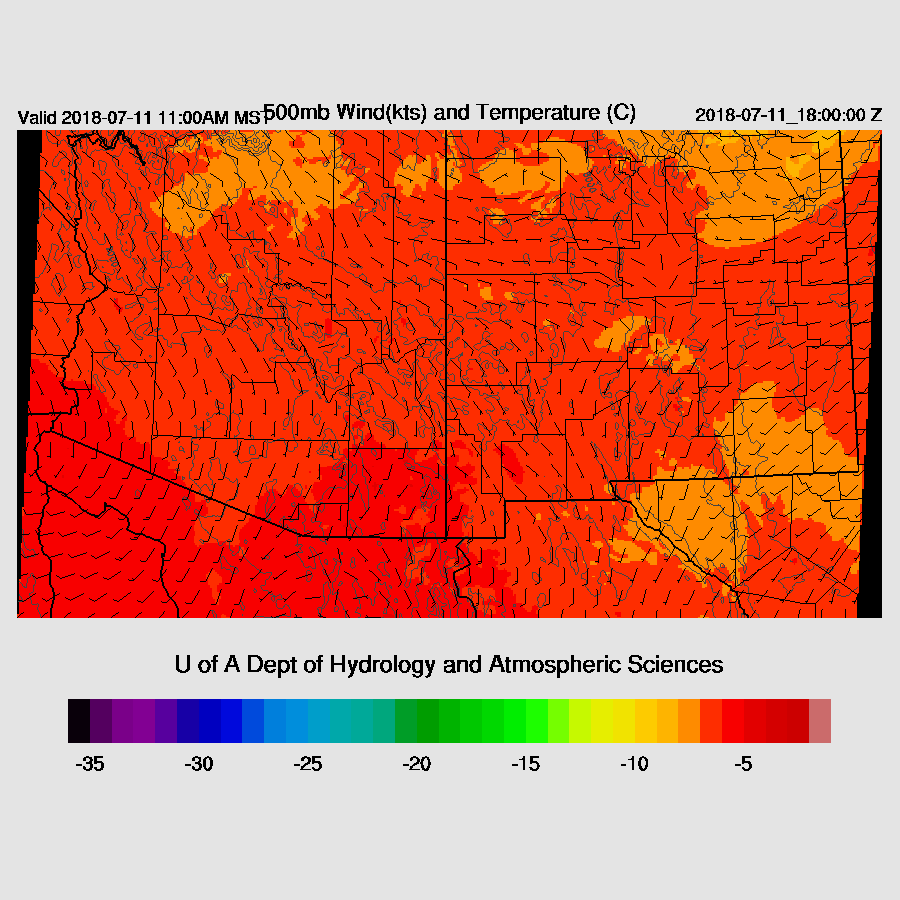
Mid-level winds are quite weak now so storms won’t move much which will enhance the flash flood risk. My guess is most activity will be over the mid and higher terrain with a few lower elevation storms that form on outflow boundaries.
Both the 6Z WRFGFS and 12Z WRFNAM have broken to scattered clouds by late morning which match current satellite trends of dissipating clouds except for SE Arizona where the IT is now located.
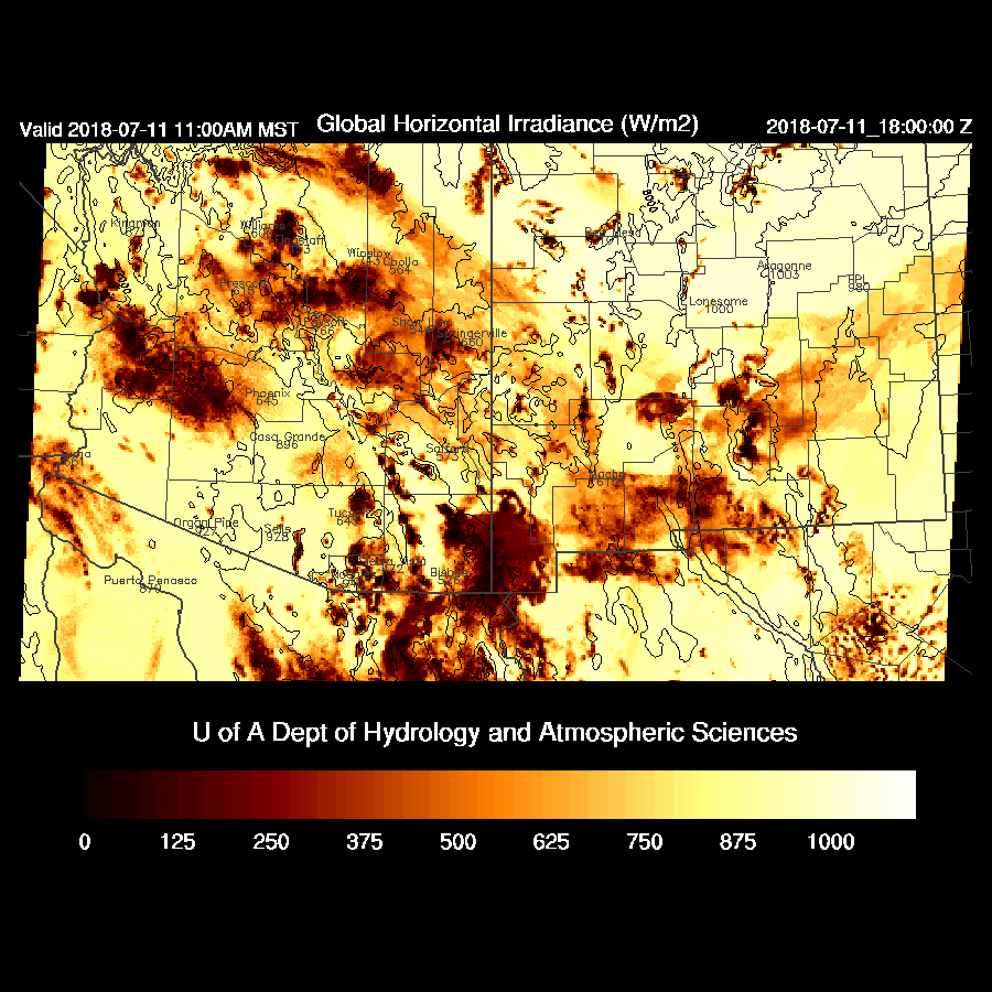
By early afternoon, scattered storms are underway over parts of SE Arizona.

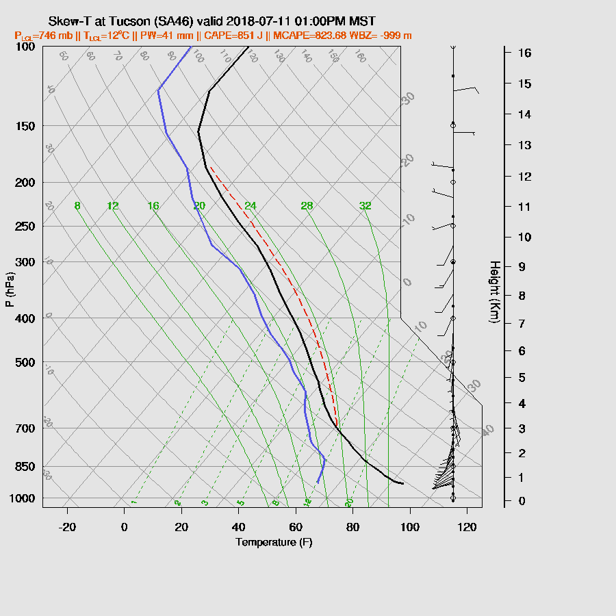
Tucson has moderate CAPE and over 40mm of PW during the early afternoon. Steering winds are light from the south and may be sufficient to move some storms into the valley. The other possibility is outflows from nearby higher elevation storms may be sufficient to trigger deep convection.
The 6Z WRFGFS has quite a bit of storm activity in the Tucson area while the WRFRR has none. In the middle is the WRFNAM with scattered activity around the area, mainly over higher terrain.

Like yesterday, storms move/develop northwestward into central Pima and Pinal counties and approaching Phoenix later in the afternoon.

Phoenix is mixed deeply by this time with around 1000 J/kg of CAPE so all that is needed is a weak outflow to initiate deep convection. IPW is very high so very heavy rain is likely with storms that form.
Both the WRFGFS and WRFNAM(below) have a strong storm or two in the Phoenix area during the early evening but nothing well organized or widespread.
Activity may continue north of Phoenix into the late evening hours.

24 hour accumulated precipitation is quite spotty but some locations may have over 2 inches.

Day 2
Very wet air continues over the state with PW as high as 50mm.

As today, CAPE also continues to be moderate to high.

The problem is that steering flow is very light thus like today, storms will mainly occur over mid and high elevations and struggle to move/form over lower elevations.
In this regime, it’s not possible to forecast accurately for the lower deserts. The best guess is a few storms are possible in Pima and Pinal county during the late afternoon hours and minimal activity for Phoenix.

No comments:
Post a Comment
Note: Only a member of this blog may post a comment.