Day 1
Moisture has been increasing slowly over southern Arizona over the past day or so but continues to be insufficient for any deep convection across Arizona.

Day 2
The 500mb forecast has a high centered over Colorado with a ridge axis stretching to the SW over Arizona placing far southern Arizona in light easterly flow while a large trough is located west of WA/OR placing much of the western CONUS in southwesterly flow.

Low-level flow becomes easterly over much of the region with very wet air present over eastern NM. This wet air advects into Arizona during the day with 850mb dew-points into the 10C range which is typically sufficient for deep convection.

A narrow band of 500-1000 J/kg of CAPE is forecast over SE Arizona with somewhat drier and more stable air over SW NM. Typically, moderate to strong easterly flow results in drying and stabilization of the air mass due to downslope flow but there appears to be a period of time where some deep convection is possible before the drying kicks in.
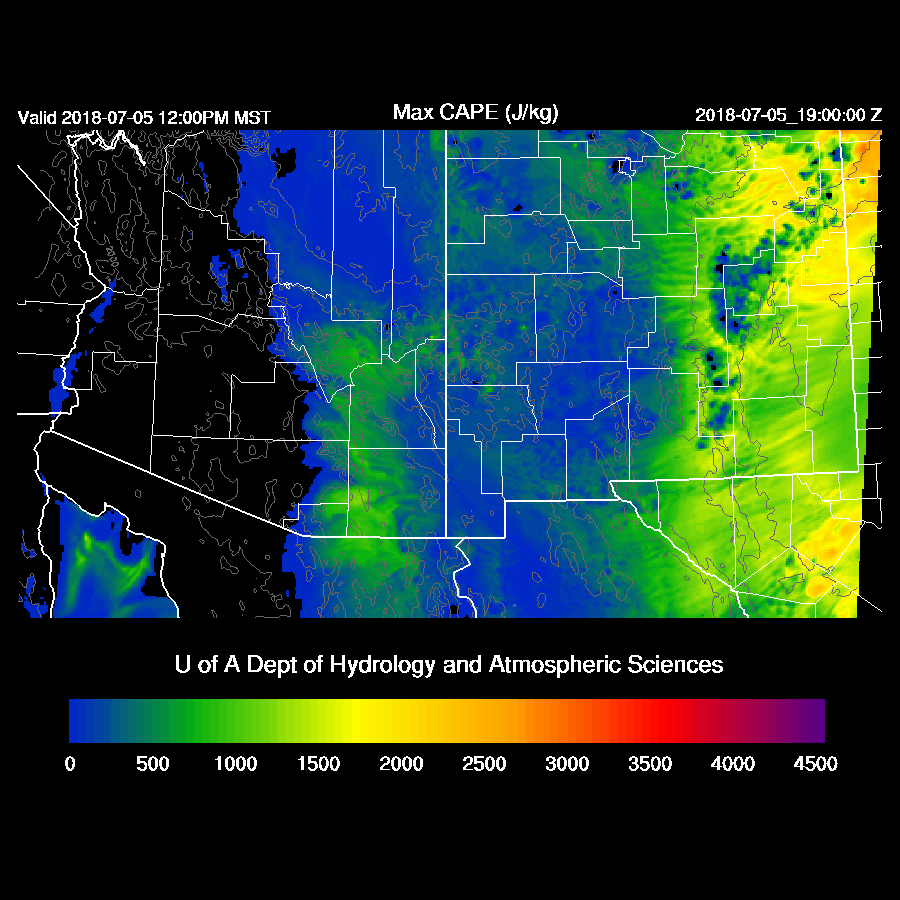
By mid-afternoon, moisture increases to over 30mm over Tucson with 300-700 J/kg of CAPE. Note that the CAPE calculation is too high in the forecast Skew-t below. Winds are unidirectional with 15-20 knots in the low levels while mid and upper-level winds are light thus shear is minimal and organization of storms is unlikely. Of interest is the deep mixed layer which is favorable for strong dry microburst winds.

By later in the afternoon, a few storms are underway across eastern Pima and up into eastern Pinal counties along this narrow strip of higher CAPE. It was interesting to see that all three of the 12Z runs plus the 6Z WRFNAM have a few storms in and around the Tucson area.
During the evening, wet air continues to advect into Arizona from NM on moderate to strong easterly flow, but CAPE is minimal so no activity is expected.

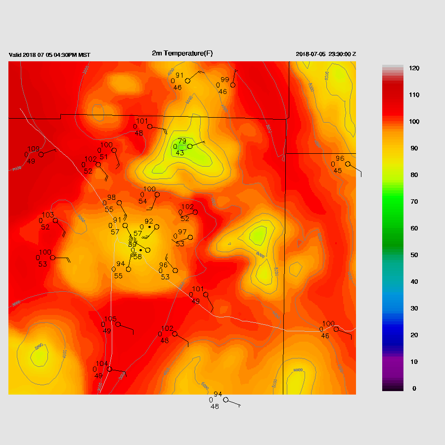
The other story is the heat. Phoenix gets to around 112-114 tomorrow afternoon. Easterly winds then develop during the evening and along with some clouds, resulting in low temperatures from 95-98 across the valley. 96F is the all-time record high low at KPHX.

No comments:
Post a Comment
Note: Only a member of this blog may post a comment.