Previous Forecast
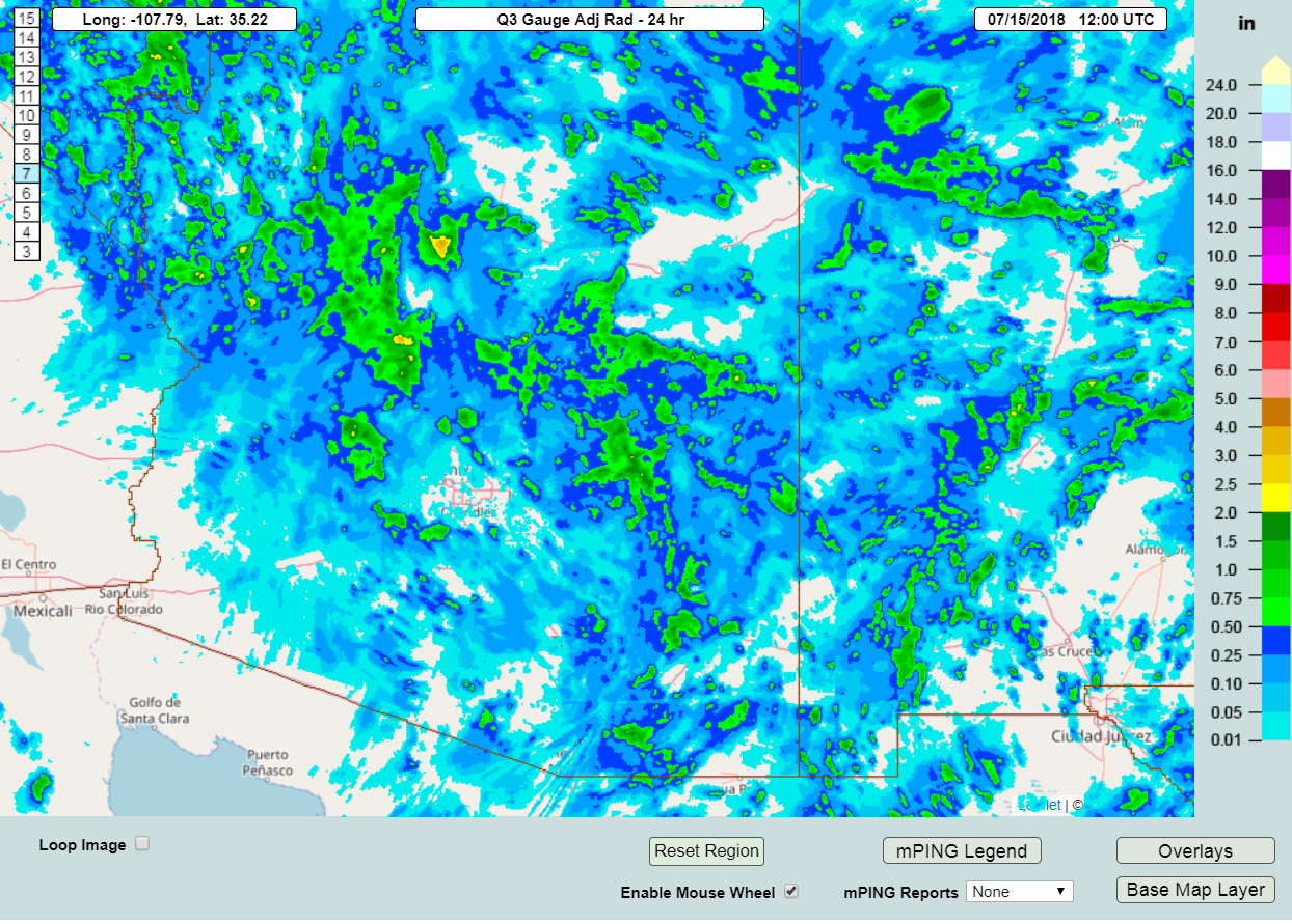
Quite a bit of precipitation fell over the higher terrain of northern and eastern Arizona. Tucson had some activity while Phoenix proper was mainly quiet.
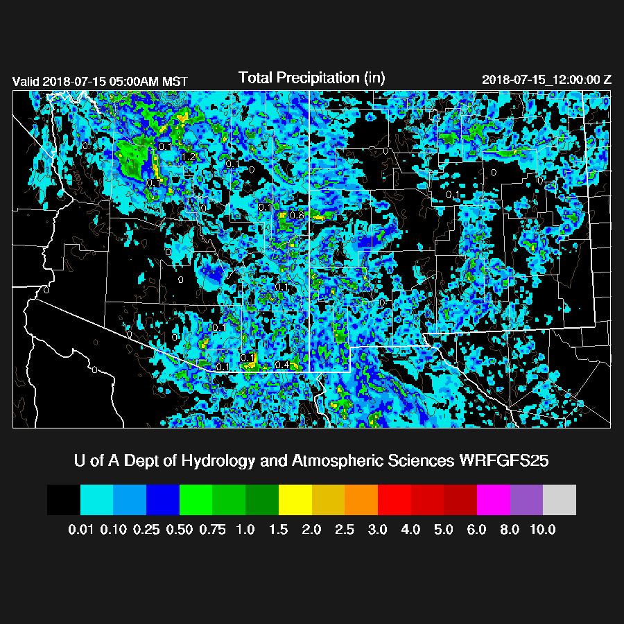
The WRFGFS did a fairly good job in spite of the complex situation due to clouds and showers at initialization.
Initializations
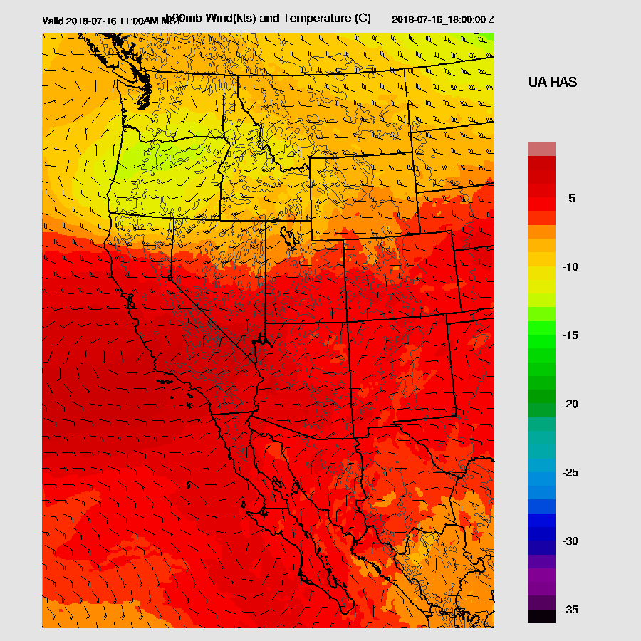
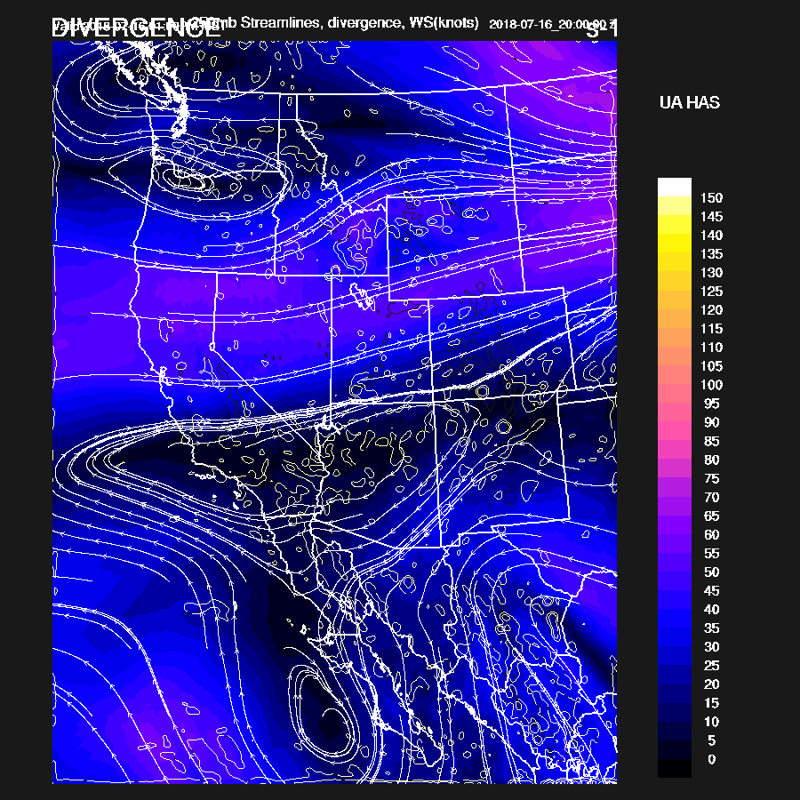
The 12Z 500mb map has a weak IT over central Arizona and a second over Colorado. The high center is over in Nevada thus the Colorado trough may drift south and impact AZ in a day or two. Another trough is located over Texas. Widespread clouds with showers and a few thunderstorms are moving south through central and southern Arizona. RR initializations of the showers and clouds were very good considering the complexity. The WRFNAM developed strong storms within the first few hours of the run over much of south-central Arizona which was way too much. It’s unlikely the WRFNAM will be very accurate today.
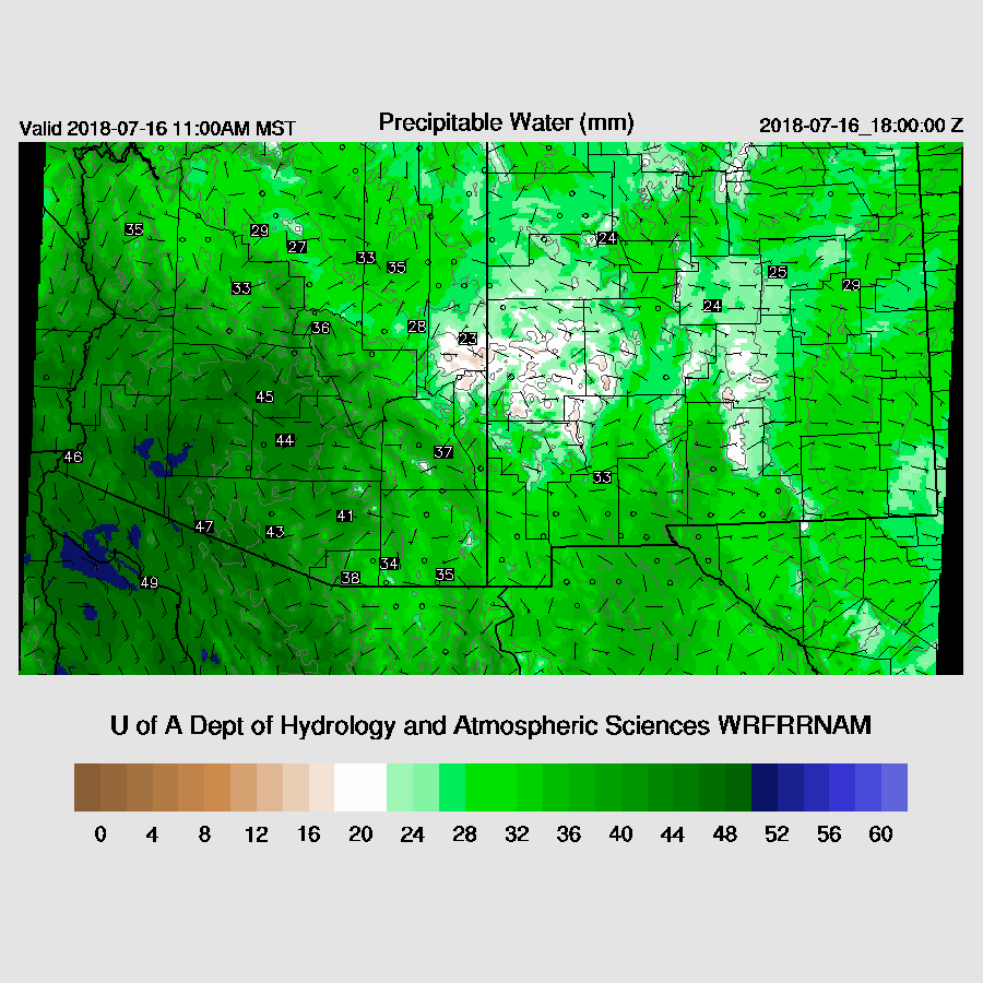
PW is very high over southern Arizona as the Phoenix area has over 50mm and Tucson is around 45mm. It’s also very wet south in Mexico as Hermosillo is 53 and Navojoa is around 65mm! The RR PW initialization had only minor errors with sites in southern Mexico being somewhat too dry. The NAM initialized better than it has in the past few days but is still too wet over much of northern Arizona. The WRFRR looks to be the best model today.
Day 1
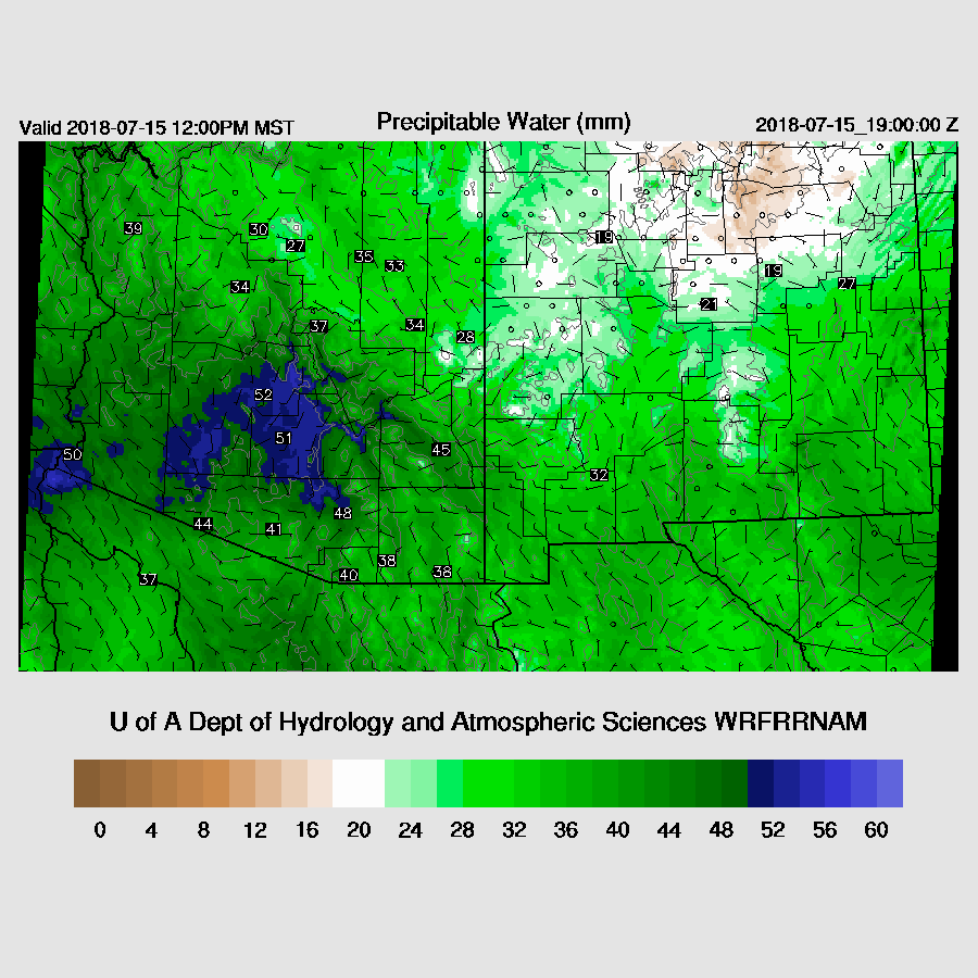
Another complex situation but the WRFRR is handling it well so far. PW is extreme for Arizona with over 50mm around southern Arizona.
In spite of all this moisture, CAPE is low over much of southern Arizona due to a combination of -4C 500mb temperatures and widespread clouds and showers over southern Arizona thus once the morning activity dies down, it’s unlikely that the atmosphere will recover much resulting in minimal activity for the Tucson and PHoenix areas.
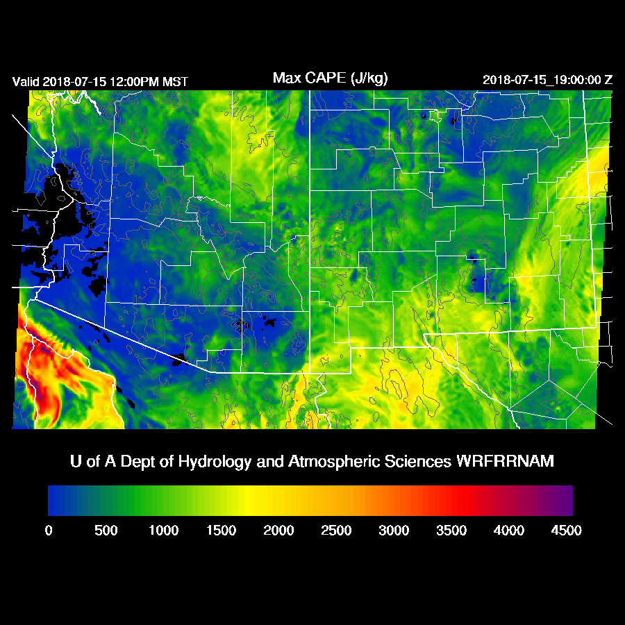
As mentioned above, 500mb temperatures are around -4 to -5C. The IT responsible for all the morning activity is located over SE Arizona by early afternoon placing much of central and western Arizona under NE flow thus storms that form later will move towards the lower elevations. Without much CAPE over the lower elevations, it doesn’t look like they will make it far.

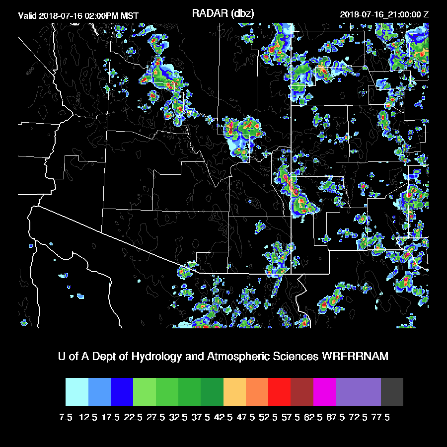
By early afternoon, showers continue over far southern Arizona while some deep convection develops over the White Mountains.

Storms remain over the higher terrain of northern Arizona this afternoon and evening.

Day 2
Very wet air continues over the state tomorrow and once again, forecasting in this regime is difficult due to probable clouds and precipitation at the initialization times.
CAPE is again moderate to higher over much of the eastern ⅓ of the state so that appears to be the area of probable storms tomorrow.

Mid-level flow is more interesting as an IT is located south of New Mexico and a ridge axis from Santa Barbara to the Four Corners. Slightly cooler air is over New Mexico is moving into eastern Arizona. With the slight cooling and good ENE flow, the lower elevations of SE Arizona may see some storms.
Strong storms are underway over the Rim and White Mountains by afternoon. These storms should move to the SW.
Strong storms move into the Tucson area during the early evening as CAPE is sufficient. Forecast confidence is generally low but this does look like a good setup for SE Arizona.

An area of difluence is over SE Arizona and northern Sonora will aid storms in those areas.
No comments:
Post a Comment
Note: Only a member of this blog may post a comment.