Previous Forecast
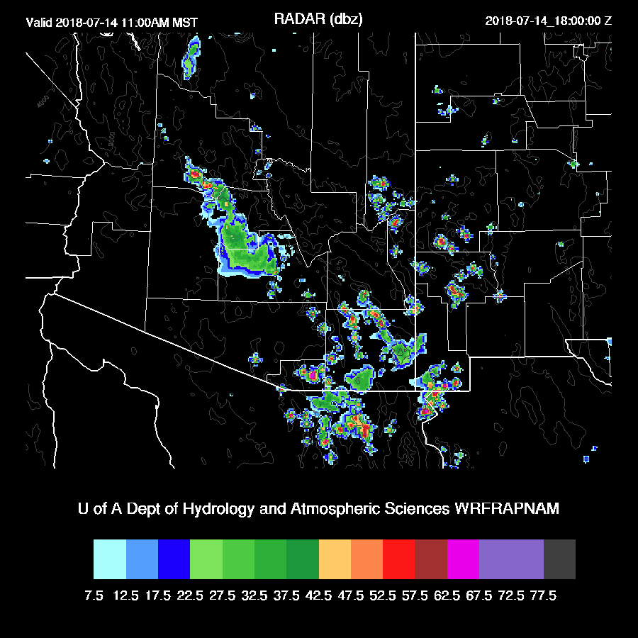
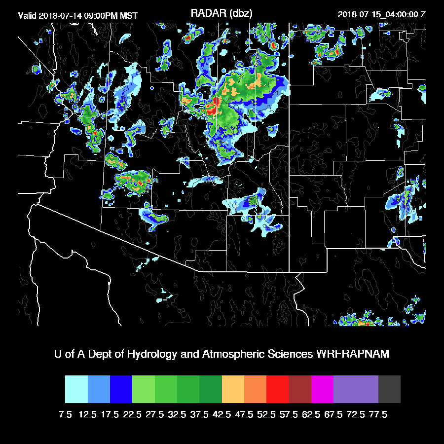
Most of the lower deserts were quiet except for a weak storm or two in Tucson and most activity remained mainly over the high elevations. Some early morning activity moved towards the Phoenix area but didn’t quite make it into the valley.
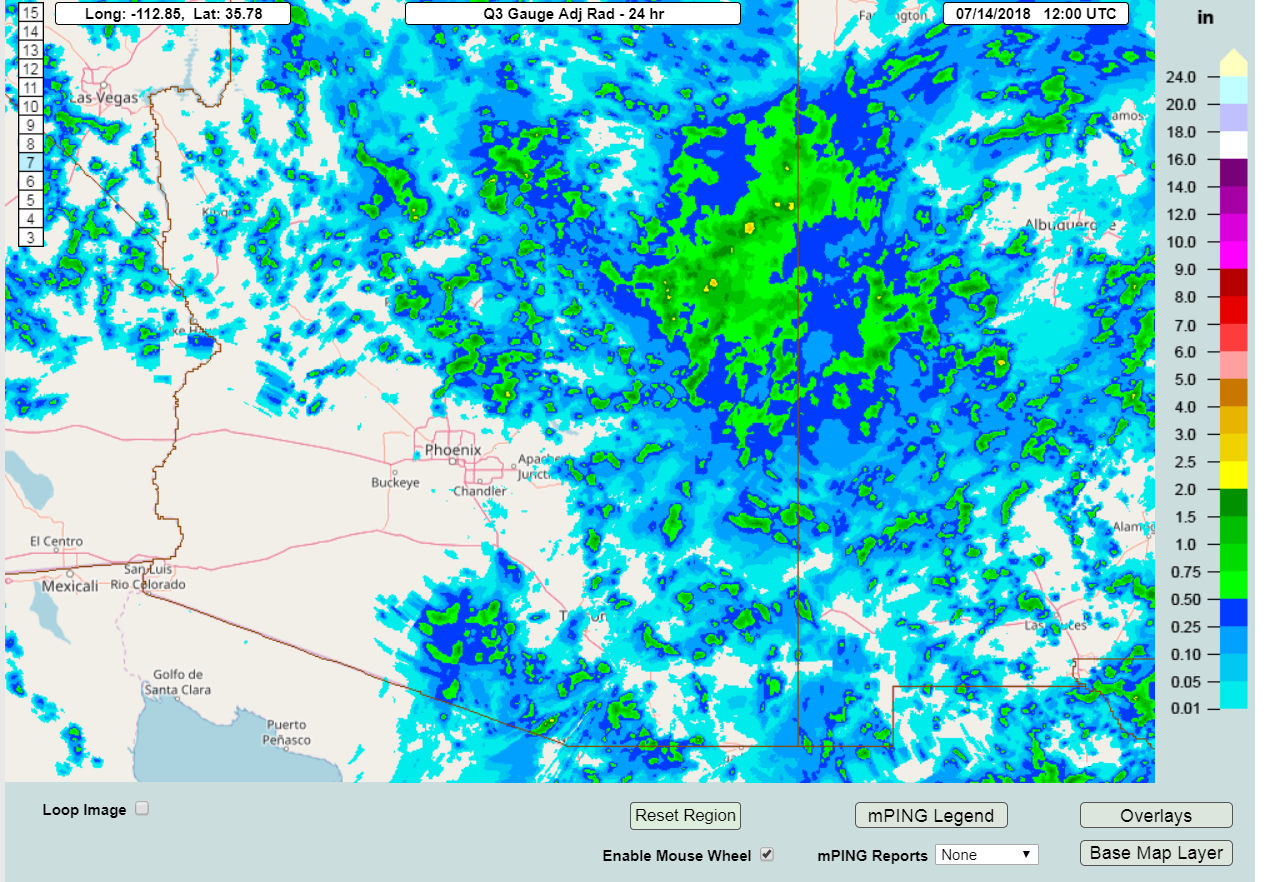
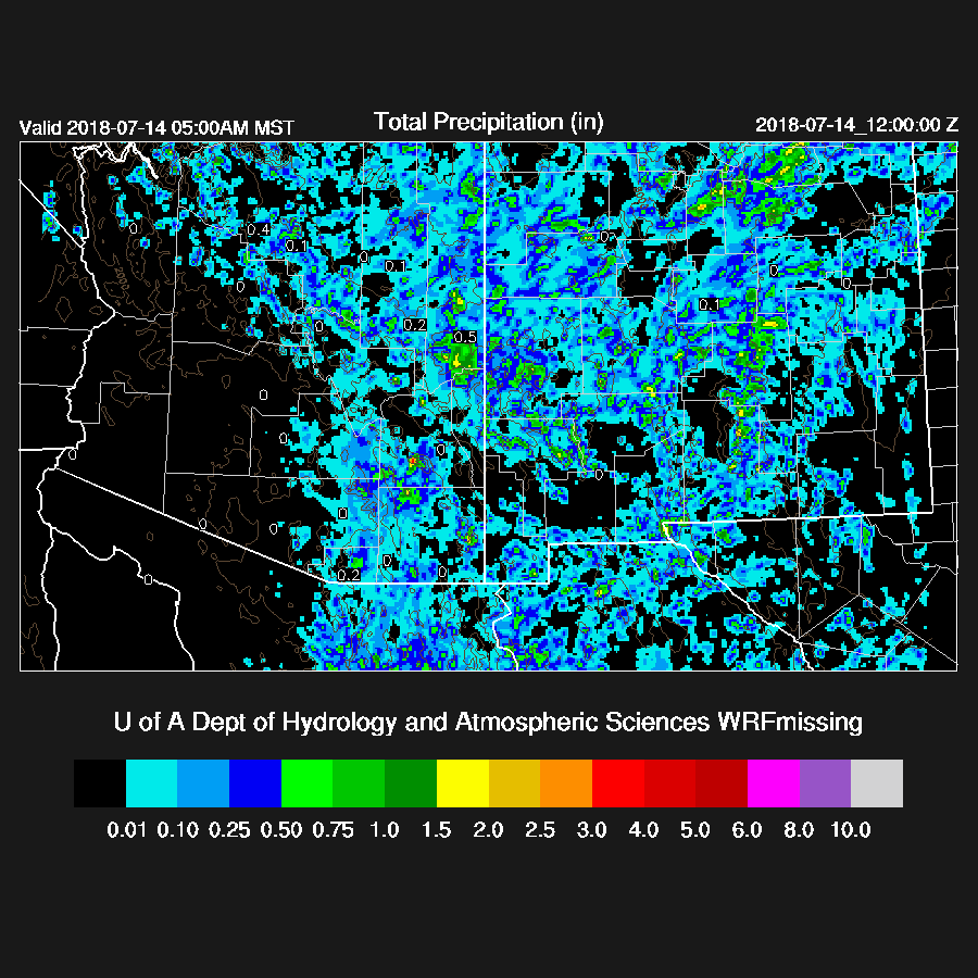
The WRFNAM was fairly accurate in spite of the widespread corrections needed to the initial PW field. These wet errors have been prevalent in the NAM the past few days for some unknown reason. The WRFNAM was too dry in central Pima and in Yavapai and La Paz Counties.
Initializations
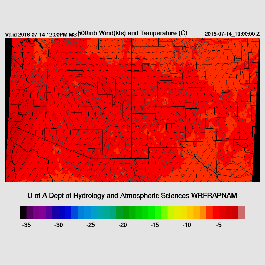
One center of the CONUS wide 500mb ridge is over southern Utah thus places much of northern Arizona in 10-20 knot NE flow. A weak inverted trough is located over eastern Arizona and western NM and another over Kansas. Temperatures are around -5 to -6 so it has cooled very slightly since yesterday.
There are widespread clouds over most of central and eastern Arizona with at least two MCVs. One is over north-central Arizona and the other just south of the NM/Mexico border. There is probably another one over the central GofC due to the large MCS there last night but clouds are probably obscuring it. Storms have already formed over southern Arizona but it doesn’t look like there is a strong surge underway from the Mexican MCS unlike what was forecast by some of the model runs from yesterday. In any case, it looks like it’s going to be a difficult initialization. The RR was able to resolve the northern Arizona IT/MCV and also has initialized the NM IT. Not enough clouds were initialized but the areas of showers in far SE Arizona and central Arizona were initialized OK. The general lack of clouds elsewhere is going to be a problem unless the actual clouds start to burn off soon. The NAM looks about the same as it doesn’t have enough clouds but does have the other features initialized OK.
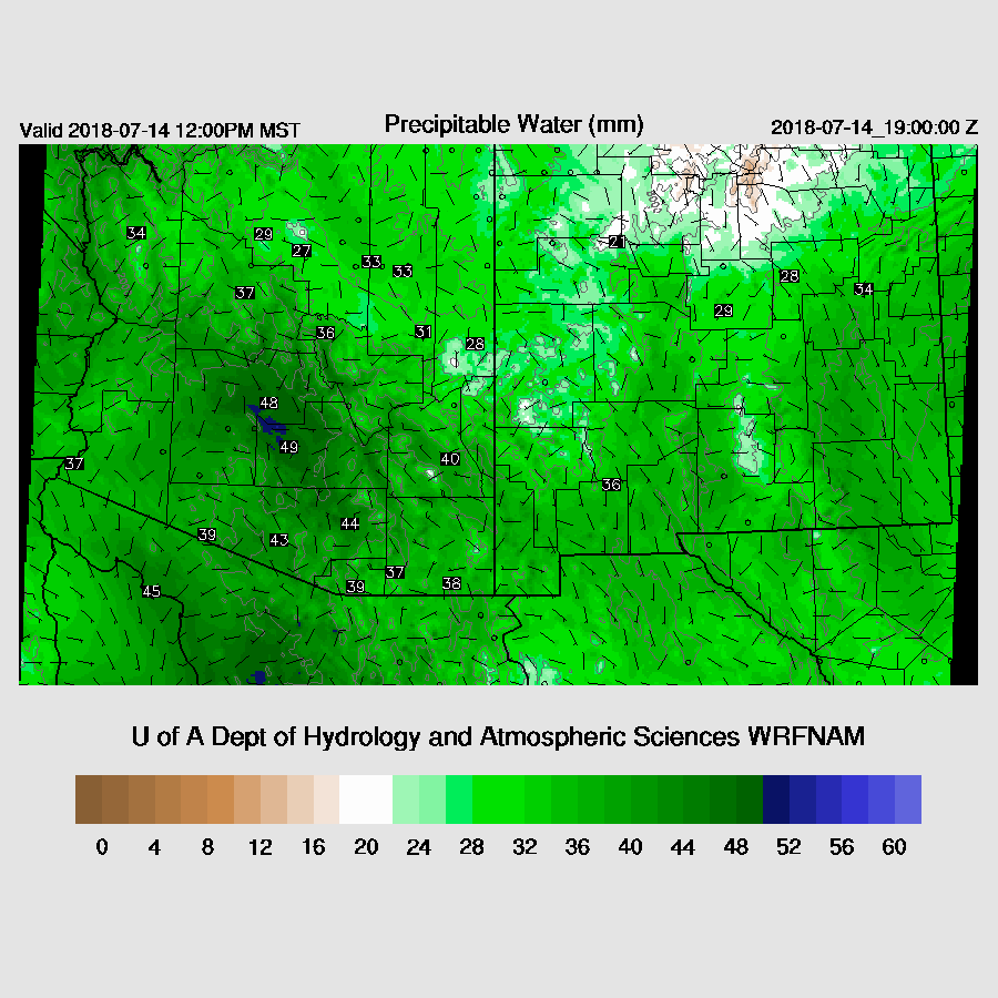
Moisture has increased as was forecast, and PW has increased to 40-48mm range over the lower deserts. Rapid Refresh PW errors were minimal except in Sinaloa where it was a bit too wet. The NAM still is generally too wet but not as bad as previous days. There are some large errors in southern Sonora and Sinaloa but that shouldn’t impact the forecast in Arizona for today.
I also took a look at the 6Z WRFGFS to see if it was any better with respect to morning clouds and it was not but did have the clouds and showers over central and into far SE Arizona. Overall, no initialization is good because of lack of clouds thus there is no clear favorite and model confidence is low.
Day 1
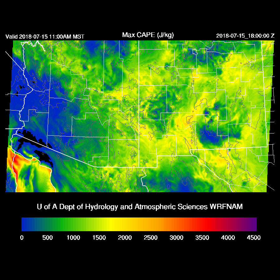
Moisture has increased over central and eastern Arizona and is very high at almost around 50mm in the Phoenix area thus the main risk is very heavy rain with any storms.
CAPE is high over SE Arizona (except where convection is already underway) and over eastern Arizona.

Steering flow is again quite light and variable. Both the WRFNAM and RR have a well defined IT located over NC Arizona which may help enhance convection later today and may steer some storms into western Arizona. 500mb temperatures are quite warm at around -5 thus and with cooling at low levels, no wonder CAPE is minimal over much of the lower deserts.
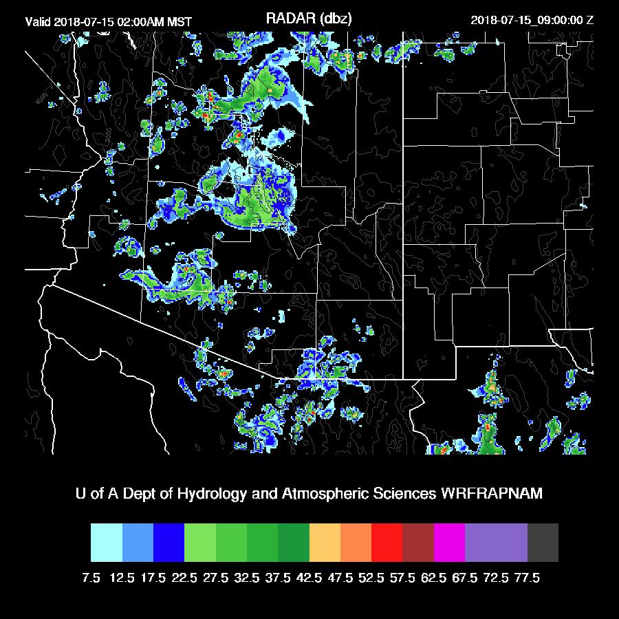
Showers and some storms continue to increase over SE Arizona and up towards Phoenix during the morning hours. The WRFRR, by far, has the best forecast so far this morning as it has forecast the ongoing activity well. Note that the initialization is now on the graphics. RAPNAM means the Rapid Refresh as initial conditions with the NAM as LBCs.
Storms continue to roam around SE Arizona into the afternoon but when and where is difficult to say. Storms also develop over eastern Arizona.
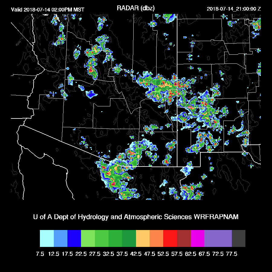
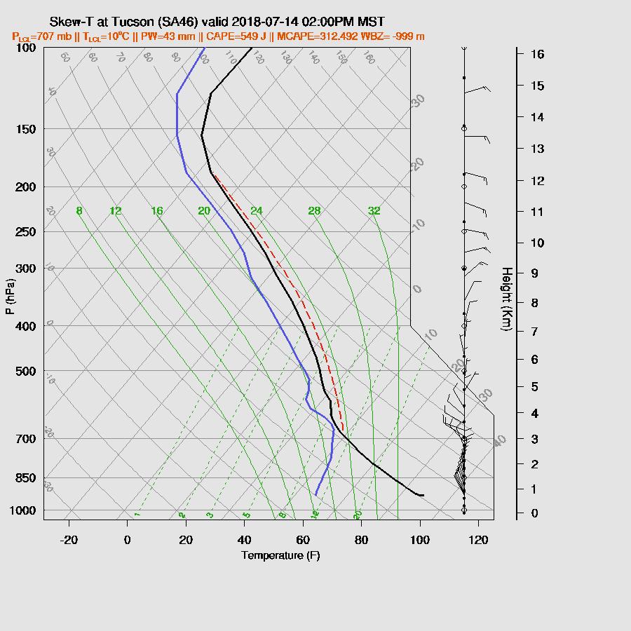
Tucson afternoon CAPE is quite low but the PBL is mixed fairly deeply so some valley deep convection is possible just about any time. The profile is tropical with nearly a saturated profile above the PBL thus any storms that form will have very heavy rain with a chance of strong wet microbursts. Steering flow is very weak and unfavorable for propagation.
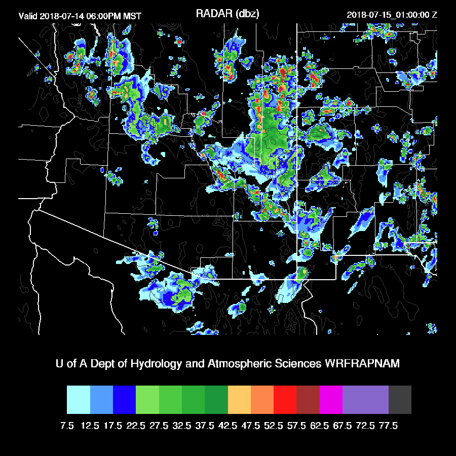
Storms continue mainly over the higher terrain into the early evening.
The situation is similar to Tucson in Phoenix by late afternoon as there is some CAPE present as well as a fairly well mixed PBL. The air-mass is very wet thus any storms that do form will produce very heavy rain as the PW is nearly 50mm. The wind profile is unfavorable for storms organizing or moving off of the higher terrain. 
A few storms do develop over the lower deserts during the evening hours but exactly where is anyone’s guess. Forecast confidence for today is low due to the complex nature and the poor cloud initializations.
The IT slowly moves to the south or southwest and is located over central Arizona overnight which is likely to cause some overnight showers and storms.
Day 2
The IT continues to move slowly to the south to a location just south of the border by midday tomorrow.

Moisture levels continue to be very high as a weak surge continues.

With such wet air, widespread clouds are again likely and will play a large role where and when convection will occur and nearly impossible to forecast. CAPE is again very high over eastern Arizona up toward the Grand Canyon so areas that see sun will have widespread storms with heavy rain.

No comments:
Post a Comment
Note: Only a member of this blog may post a comment.