Previous Forecasts
The atmosphere remains capped over all of the lower deserts but a different story for the high terrain to the north of Phoenix saw some extreme amounts of rain including 5-7 inches over the San Francisco Peaks. Many other areas saw amounts from 1.5 to over 2 inches.
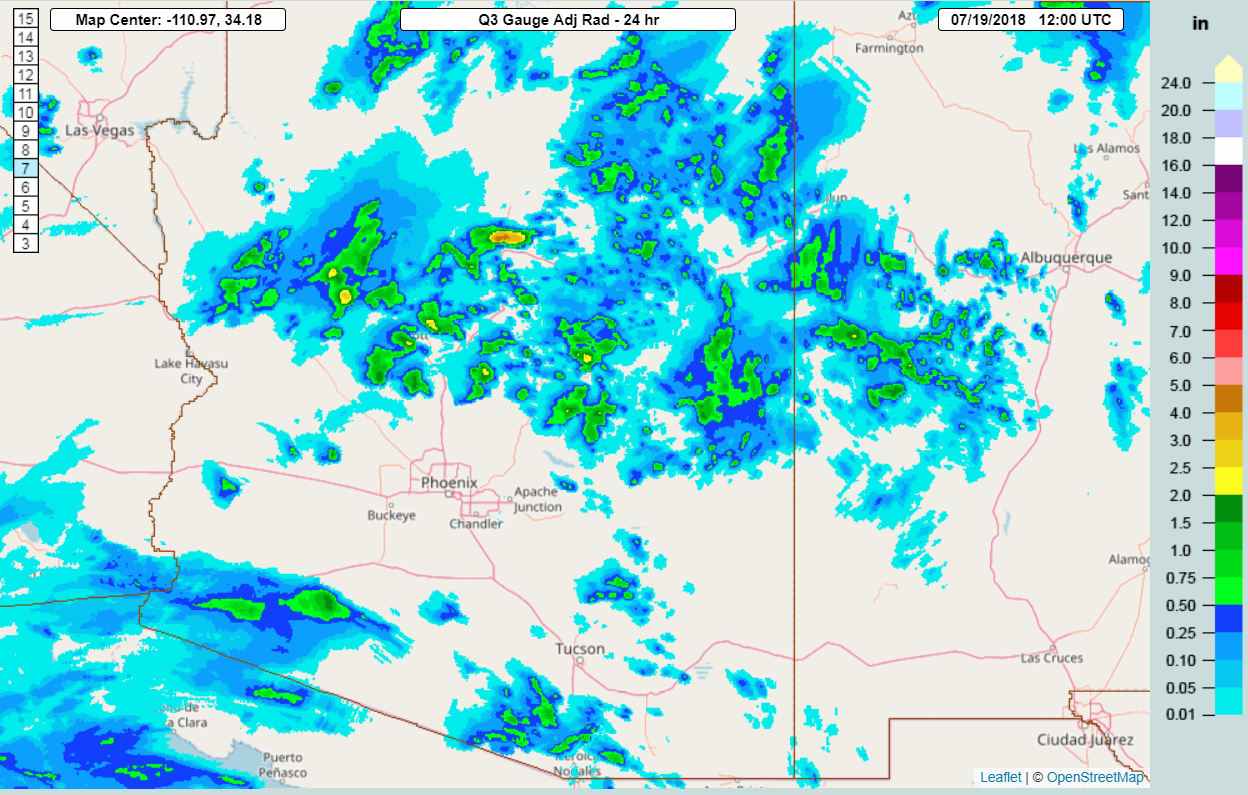
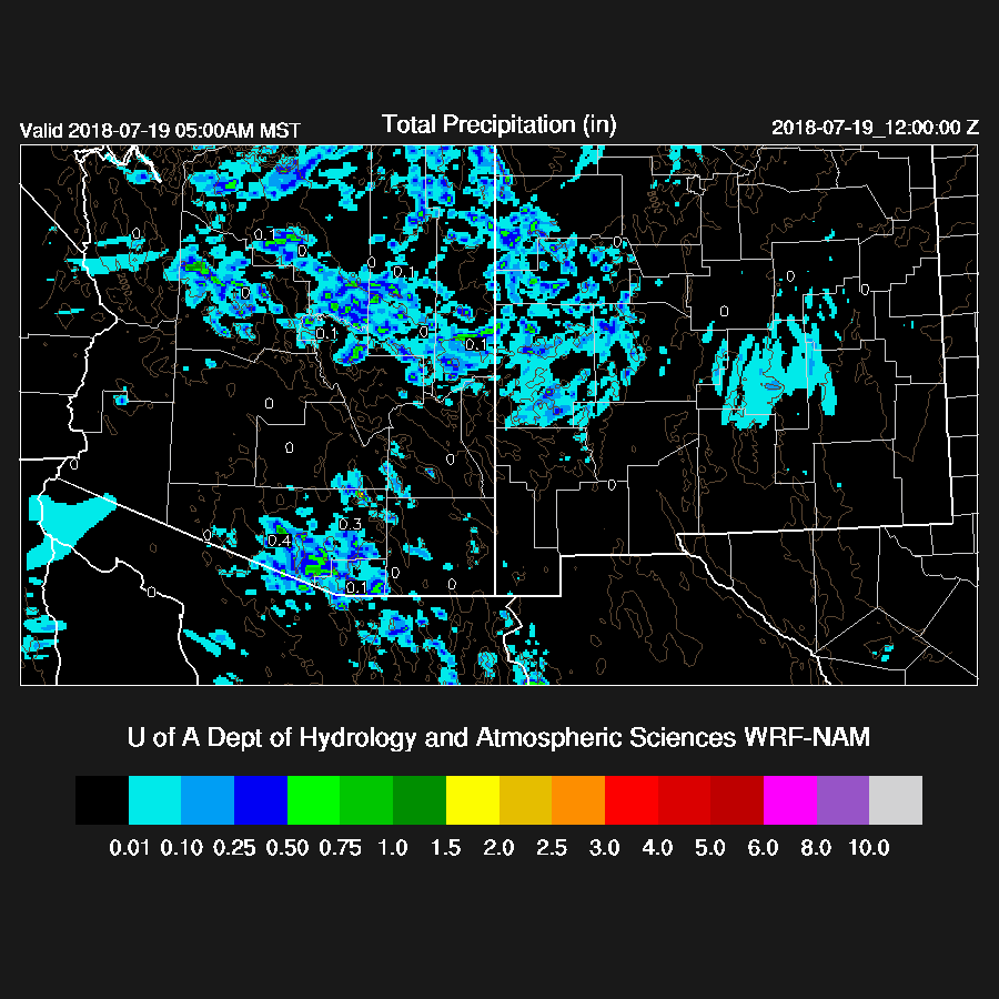
The WRFRR did not have enough precipitation over northern Arizona while both the WRFNAM and WRGFS were more accurate but neither were able to forecast some of the extreme amounts that fell.
Bob Maddox has a nice summary of yesterday here
Initializations
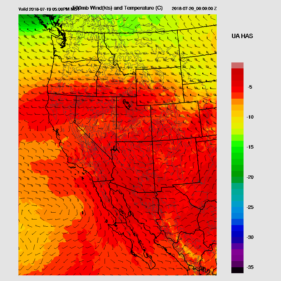
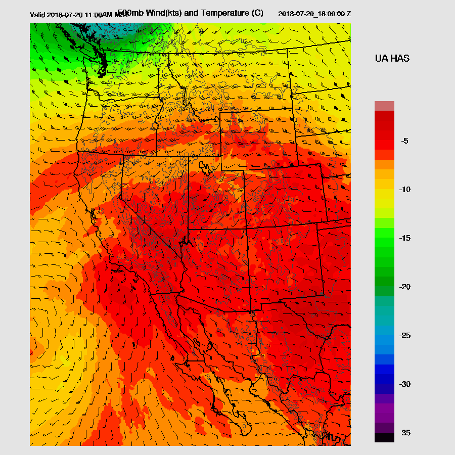
The upper air pattern remains the same as a ridge continues across the southwest with warm air from around -4 to -5C at 500mb. No cyclonic features were seen either at 500 or 250mb. Satellite imagery has a weak IT just off the coast of northern Baja moving north.
Most of the southwest CONUS and all of northern Mexico were cloud free which is quite unusual for what is normally a very active part of the monsoon season. The NAM and RR didn’t initialize the few clouds that were present in southern NM or Northern Arizona but it’s not a big error as they are thin and scattered.
The NAM had a 3-5mm bias at most stations and the RR had a 4-5mm wet bias over Arizona which is a little surprising as it’s had good initializations lately. The 6Z GFS also was too wet by 5-12mm over NW Arizona but it was OK elsewhere. These errors decrease the confidence somewhat in what was a nearly error-free initialization.
Day 1
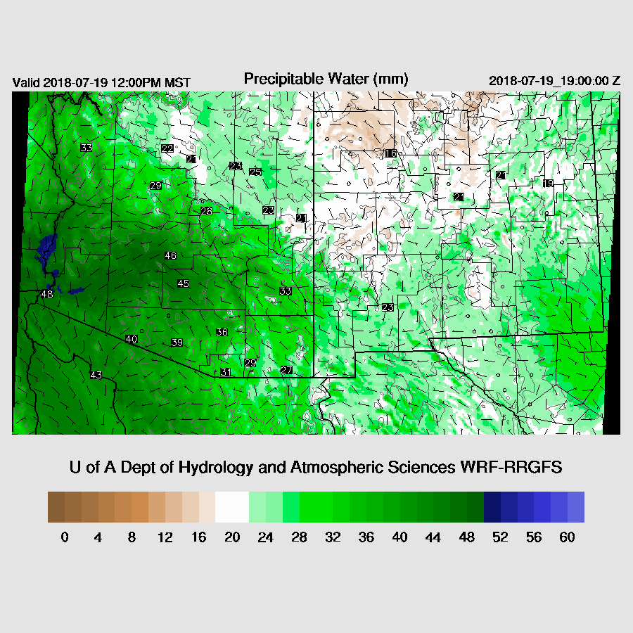
Another ridiculously wet morning across Arizona as lower elevation dew-points are around 70F, including Tucson, which is highly unusual. The morning surface station map shows a surge continuing over the southern ½ of the state with the moisture pushing as far east as Deming NM. PW is in the 40-48mm range over the lower deserts but drying was noted in NW Mexico over the past 36 hours which may eventually dry us out somewhat. The weak Gulf Surge continues into the early afternoon and PW remains steady over Arizona. The surge is providing a good low-level inflow to storms that may form and move to the west but is also advecting somewhat cooler low-level air to offset heating. I hate to use the phrase 'cold air advection” here in the summer.
Mid-level flow is mainly ESE so quite favorable for steering storms into the lower elevations, especially in SE Arizona. However, temperatures are very warm with around -5 to -4. Jeff Beamish pointed out that Tucson’s 500mb at 0Z was -2!
Both the 12Z soundings from Phoenix and Tucson are strongly capped again but extreme CAPE is present. I don’t see much change from yesterday so deep convection is unlikely for the lower elevations but it’s a different story for mid and high elevations.
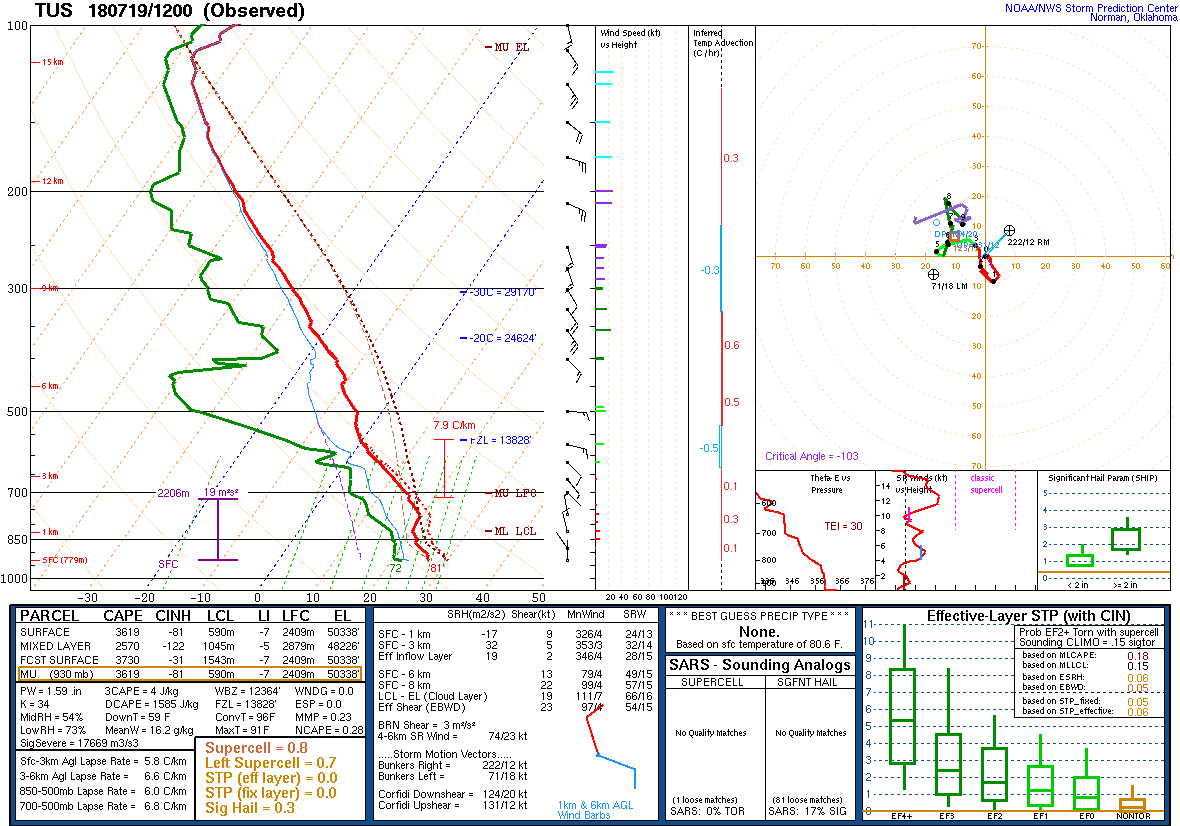
Speaking of CAPE, by noon, extreme values are over south-central Arizona and moderate to very high over far SE AZ thus storms are likely to initiate over the high terrain and move to the WNW so at least that is better than yesterday for SE Arizona.

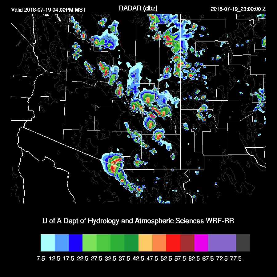
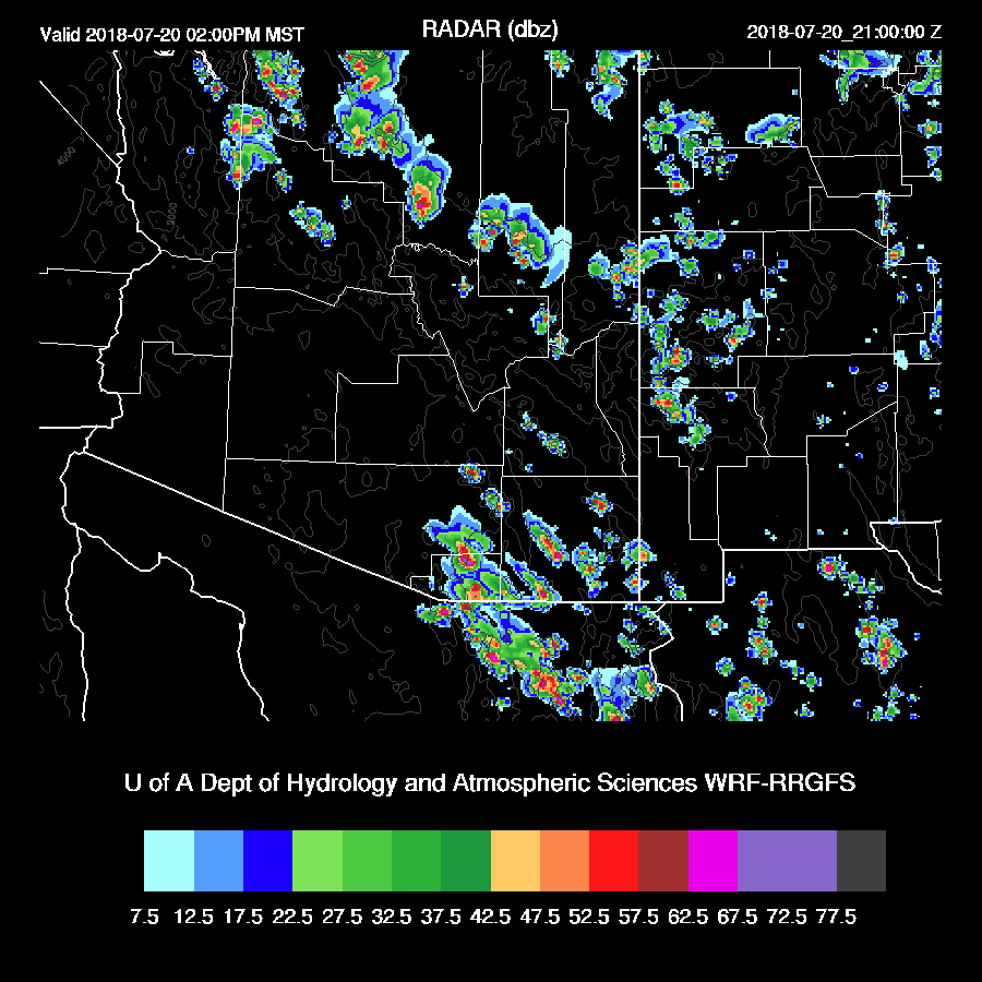
Deep convection is underway over the highest terrain of a large part of SE Arizona by early afternoon.

It looks like storms are having trouble breaking the cap except over the higher elevations as they struggle to get into the lower elevations of even Cochise/Graham Counties. Both the WRFRR and WRFNAM are similar as are the 6Z runs.

Tucson is so close as the PBL is mixed deeply by late afternoon. Below is the WRFRR which has 46mm of PW and likely too wet though. The low-level shear is excellent and steering is also excellent. Also good is that the upper winds are blowing about 90 degrees from the steering thus keeping anvils from shading.

Both the WRFNAM and RR move storms towards the Tucson area by late afternoon.
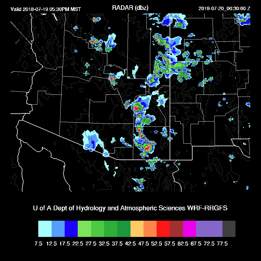
In spite of the WRFRR being a bit wetter, storms die right as they move off of the mountains to the east of Tucson but the WRFNAM does manage to put a big one over the valley this evening.

So I’d say the odds for Tucson proper are about 50-50. Storms that do make it in are going to be strong to severe with very strong/severe localized wet microburst winds along with very heavy rain. The WRLFA has very high lightning flash rates with the SE AZ storms. Even if they don’t make it into the Tucson valley, they are going to be close to places like Vail and Benson are likely to see big storms.

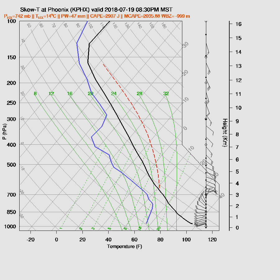
Both runs dissipate storms as they move through eastern Pima as they apparently run into a more capped/not as well mixed atmosphere as seen in the evening forecast Skew-T for Phoenix below.
Big storms do make a run for the Phoenix valley and get pretty close before dying out.
Day 2
The high center waffles back to the east and is located over northern NM keeping Arizona under good SE steering. Mid-level temperatures look like they cool slightly so maybe a bit more favorable for deep convection, especially for SE Arizona.
Moisture decreases somewhat due to the drying noted in NW Mexico today. Weak flow up the Gulf of California keeps low-level flow mainly westerly over eastern Arizona so low-level shear should again be good.

In spite of a little decrease in moisture, CAPE remains extremely high over SE Arizona.

Storms again develop over mainly the high terrain of SE Arizona and along the Rim with some very strong storms once again.
Once again, a cap is preventing deep convection for lower elevations. The Tucson PBL is mixed deeply by late afternoon but is going to need an outflow to trigger deep convection.

Depending on what run I look at, some have storms in Tucson and some do not so the situation is much like today.

However, all of the runs keep Cochise county active well into the night. Storms again move toward the Phoenix area but don’t make it into the valley.

Storms look especially unfavorable for Phoenix as a capping inversion continues.

No comments:
Post a Comment
Note: Only a member of this blog may post a comment.