Previous Day
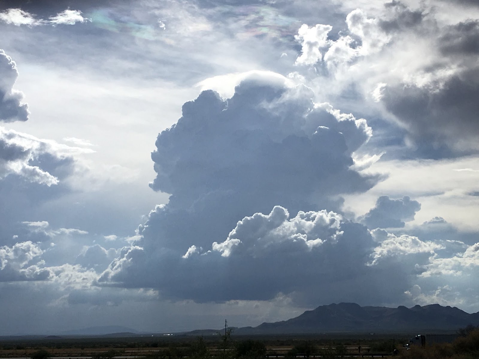
Big storms again struck northern Arizona with another big precipitation event in the Flagstaff area. Strong storms also developed over southeastern Arizona and south of Nogales. This large complex sent out a massive cirrus shield and outflow over the lower deserts from Tucson and to the west which killed any chances of storms. Big storms to the east were responsible for one of the best sunsets that I’ve ever seen.

I was driving back from Paradise, AZ during the afternoon so got to see the Cochise County action first hand. This was a severe warned storm just south of Mt Graham.

This was a rapidly developing storm with a Pileus cloud, north of Benson.

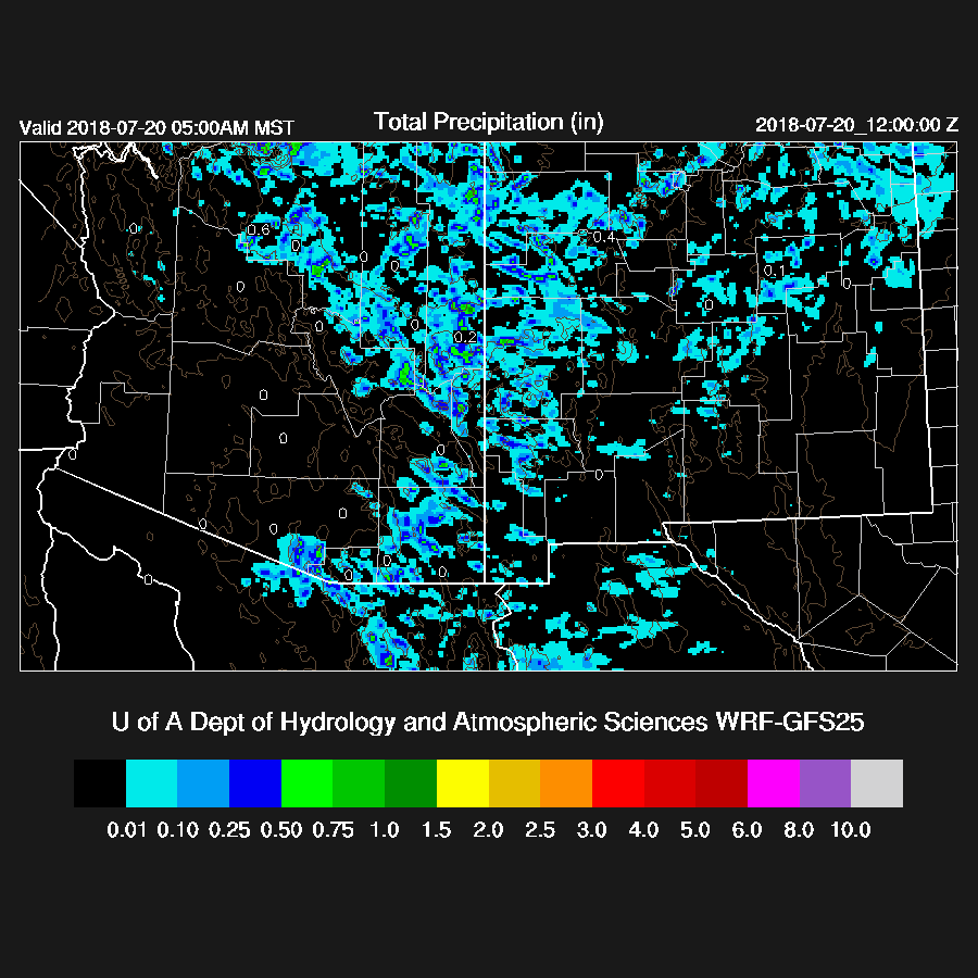
The low bias for precipitation over NW Arizona continues with all three of the runs. The best was the WRFGFS which still didn’t have enough.
I’ve been making a few test runs using a 50 layer configuration and the 15Z RR and this one did a lot better but had a high bias in SE Arizona! I’ll probably run this configuration daily to see how it performs.
Initializations
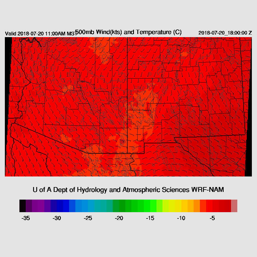
The 500mb high center is located over far NE NM thus placing Arizona in a moderate southeasterly to southerly flow. 500mb Temperatures are still very warm and are from -4 to -6C. No obvious inverted troughs were present on either the 500 or 300mb maps except for a weak trough moving into southern Utah. Satellite imagery does have an area of deep convection and clouds over eastern Sonora this morning so there must be something there. Water vapor imagery does show a slight amount of cyclonic rotation in that area. You have to look hard to see it! The NAM had a bit of an IT over northern Chihuahua while the RR has nothing obvious.
The state is mostly clear except for clouds along the southern NM/AZ border which are associated with the phantom IT. Both the RR and NAM had these clouds initialized well. In the outer domain, they both initialized the ongoing deep convection OK also.
The RR PW initialization had minimal errors except over western Arizona where it initialized too wet. The NAM finally looks a bit better with only some areas that were too wet and no errors larger than ~4mm. Overall, both initializations look good and model confidence is high.
Day 1
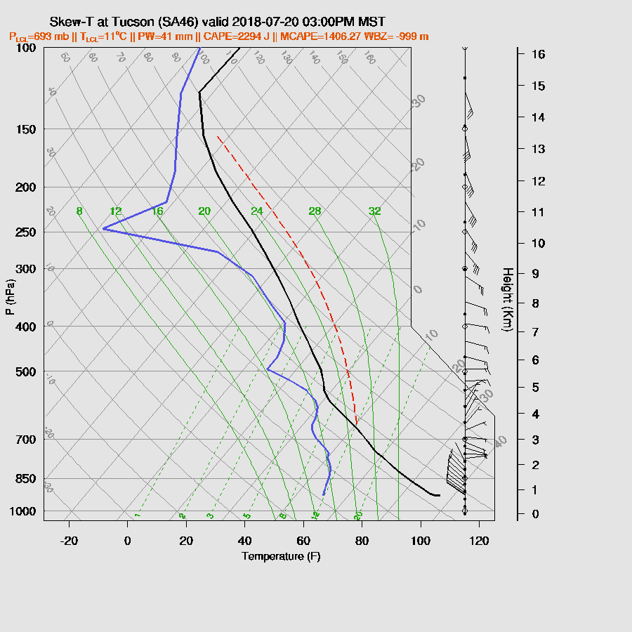
It’s another day of high CAPE and moisture along with a capping/subsidence inversion as seen at both Tucson and Phoenix. It continues very moist over most of the state with >40mm in the deserts. Surprisingly, all Suominet stations that I plot on the web page are now reporting which is a first for this summer. By the way, I am attempting to secure funding to keep Suominet running so if your organization is interested in helping out, email me. I’m looking for around $10k for them. Southerly winds from the GofC have weakened with only light southerly flow turning to westerly over central and southeastern Arizona. PW continues to remain fairly high over all of the state with heavy rain likely with storms. Dry air is again lurking in NM and could come back into Arizona at some point.

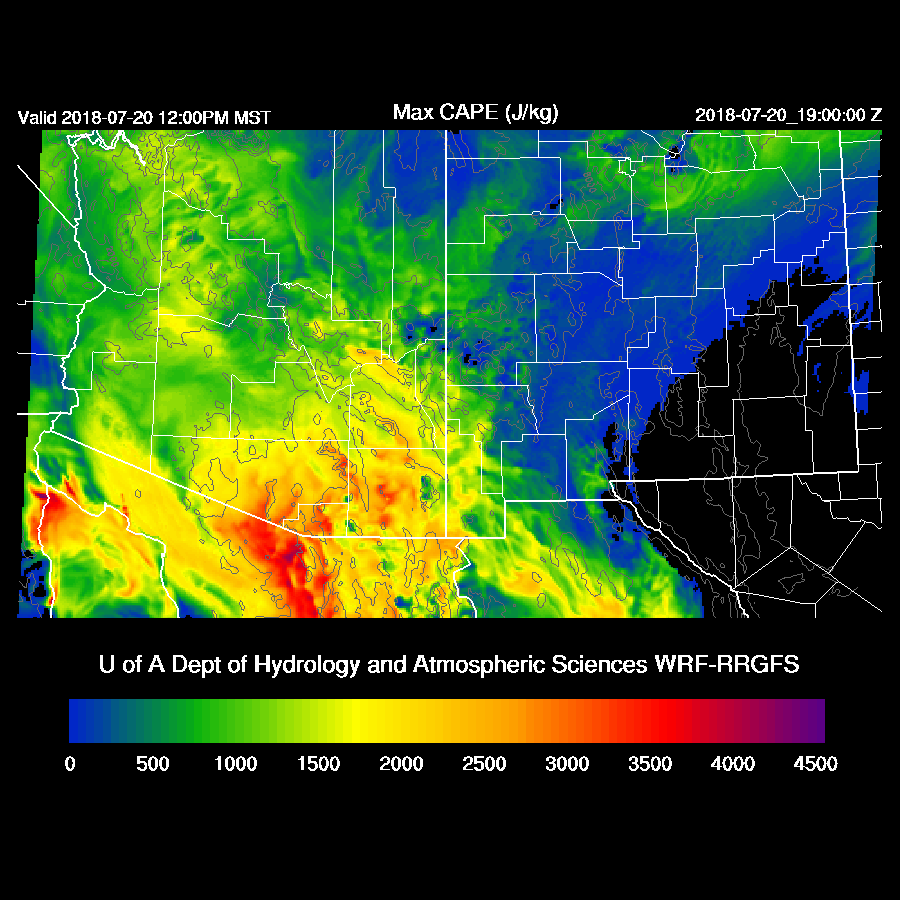
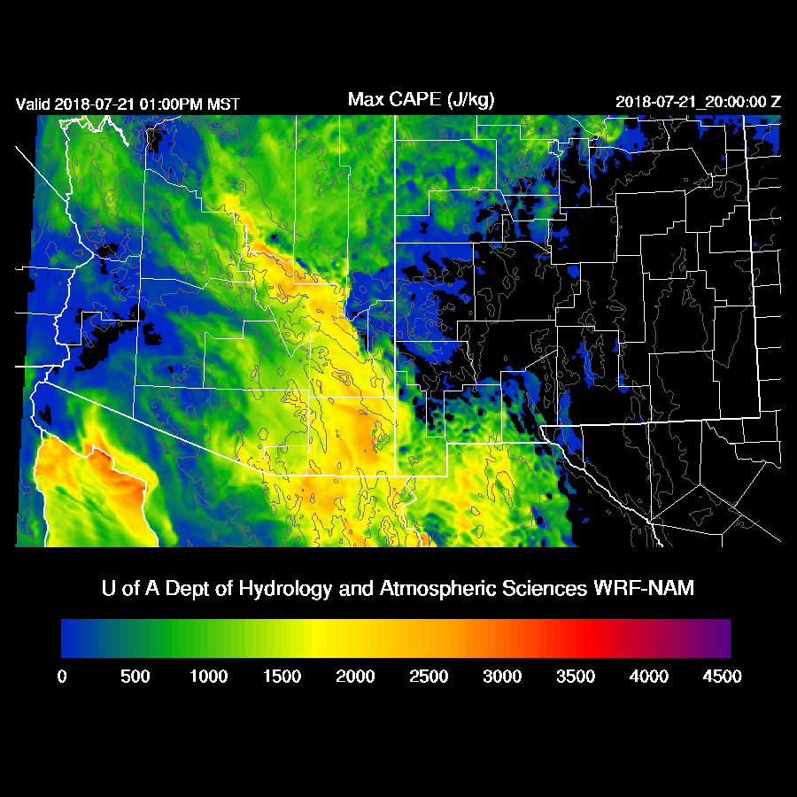
CAPE is again high to extremely high over much of the state. SE Arizona is especially unstable again and it’s likely big storms will develop over the higher terrain there.
Both the WRFRR and WRFNAM do have a weak IT moving westward over far northern Chihuahua during the day. Elsewhere, steering flow is mostly light from the SE at 5 to 10 knots so not that great for moving storms but it will increase the flash flood risk.
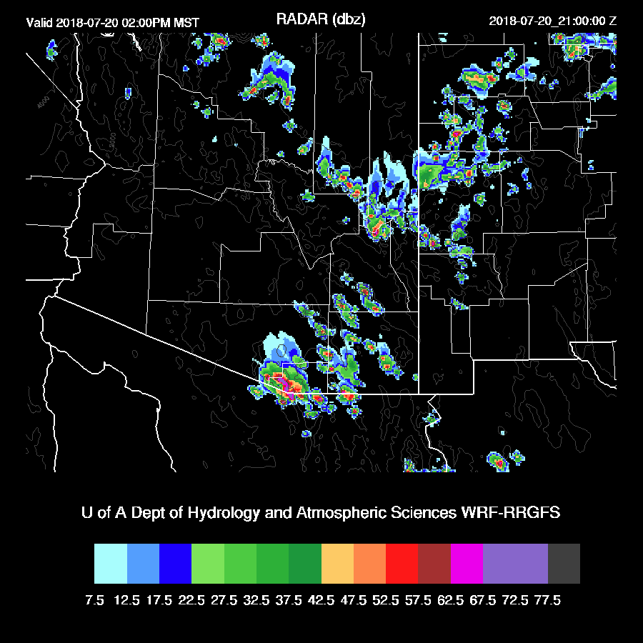
Deep convection initiates quickly and by 2-3pm, strong to severe storms are over SE Arizona. Like yesterday, the models are predicting a complex of strong to severe storms over Santa Cruz County. (go get ‘em Lori!)
It’s about the same story in Tucson too as the PBL doesn’t mix deep enough to trigger deep convection unless a strong outflow move into the valley or there is some other lifting mechanism in play (IT later maybe?)
The details between the runs are somewhat different but the general message is most storms stay over the higher elevations of SE Arizona. Anvil shading and outflows will probably kill any chances in Tucson this afternoon.

Maybe there is a trough over far SE Arizona, maybe there isn’t. There does seem to be slightly cooler air over southern AZ and into NM though. It would have been a big help if there was some upper air data from northern Mexico today and the latest news for Empalme is now Aug 5 for resumption.
Now it gets more interesting for the Tucson area, especially if the earlier activity does not stabilize the PBL like what happened yesterday. Both runs develop evening activity over parts of SE Arizona and into Mexico. The WRFRR is especially active as it didn’t have that much activity over Cochise and eastern Pima this afternoon to modify the airmass. By late evening, some strong to perhaps severe storms are scattered across SE Arizona.

Almost forgot, what about Phoenix? CAPE is moderate to high as well as a fairly deeply mixed PBL during the evening. It’s possible that a storm or two could develop over the valley but most activity is expected to stay over higher terrain.

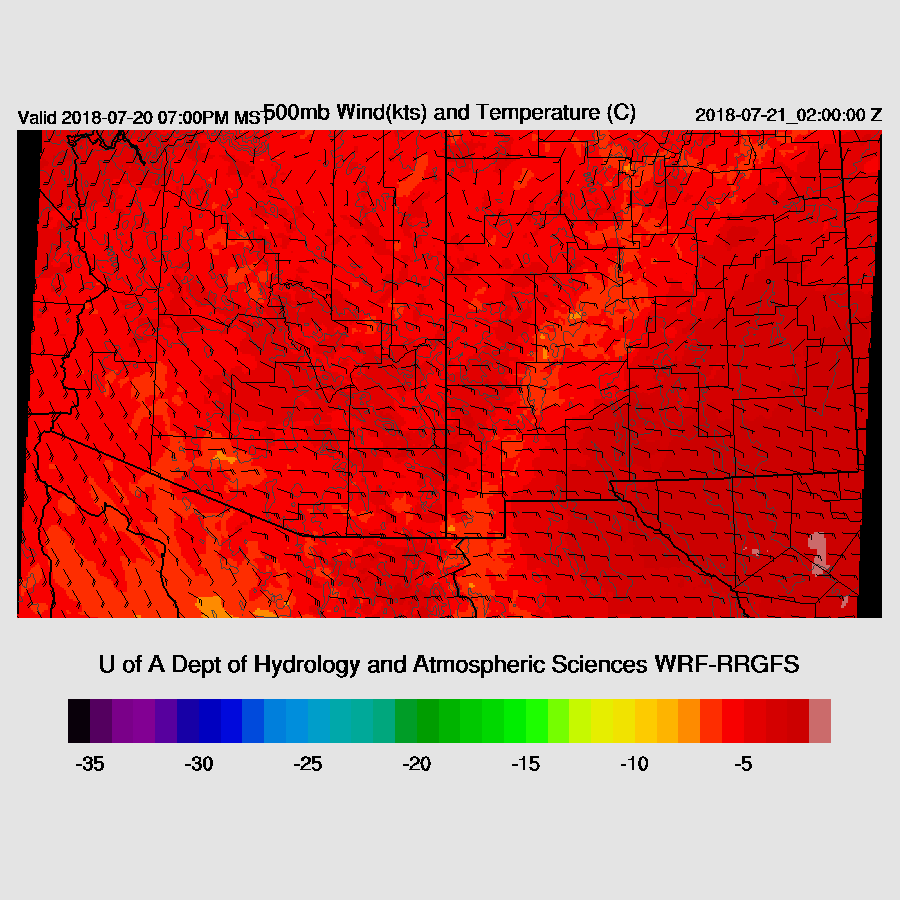
It continues to be interesting overnight as now a well defined IT/MCV move to the NW towards Phoenix.

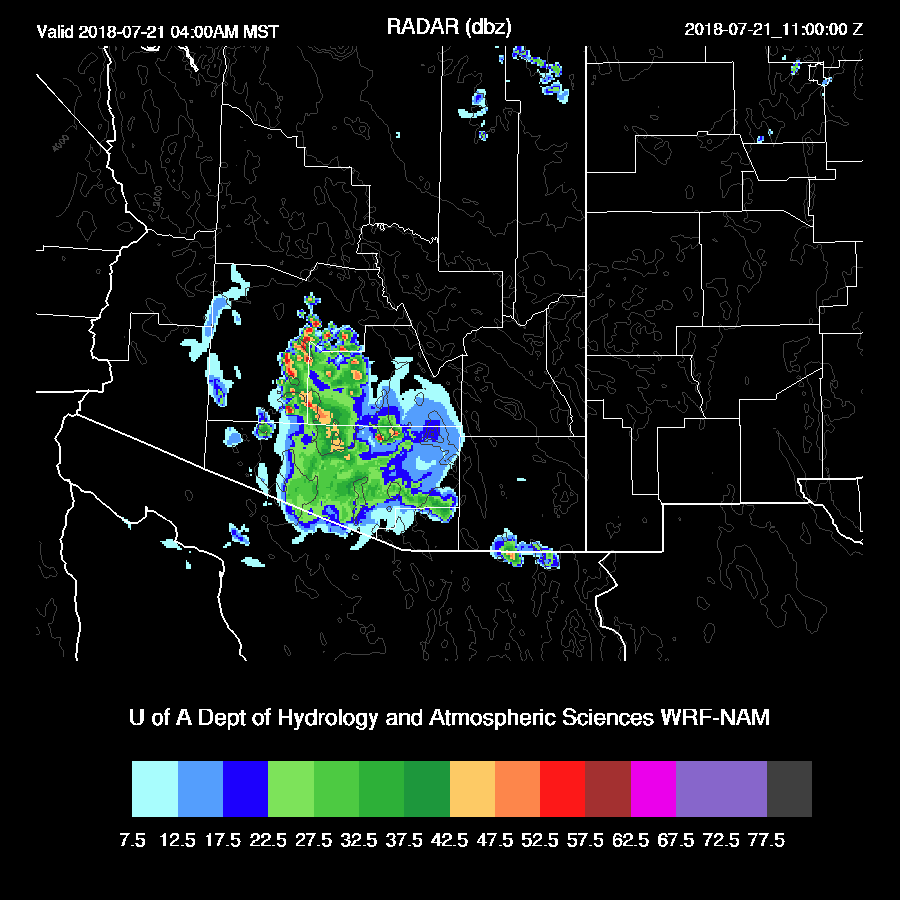
Widespread showers and some thunderstorms move into the Phoenix area during the early morning hours in both the WRFRR and WRFNAM. It’s going to be potentially a long night for chasers.
Day 2
If all the activity today through tomorrow morning pans out, it’s likely to be a down day tomorrow especially as mid-level temperatures warm slightly. Note the -2C in NM.

Hello dry air from New Mexico, goodbye monsoon in much of eastern Arizona.

CAPE is still quite high over SE Arizona and parts of the Rim towards Flagstaff so some storms are possible there.
And that is about where WRF forecasts storms. Otherwise, most other areas have no activity.

Oh, this looks like fun next week.
No comments:
Post a Comment
Note: Only a member of this blog may post a comment.