Previous Forecast
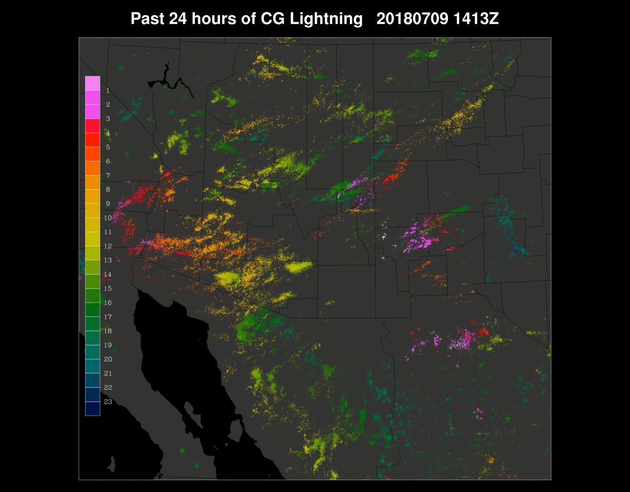
It was quite active over much of the state except for SE Arizona where downslope easterlies again ruled. My drive from Paradise, AZ to Tucson was interesting. Surface winds were blowing about 10-20 mph from the east, dew points around 50F and only a few cumuli. At about Vail, winds shifted to the west and the cumulus clouds changed to cumulus congestus. The 6Z model runs were completely wrong as there was no activity in the Phoenix area and only a little around Tucson. The 12Z runs were better but they forecast late night activity for Phoenix which never really materialized. However, just west, it was active for much of the night more in line with a 15Z WRFRRx that I ran later yesterday.
Out of the normal suite of runs, the 12Z WRFRR performed OK as it had precipitation more or less in the right locations. There wasn’t enough in SW Arizona or in Yavapai county though.
Initializations
The pattern continues to be dominated by the western CONUS ridge and it has expanded to stretch from coast to coast. A large area of generally cyclonic rotation is located under the ridge from Texas to Arizona. The New Mexico IT continues to inch towards Arizona and can be seen clearly over SW NM in the mid-level water vapor image, just north of Silver City. Visible imagery shows the circulation a bit farther to the south at lower levels of the atmosphere. 6Z runs have it too far south, just south of the NM bootheel. The 12Z RR also initializes the lower level circulation too far south but at higher levels, the location is accurate as seen in the 300mb plot below. This puts much over southern Arizona under divergence aloft. The 12Z RR also has the mid-level circulation south in Mexico so maybe I’m misjudging the mid level location. The upper-level location is accurate.

Clouds and a few showers were present over southwestern Arizona and far eastern Arizona into NM. The WRFRR initialized these areas well but has too much activity over NW Arizona. The 6Z WRFGFS has too much activity over east-central Arizona around 12Z. I’m not waiting for the 12Z WRFGFS today as I want to get the discussion out early. The 12Z NAM initialized clouds very well.
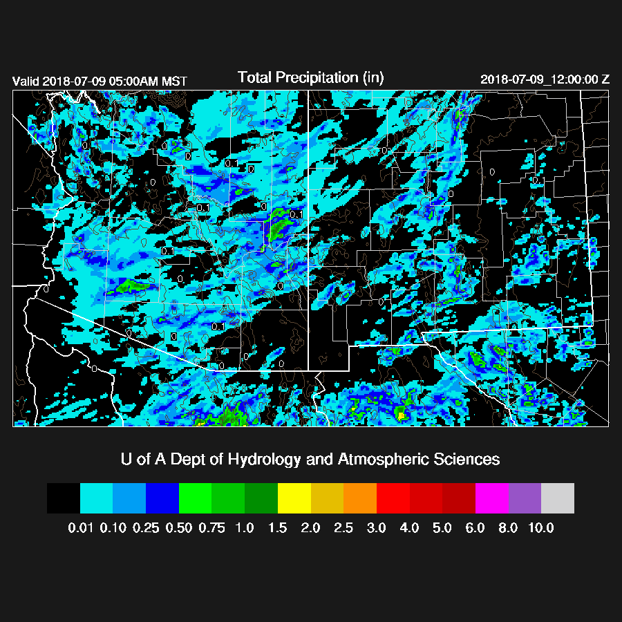
Suominet has really been sporadic lately with almost no Arizona stations reporting at 6Z. Elsewhere, GFS 6Z initialization errors were small. The 12Z RR was also pretty good but there was a large wet bias near Yuma. The 12Z NAM also had a large error in Mexico where it was too wet near Guaymas but will hopefully not impact Arizona too much today. Overall, the 12Z initializations look pretty good with perhaps the 12Z RR being the best.
Day 1
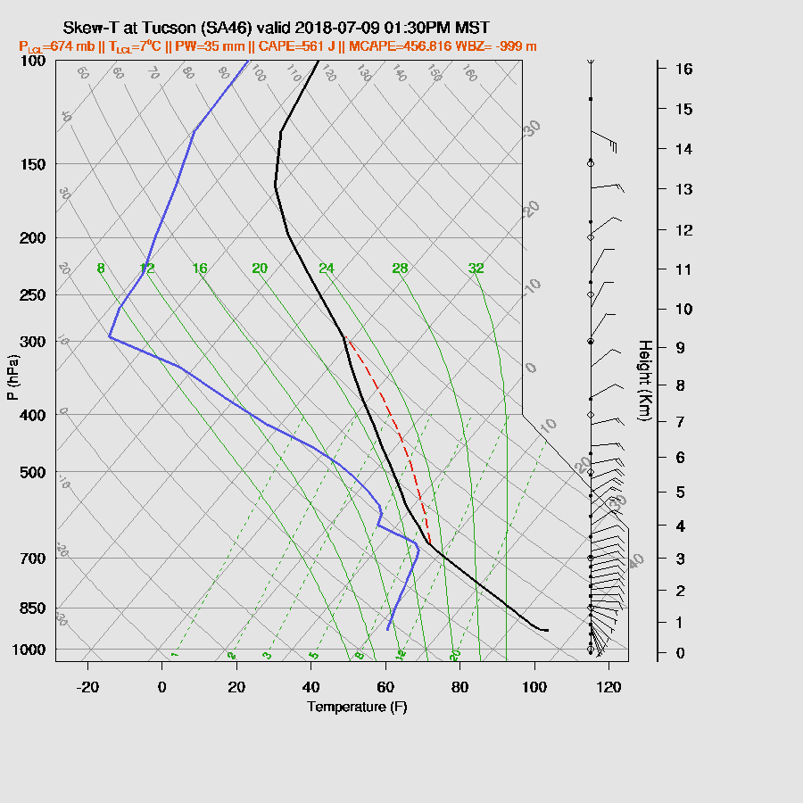
Morning PW is quite high over western Arizona with around 50mm at Yuma and 45mm near Phoenix. The 12Z Tucson sounding has 39mm along with the best CAPE so far this year, around 900 J/kg MLCAPE. The Phoenix soundings indicate a bit of low-level cooling has occurred thus some heating and lifting is going to be needed there. Phoenix surface based CAPE is a respectable 1000 J/kg and DCAPE is around 500 J/kg. Tucson DCAPE is much larger, 1400 J/kg thus very strong winds are possible with storms today. By mid-day, weak southerly flow continues to advect moisture into western and central Arizona and low-level easterly flow continues over SE Arizona with the boundary from far eastern Pima up towards Gila county.

Around midday, CAPE is forecast to be high from southern Arizona all the way up to around Flagstaff thus these areas are likely to see the strongest storms today.

The mid/upper low is over SE Arizona by mid-day with favorable NE steering flow across much of the state. 500mb temperatures are also quite cool with -7 to -9C. This is one of the best situations for a widespread outbreak of strong/severe storms that I’ve seen in some time.

Deep convection initiates early and by shortly after noon, strong storms are underway over the high country and far SE Arizona.

Storms move quickly to the WSW and by 2-3pm are moving into the Tucson area and threatening Phoenix.

I know it’s a little hard to believe, but it doesn’t look all that great for Tucson. CAPE is only around 500 J/kg and the wind profile has little or no low-level shear thus storms won’t have much organization and are likely to be scattered in nature. The PBL is nearly mixed to the LFC during early afternoon and is quite deep so some strong winds are likely from the scattered storms.
The situation in Phoenix is much different as there are low-level moist southwesterly winds providing good low-level shear along with good mid-level flow. CAPE is above 1000 J/kg but the mixed layer is fairly shallow and is going to take very strong outflows to lift it high enough for deep convection. The 12Z sounding says the LFC is just above 700mb.

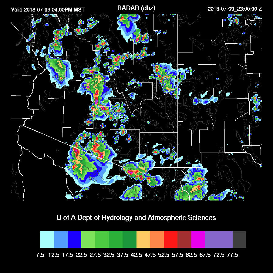
Strong to severe storms move into the Phoenix valley around 4pm while other severe storms continue/develop farther south in Pinal and central Pima counties. Reflectivities indicate that hail is likely with some of the storms with maybe even some large hail.
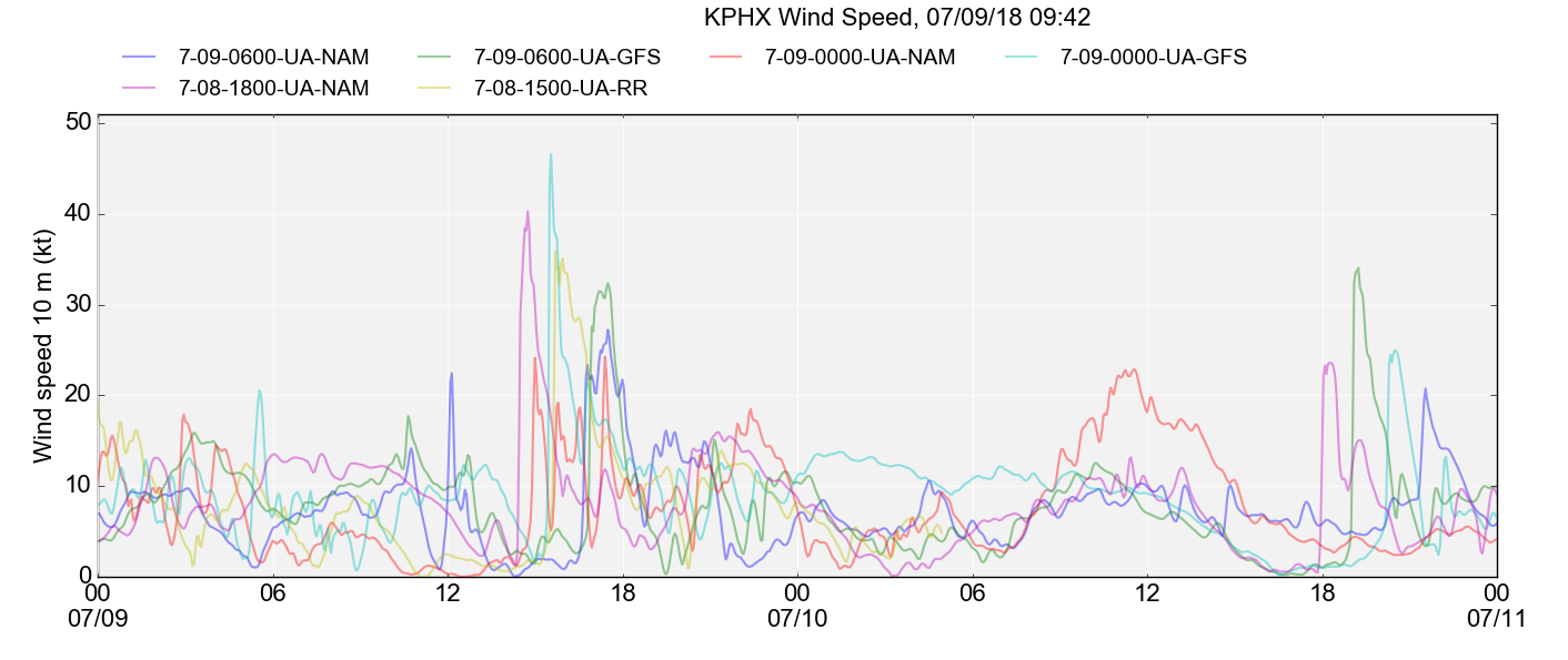
Winds are the main concern as both the WRFNAM and WRFGFS forecast very strong thunderstorm winds in the Phoenix area with isolated gusts above 80mph.

The worst case is the WRFNAM where 60-knot winds are predicted. Model winds are an instantaneous grid box averaged wind and similar to a 5-minute point average. With a gust factor of 50% added, there could be some gusts to over 100mph!

Below is a plot showing wind speeds from the various overnight model runs for KPHX supplied by Will Holmgren. It indicates that this a high confidence event with every model run exhibiting strong thunderstorm outflow winds for the late afternoon.
Very heavy rain is also expected from some of the storms with localized amounts exceeding 2 inches. The storms continue to move quickly to the WSW and by early evening, some very strong/severe storms continue from western Pima up to west of Flagstaff.
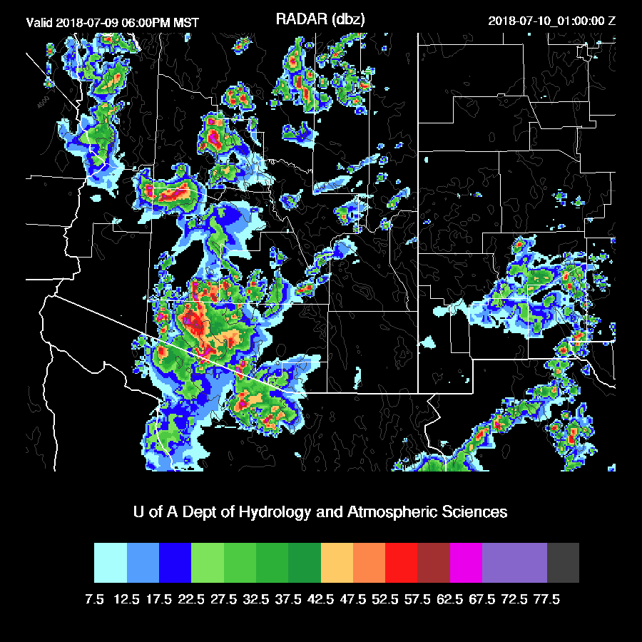
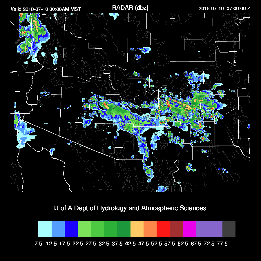
Both the WRFNAM and WRFRR are quite similar so far but the WRFRR (below) redevelops some storms in the Tucson area during the early evening hours.

Activity decreases later in the evening except over far eastern Arizona where a few storms may redevelop.
Day 2 will follow later this morning or early afternoon.
No comments:
Post a Comment
Note: Only a member of this blog may post a comment.