Day 2
The old rule of thumb is that the day after a big day is not very active because the lower atmosphere has been cooled and stabilized, debris clouds hold back heating, and more energy goes into latent heat. That looks to be true tomorrow. The mid/upper low and associated cool air aloft is located along the Colorado River valley by midday and flow over much of eastern Arizona is from the southeast. Thus, mid-level warming will also be a negative.

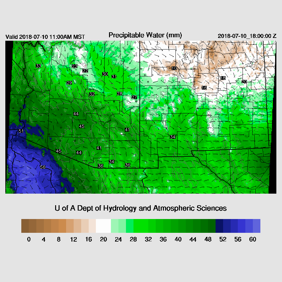
Plenty of moisture continues in place over the region with light easterly flow again over SE Arizona.
In spite of the warming of the mid-levels, CAPE is still quite high over parts of the state, especially the far SE and into SW NM so maybe it is finally their turn.

In general, scattered storms are present over the higher terrain of SE Arizona and far NW Arizona during the afternoon and into the early evening. Storms over far NW Arizona are likely to be strong due to the presence of the IT.

No comments:
Post a Comment
Note: Only a member of this blog may post a comment.