Previous Forecast
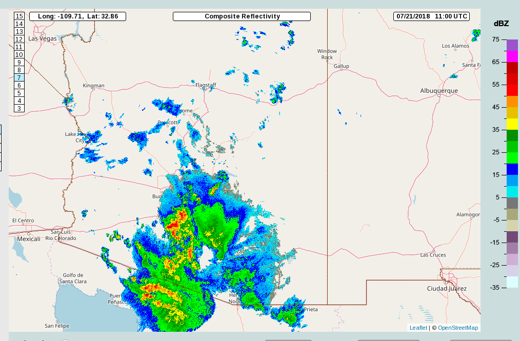
Back on the 20th and the early morning of the 21st, an MCS formed over far northern Sonora and moved across much of south central Arizona into western Arizona. Both the 12Z WRFNAM and RR did an excellent job forecasting this event.

Initializations
I debated doing a discussion today as the various models are waffling on lower elevation activity. I decided to mainly to stay in practice and to mention that Tucson had 6000m heights at 500mb yesterday! The morning sounding is at 5990 but mid-level temperatures are around -6 to -7C which is fairly cool for 6000m heights. Needless to say, the anticyclone center is parked over SE Arizona while a full latitude trough is over the eastern CONUS. As is typical, there is no data in all of northern Mexico but the 300mb analysis has a weak IT located over Sonora. There is nothing obvious in the satellite imagery in that area. There is a weak IT/MCV moving over the NM Bootheel with some associated clouds and a few showers. Both the NAM and RR have a weak trough initialized but it looks like it’s moving due south and won’t be a factor for Arizona.
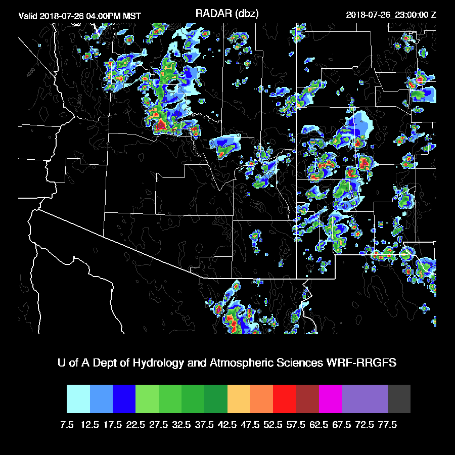
There is an area of dissipating clouds and showers to the east of Phoenix which was initialized well by the RR. However, the RR was missing the far SE AZ and SW NM clouds while he NAM was missing both.
RR PW initialization was excellent with only minimal errors. The NAM again had a wet bias at most sites with some very large errors in NW Mexico. Neither initialization is all that great so I took a quick look at the 6Z WRFGFS is it looks pretty good so it may be more accurate for today.
Day 1
There has been a gradual increase of moisture across the state over the past 24 hours with PW now around 35mm for most of southern Arizona. This continues to be the case into the early afternoon as weak flow from the Gulf of California continues the moist air advection. Much of New Mexico is also quite wet so even if low-level easterlies start up over SE AZ, there won’t be much drying. 
CAPE is low to moderate over far southern Arizona and over the Rim, at least in the 12z WRFRR. The recent model runs have quite a different CAPE forecast for today and the 6Z WRFGFS has quite a bit more in these two geographic areas. I can’t really say which is correct as they all have similar PW forecasts thus I’ll go for the middle of the road, which is the WRFNAM.

Steering flow is bad except for SE Arizona where some storms could be steered into the lower elevations due to mainly northerly flow. As noted earlier, mid-level temperatures are fairly cool at around -7C.

During the afternoon, storms develop over the high terrain of the Mogollon Rim and the White Mountains and over the higher terrain of SE Arizona.

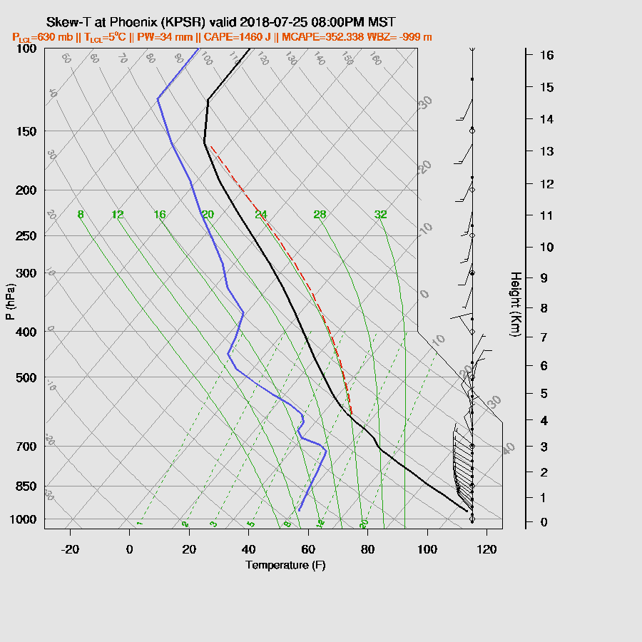
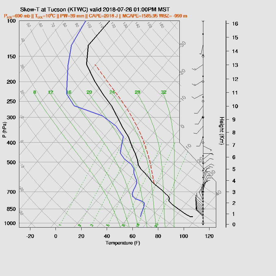
I don’t know what to think about the forecast Skew-T for Tucson. On one hand, the PBL seems to be mixed very deeply with a pronounced strong/severe wind inverted V profile and moderate CAPE. On the other hand, winds are strange with a deep NW flow and what appears to be slight low-level cooling and increased moisture which could keep deep convection in check.

The WRFRR has little or no activity for the Tucson area but the other two runs have some scattered storms in and around Tucson. The WRFNAM is again the middle of the road.

While Phoenix has a decent amount of CAPE, there is an inversion at the top of the PBL preventing any deep convection without the assistance of a strong outflow.
While there are some strong outflow boundaries produced today, they are mainly limited to SE Arizona and into SW NM. It looks like another big dust storm is in store for the Lordsberg playa.
Activity continues along the border into the late night hours with perhaps an MCS forming in far northern Sonora. This may push a large outflow boundary towards the GofC for another push of moisture into AZ overnight.

The 12Z WRFGFS is out far enough to say that it keeps most of the strong storms over the higher terrain of SE Arizona and mainly out of Tucson.

Day 2
This outflow forced surge does happen in the WRFNAM and WRFGFS resulting in an increase in moisture.

However, our old nemesis is back, the strong inversion at the top of the PBL. Steering flow is a bit better as the flow is northeasterly at 5 to 15 knots as the anticyclone center moves to western Arizona.
CAPE is up over much of the state but the lower elevations will be strongly capped.

THE WRFRR has less moisture and less of an inversion thus a bit more activity but even it keeps almost all storms over the higher elevations.
About the only “relief” are slightly lower temperatures for the lower deserts but higher dew-points.

No comments:
Post a Comment
Note: Only a member of this blog may post a comment.