Previous Forecast
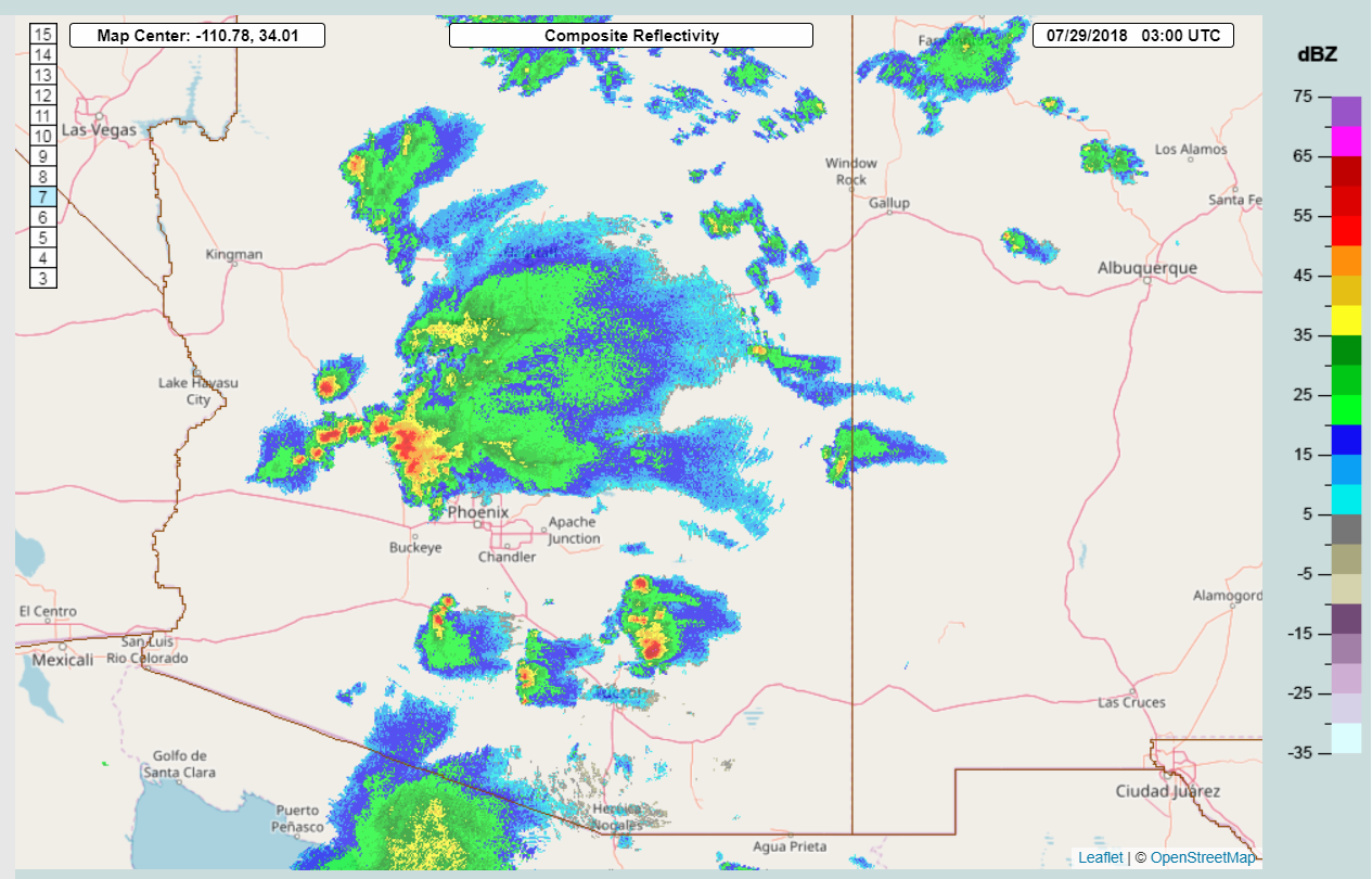
The model runs struggled yesterday as most of them had storms developing in the Phoenix valley but no storms materialized. It was close, as the 0Z Phoenix sounding was mixed deeply and it appeared that any outflow boundary would trigger convection. Areas just to the north and west of Tucson had a lot of activity.
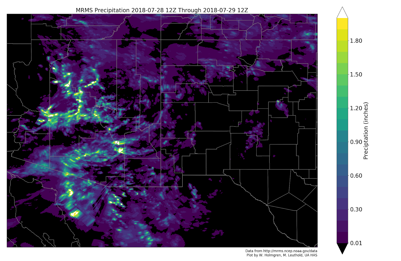
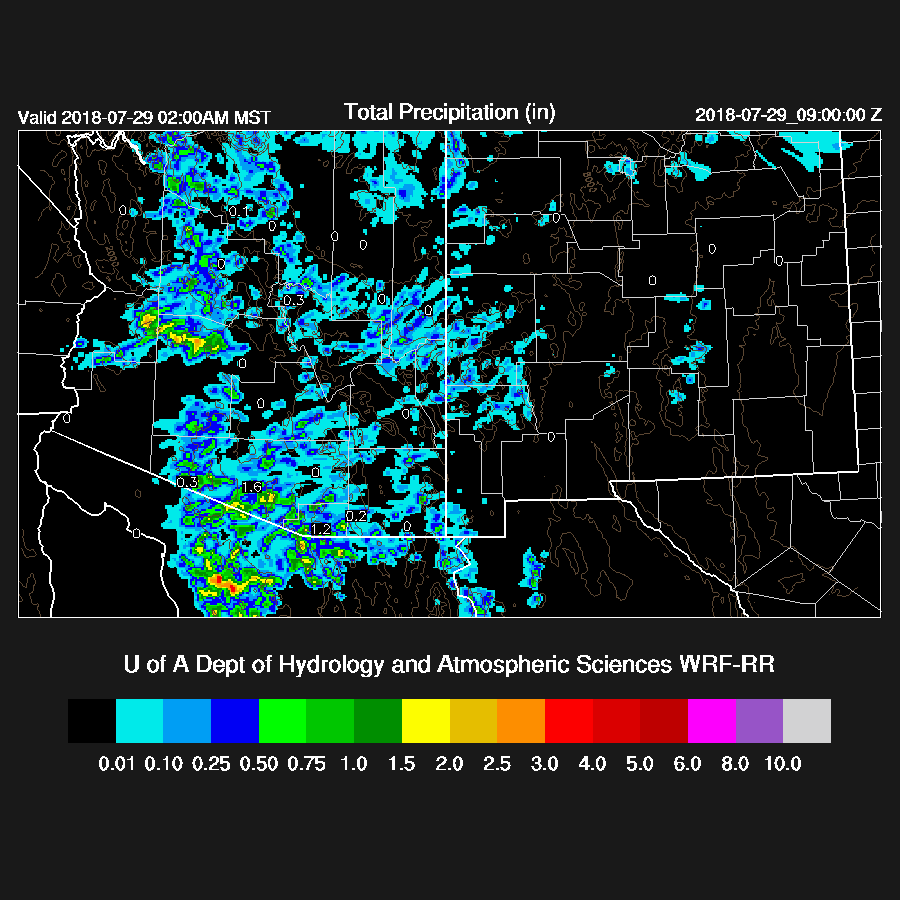
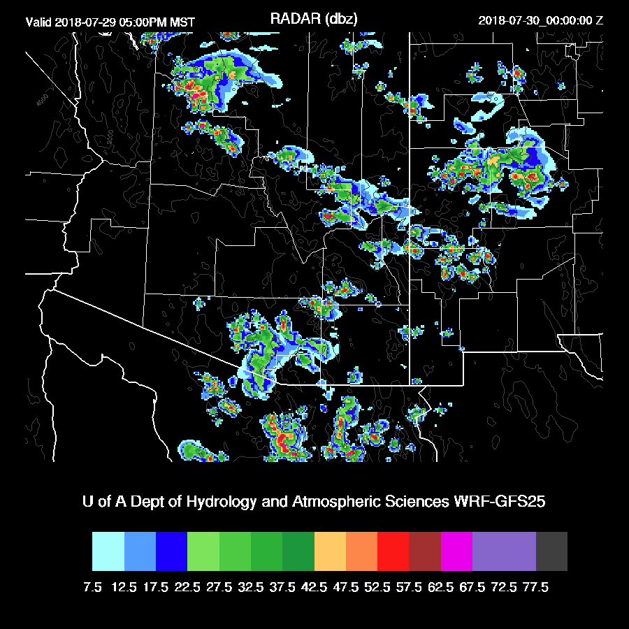
The best run was the 15Z WRFRR which turned out to be very accurate. It kept storms out of the Phoenix area and was able to forecast the early morning activity across central Arizona.
Of interest was the comparison to the 15Z HRRR which uses mostly the same RR initialization. It moved a huge squall line through Phoenix.

The WRFRR kept storms to the north and west of Phoenix but a little too intense. It was also able to correctly forecast the scattered deep convection NW of Tucson.

Initializations
The center of the 500mb anticyclone has moved north into Nevada in response to a digging trough over the midwest. A broad inverted trough is located over SW Arizona and into NW Mexico and is responsible for the early morning activity and widespread clouds across much of Arizona. Visible imagery indicates an MCV over far SW Arizona which was not resolved in the upper air data. Both the RR and NAM initialized the IT okay and the RR even had a bit of a closed circulation at 600 in SW Arizona.

High and mid clouds cover much of southern Arizona along with some continuing showers in the vicinity of the MCV. The RR was able to initialize both the clouds and showers well but the NAM didn’t have enough of either. The NAM also had a 4-6mm wet bias over much of eastern Arizona while the RR initialized well. A quick look at the 6Z WRFGFS shows that it also forecast the morning clouds and showers well but did have some moderate to large PW errors over central Arizona. The WRFRR has initialized well and will be the model of choice.
Day 1
PW is very high across southern Arizona (43-50mm) in the wake of the overnight activity. It continues this way during the day with maybe even an increase over western Arizona. Moist air has pushed eastward into SW NM so maybe far SE Arizona will have some decent rains today/tonight.
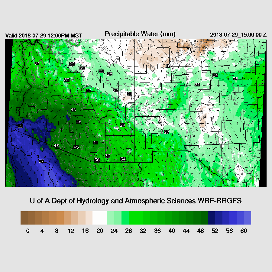
There is an impressive area of 50mm+ PW all the way down the Gulf of California and even very wet air well out into the Pacific.
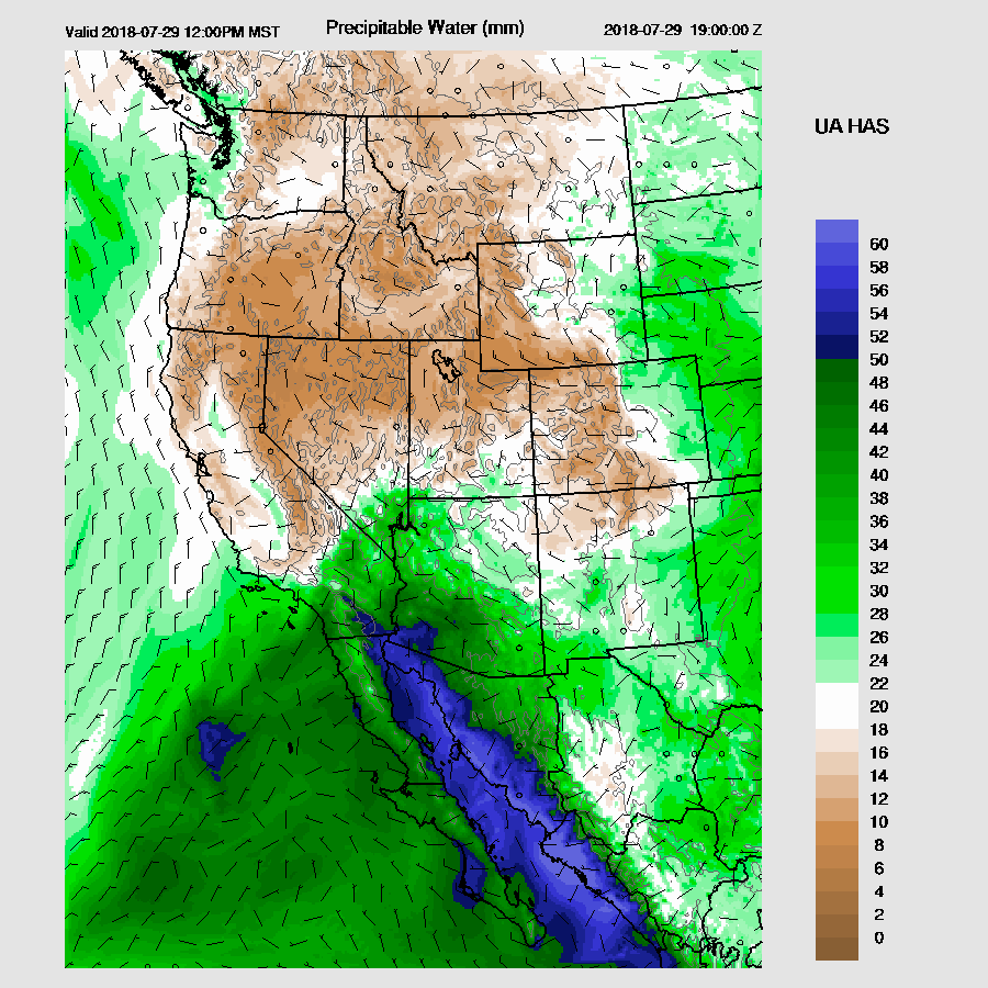
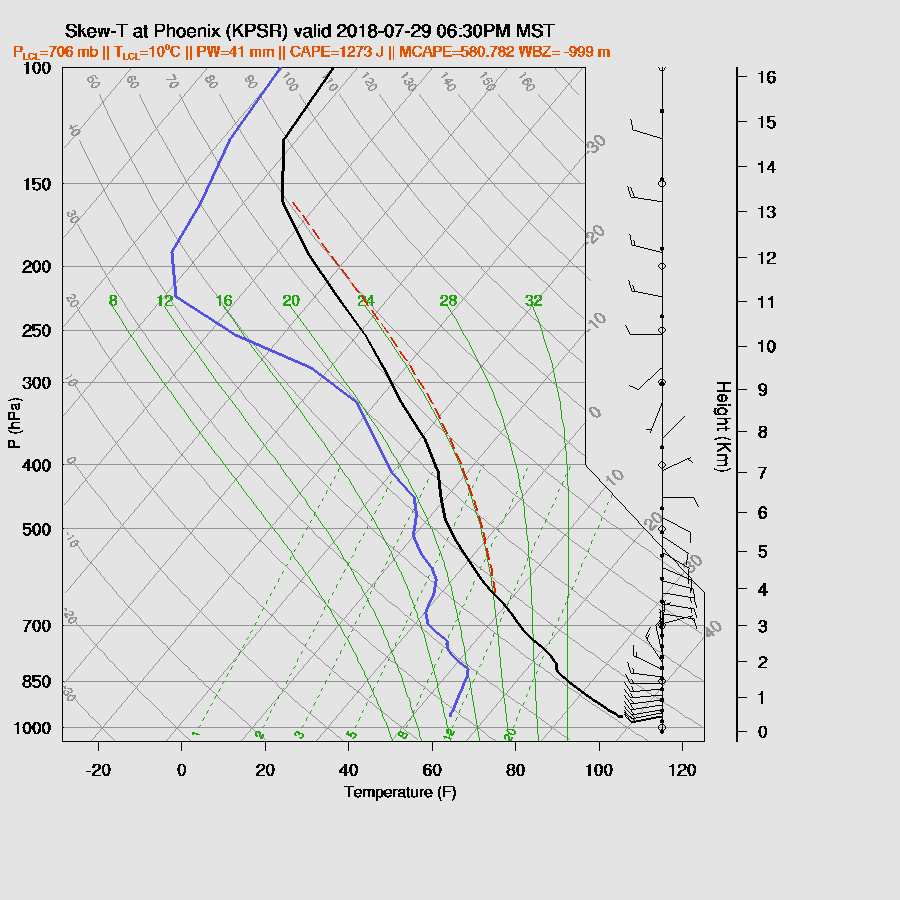
CAPE is very high over SE Arizona and NW Arizona thus those areas are likely to be the most active if it gets warm enough but CAPE is also quite high over the lower deserts. The Tucson 12Z sounding had quite a bit of MLCAPE, around 1100 J/kg, and wasn’t that worked over, so just going by that SE Arizona should be quite active today.

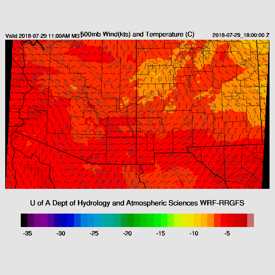
The WRFRR closes off the far SW AZ IT and moves it to around Yuma while another weak IT is over SE Arizona. 500mb temperatures are around -7 C to a warm -4 C.
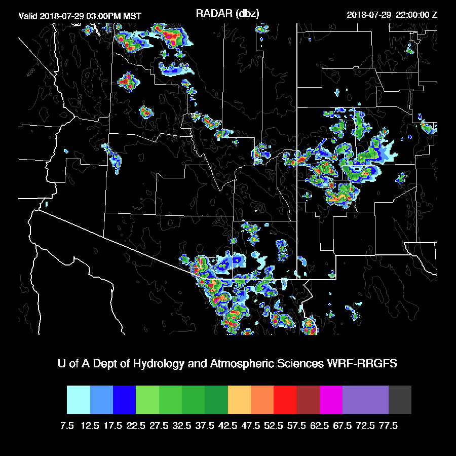
Storms take their time getting going today and by mid-afternoon, there are a few scattered about over the high terrain and far southern Arizona.
By early evening, Tucson is mixed deeply and near the LFC. PW is very high at around 44mm and CAPE is around 1000-1400 J/kg so storms that form will produce very heavy rain. The vertical wind profile couldn't be much better: good low-level shear, 15-knot mid-level steering, and light westerly aloft to push anvils away from the storm movement.
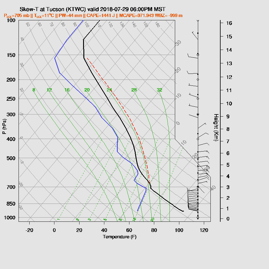
The 6z WRFGFS is also fairly quiet as only a few storms are active over the higher terrain around the Tucson area late this afternoon. This is a head scratcher as the Tucson vertical profile looks so good. I guess the model’s inversion at the top of the PBL is too strong to overcome at lower elevations as the very wet and slightly cooler air moves in from the west.
It’s quite obvious this is the case at Phoenix as the PBL is not mixed very deeply plus there is a pronounced cap just above 850mb. Other than that, it looks great!
This evening, the WRFRR develops some storms over SE Arizona and moves them toward Tucson area but they die out before arriving. Perhaps the outflows will be enough to kick off some activity?
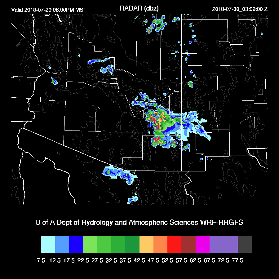
For what it’s worth, the 6z WRFGFS does develop a few storms to the east of Phoenix this evening. So, again, there is quite a bit of spread and no model consensus thus confidence is low.

Day 2
I’m reminded of this song when I’ve started to write this section the past few days. Just replace “sun” with “storms”. Day 2 forecasts have been too active as I think they are not handling the low-level cooling in the 24+ hour time frame but that is just a guess. Maybe upper air data from Mexico would help this situation?
Moisture remains very high over southern Arizona while dry air has moved into much of northeastern part of the state.

Once again, CAPE is moderate to very high over much of the southern ½ of the state. A very pronounced boundary exists between the two air-masses and sometimes these can act as convergence zones and help trigger deep convection.

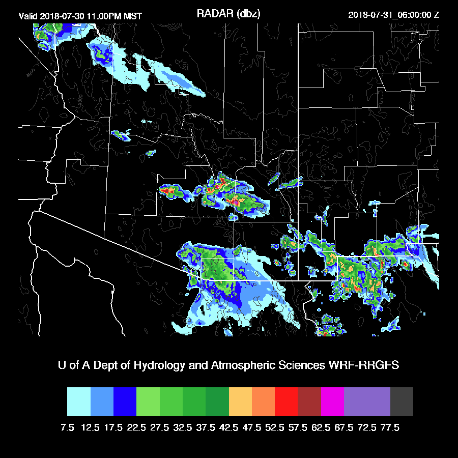
Tucson becomes well mixed by late afternoon with around high CAPE and a very good wind profile thus it looks like a very good situation for big storms. Both the WRFNAM and RR are very similar.

Both model runs develop strong/severe storms over SE Arizona during the late afternoon and move them into the Tucson area during the early evening. In spite of both runs being very active, I’m skeptical.

The WRFRR develops storms in Pinal County on the edge of the strong outflow but Phoenix only gets a big dust storm.

No comments:
Post a Comment
Note: Only a member of this blog may post a comment.