Previous Day
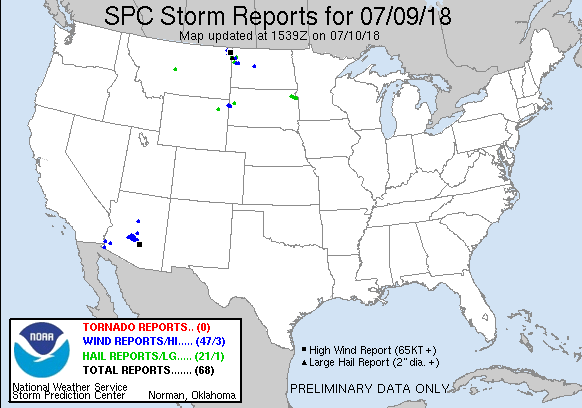
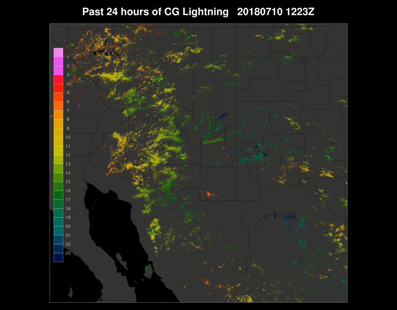
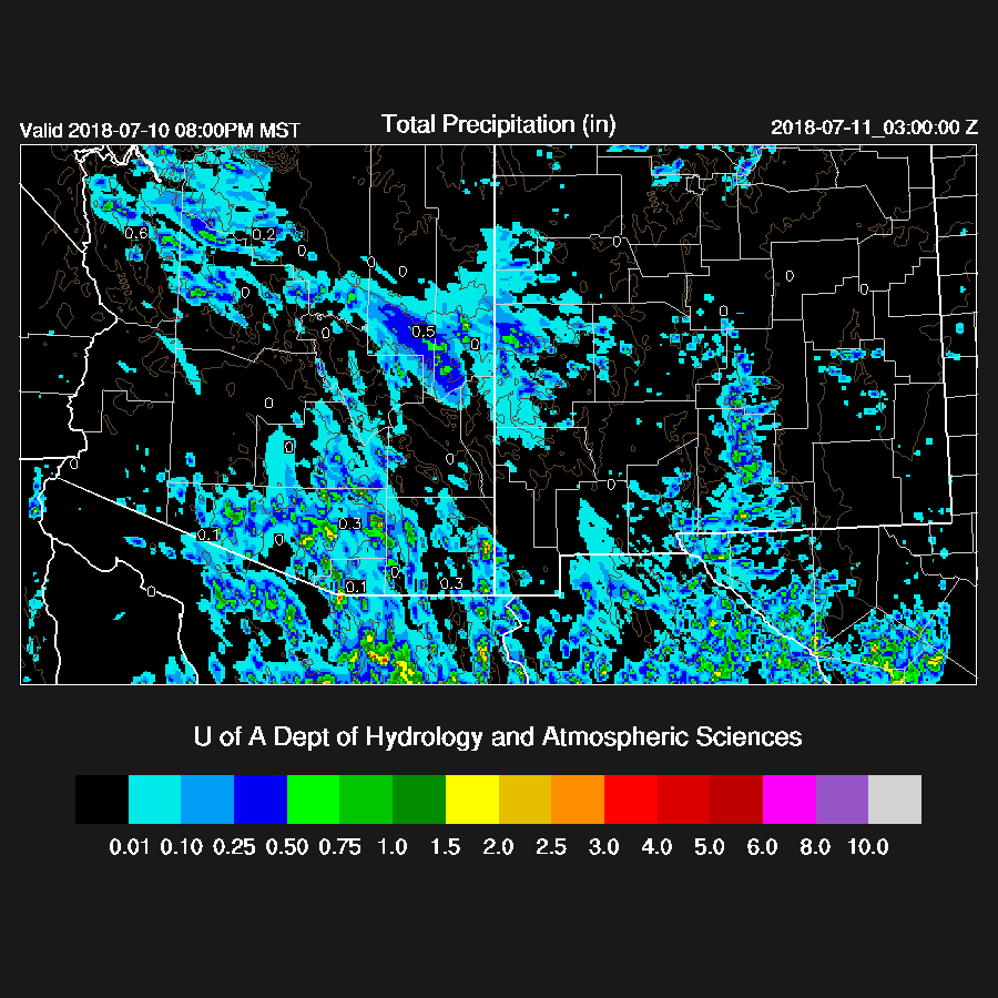
A major severe weather outbreak occurred from the Phoenix area all the way to Yuma with many reports of high winds, pea size hail, and over an inch of rain.

In general, all of the 12Z runs had the right idea with precipitation amounts and locations. The WRFRR was especially good except for Cochise County.

The WRF forecasts were outstanding, especially the 12Z WRFNAM as it was able to correctly predict the high wind event for the eastern ½ of the Phoenix valley. The run to run consistency was amazing even out to 36 hours or more in advance.

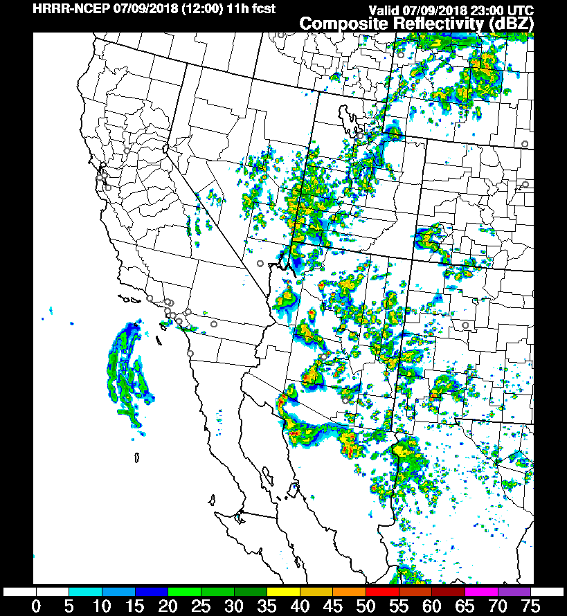
I wanted to briefly look at the HRRR/HRRRx. The 12Z operational HRRR did not have nearly enough activity around the Phoenix area and weakened the storms as they moved into the lower deserts.
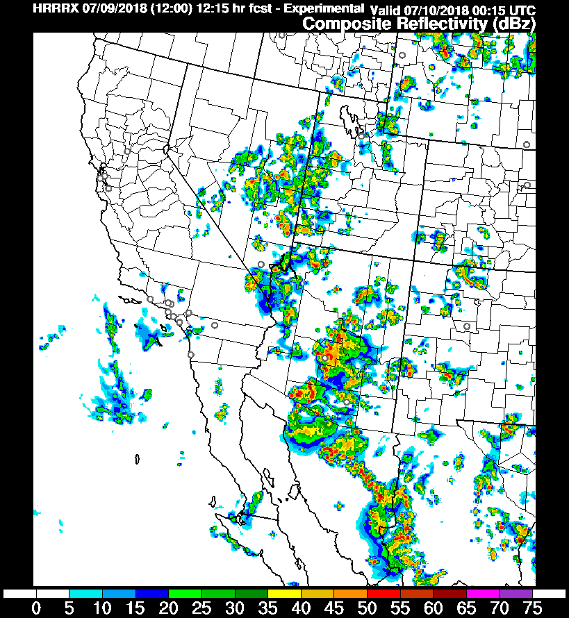
On the other hand, the HRRRx was excellent and was similar to the WRF runs. The HRRRx moved storms all the way to Yuma. Maybe SPC was only looking at the operational HRRR yesterday thus missing this major event?
The operational HRRR will be upgraded to the current HRRRx as of July 12, 12Z -- just a few days too late for this event.
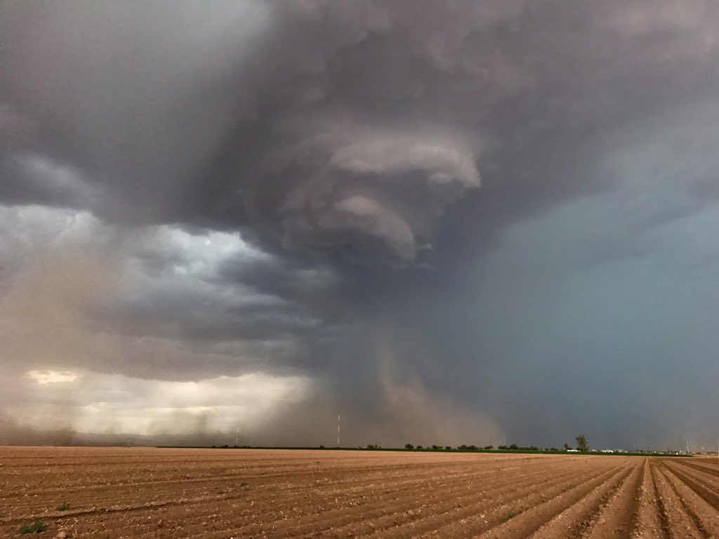
Here are some pictures from John Sirlin of the impressive organization and subsequent haboob. Below is in eastern Pinal County.
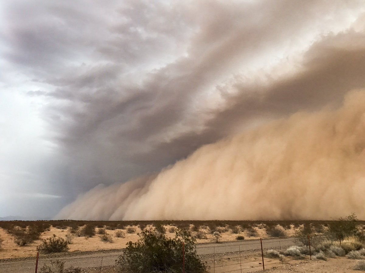
Along I-8 towards Yuma.

Initializations
The 500-250mb IT is located approximately east/southeast of Yuma at 12Z, which is quite far off from the forecast position of near Vegas from yesterday’s runs. The 500mb high center remains over northern CO thus putting much of Arizona in 15 to 20 knot southeasterly flow. 500mb temperatures have increased somewhat with -6 to -8 C over the state. The 12Z initializations look accurate. PW has increased and is now at very high levels not normally seen so early in the monsoon with around 45mm at Tucson and 50mm over the lower deserts. The NAM is somewhat too wet over western Arizona and into Mexico but the errors shouldn’t impact the forecast too much. The RR is better as errors are small, including in Mexico.
There is a bit of good news from Suominet for once and they have been able to restore many of the missing stations in Arizona, including the UofA and a few from Mexico, including Hermosillo. Still, Suominet is barely functional and needs external support to continue.
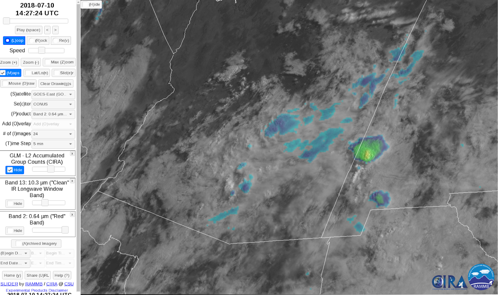
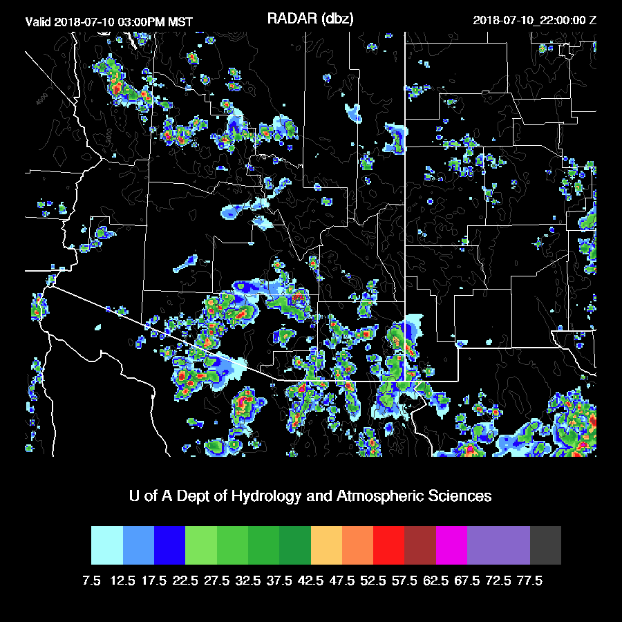
The big problem today is all the clouds and embedded showers that are still ongoing as of 16:30Z. Rain is falling between Tucson and Phoenix plus some small storms over SW NM. The satellite imagery does not show much decrease in the clouds so far and even an increase over western Arizona. The RR has initialized somewhat too many showers and clouds over the eastern Rim and White mountains and not enough over western Arizona. The NAM has less activity and looks to be better initialized over eastern Arizona except for Cochise county where it is too cloudy. Western Arizona also does not have enough clouds. The GFS is also very cloudy over eastern Arizona and too clear over the west as the others. In general, the clouds are depicted fairly well considering the complexity of the situation. I’d say the RR has too much morning activity thus the WRFNAM and WRFGFS may be the better runs today but overall confidence in any run is low due to the complex nature.
Day 1
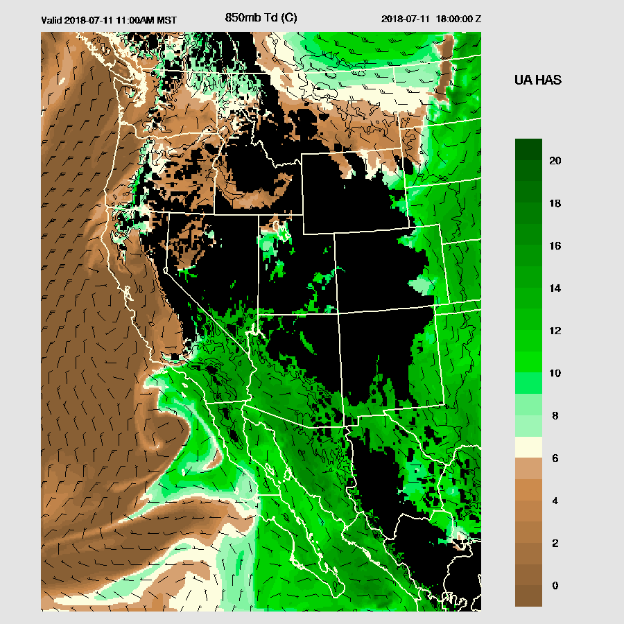
As mentioned above, the atmosphere is now very wet as 850mb Td are as high as 15C in some locations. It is wet in New Mexico too and the easterly winds that have plagued far SE Arizona have weakened.

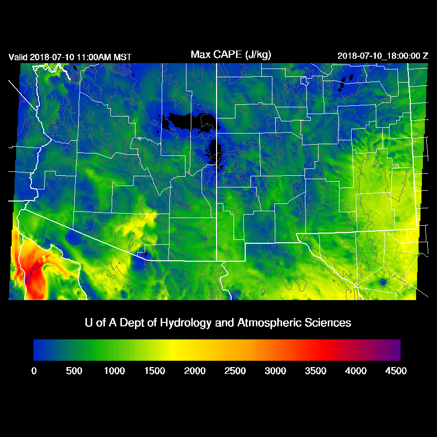
The various model CAPE forecasts are a mishmash of high vs low values due to areas of clouds and precipitation. The best I can say is that areas that get some sun and haven’t had much precipitation will see some moderate to high CAPE which will support some strong storms. Where that will be is uncertain -- maybe Cochise county as Lori B pointed out to me earlier.
Scattered storms, some with very heavy rain, are in SE Arizona this afternoon. When and where is anyone’s guess?
Tucson has potential today if there is some heating. Some runs, like the WRFNAM, below, have a lot of CAPE and favorable winds. 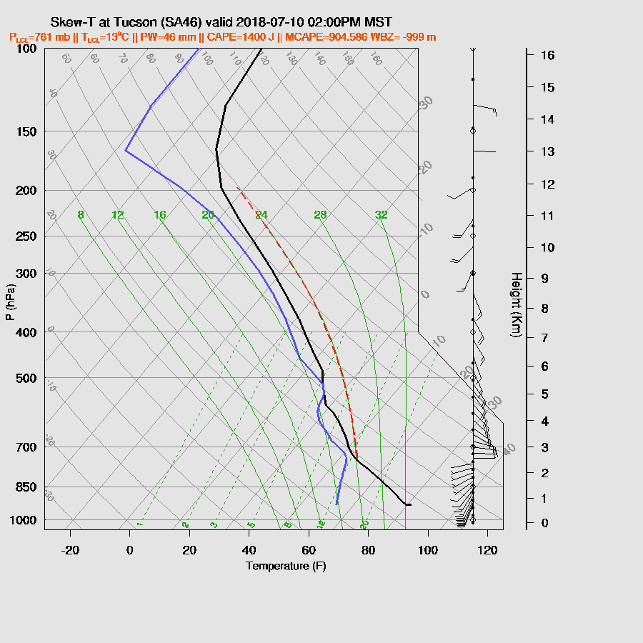
The middle of the road looks to be the WRFRR as it has a bit less CAPE but still more than enough to support big storms. However, heating is going to be a problem as there is a significant cap present.

The WRFNAM continues with scattered strong storms over SE Arizona and by late afternoon/early evening, develops some in the Tucson area. The other two runs have little or no activity which is just as likely in my opinion.

The risk of heavy precipitation with individual storms is high due to the wet air. Model QPF is 1.5 to 2 inches for a few storms.
The WRFNAM redevelops storms in the early morning hours over central Arizona while the other runs do not. It could happen as when the atmosphere is so moist like it is now, deep convection can form just about any time.

Day 2
The 500mb pattern has our departing IT west of San Diego and Arizona in a general southerly flow of 10 to 20 knots. There is another trough that is cutting under the ridge over NE NM but it doesn't look like it’s going to make it down to Arizona.
Very wet air continues to be advected into the state from the south and even moves as far west as So Cal due to the westward moving IT.
There is a lot of CAPE present across much of the state tomorrow thus a big day is in store for some locations. It’s all going to come down to heating again. The image below is from the WRFRR which did not have any nocturnal activity tonight.

The potential is there for big storms for both Tucson and Phoenix but I am hesitant to make that call due to the large uncertainty over what happens today and tonight.


No comments:
Post a Comment
Note: Only a member of this blog may post a comment.