Previous Forecast
Showers and a few thunderstorms were widespread overnight with mainly light to moderate rain. I got over 1” during a thunderstorm around 7am. In general, the models did an OK job overnight considering the complex situation but nearly all runs missed the morning convection.
Initializations
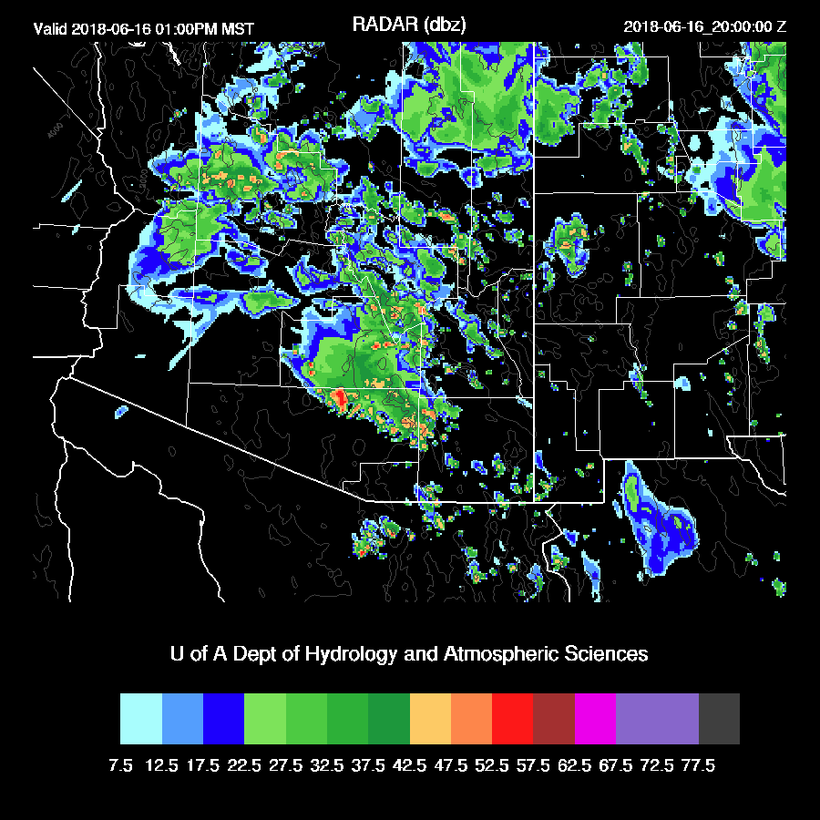
The main issue is going to be how much heating will occur in southern Arizona. As of 16Z, rain is ending across the Tucson area and skies are partly cloud across far south central to SW Arizona. The 12Z(WRF)NAM did a pretty good job initializing the clouds and precipitation but the 6Z WRFGFS did not have enough clouds and showers during the morning hours so is likely to be too active. WRFNAM IPW was initialized well and in spite of the complex initialization, the WRFNAM initial conditions look pretty good.
Day 1
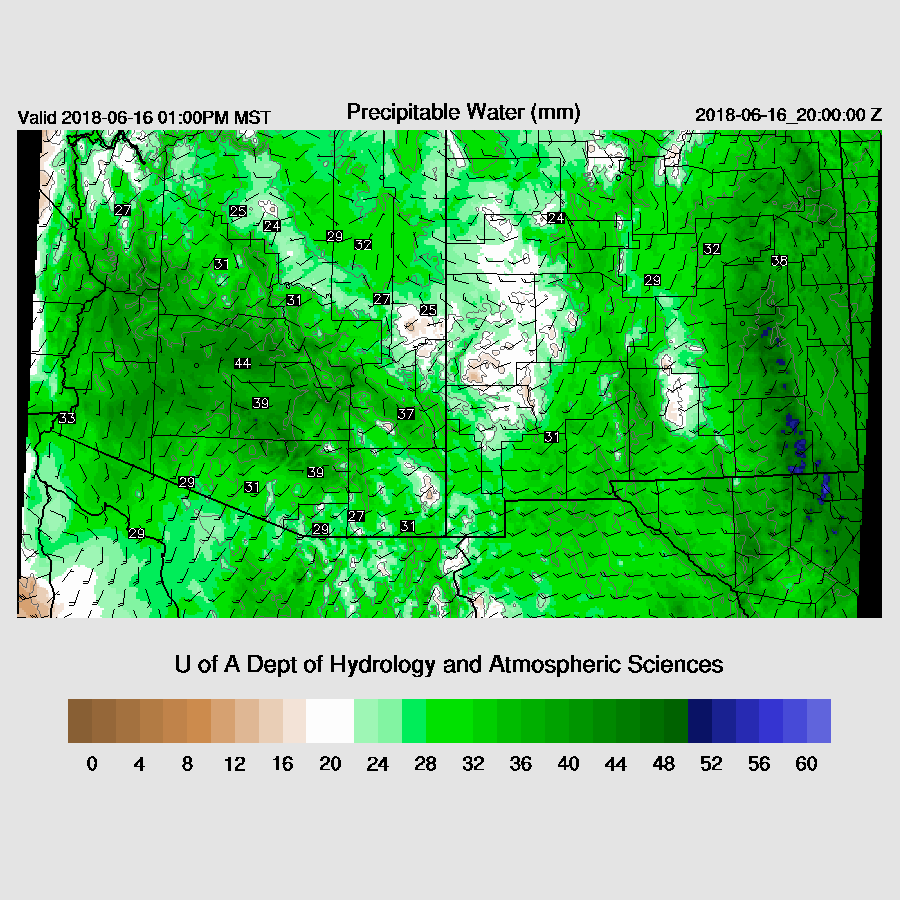
Wow, is it wet. Tucson PW peaked at around 44mm last night and Buckeye at 46mm. Moisture begins to decrease and by early afternoon drier air is moving into the southern part of the state but plenty of moisture is still available for showers and storms.
The upper-level low is over western Arizona by early afternoon with quite cool air over central and southern Arizona which will create steep lapse rates and some CAPE.

As was forecast yesterday, CAPE is moderate over much of Arizona thus storms are likely for areas that receive some heating and perhaps even for areas that don’t.

Scattered storms develop by late morning from Phoenix down to Tucson and continue throughout the afternoon.
Activity decreases around the Phoenix area by late afternoon with storms continuing around SE Arizona (WRFNAM below). There is quite a bit of uncertainty due to the issue with clouds/heating and it’s possible that there will be less activity, similar to the 12Z WRFGFS, which just became available. 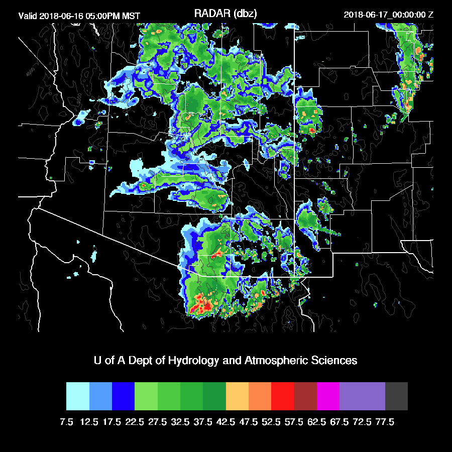
The main threat this afternoon is heavy rain as some storms will produce over 1”/hour.

Day 2
The airmass dries out rapidly thus no activity is forecast.

No comments:
Post a Comment
Note: Only a member of this blog may post a comment.