Initializations
It’s a new year and I’m not quite ready for monsoon-like activity as I just got back from a few weeks in Italy. Hurricane Bud is located due south of La Paz and is slowly moving north. It doesn’t look all that impressive on satellite images this afternoon and I see NHC has downgraded it to a Tropical Storm. I can’t say how well Bud is initialized by the 12Z WRFGFS or WRFNAM as it’s a bit south of the southern boundary of the outer domain, but a quick look at the actual models have the location OK. It’s also hard to judge the 12Z intensity too. The GFS was a bit weaker and may be more accurate in this regard. Also of interest, is the weak upper trough located 500 miles or so WNW of central Baja. The NAM and GFS initialized this feature a bit farther to the south of what the WV imagery indicates.
Day 1
Day 1 is already nearly over as of this post.
Day 2
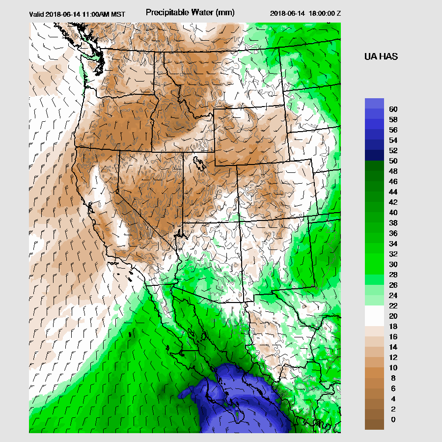
Bud approaches far southern Baja by midday and its track is nearly ideal to trigger a Gulf Surge. The surge is underway by this time, increasing the IPW into 20mm-30mm range across the southern parts of Arizona.
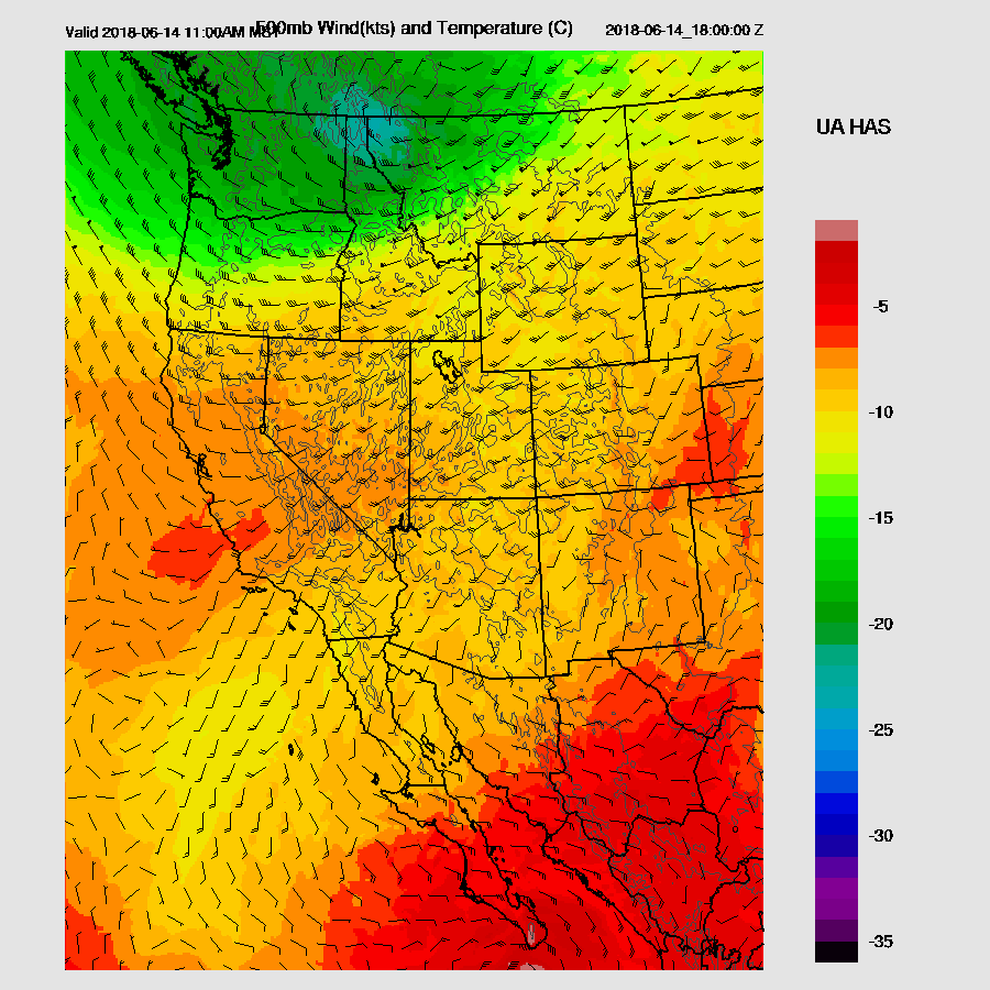
The weak trough off of Baja remains mostly stationary with SW mid level flow across much of the SW US along with fairly cool air at 500mb as temperatures ard around -10C. This trough is may interact with the moisture from Bud in a few days.
CAPE is quite limited tomorrow with only New Mexico and far SE and eastern Arizona having sufficient amounts to support deep convection.
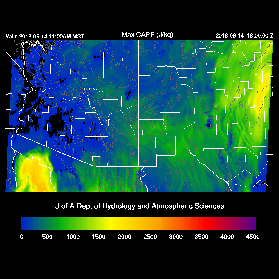
A few storms do initiate during the afternoon in these areas with some localized strong winds. Note that I am using a different microphysics scheme (Thompson) which testing has shown to decrease the high reflectivity bias frequently seen with the Morrison MP scheme. Thompson also produces smaller areas of heavy precipitation and less widespread areas of light precipitation.

I ran both schemes today to show the difference. Below is the Morrison MP scheme.

Thompson Scheme. Note that the extent of the light precipitation amounts is much smaller and areas of heavier precipitation are more compact.

Day 3
The 12Z runs are remarkably consistent with the track of Bud and place it over the southern Gulf of California by 18Z on Friday. Both still have some 45-50 knot winds associated with the TS which I find a bit too strong as it has already weakened significantly and has to travel across southern Baja.

The two main issues for the next few days are going to be the trough and how cloudy it’s going to be. Too many clouds will not allow enough heating for deep convection. However, if there is interaction with the weak trough and cool mid level air, that may be enough to form showers and storms. The weak trough and associated cool mid level air is located over the SW US and out west of Baja.

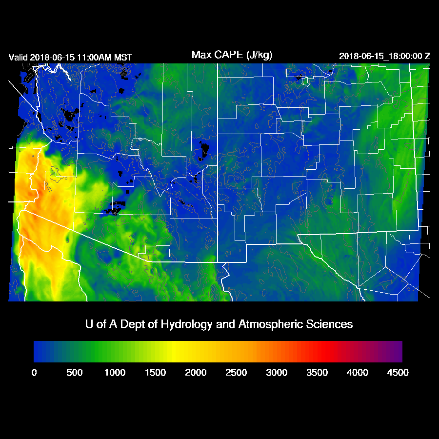
By Friday, the models look quite a bit different as the WRFNAM (below) has much more CAPE over southern and far SW Arizona. It’s hard to say which is right and we’ll just have to wait and see.
Heating is going to be an issue with all the clouds around on Friday. I do see a problem with the new configuration as it appears upper level anomalous waves are being introduced perhaps due to boundary issues. The new configuration also increases the amount of clouds produced by WRF thus improving the issue we’ve had over the years of insufficient model clouds.

It’s a very complex situation and confidence is low. My best guess is showers and some thunderstorms, perhaps strong, over mainly SE Arizona during the afternoon as the cooler air aloft and weak trough offset the lack of heating due to extensive clouds.

No comments:
Post a Comment
Note: Only a member of this blog may post a comment.