Previous Forecast
The WRFRR series was too active for southeastern Arizona, and the WRFGFS had the best forecast.
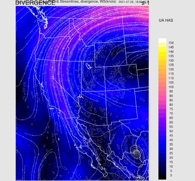
CONUS is dominated by a large anticyclone, with the center in Nebraska, far from Arizona. Arizona is under mainly southeastern flow at mid-levels with slightly cooler temperatures, -6 to -7C. There are multiple upstream mid and upper-level troughs we'll have to keep an eye on. One is located over N Texas.
There are multiple inverted troughs in the upper levels. One is over Chihuahua, providing support for the strong storms in Sonora last night, the second larger one is near Brownsville, and a third is over Cuba, all moving westward. I haven't seen a pattern like this in a long time, just like the good old days.
Moisture has decreased quite a bit over the past 2 days, but due to some slight cooling at 500mb, and no a minimal subsidence inversion, as the high center is in NE.
Initializations
It's clear over much of Arizona and scattered to broken clouds in NM. GOES-derived PW indicates a range from 35 to 40mm over the lower deserts. Enough for storms, perhaps?
Day 1
Low-level flow is light and variable, with no sign of a surge signal, but a moderate amount of moisture remains over the state. In a normal year, this would be considered quite high!
The CAPE situation has improved, as seen from the Tucson sounding and the GOES-derived CAPE.
Southern, southeastern, and NW Arizona are the potentially active areas today.
Storms develop over the higher terrain of far south-central Arizona this afternoon, and a few areas scattered about the highest terrain elsewhere. There is a high run-to-run consistency today.
The forecast Skew-T for Tucson looks good as this afternoon, the PBL is mixed deeply and nearly ready to connect with a moderate amount of CAPE and a little low-level shear. Thus it looks like mid to late afternoon storms in/near Tucson. Steering flow is also good, but upper winds will blow anvils out ahead of storms, potentially shading and stabilizing those areas.
CAPE is forecast to only be 200-700 J/kg at Phoenix, as well as a weak inversion on top of the mixed layer. It doesn't look good for storms there, especially as anvils blow off that way.
Day 2
Moisture decreases quite a bit, resulting in marginal 850mb dew points of 10C or less.
This results in marginal CAPE for storms for most areas.
A few storms for the higher elevations, and that is about it.
It's looking better for Thursday as moisture increases some and an IT draws closer.


No comments:
Post a Comment
Note: Only a member of this blog may post a comment.