Previous Forecast
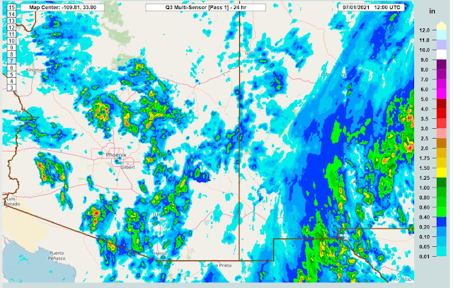
Activity picked up over the state with quite a bit of rain falling north of Phoenix, finally. The Tucson Hole was in full force as storms were practically all around the valley.
Model runs were few and far between. Fortunately, most of the issues with the incoming initialization data have been fixed and runs are completing today. The 6Z WRFGFS had the right idea.
Discussion
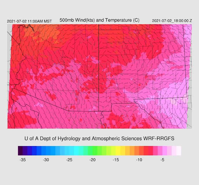
The 500mb map still doesn't look like a typical monsoon pattern. A broad cyclonic circulation is still present over the Intermountain West, and Arizona is mainly light and variable flow. Temperatures aren't too bad as they are around -7 to -8C. Warmer air is present over NM and western TX. 700mb does show a broad area of cyclonic circulation in Mexico, maybe leftover from Enrique? There is a bit of a low-level swirl over Baja California Sur.
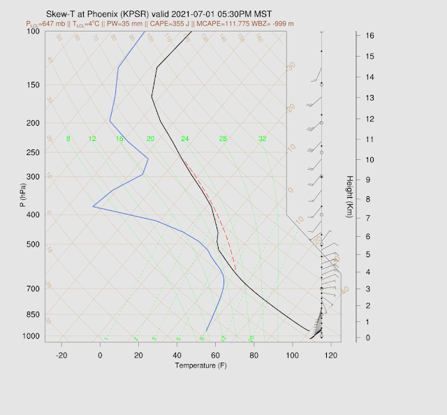
The 12Z Tucson Skew-T does have a little CAPE and a nearly saturated profile. The wind profile is pretty good with some decent ENE steering flow. There are a couple of mid-level inversions, but deep convection should form with a little heating/OFB action.
Initializations
IMO, the key for today is how well the initializations handle the thick clouds that are over far SE Arizona, as heating is going to be important for where deep convection forms. All recent initializations are quite accurate with respect to clouds. The 12Z RR seems to be the most accurate.
6Z NAM had some quite large PW errors over NW Mexico and into the SW US. The rest of the initializations have minimal errors. My favorite is the 6Z GFS and 12Z RR.
Day 1
Since yesterday, moisture has decreased but is still sufficient to support scattered activity as 850mb Td is still >10C over much of southern Arizona. Moist low-level downslope flow continues over far eastern Arizona. Combined with thick clouds, not much activity is expected there.
CAPE continues to be marginal, so storms aren't expected to be too strong. The wet air mass will result in some storms producing heavy rain, though.
Afternoon steering flow is favorable for southern Arizona as flow is mainly northeasterly. It's a bit weak at only 5-10 knots but could steer some higher elevation storms into the lower deserts.
It looks like the storms begin on the sunny side of the cloud boundary by mid-afternoon.
It looks good for the Tucson area as CAPE is around 300-600 J/kg, decent steering, and a bit of low-level shear.
Some good, some bad with regards to storm chances in the Phoenix area. Shear and steering are good, but CAPE is minimal. The sub-cloud layer is mixed deeply, so any storms that form may produce very strong winds.
Most runs develop storms to the N-E of Phoenix, and steering brings a few into the valley this evening.
Some storms may continue over SW Arizona into the early mornings.
Day 2
The 500mb anti-cyclone recenters over NE Arizona, resulting in mainly SE flow over the southern 1/2 of the state. The bad news is that warmer air of around -6C is present over southern Arizona.
Plenty of moisture continues over the state, with PW in the mid 40mm range over SW Arizona.
CAPE is sufficient to support scattered storms. There are a few areas that have higher CAPE, so some storms could be strong.
The Tucson area looks quite good as CAPE is >1000 J/kg, and the BL is mixed fairly well. There is decent mid-level steering too. Maybe the first big day is on tap?
Storms develop by late afternoon in and around Tucson.
Phoenix is also looking better as CAPE is around 800 J/kg, low-level shear, and mid-level steering flow. The PBL is also mixed deeply.
Storms continue into the evening hours, and steering flow moves storms from Tucson towards Phoenix. Confidence is low as not too many runs are forecasting storms in/around Phoenix.


No comments:
Post a Comment
Note: Only a member of this blog may post a comment.