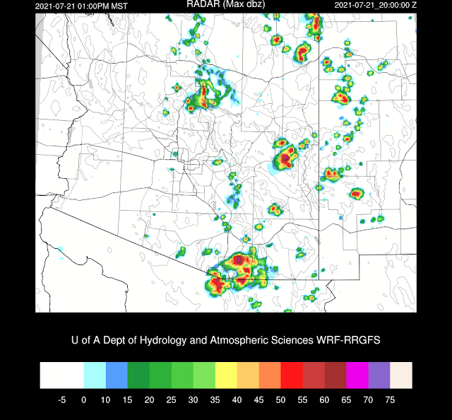
It was quite active in NW Arizona again and along the Rim and Flagstaff. Scattered storms developed over far southern Arizona too. It dumped on me in Paradise during the mid-afternoon as I got 1.77 in less than an hour, which got all the washes running.
Discussion
Once again, there are ongoing showers and weak storms. This area is west of Tucson and goes to the Phoenix area, and is being forced by a westward-moving IT located over the northern Gulf of California. The IT isn't obvious on either the 700 or 500mb map. The 500mb CONUS anticyclone has weakened a little and stretches from northeastern Arizona to South Dakota, resulting in east to southeast steering flow over the state. Temperatures are again fairly warm at -5 to -6C. In the old days, -5C would be considered hot at 500mb.
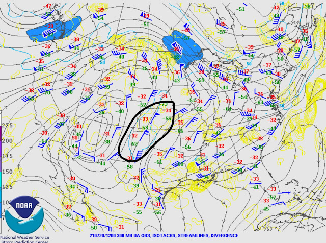
I've been keeping my eye on the eastern CONUS trough, as mentioned yesterday, and today, there is an upper-level jet streak coming down the backside, which will help break off a piece and move it under the ridge as a large inverted trough.
Once again, Tucson and Phoenix have a lot of morning CAPE. Tucson is a surprising 2000 J/kg MLCAPE. I would have thought there would have been more deep convection around with CAPE that high. The only model run from yesterday to get close was the WRFNAM, as it had 1000-1700 J/kg.
PW has increased, especially over western Arizona, where it's an astounding 55mm near Yuma and Organ Pipe and up to Phoenix, which is a daily record. Tucson was .01 inches short of their daily record. PW has decreased in southwestern NM and eastern Arizona, as was the forecast. It's a little hard to tell what is going on in SE Arizona as there are no working Suominet GPS stations.
Initializations
Most initializations were accurate with the placement of morning clouds and showers. The 9Z and 12Z RR is a bit too cloudy in western Arizona and have too many morning storms, but that shouldn't matter much for the rest of the state. PW was generally accurately initialized, except for the NAM. All initializations had the IT initialized well. The favorites are the GFS and RR initializations, and model performance should be good today/tonight.
Day 1
The drying trend for eastern Arizona continues as low-level easterlies make their way as far west as Tucson. This sets up a nice low-level convergence zone which can be a favorable location for convective initiation.
Very moist air continues over western Arizona, but the weak surge that increased moisture overnight has stopped during the afternoon.
CAPE is forecast by most runs to become moderate to high along this convergence line. This area is likely to be the hot spot for storms today/tonight.
Or maybe not. Most runs have only scattered activity at the boundary in Pima County. The rest of the area must be capped.
The PBL is mixed fairly deeply at Phoenix, but the drier and warmer air above the top of the mixed layer keeps deep convection from forming. There is an inversion at 700 and another above 500mb.
The potential is there in Tucson, for sure. CAPE is 1500 to 1800 J/kg with good low-level shear and 20 knots of southeasterly steering flow. The PBL is not mixed deeply (at least in this particular run) and will be difficult to trigger deep convection.
Dry air advection above the PBL, and the inversions are just too much. Little or no deep convection is forecast for this evening.
Day 2
The mid-CONUS jet streak is located from west Texas into far southern Arizona. It will help enhance and organize storms as it draws closer as it puts the area under upper difluence/divergence.
Moisture sloshes back to the east and is more than enough over much of southern and central Arizona.
Again, there is a sharp boundary between the moist and potentially unstable air versus the drier air in NM. Perhaps this day, it will help force deep convection along this line.
Storms get off to an early and energetic start as severe storms may be present by early afternoon south of Tucson. These storms move off to the WSW.
Tucson looks primed for a big day. CAPE is high, and the wind profile is generally good. All it will take is a strong OFB to get things going.
Some runs continue to increase the coverage and intensity of storms into the evening hours. 9z WRFRR


No comments:
Post a Comment
Note: Only a member of this blog may post a comment.