Monday, July 31, 2017

20170731

Previous Day
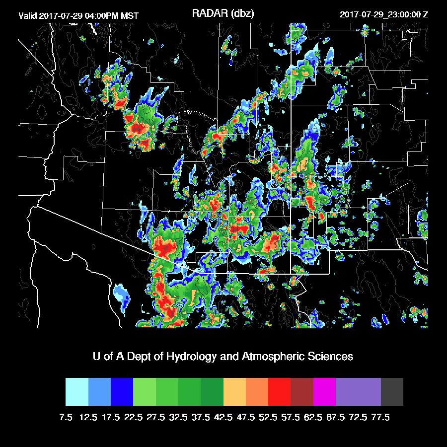
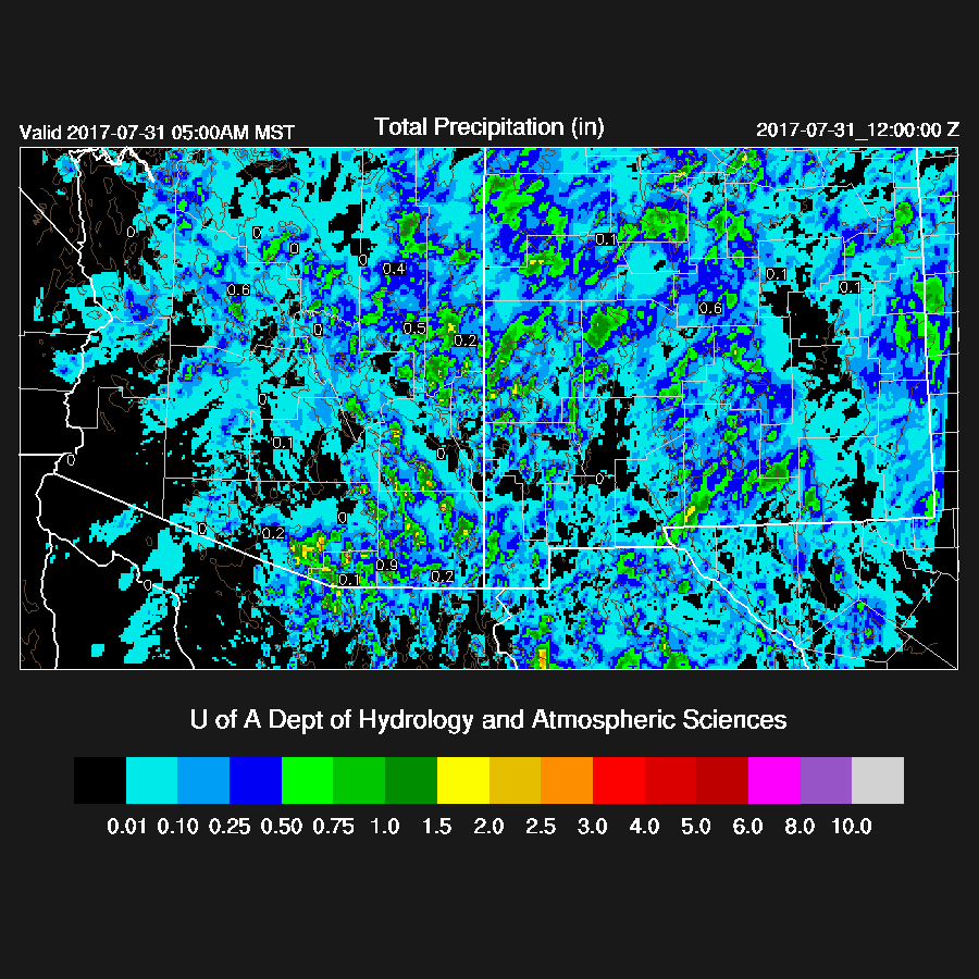
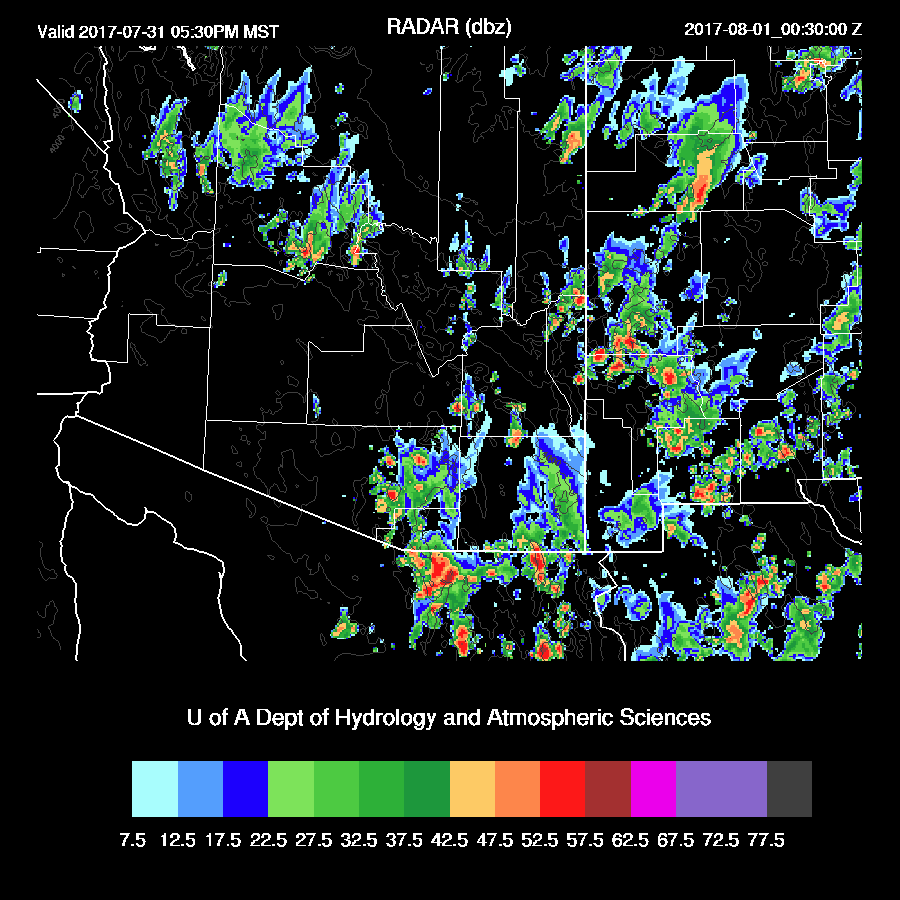
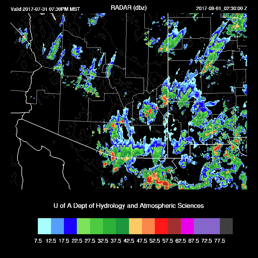
A mostly down day for the Tucson and Phoenix areas while it was quite active over eastern Arizona where more heating occurred.


The WRFRRx was the best as it had the most activity over eastern Arizona.


Initializations
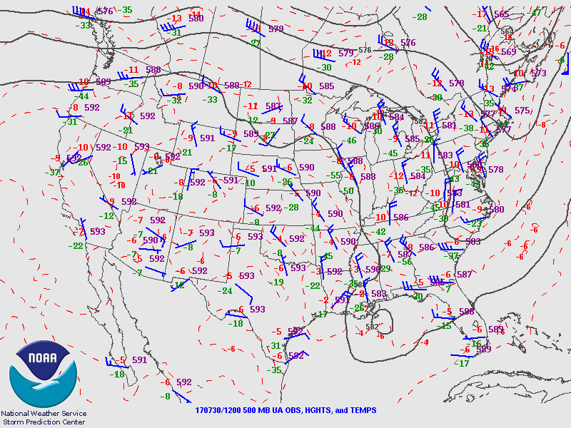
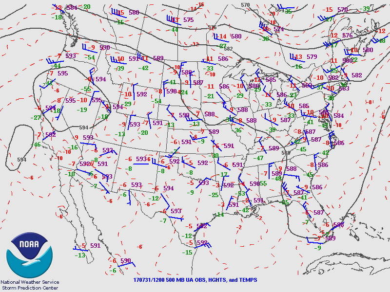
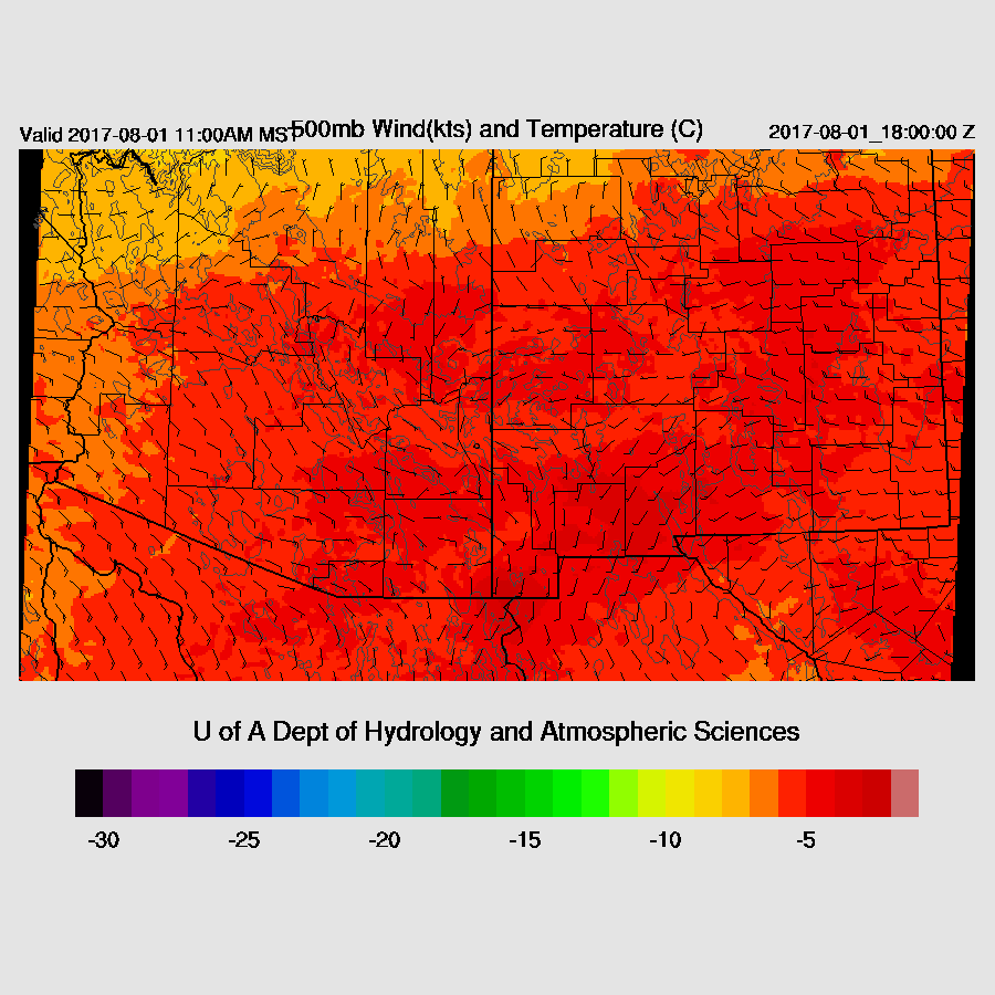
A weak large IT continues over far NW Mexico and into southern Arizona.  The 500mb high has become better established over Reno thus giving Arizona slightly more favorable steering flow.  500mb temperatures have also cooled a few degrees since last week and are around -6 to -7C.  All the 12Z initializations look good.


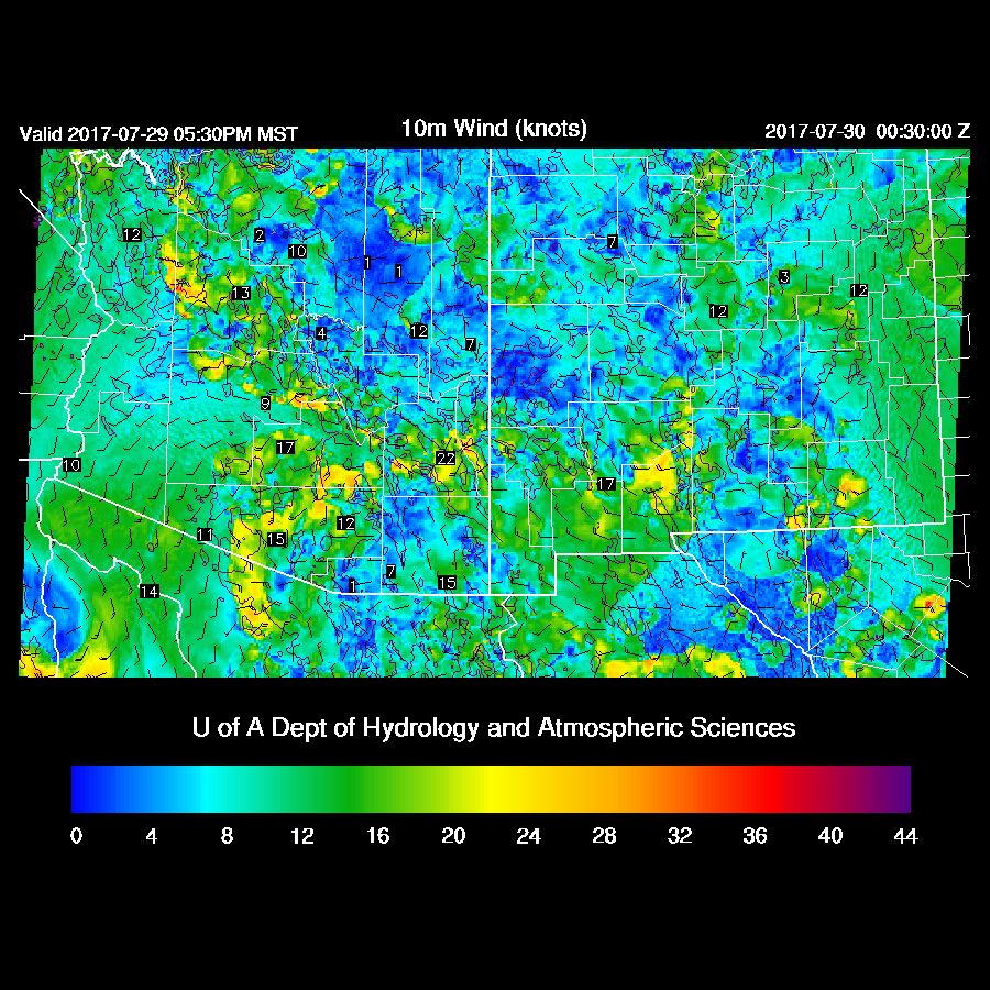
The southern ½ of the state is mainly clear except for far SE Arizona.  The northern ½ has scattered to broken clouds which seem to be increasing over time this morning.  The GFS and NAM do not have enough clouds over northern Arizona.  The RRx is better but it doesn’t have enough coverage either.  The RR does have clouds in far SE Arizona.  The WRFRR also has a better temperature forecast as the other two model runs are too warm at sites in SE Arizona. The NAM is again too wet at most stations while the GFS and RRx have minimal errors.  I would go with the WRFRR again today as it has the best initialization.  The WRFGFS also looks fairly good except for the lack of clouds.  This error is unlikely to impact southern Arizona.  In general, model confidence is a bit higher than over the past few days.


Day 1
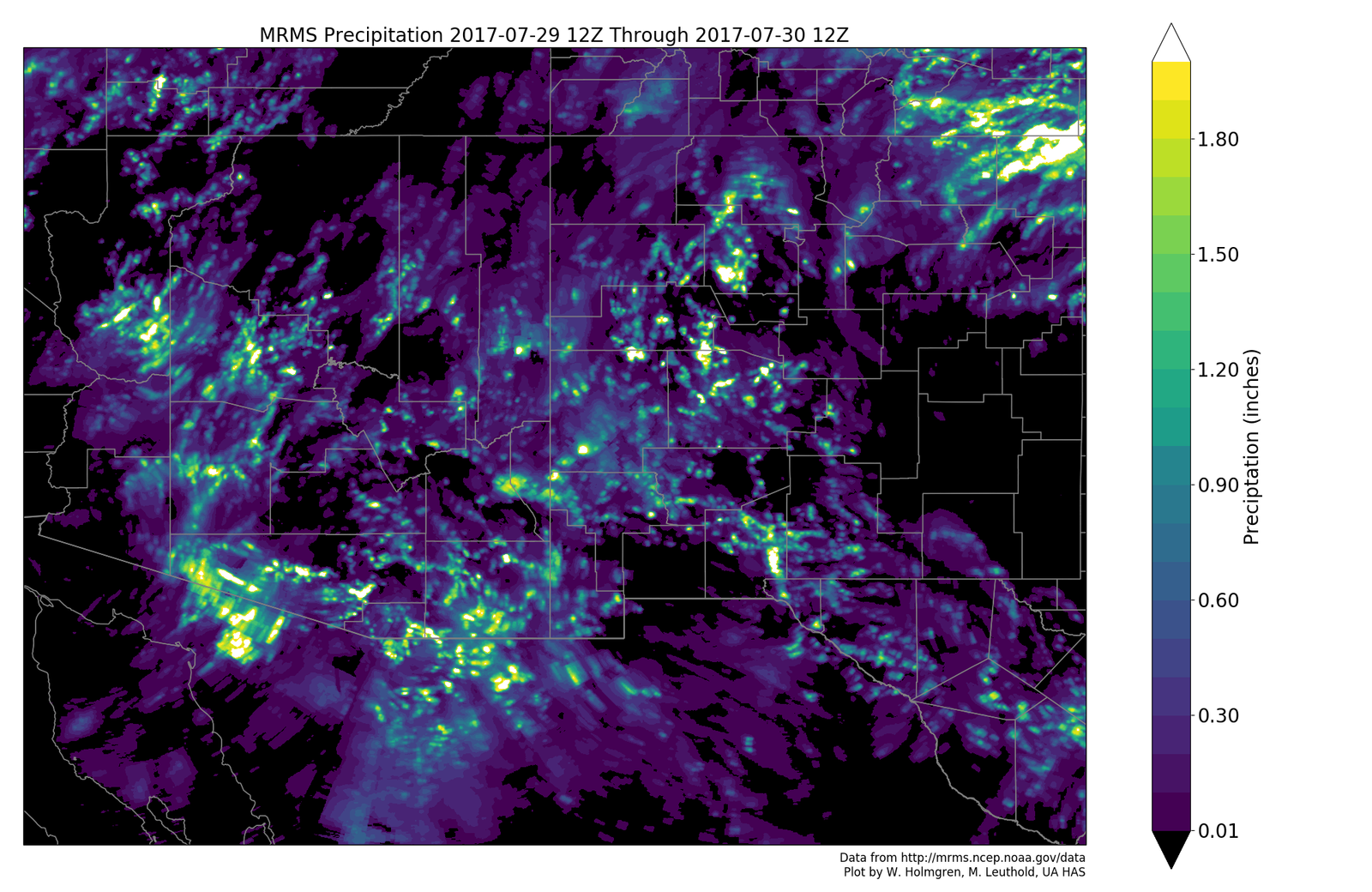
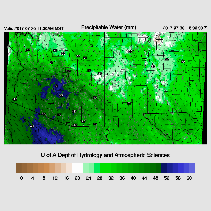
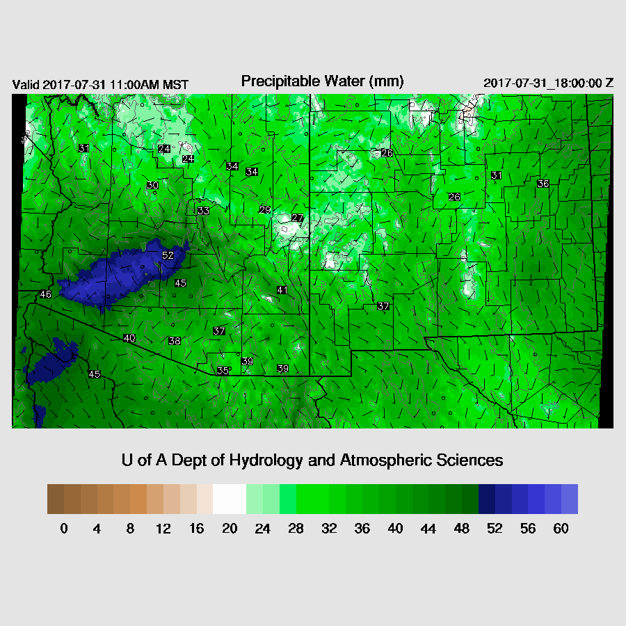
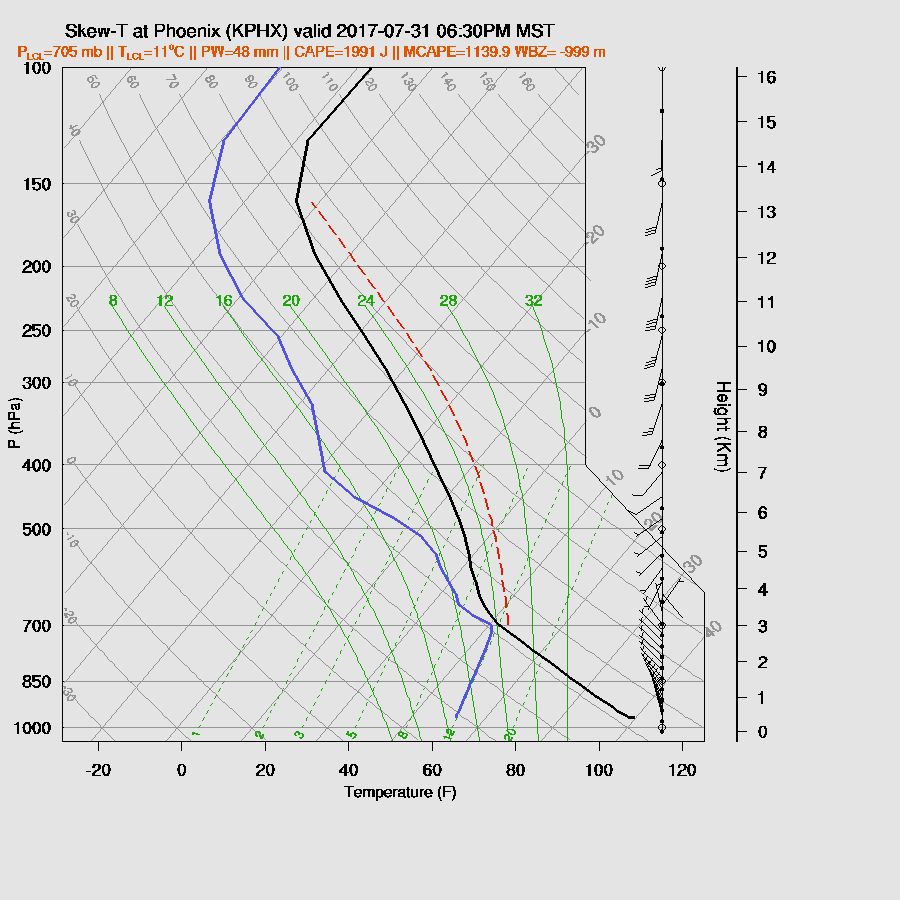
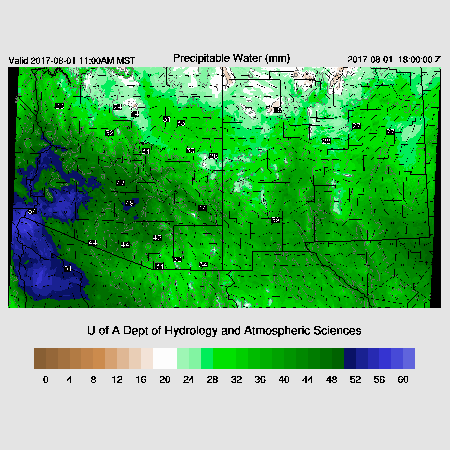
SE Arizona has dried out, relatively speaking, as IPW is generally just under 40mm.  It’s still quite wet near the surface as 850mb dewpoints are still around 15C.


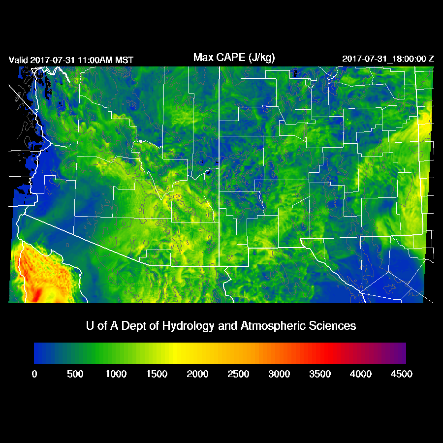
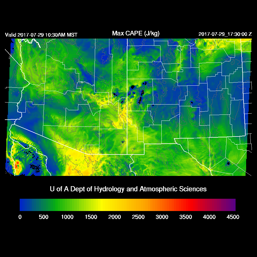
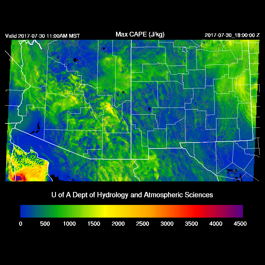
There is not much model consensus with regards to midday CAPE as the WRFGFS has the most over SW Arizona, the WRFNAM over south central Arizona, and the WRFRR (below) over  SE and south central Arizona.  I have no idea which is correct.  In any case, some parts of southern Arizona have very high CAPE which will support some strong storms.

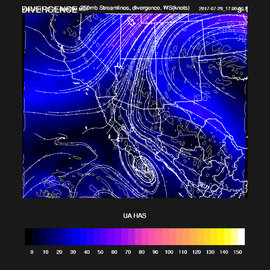
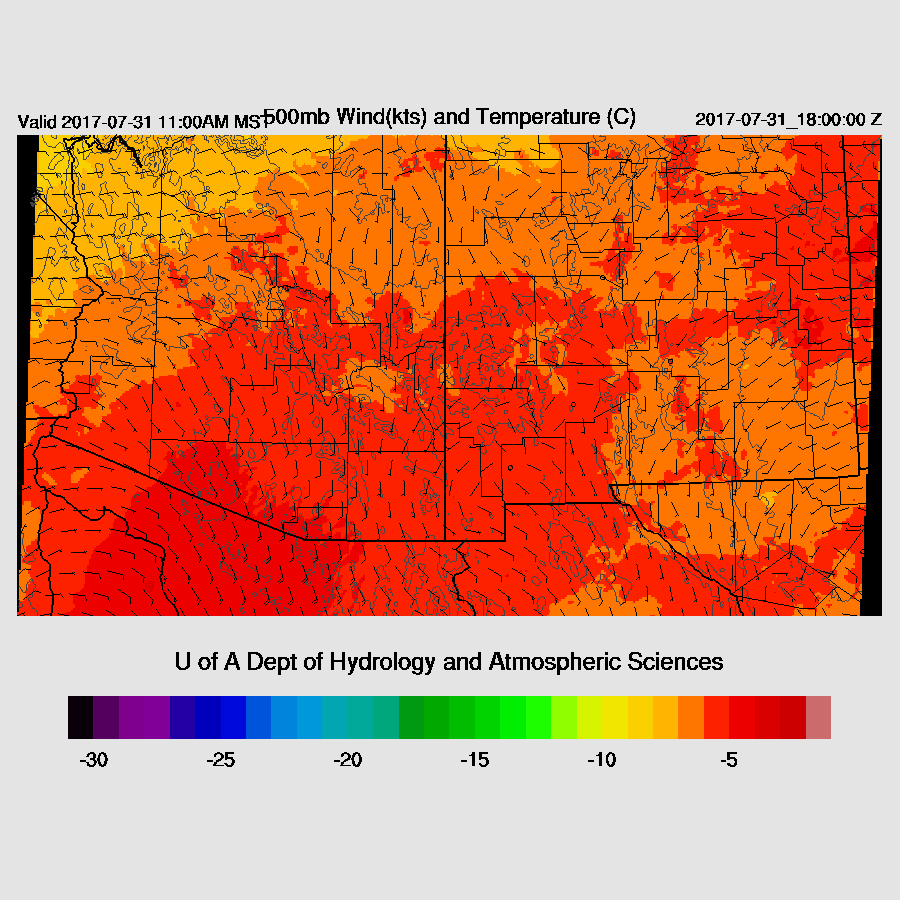
It’s not the best 500mb pattern as winds are mainly southerly at 5 to 15 knots.  In spite of slightly cooler air at 500mb this morning, warmer air advects into far southern Arizona during the day.


Deep convection gets an early start over the typical high terrain locations.  As all the model runs are too clear in northern Arizona, storms will get a later start.

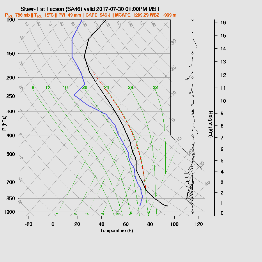
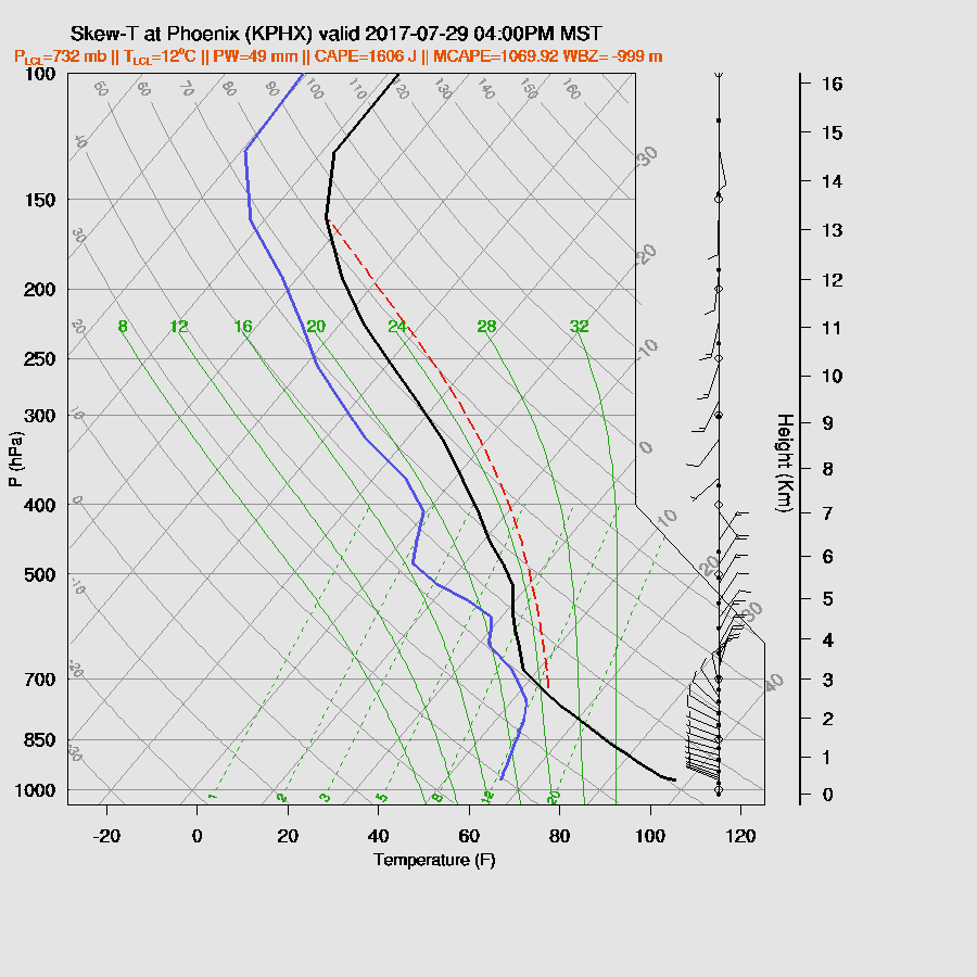
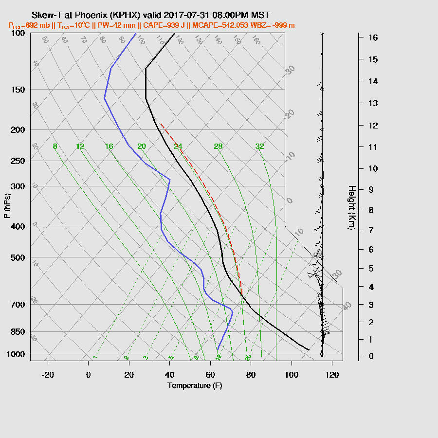
Not the best looking SkewT for Tucson as steering winds are southwesterly and not very strong while upper flow is quite strong and will blow anvils out in front of storms that form over the higher terrain south of Tucson.  The WRFRR also only forecasts marginal CAPE.


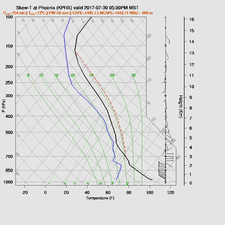
The WRFGFS (below) has quite a bit more CAPE at around 1300 J/kg and a cap to hold back convection until strong outflows can come through.   The winds situation is similar to the WRFRR.


By late afternoon, the WRFRR (below) has some weak storms in the Tucson area.  It appears most stay over the higher terrain.


The WRFGFS (below) is much more active and has severe storms in Cochise County during the late afternoon.  The WRFNAM is similar. As much as I want it to be so, that does not mean that the forecast below is more likely than the WRFRRx forecast.


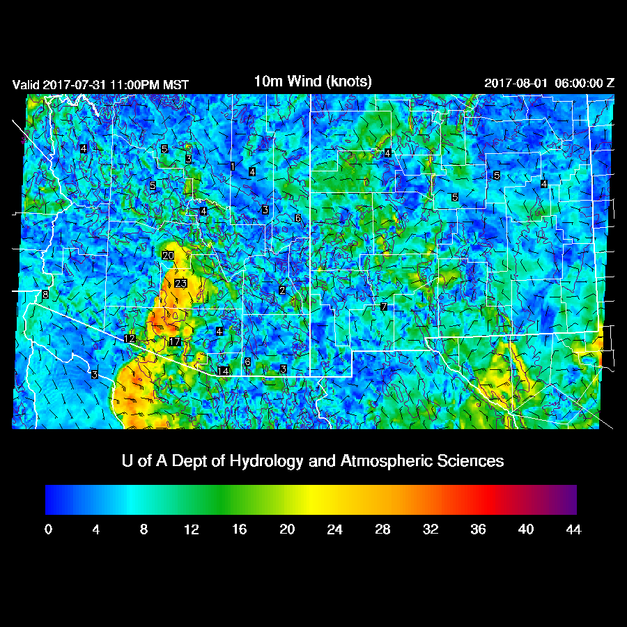
The WRFGFS moves a strong outflow into the Tucson area during the evening. It’s strong enough to trigger deep convection as the WRFGFS is also forecasting decent westerly low-level winds.

Both the WRFGFS (below) and WRFNAM have scattered strong storms in Pinal and Pima Counties during the evening.   Very strong storms continue south of the border.


So, what about Phoenix?  The situation isn’t clear there either.  The WRFRR (below) mixes the PBL quite deeply by early evening and also has around 1200 J/kg of CAPE, which is enough to support storms.  


A few storms move south towards Phoenix and by early evening, a few weak storms are in the area.


The WRFGFS also has a moderate amount of CAPE which may be enough to support some deep convection.  


The strong storms in Pinal and Pima eject an outflow towards the Phoenix area later this evening. It probably isn’t enough to trigger widespread deep convection as there is no outflow intersections forecast.  A storm or two could pop up, though.


Day 2
The WRFGFS and WRFNAM spin up an MCV due to the large MCS they predict over northern Sonora tonight.  This leaves behind plenty of debris clouds as well as cool and more stable lower atmosphere.

I've always found it cool that the WRF can spin up MCVs. We'll see tomorrow if this actually happens.


Very wet air continues to be present tomorrow.

The WRFRRx 500mb again has weak steering flow with winds shifting to mainly southeasterly.

The WRFRRx is much more active around the Phoenix area during the evening and moves storms into the metro area from the high terrain to the east and north.  The other two model runs have almost no activity over southern Arizona tomorrow.   So it will all depend on what happens in northern Mexico tonight.


Sunday, July 30, 2017

20170730

Previous Forecast
A fairly active day which included both Phoenix and Tucson.  The west side of Phoenix had severe thunderstorms during the late afternoon and Tucson had some storms that again produced very heavy rain.


No forecast really was that good.  The WRFRR was doing well up until the outflows converged over SE Phoenix.  The WRFRR then forecast widespread strong storms along the convergence zone which never materialized as the WRFRR had too much CAPE.  The WRFNAM had a similar problem.  The sounding from 0Z indicated only 300 J/kg thus only a few weak storms were able to form along the convergence line.  A wasted opportunity.   Something I didn’t mention was the forecast of strong winds associated with the storms that moved across the west side of Phoenix as most of the runs did have strong winds, but a little further to the west.
Initializations
“Too wet to rain” is the message for today.  Widespread clouds are present this morning across almost all the state due to the record setting (Tucson) amount of moisture plus the weak trough across southern Arizona and into Sonora.  Mid level flow is weak over much of the SW US with no well defined high center.  The 12Z mid-level initiations look OK at 500mb.


The WRFRR is doing a fair job with the thick mid level clouds this morning.  The WRFNAM and WRFGFS don’t have enough coverage.  This summer, I’ve implemented a modified option to better model these mid level clouds as morning debris clouds in the model have always been too sparse. So far this monsoon season, it’s been an improvement over the default.  The NAM continues to have issues with too much moisture and that is again the case today as it’s a few mm too wet.  The RR and GFS have only minor errors.  It is amazing to see that Tucson/Phoenix have higher PW than just about anywhere along the west coast of NW Mexico!  The WRFRR seems to have the best initialization today.


Day 1
Like I said above, it’s “too wet to rain” today which means there is so much moisture and associated clouds thus not enough heating will occur to develop storms over the lower elevations.  


CAPE is very high over much of SE Arizona thus areas that see some heating will see some strong storms with very heavy rain.


Steering flow is mainly light and variable except over SE Arizona as winds are SSE at 10 to 15 knots.  That area is likely to be the hot spot for storms today as they are also getting some insolation.


Storms develop by late morning over SE Arizona and continue into the early afternoon.  A few are possible along the Rim too.


The potential is there for Tucson as the atmosphere remains extremely wet along with around 1000 J/kg of CAPE so it’s not out of the question that a storm or two may pop up over Tucson.  Mid-level steering flow is poor and any storms that form won’t move much.


A few storms continue over the higher terrain of the state into the late afternoon. None of the model runs forecast storms for Tucson.


Phoenix also continues to be very wet today and this evening with over 1000 J/kg of CAPE.  Mid level steering winds are poor and there is a fairly strong inversion above the mixed layer which will need significant intersecting outflows to break and this is very unlikely to happen today.


Day 2
There is a big difference between the WRFGFS/NAM and the WRFRR as the WRFRR is quite a bit drier over the western part of the state.  I don’t know which is correct but my guess is that it’s not going to dry out that much.  In any case, the eastern ½ of the state has more than enough moisture to support deep convection.


CAPE is again quite high over the eastern part of the state.  The morning cloud cover is forecast to be less so there should be more heating thus more storms tomorrow.


Mid level steering flow continues to be light with 5 to 10 knots mainly from the SSE.


Some runs do have a fair amount of activity during the late afternoon and into the evening over SE Arizona and into the Phoenix area.


Saturday, July 29, 2017

20170729

Previous Forecast
There was a big increase in thunderstorm activity over parts of the state, especially SE Arizona.  Strong storms with very little movement developed over parts of Tucson with some areas receiving over 2 inches of rain.  Yavapai County also got soaked again.  


Model performance was poor as most 12Z runs did not have nearly enough activity over SE Arizona and Yavapai County.  The exception was the WRFGFS (below)as it did OK over most areas.  Unfortunately, I thought it was going to have too much activity.  It’s hard to sift the wheat from the chaff sometimes.


Initializations
The 500mb pattern is a mess with light flow and multiple MCSs and ITs.  The high center is ill defined, somewhere over NV/UT.  One IT is located over much of eastern Arizona and satellite imagery indicates the center is between Tucson and Phoenix.  An MCV is moving out of far NW Chihuahua towards SE Arizona.   I’m sure there is another under the ongoing area of convection located in Sonora.  A broad cyclonic circulation continues across much of NW Mexico while another upper-level trough is located over Baja California Sur and another over the Big Bend.  Crazy!  None of the initializations get the Chihuahua NCV very well but at least the GFS and RRx have it as a weak trough.  The Arizona IT is initialized OK by all three and 250mb is initialized OK by all three models too.


Widespread clouds are located over much of western Arizona up to NE Arizona and there are a lot of clouds over SE Arizona which are now burning off.  Showers and storms continue south of the border and there are a lot of clouds associated with the Chihuahua IT.  It will be a miracle if any initialization gets all of this.  The RRx is the best of the three as it has the storms and clouds in Sonora and It also has some clouds associated with the Chi IT.  It is OK with western and central Arizona clouds but is missing the thick cloud across NE Arizona.  The GFS is OK in Mexico but not quite enough clouds in Arizona.  The NAM is similar except missing the Sonora clouds and storms and the NAM is a little too wet over NW Mexico again.  The other two have minimal IPW errors.  No initialization was great but it could've been worse.  I have no clear favorite except to say the WRFGFS and WRFRRx have been better over the past few weeks.  

Day 1
Impressive amounts of moisture continue in the state as a weak surge continues to advect in moist air.  This has got to be some sort of July record as I never remember such a long period of time with IPW so high.  Very heavy rain is again likely with storms.

850mb dewpoint temperatures are again high over SE Arizona and also now over central Arizona thus it is more likely for storms in the Phoenix vicinity later today/tonight.

The 500mb pattern looks pretty good for the Phoenix area as 10 to 20 knot NE steering is forecast by some of the 12Z runs.  Mid level temperatures have also cooled slightly thus a more favorable thermodynamic profile.  SE Arizona is under light and variable flow thus storm organization is going to be lacking there.  The one unknown is the MCV moving out of Chihuahua as it was not well initialized. The WRFGFS (below) has something SE of El Paso, but that is not in the right location.   Convection usually forms just on the outer cloud band of these features and looking out the window here in Paradise I see deep convection already underway over the Chiricahuas.  That is a good indicator for an active day in SE Arizona.


Moderate to high CAPE is in place over much of the state thus it should be a quite active day.

250mb flow will shear anvils off to the NE away from storm motion, thus another positive for today.  Areas of upper divergence are also forecast for much of the state.

The various runs disagree on exact locations but the general message is that storms start early over the high terrain of eastern and southeastern Arizona.  By mid afternoon scattered very strong storms are over much of SE Arizona and in and near Yavapai County.


An impressive amount of CAPE for Tucson by midday.  The PBL is mixed well and all that is needed is a strong outflow from nearby mountain activity to initiate convection.  Like yesterday, storms won’t move much and new storms will form on outflow boundaries.

Later in the afternoon, activity shifts to central Arizona where large storms are underway and an organized area of storms moving into western Maricopa County.

The Phoenix area has enough CAPE to support storms as well as a well mixed PBL which is fairly deep, thus supporting strong winds.  Steering and shear are also very good.

Some model runs have outflows converging and intersecting in Maricopa and Pinal counties this evening and with the moderate amount of CAPE, big storms are possible.


Strong/severe storms are present over parts of Pinal and Maricopa Counties this evening.

Day 2
A quick look at Day 2 shows a moderate amount of CAPE.  However, with all the activity today, it could be a down day tomorrow as well as low confidence in the forecast.

An IT remains more or less stationary over Arizona keeping western Arizona under decent NE steering flow.  Southern Arizona stays in light flow with somewhat warmer temperatures aloft resulting in less activity and storms mainly over the mountains.


Most activity is restricted to areas of northern Arizona.