Discussion
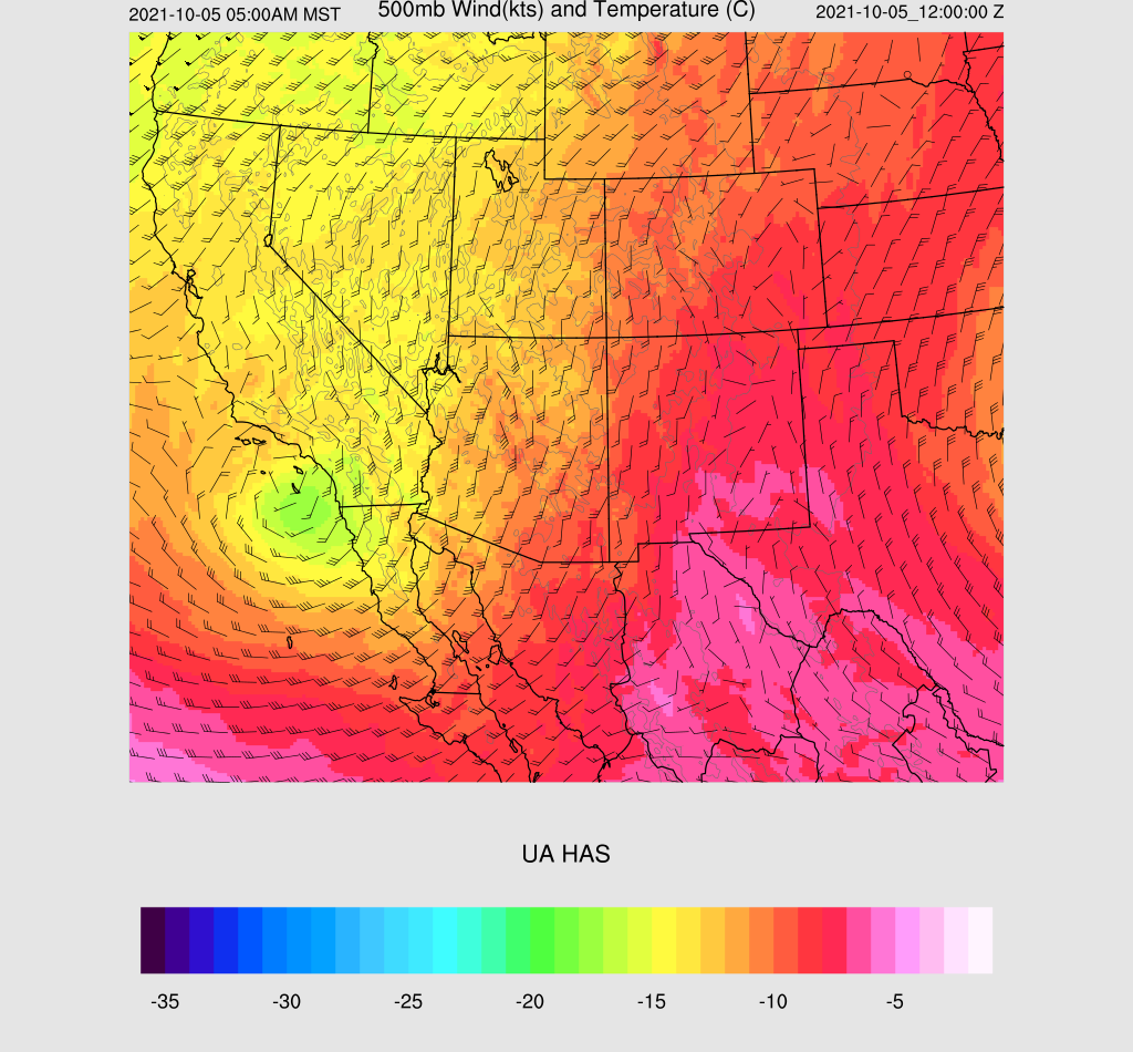
Moisture has increased significantly since yesterday and is now around 30mm for most southern Arizona locations. Showers and some thunderstorms are present over much of the state this morning as the moisture is interacting with the approach of the California closed low, which is now near San Diego.
Impressive upper divergence is mainly responsible for the shower and thunderstorms activity ahead of the low.
Surface-based CAPE is non-existent, but both the Tucson and Yuma 12Z soundings indicated 6-900 J/kg of elevated CAPE, thus the ongoing thunderstorm activity, especially in SW Arizona.
Initializations
The NCEP initializations have their work cut out for them today, for sure. To my surprise, all the initializations were fairly good at the placement of morning activity and clouds. The best was the 12Z HRRR, as the other runs didn't have enough/any activity in SW Arizona. All initializations had minimal PW errors. The 12Z WRFHRRR appears to be the best initialization, but none are poor enough to exclude.
Day 1
So far, so good, from a model accuracy perspective as the band of clouds and showers moved across the state. This band continues to move north, while activity continues over southwestern Arizona. PW remains around 30mm into the early afternoon hours. 850mb dewpoints are highest in a band from far SE Arizona, along the base of the Rim, up towards Payson/Prescott. A (near) surface low didn't seem to materialize over south-central Arizona, but moderate low-level SE flow is present in the area of higher dewpoints, resulting in a favorable vertical shear profile.

CAPE is quite high in the same areas, especially for this time of year. Some areas are approaching 1500 J/kg. Along with quite cool air in the mid-levels, some storms could have large hail.
By early afternoon, the mid/upper low begins to eject to the northeast, across NW Arizona, resulting in moderate to strong upper divergence/difluence over much of the state. Everything is in place for a big severe event for parts of the state especially if there is some heating. Satellite trends do indicate clearing over central and northern Arizona and the model runs generally have the right idea.
The afternoon vertical profile forecast is looking good for organized strong to severe storms in/near Phoenix. There is both directional and speed shear, and >1000 J/kg of CAPE.
Tucson doesn't look as favorable as there is limited directional shear and not much speed shear. CAPE is also lower, but perhaps sufficient to support some storms.
The other hot spot for activity is eastern and far southeastern Arizona. The directional shear is very good, as well as CAPE.
By mid-afternoon, strong to severe storms develop over southeastern Arizona as well as parts of Yavapai County. RADAR reflectivity indicates large hail with some of the storms.
Storms begin to develop in and around Phoenix by late afternoon, with some potentially severe storms. Storms also move towards the Flagstaff area and continue in eastern Arizona. Most runs are similar so forecast confidence is high.
Besides hail, some storms could produce high lightning flash rates. A tornado or two is also possible with a few of the storms, especially the ones north of Phoenix where shear is the best.
15Z WRFRR doesn't have as much activity for the Phoenix area.
Strong storms continue into the evening hours for far eastern Arizona and areas around Flagstaff.
The event is still on track to produce widespread moderate rain over northern Arizona, and some areas approaching 2".