Discussion
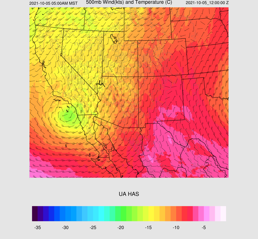
A large mid and upper cut of low is slowly making its way towards the state, which will result in a transition-type event including the risk for severe weather over parts of Arizona tomorrow. WV imagery and upper air plots place it SW of San Diego. This has already resulted in an increase in moisture over the state as PW has increased to around 20mm for many locations in southern Arizona. GOES-derived PW is increasing over Sonora as well, but no CAPE exists north of Sinaloa.
WV imagery indicates that the low may be a bit further to the south compared to the 250mb analysis. This is also the case with the morning initializations as they have a position similar to the analysis.
Day 1
PW continues to increase slowly today, and by late afternoon, is in the mid 20mm range over southern Arizona.
It's still dry at the lower levels, except for far SE Arizona.
Despite limited moisture and low CAPE, many runs manage to develop a few high-based showers and storms around the Tucson area later this afternoon and into the evening.
Low-level moisture continues to increase overnight and by early morning, there is an area of higher 850mb dewpoints from SE Arizona into central Arizona. This will result in scattered showers and storms for many parts of the state overnight.

Day 2
Now the fun begins! The cut-off low has made its way to around San Diego by 12Z tomorrow, with temperatures as cold as -17C.
Moisture continues to increase and by 18Z, it is around 25-35mm for much of the southern 1/2 of the state. In addition, a weak surface low is present over south-central Arizona, resulting in low-level southeasterly flow over eastern Arizona. With the mid-level winds from the SW and low-level winds from the SE, there is going to be significant low-level directional shear.
The lower troposphere also moistens up, especially in a band from far SE Arizona to around Flagstaff. This results in a band of moderate CAPE which is more than enough to support strong to severe storms, despite earlier widespread showers and storms. Most of the model forecasts move the clouds and showers into NE Arizona during the morning hours, resulting in heating and recovery.
The forecast vertical profile exhibits classic severe weather and mini super-cell event for parts of Arizona later tomorrow afternoon. CAPE is surprisingly high for the Phoenix area and the amount of directional and speed shear low topped organized severe storms are possible, with frequent lightning, hail, and some strong winds.
The various forecasts are in general agreement that southeastern Arizona and areas north of Phoenix are most likely to see strong to severe organized storms at some point tomorrow afternoon and into the early evening. It's not possible to be more specific as the situation is so complex and dependent on how much activity occurs tonight, and on how much heating will be realized tomorrow.
48-hour precipitation amounts could be over 2" for the orographically favorable locations of northern Arizona.


No comments:
Post a Comment
Note: Only a member of this blog may post a comment.