It’s a new season and there have been some upgrades to WRF since last year. I’ve increased the number of vertical model layers to 43 from 38 with the increase distributed in the lower PBL. So far, this has resulted in better temperature forecasts at night but I can’t say if it will help with convection forecasts. The graphics have been updated to use png rather than gif and this is a work in progress. Also, some test ensemble products are being created and are available on the web site in the Pima Regional WRF area. There is currently an issue with some of the products on that page.
Initializations
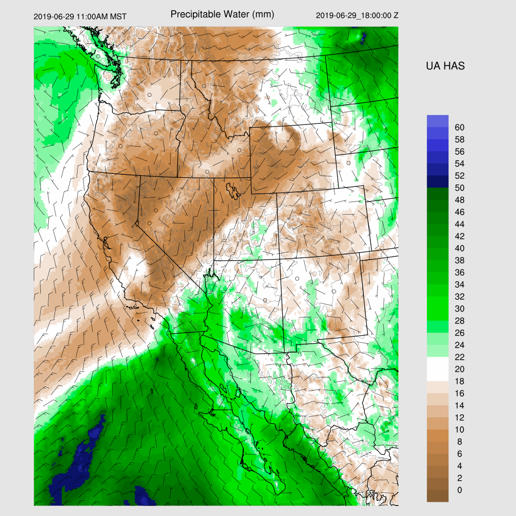
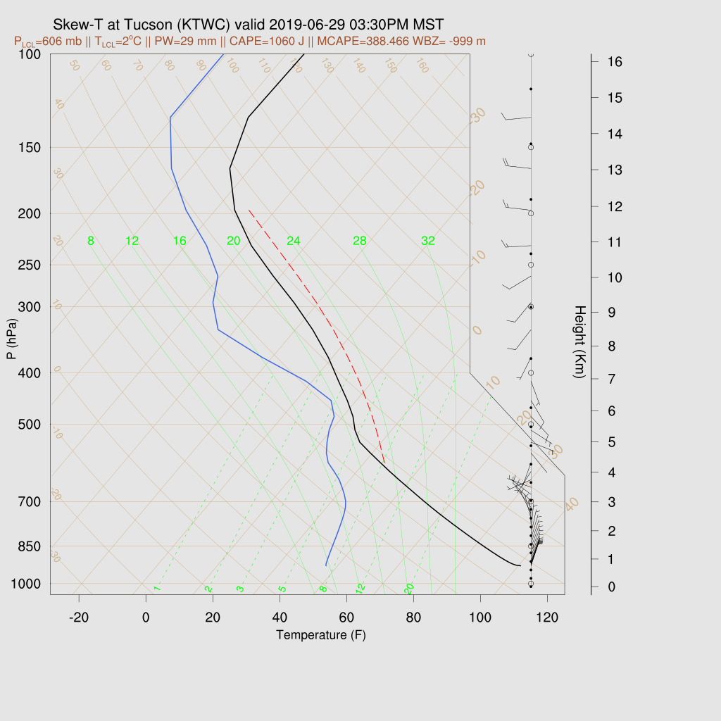
Enough moisture has trickled in to fire off some storms over far SE Arizona last evening and this moisture has moved into the Tucson area this morning as PW has increased to 27mm at Tucson and Td of nearly 50F. The NAM was a bit too wet over far SE Arizona and into Mexico but wasn’t too bad. The RR appears to have a better initialization as it is handling the moisture increase in/around Tucson more accurately. Mexican upper air data at 12Z was available at La Paz, Chihuahua, and Mazatlan which is better than last year and I wonder if Guaymas/Empalme will ever reappear? In any case, no obvious mid to upper-level circulations are obvious. Both the NAM and RR initialized a very weak inverted trough over far southern Arizona which may be responsible for the clouds and a few morning showers so there might actually be something there.

Neither the 12Z RR or NAM initialized the morning clouds or showers very well. The 15Z is much better. So far, from what I’ve seen, the 15Z WRFRR appears to be initialized the best.
Day 1
I debated on even writing a discussion as it’s not really that active today but I thought it good practice. PW continues to slowly increase over SE Arizona with Tucson up to 27-30mm by early afternoon.

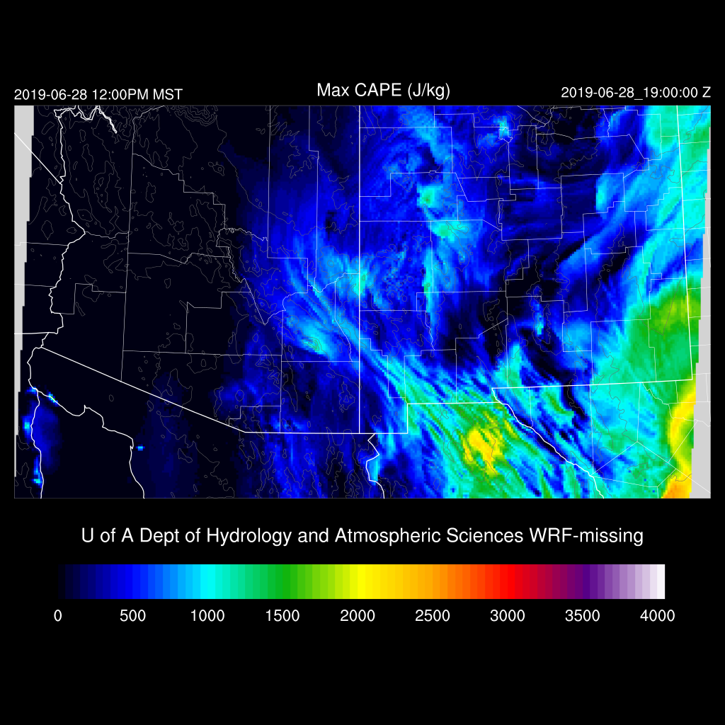
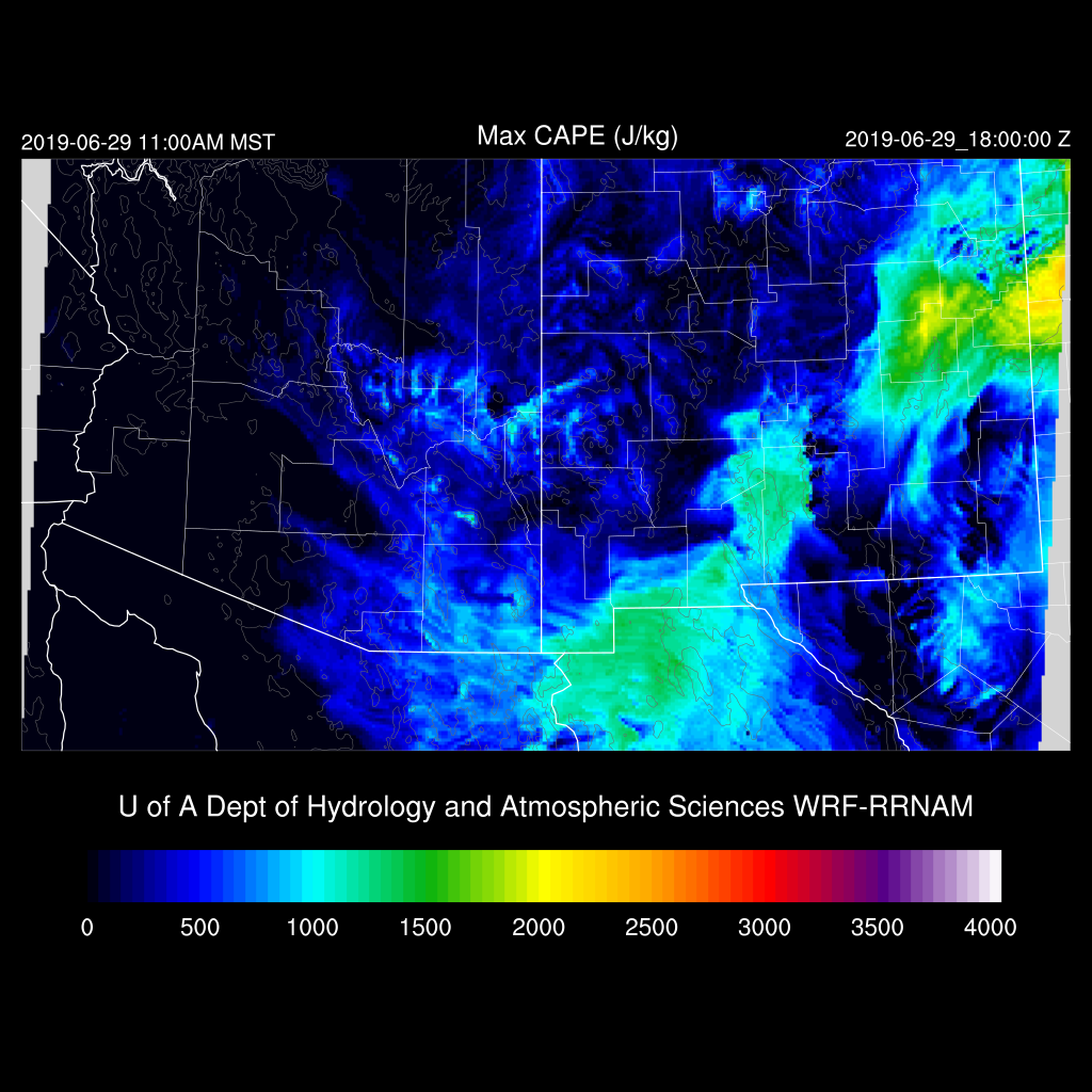
Afternoon forecast Max CAPE is around 200-300 J/Kg which is likely to be enough for storms over the high terrain of SE Arizona. The wind profile is not favorable for much propagation as south-westerlies are present above 700mb.

Higher CAPE is present over east central AZ and into western NM thus those will be the more active areas today.
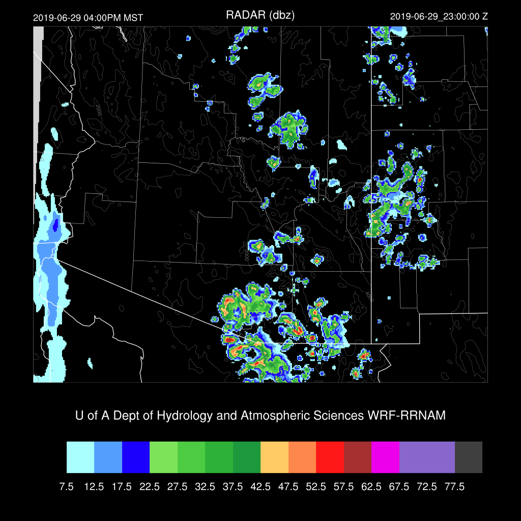
A few weak storms pop up over SE Arizona this afternoon but most activity is over in NM.

There is a bit more activity by late afternoon into the early evening over SE and EC Arizona.

The mixed layer is very deep thus some storms could produce very strong outflows.
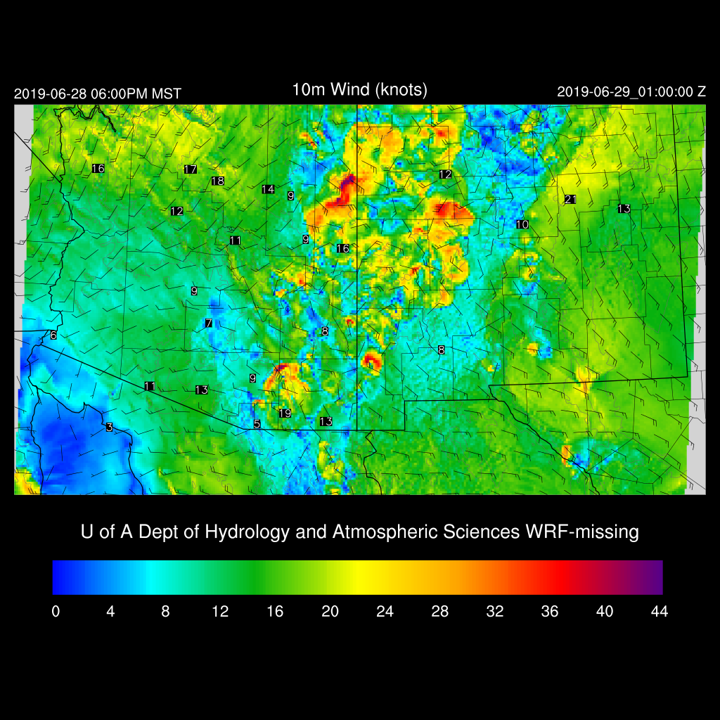
Tucson may see a strong outflow early this evening but no precipitation is expected.

Parts of SW NM and far SE Arizona are likely to see activity continuing into the late evening as a low-level convergence zone sets up as storms interact with moderate SE low-level flow across southern NM.

Day 2
Moisture from T.S. Alvin begins to advect into western Arizona while low-level easterlies push moisture into south-central Arizona. Low-level downslope flow may put a damper on storms over far SE Arizona. The WRFRR flow is weaker so it may be more active.
In spite of the moisture increase, CAPE is limited to mainly eastern and southeastern Arizona.
Not that great of flow for Arizona as much of the state continues to be in SW flow as a strong trough continues over the NW CONUS. Weak SE steering is present over E-SE Arizona. 500mb temperatures are around -7 to -8C which is fairly cool thus with good heating, eastern Arizona could be quite active.

There is quite a difference between the WRFRR and WRFNAM. Both have afternoon storms over the higher terrain of E-SE Arizona during the afternoon hours but the WRFRR is more active in and around Tucson by late afternoon as forecast Max CAPE is around 400 J/kg. Steering flow is light and variable thus storms won’t move much.
Forecast confidence for day 2 is low as there is a lot of model spread. The WRFRR is quite active over southern Arizona during the late afternoon. Winds are again likely to be the main issue as the sub-cloud layer/PBL is again very deep.